 Abandoned

Overview
An Army town that emptied in 1999

Fort McClellan began in July 1917 as Camp McClellan, one of 32 camps thrown up to train men for World War I on farmland north of Anniston. It became a permanent post in 1929, and the Army began the Spanish Colonial Revival headquarters, barracks and officers' houses that still stand on the hill at its center. The first barracks were finished in 1930, and New Deal workers added more buildings, streets and utilities in the mid-1930s. In World War II nearly half a million soldiers trained here, and a prisoner-of-war camp held Germans and Italians.
After the war the post was home to the Chemical Corps school, the Women's Army Corps Center and, from 1975, the Military Police School. It was a town in its own right. The census counted 5,334 people living on the post in 1970, 7,605 in 1980 and 4,128 in 1990, and in its last decades it averaged about 10,000 soldiers and 1,500 civilian workers. The 1995 base-closing commission voted to shut it, and the closing ceremony came on May 20, 1999. The schools moved to Missouri.
What happened next depends on which part you mean. Since 2010 about 3,000 acres have been redeveloped as McClellan, part of Anniston, and an October 2026 travel article says hundreds of people live in the old military housing. The Alabama National Guard kept a training center and the ranges. The wooded ridges became a wildlife refuge. In between, whole blocks of barracks stood empty for years. Wikipedia lists Fort McClellan among Alabama's ghost towns as "abandoned/historic."
Timeline
From mobilization camp to closing ceremony

- Camp Shipp, a short-lived Spanish–American War camp, holds nearly 10,000 Alabama volunteers within Anniston's northwest city limits.
- The federal government buys 18,952 acres north of Anniston for $247,000.
- The War Department establishes Camp McClellan, one of 32 mobilization camps for World War I. By October more than 27,000 men of the 29th Division are training here.
- The camp has 1,534 buildings, plus 118 in its hospital, by the count in the National Register nomination.
- A War Department order makes the camp a permanent post, Fort McClellan.
- WPA money pays for roads, an airfield and new permanent buildings, most of them in the Spanish Colonial Revival style.
- The post grows to 42,286 acres, plus the 22,168-acre artillery range later named Pelham Range. The National Register nomination puts the post at some 45,680 acres at its largest. At its peak it holds 2,170 officers and 42,126 enlisted soldiers. Nearly 500,000 train here during the war.
- A prisoner-of-war camp for 3,000 opens west of the headquarters. Its cemetery holds 26 German and 3 Italian prisoners.
- The post goes on inactive status with only a maintenance crew. The National Register nomination gives 1946.
- Fort McClellan reopens for National Guard training and the Chemical Corps. The National Register nomination dates the reactivation to 1950.
- The post becomes the first permanent home of the Women's Army Corps Center. The corps is disbanded in 1978.
- The Military Police School moves in from Fort Gordon, Georgia.
- The Base Realignment and Closure Commission votes to close the post.
- The closing ceremony. The schools leave for Fort Leonard Wood, Missouri.
- Mountain Longleaf National Wildlife Refuge is established on 7,759 acres of the old training land. It now covers 9,016 acres. Wikipedia dates the post's ordnance cleanup to 2003–2014, but the refuge's western part is still closed for it.
- Four historic districts on the old post join the National Register. The World War II barracks district is listed as vacant.
- The McClellan Development Authority is certified to redevelop the post.
- Neighbors near Headquarters Road complain of graffiti spreading across three abandoned buildings, ABC 33/40 reports.
- Pelham Range, the Guard's artillery range west of the old post, is renamed the Clarke Range Complex for Maj. Gen. Mary E. Clarke, a former commander of the Women's Army Corps Center and School here.
- The World War II Housing Historic District is removed from the National Register. The notice gives no reason.
- Comedian Katt Williams's publicist confirms he has bought the idle "Starships" barracks complex for a planned film studio.
- A travel article in Explore says hundreds of people live in the former military housing.
What's left
Headquarters hill, empty barracks and a fence line


The heart of the old post is the headquarters hill, with Buckner Hall, Stanley Barracks, Silver Chapel and the officers' houses on Buckner Circle. These are the white stucco, red-tile buildings of the 1930s, and they make up the Post Headquarters Historic District. Northeast of them is the Industrial district of warehouses and garages. The ammunition bunkers sit along the foot of the mountain. All three districts went on the National Register in 2006. Photos from April 2014 show the headquarters buildings and houses kept up, and the ammunition area fenced. A drive-through video posted in September 2026 shows cars in the driveways of the old post's red-tile houses, while stucco barracks stand behind cracked, weedy parking lots, one with vines climbing its walls.
The empty parts tell the ghost-town story. When the World War II barracks district east of headquarters was nominated in 2005, its 26 frame barracks and two churches were vacant. The barracks had housed National Guard troops until 1998. Most were in generally good condition despite years of deferred maintenance, but one was deteriorated and a porch had collapsed. Photos from April 2014 show one of the churches with its paint peeling and cleared ground where other barracks had stood. The district was removed from the National Register in October 2023. The notice gives no reason, and we found no report of what still stands there.
Elsewhere on the old post stand the "Starships," about 30 Cold War concrete buildings: barracks, two gyms and an academic building, on 90 to 117 acres by different reports. In June 2023 the McClellan Development Authority's director told ABC 33/40 the complex had "just been sitting there," and it was for sale for $1.5 million. In November 2024 Katt Williams's publicist confirmed he had bought it for a film studio, with no plans announced. In January 2020 neighbors near Headquarters Road reported graffiti across three abandoned buildings owned by an out-of-state owner. We found no newer report on either site.
On the 1947 map below, the prisoner-of-war camp sits northwest of Wygant Hill and its cemetery on the hill's southwest slope, west of the headquarters oval. The 1947 and 1956 sheets both show a golf course to the north and an amphitheater to the northeast. The 1900 sheet shows the same ground before the Army came: farms, the Southern Railway and hamlets such as Weavers and Fergusonville below Choccolocco Mountain.
- Buckner Hall, the 1930s post headquarters
- Stanley Barracks
- Silver Chapel
- Officers' houses on Buckner Circle
- Industrial district warehouses and garages
- Ammunition storage bunkers (fenced in 2014)
- World War II barracks district (vacant in 2005, delisted 2023; what stands now is unknown)
- The "Starships" Cold War barracks (idle in 2023)
- German-Italian POW cemetery, 29 graves


Access
Four landlords, four sets of rules

McClellan, city of Anniston. The McClellan Development Authority runs the redevelopment of the old post center. Its public sites include Lake Yahou Park, with an 8-acre lake and a half-mile walking trail, and 18 miles of multi-use trails. Both are open daily from 6 a.m. to 7:30 p.m. from April to September and from 6 a.m. to 5 p.m. from October to March. Fishing in the lake needs a $5 license bought in person at the authority's office. The authority's trail map warns that unexploded munitions such as mortars and shells may still lie on the site, and tells users to stay on the trail. The streets are city streets, but the empty buildings along them belong to private owners.
Alabama National Guard. The Guard's Fort McClellan Training Center provides ranges, classrooms and field training areas, and it oversees the Clarke Range Complex, the former Pelham Range, for large ordnance, small arms fire and maneuvers. The range land is federally owned. The Guard's page lists no public access, so treat Guard land as closed.
Mountain Longleaf National Wildlife Refuge. The Fish and Wildlife Service keeps the area west of Ridge Road closed to the public while the Army, which remains responsible for it, clears unexploded ordnance, and opens only the eastern part. All access is through the eastern gate on Bain's Gap Road, and closed areas are posted. The refuge is open in daylight only, outside permitted hunts. Camping, campfires, ATVs and collecting plants, rocks or artifacts are banned, and the only restrooms are at the office on Baby Bains Gap Road.
Department of Homeland Security. Wikipedia says the department's Center for Domestic Preparedness is on part of the old post. We found no visitor information for it.
Historic maps
Fort McClellan on USGS maps, 1900–1981
Crops from the USGS Historical Topographic Map Collection, centered on the townsite. Each sheet shows what surveyors mapped that year; compare them with today's topo and aerial on this page.

Day trip
Plan a day trip to Fort McClellan from Anniston
Take it with you
Day trip itinerary
The essentials, the sample day with boxes to tick, what to photograph and the coordinates, on two printable pages. Handy where there's no signal.
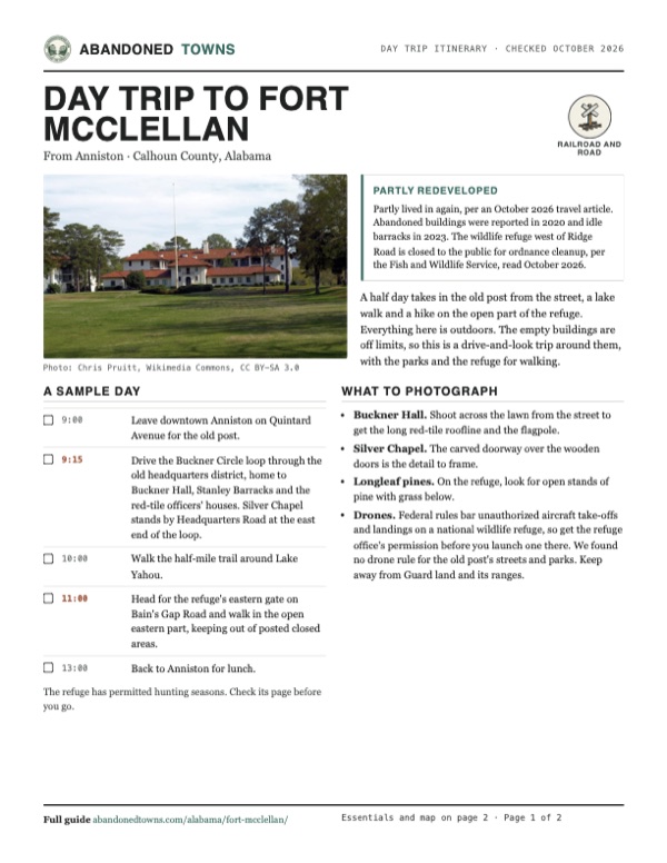
Download the PDF (630 KB)A half day takes in the old post from the street, a lake walk and a hike on the open part of the refuge. Everything here is outdoors. The empty buildings are off limits, so this is a drive-and-look trip around them, with the parks and the refuge for walking.
A sample day
- Leave downtown Anniston on Quintard Avenue for the old post.
- Drive the Buckner Circle loop through the old headquarters district, home to Buckner Hall, Stanley Barracks and the red-tile officers' houses. Silver Chapel stands by Headquarters Road at the east end of the loop.
- Walk the half-mile trail around Lake Yahou.
- Head for the refuge's eastern gate on Bain's Gap Road and walk in the open eastern part, keeping out of posted closed areas.
- Back to Anniston for lunch.
The refuge has permitted hunting seasons. Check its page before you go.
What to photograph and film
- Buckner Hall. Shoot across the lawn from the street to get the long red-tile roofline and the flagpole.
- Silver Chapel. The carved doorway over the wooden doors is the detail to frame.
- Longleaf pines. On the refuge, look for open stands of pine with grass below.
- Drones. Federal rules bar unauthorized aircraft take-offs and landings on a national wildlife refuge, so get the refuge office's permission before you launch one there. We found no drone rule for the old post's streets and parks. Keep away from Guard land and its ranges.
Map & directions
Getting there
Fort McClellan sits on the north side of Anniston, and the old headquarters on Buckner Circle is 5.4 miles from downtown. From Birmingham, take I-20 east and come up US 431, Veterans Memorial Parkway. Both routes end on city streets at the headquarters hill.


Base map: USGS The National Map (public domain). Routes: OSRM on © OpenStreetMap contributors data (ODbL), computed October 2026. Times assume dry roads.
- From downtown Anniston, take East 14th Street and turn left on Quintard Avenue (AL 21).1.1 mi
- Continue north as Quintard Avenue becomes McClellan Boulevard.1.6 mi
- Bear right on the ramp and merge onto Veterans Memorial Parkway (US 431).1.0 mi
- Turn left on General Gerald Watson Way, then right on Summerall Gate Road.1.1 mi
- Turn left on Buckner, which becomes 20th Street, then left on Headquarters Road and right on Buckner Circle at the old headquarters.0.6 mi
- From downtown Birmingham, take 5th Avenue North and 22nd Street North to 1st Avenue North (US 11/US 78) and follow it east.4.6 mi
- Turn right on 64th Street North and right on 1st Avenue South, then turn left twice to the ramp onto I-20.0.4 mi
- Follow I-20 east toward Anniston.57.2 mi
- Leave I-20 and turn left on Leon Smith Parkway (US 431). It becomes Golden Springs Road, Henry Road and Veterans Memorial Parkway.6.9 mi
- Turn right on General Gerald Watson Way, then right on Summerall Gate Road.1.1 mi
- Turn left on Buckner, which becomes 20th Street, then left on Headquarters Road and right on Buckner Circle.0.6 mi
Road and safety notes
- The old post is part of Anniston now, and the route runs on city streets and US 431.
- Vacant buildings are private property. Graffiti and vandalism were reported in 2020. Stay on the street.
- Guard ranges fire heavy and small arms. Keep out of Guard land and out of the refuge west of Ridge Road, which is closed for unexploded ordnance.
- The McClellan trails map warns that unexploded munitions may still lie on the site. Stay on the marked trails.
Photos
Fort McClellan in photos
Visitor reports
Been to Fort McClellan?
Been there lately? Tell the next visitor what you found: whether you could get in, the state of the road and what's still standing. Photos are welcome. We read every report before it appears here.
Railroad and road
More railroad, road and fort ghost towns
The nearest, in other states.

 Guide
Pigeon Roost
33.53, -89.16Choctaw County, Mississippi
A trading post and stand on the old Natchez Trace, home of the Choctaw chief David Folsom. Nothing of it stands. A parkway pullout and a wooden sign…
 Guide
Ellenton
33.22, -81.73Aiken County, South Carolina
A railroad and farming town of about 760 people, emptied in the early 1950s to build the Savannah River Plant. Its streets and curbs lie in the woods…
Nearby
Other sites near Fort McClellan
Straight-line distance from the townsite to other mapped sites in our Alabama index.
- Tooktocaugee5.9 mi E · Calhoun
- Chulafinnee14.6 mi SE · Cleburne
- Minden17.8 mi W · Calhoun
- Arbacoochee18.8 mi SE · Cleburne
- Bluffton28.6 mi NE · Cherokee
- Chandler Springs29.1 mi SW · Talladega
- Turkey Town29.6 mi N · Cherokee
- Nottingham34.7 mi SW · Talladega
Sources
Sources and credits
- Wikipedia, "Fort McClellan", retrieved October 2026: Camp Shipp, the 1917 purchase and founding, the 1929 designation, WPA building, the World War II expansion and peak strength, the POW camp and cemetery, the postwar schools, the 1995 vote and 1999 closing, the census figures for 1970 to 1990, the Guard training center, the Center for Domestic Preparedness, the McClellan Development Authority, the 2003–2014 ordnance cleanup and the refuge.
- Wikipedia, "List of ghost towns in Alabama", retrieved October 2026: Fort McClellan listed as "Abandoned/historic," a former army base.
- National Register nomination, Fort McClellan World War II Housing Historic District (prepared December 2005, listed November 8, 2006): the vacant barracks and churches, their condition, Guard use until 1998, the 1917 farmland, the 1919 building count, the first permanent barracks of 1930 and the WPA work of 1936–37, the 45,680-acre figure, the 1946 inactive date and 1950 reactivation, the POW camp west of headquarters, the districts northeast and east of headquarters, the post now within Anniston and renamed McClellan.
- National Park Service, National Register weekly list, October 6–12, 2023: the World War II Housing Historic District removed on October 10, 2023.
- Wikipedia, "National Register of Historic Places listings in Calhoun County, Alabama", retrieved October 2026: the Post Headquarters, Industrial, Ammunition Storage and World War II Housing districts, all listed November 8, 2006.
- ABC 33/40, "Graffiti on old Fort McClellan property concerning for homeowners", January 23, 2020: three abandoned buildings near Headquarters Road, the out-of-state owner, the city and authority cleanup.
- ABC 33/40, "Old Army barracks and property at former Fort McClellan could soon have new life", June 5, 2023: the "Starships" barracks, 117 acres for $1.5 million, "just been sitting there."
- Calhoun Journal, "Katt Williams Purchases Former Alabama Military Base for Film Studio Development", November 23, 2024: the publicist's confirmation of the purchase, about 30 Cold War-era concrete buildings on 90 acres, no announced plans.
- Amanda Morgan, "Alabama's Former Army Base Is Now A Thriving Community With Horse Trails, Camping, And A Lake Park," Explore, October 18, 2026: hundreds of people live in the former military housing.
- McClellan Development Authority, Recreation, read October 2026: Lake Yahou Park and multi-use trail hours, the phone number; its Lake Yahou Park rules and FAQ: free entry, the $5 cash-only fishing license, catch and release, no swimming, the walking-only lake trail; its trail map: the unexploded-munitions warning and weak cell service; and home page: the 10,000-acre McClellan community.
- Exploring Alabama, "You Won't Believe How It's Changed: Fort McClellan 2026 Cruise", YouTube, posted September 13, 2026: a drive through the old post showing lived-in red-tile houses, weedy lots and a vine-covered barracks. Not embedded: it has no narration or captions, only on-screen notes, and we could not confirm that every lot it drives into is open to the public.
- U.S. Fish and Wildlife Service, Mountain Longleaf NWR, Visit Us, Rules & Policies and About Us, read October 2026: only the eastern part open, the area west of Ridge Road closed while the Army clears unexploded ordnance, the eastern gate on Bain's Gap Road, posted closed areas, daylight hours, the rules, the restrooms, the office address and phone, the May 31, 2003 establishment on 7,759 acres and today's 9,016 acres.
- 50 CFR 27.34, "Aircraft", read October 2026: unauthorized aircraft landings and take-offs on a national wildlife refuge are prohibited; 50 CFR 26.21 (trespass on a refuge) and 16 U.S.C. 668dd(f) (fines and up to 180 days in jail, or a year for knowing violations), read October 22, 2026.
- Will Blakely, 1819 News, October 5, 2023: Pelham Range renamed the Clarke Range Complex for Mary E. Clarke, operated by the Guard on federally owned land of the former post.
- Alabama National Guard, Fort McClellan Training Center, read October 2026 as the Internet Archive copy of June 22, 2026 (the live page blocks automated readers): the ranges, classrooms and field training areas, and the Clarke Range Complex for large ordnance, small arms fire and maneuvers.
- Elevation: USGS 3D Elevation Program point query. Routes: OSRM on OpenStreetMap data, October 2026.
Photo and map credits
- Buckner Hall, the former post headquarters, April 2014: Chris Pruitt, Wikimedia Commons, CC BY-SA 3.0
- Stanley Barracks, April 2014: Chris Pruitt, Wikimedia Commons, CC BY-SA 3.0
- Silver Chapel, April 2014: Chris Pruitt, Wikimedia Commons, CC BY-SA 3.0
- The commanding officer's quarters, April 2014: Chris Pruitt, Wikimedia Commons, CC BY-SA 3.0
- Officers' houses on Buckner Circle, April 2014: Chris Pruitt, Wikimedia Commons, CC BY-SA 3.0
- Building 234, a former regimental garage in the Industrial district, April 2014: Chris Pruitt, Wikimedia Commons, CC BY-SA 3.0
- Building 4401, an ammunition storage building behind a fence and gate, April 2014: Chris Pruitt, Wikimedia Commons, CC BY-SA 3.0
- A World War II-era church with peeling paint, April 2014: Chris Pruitt, Wikimedia Commons, CC BY-SA 3.0
- Cleared ground where World War II barracks stood, April 2014: Chris Pruitt, Wikimedia Commons, CC BY-SA 3.0
- The WAC Training Center from the air, 1954: U.S. Army, Wikimedia Commons, Public domain
- Women's Army Corps recruits arriving by Army bus, 1954: Charlotte Brooks, Wikimedia Commons, Public domain
- Mountain Longleaf National Wildlife Refuge, August 2004: Department of the Interior. U.S. Fish and Wildlife Service. National Conservation Training Center. 10/1997-8888, Wikimedia Commons, Public domain
- Topo map, area base map and aerial imagery: USGS The National Map (public domain).
- Historic maps: USGS Historical Topographic Map Collection (public domain): Anniston 1900, 1:125,000; Anniston 1947, 1:24,000; Anniston 1956, 1:24,000; Anniston 1981, 1:100,000.