 Abandoned

Overview
A company camp above the tree line

Independence Mine sits in a bowl high in the Talkeetna Mountains, near the top of Hatcher Pass, about 14 miles northwest of Palmer. Prospectors worked the Willow Creek district from the late 1890s, and Robert Lee Hatcher staked its first lode gold claim in 1906 or 1908 (sources differ). In the 1930s two neighboring hard-rock mines were joined into one operation, and from 1934 the Wasilla Mining Company built a full company camp here, with an aerial tram to carry the ore.
It was not a town with a main street. It was a camp of some 16 frame buildings, once linked by covered wooden walkways: bunkhouses, a mess hall, the manager's house, an assay office and a mill. In 1941 it had 204 men on the payroll and 22 families living on site. The mine produced more than 165,500 ounces of gold, which Wikipedia ranks second among Alaska's hard-rock gold mines.
The war shut it in 1943. It reopened briefly and closed in 1950 or 1951, and a short revival from 1979 to 1982 ended within months of its new mill opening. The land went to the state in 1980, and Independence Mine State Historical Park now keeps the camp. KTUU called it a ghost town frozen in time in 2021. The 2022 Anchorage Daily News report on the site found broken windows, kicked-in doors and failing foundations, and restoration has been under way since.
Video
Engines, the assay office and late snow
On a wet, cloudy day the creator walks the paved path through the camp past the bunkhouses, looks over the big diesel engines and generator parts set out on the gravel, and passes the mine office and old sleds. Inside the assay office he shows the furnaces, rock drills, bits, a safe and ore samples, and he walks over snow on what he says is June 29. The video ends with the drive on up Hatcher Pass in the clouds, past a frozen lake. The creator guesses the machinery was built in the 1920s; our sources date the camp from 1934. He says panning is allowed anywhere in the park; the park's page says with a pan and shovel only.
 Play “Alaska Gold Mine Adventure - Independence Mine and Hatcher Pass Alaska” from YouTube
Timeline
From Hatcher's claim to a state park
- Mining claims are reported near Fishhook Creek, in the Willow Creek district.
- Robert Lee Hatcher stakes the first lode gold claim in the Willow Creek valley. The Anchorage Daily News gives 1906; another account gives 1908.
- The Wasilla Mining Company, formed from the early claims, begins working the mines; the National Register listing dates the camp from 1934. The two neighboring mines are merged into one operation in the 1930s.
- The camp booms. An aerial tramway carries ore from the mines.
- 204 men work the mine, and 22 families, with eight school-age children, live on site.
- The mine is ordered shut as nonessential to the war effort.
- Mining resumes after the war. Wikipedia says the company ended operations in 1950; the Anchorage Daily News says the mine closed for good in 1951.
- The Independence Mines are listed on the National Register of Historic Places.
- Underground work resumes under Coronado Mining, joined by Enserch in 1981. A new mill is dedicated in August 1982, and work stops that November.
- The land is donated to the state, which makes it a state historical park.
- The Helmsley Charitable Trust gives $1.3 million to restore four damaged buildings and harden them against vandalism.
- The tour operator notes a restoration project that changes which buildings can be entered.
On the ground
Bunkhouses, a mess hall and a fallen mill

The camp is laid out along a paved path below Bullion Mountain. The tour operator lists the General Manager's House, Bunkhouse No. 2, with a small gift shop, and the Assay Office as the buildings open to visitors. The park's page says the assay office has displays on assaying and retorting. The photos here show both bunkhouses, the mess hall and the manager's house standing, with red-trimmed windows, and the mill above them fallen into a heap of timbers and rusted roofing. Tram towers and rail lines climb the slope. A photo of September 22, 2025, shows a mine tunnel portal with a covered timber walkway beside a creek.
The 2022 Anchorage Daily News report found broken windows, unstable foundations, water-damaged walls and doors kicked in by vandals. A $1.3 million grant that year paid for work on four buildings, and the tour operator says a 2024 and 2025 restoration project changed which ones are open. A 2024 photo here shows a lift parked beside the bunkhouse.
The historic maps below show the camp as a cluster of buildings on the East Fork in 1949, between the Gold Cord Mine to the north and the Independence and Martin mines on the slopes around it, with Hatcher Pass and the road to the south. The 1979 sheet, at a smaller scale, labels it Independence Mine State Historical Park, and the 1994 sheet shows the park, the roads and the same mines.
- Bunkhouses No. 1 and No. 2, the mess hall and the manager's house
- The Assay Office with mining displays
- The collapsed mill and rail trestle (closed to the public)
- Tram towers, rails and mine portals (shafts closed)
- Old engines and machinery around the camp


Historic maps
Independence Mine on USGS maps, 1949–1994
Crops from the USGS Historical Topographic Map Collection, centered on the townsite. Each sheet shows what surveyors mapped that year; compare them with today's topo and aerial on this page.

Day trip
Plan a day trip to Independence Mine from Palmer
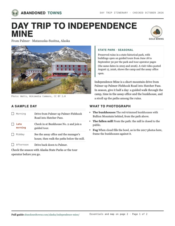
Take it with you
Day trip itinerary
The essentials, the sample day with boxes to tick, what to photograph and the coordinates, on two printable pages. Handy where there's no signal.
Download the PDF (603 KB)Independence Mine is a short mountain drive from Palmer up Palmer-Fishhook Road into Hatcher Pass. In season, give it half a day: a guided walk through the camp, time in the assay office and the bunkhouse, and a stroll up the paths among the ruins.
A sample day
- Drive from Palmer up Palmer-Fishhook Road into Hatcher Pass.
- Check in at Bunkhouse No. 2 and join a guided tour.
- See the assay office and the manager's house, then walk the paths below the mill.
- Drive back down to Palmer.
What to photograph and film
- The bunkhouses The red-trimmed bunkhouses with Bullion Mountain behind, from the path above.
- The fallen mill From the path: the mill is closed to the public.
- Fog When cloud fills the bowl, as in the 2017 photos here, frame the bunkhouses against it.
Map & directions
Getting there
Independence Mine is at the end of Gold Cord Road, off Palmer-Fishhook Road (Hatcher Pass Road) at about mile 17. Alaska State Parks gives the way from the Glenn Highway at milepost 49.5, or from the Parks Highway at milepost 36.1 by Trunk Road. Both routes below end at the park.


Base map: USGS The National Map (public domain). Routes: OSRM on © OpenStreetMap contributors data (ODbL), computed October 2026. Times assume dry roads.
- From downtown Palmer, take South Alaska Street and West Arctic Avenue to the Glenn Highway (AK 1).0.6 mi
- Turn right on the Glenn Highway.1.5 mi
- Turn left on Palmer-Fishhook Road and climb into Hatcher Pass.17.2 mi
- Continue on Gold Cord Road to the park.1.4 mi
- From downtown Anchorage, take K Street, 6th Avenue and 5th Avenue to the Glenn Highway (AK 1).2.7 mi
- Follow the Glenn Highway north.33.0 mi
- Bear left on the Parks Highway (AK 3) and take the Trunk Road exit.2.0 mi
- Follow Trunk Road north through two roundabouts.5.9 mi
- Turn left on Palmer-Fishhook Road and climb into Hatcher Pass.14.8 mi
- Continue on Gold Cord Road to the park.1.4 mi
Road and safety notes
- The park's page gives the address as mile 17.3 Hatcher Pass Road. Outside the gate hours of 9 am to 7 pm, park in the lower lot and walk up.
- We have no dated source on the road surface or its winter maintenance. Hatcher Pass is a mountain road: check Alaska 511 before you go.
- The routes are computed from OpenStreetMap and haven't been driven by us.
Photos
Independence Mine in photos
Visitor reports
Been to Independence Mine?
Been there lately? Tell the next visitor what you found: whether you could get in, the state of the road and what's still standing. Photos are welcome. We read every report before it appears here.
Gold mining
More gold mining ghost towns
The nearest in Alaska.

 Guide
Knik
61.46, -149.73Matanuska-Susitna, Alaska
The commercial center of upper Cook Inlet until the Alaska Railroad passed it by. About 500 people lived here in 1915; by 1919 only one store was…
 Guide
Chicken
64.07, -141.94Southeast Fairbanks, Alaska
A gold camp on Chicken Creek that has hung on since the 1890s. Twelve people lived here in 2020. In summer, three small businesses sell fuel, food…
Nearby
Other sites near Independence Mine
Straight-line distance from the townsite to other mapped sites in our Alaska index.
Sources
Sources and credits
- Wikipedia, "Independence Mine State Historical Park", retrieved October 2026: coordinates, elevation, 1897 claims, the Wasilla Mining Company from 1934, production, 1950 closure, the 1979 to 1982 revival, NRHP listing and the 1980 donation.
- ghosttowns.com, "Independence Mine", read October 2026: fact sheet, Hatcher's 1908 discovery, the 1936 boom and the tram.
- Alaska State Parks, "Independence Mine State Historical Park", read October 29, 2026, with the same season in the Internet Archive copies of September 15, 2025 and June 6, 2026: visitor center season, gate hours, directions, 761 acres, the assay office, gold panning rule.
- Alaska State Parks, fees, read October 29, 2026 (2026 rates): the $5 parking fee and the $15 mine admission listing.
- Salmon Berry Travel & Tours, "Independence Mine State Historical Park", read October 29, 2026: tour prices, length and times, open buildings, the closed mill and shafts, the 2024 and 2025 restoration.
- Loren Holmes, "Independence Mine State Historic Park receives $1.3 million grant for preservation work", Anchorage Daily News, August 9, 2022: Hatcher's 1906 claim, the 1941 workforce, 1943 and 1951 closures, building damage and the grant.
- Aaron Morrison, "Roadtrippin': Rich history of Independence Mine", KTUU, June 13, 2021: the mine as a ghost town, more than 200 workers, tours.
- Backwoods Florida Adventures, "Alaska Gold Mine Adventure - Independence Mine and Hatcher Pass Alaska", YouTube, posted August 15, 2026 (the creator says it is June 29): the camp, engines and assay office open, snow on the ground; checked against its captions and storyboard frames.
- Photos: Wikimedia Commons, credited below each one. Elevation: USGS 3D Elevation Program point query. Routes: OSRM on OpenStreetMap data, October 2026. Not field-checked.
Photo and map credits
- The Independence Mine camp in the Hatcher Pass valley, September 2008: Frank K. from Anchorage, Alaska, USA, Wikimedia Commons, CC BY 2.0
- The bunkhouses below Bullion Mountain, September 2024: Watts, Wikimedia Commons, CC BY 2.0
- The manager's house, August 2017: Explorer1940, Wikimedia Commons, CC BY-SA 4.0
- The mess hall in fog, August 2017: Explorer1940, Wikimedia Commons, CC BY-SA 4.0
- Bunkhouse No. 2, with the gift shop, August 2017: Explorer1940, Wikimedia Commons, CC BY-SA 4.0
- Bunkhouse No. 1, August 2017: Explorer1940, Wikimedia Commons, CC BY-SA 4.0
- Camp buildings in fog, August 2017: Explorer1940, Wikimedia Commons, CC BY-SA 4.0
- The collapsed mill on the slope, August 2017: Explorer1940, Wikimedia Commons, CC BY-SA 4.0
- The fallen processing mill and rail trestle, September 2011: Switchbladesista, Wikimedia Commons, CC BY-SA 3.0
- A tram tower above the camp, September 2011: Switchbladesista, Wikimedia Commons, CC BY-SA 3.0
- An old engine and oil drums by a camp building, September 2020: Zakary Hartford, Wikimedia Commons, CC BY-SA 4.0
- A mine tunnel portal with a covered walkway, September 22, 2025: Meecex, Wikimedia Commons, CC BY-SA 4.0
- A camp building above red autumn tundra, August 2016: Kimberly Hack, Wikimedia Commons, CC BY-SA 4.0
- The camp under snow, seen from above, November 2013: Will Koeppen, Wikimedia Commons, CC BY-SA 4.0
- Area base map, topo and aerial imagery: USGS The National Map (public domain).
- Historic maps: USGS Historical Topographic Map Collection (public domain): Anchorage D-7 1949, 1:63,360; Anchorage 1979, 1:250,000; Anchorage D-7 1994, 1:63,360.