 Abandoned

Overview
A resort called Allah

Allah grew from a ranch on a stretch of the Hassayampa River where the water flows above ground, a few miles southeast of Wickenburg. Frederick Brill, a Prussian immigrant, settled there in 1866. Over 45 years he raised crops and livestock, planted one of Arizona's earliest orchards and started what is called the state's first carp farm.
Two years after Brill died, John Sanger bought the ranch and turned it into a resort. He named it the Garden of Allah, for the desert in a popular novel of the day, and the name was later cut to Allah. Guests came out on the Santa Fe, Prescott & Phoenix line and got off at a flag stop called Allah Station. A history of Arizona dude ranching calls it likely the first in the state. For two years, 1917 to 1919, Allah had its own post office, and from 1918 the YMCA ran summer camps for boys on the grounds.
The resort didn't last. The land went through several owners until The Nature Conservancy bought it in 1986 to protect the river. Since 2017 Maricopa County has run it as the Hassayampa River Preserve, so the old ranch grounds are open to anyone who pays the entry fee.
Timeline
From Brill's Ranch to nature preserve

- Frederick Brill, a Prussian immigrant, starts a ranch on the Hassayampa River below Wickenburg. He grows crops and one of Arizona's earliest orchards, raises livestock and farms carp.
- The Santa Fe, Prescott & Phoenix Railway, the "Peavine," opens to Phoenix along the west side of the river.
- Brill dies after about 45 years on the ranch.
- John Sanger buys the ranch and opens a resort he names the Garden of Allah, after the desert in a popular novel. It may have been Arizona's first dude ranch.
- Guests arrive by train at a flag stop called Allah Station. The Sanger Building, believed to be the ranch hands' bunkhouse, goes up in these years.
- Allah has its own post office, with Frances Sanger as postmaster.
- The YMCA holds the first of its summer camps for boys here.
- The land passes through a string of owners: a working ranch, a winter home, then a planned retirement community.
- World Book lists Allah with 100 people.
- The Nature Conservancy buys the property and begins restoring the river habitat.
- The property reopens to the public as the Hassayampa River Preserve.
- Land purchases bring the preserve to about 770 acres.
- Maricopa County Parks and Recreation becomes a partner and part owner and takes over running the preserve.
- Open to visitors Wednesday to Sunday, with seasonal hours.
1913–1919
The Garden of Allah

In June 1913 the Yuma Examiner reported that the new resort would be named the Garden of Allah. The name came from the desert setting of a famous novel of that title, and a 1933 guide to Arizona place names says the ranch got it because the country looked like the desert in the book. Sanger ran it as a dude ranch for visitors who came for recreation and the desert climate.
The railroad made it work. Trains on the Peavine, the Santa Fe line from Ash Fork to Phoenix, stopped at Allah Station on the west bank of the river. Frances Sanger ran the post office from 1917 to 1919. The YMCA's boys' camp was still going in 1922, when the Arizona Republican announced its fourth annual session.
The preserve's palm trees may be more than 100 years old. Historical accounts say they were brought from Castle Hot Springs.
World Book still listed Allah with 100 people in 1960, long after the resort years, when the ranch had already changed hands several times.
What's left
The preserve today


The preserve covers about 770 acres of river bottom, with cottonwood-willow forest, mesquite bosque and Palm Lake. Self-guided trails run along the river and around the lake. The Sanger Building from the resort years still stands, and the visitor center has more of the ranch's history.
Wikipedia, citing a 2016 history, says the ruins of Allah's railroad station are still visible. They are beside the tracks on the far side of the river from the visitor area. The 1964 USGS sheet below puts the Allah name there, with Palm Lake and the ranch buildings to the north and the highway on the east bank. We don't know of a public trail to the station site, and the railroad is an active BNSF line.
- Ranch grounds and Palm Lake
- Old fan palms
- Sanger Building (1913–1917)
- Allah railroad station ruins (no public trail known)


Historic maps
Allah on USGS maps, 1954–1988
Crops from the USGS Historical Topographic Map Collection, centered on the townsite. Each sheet shows what surveyors mapped that year; compare them with today's topo and aerial on this page.

Day trip
Plan a day trip to Allah from Wickenburg
Take it with you
Day trip itinerary
The essentials, the sample day with boxes to tick, what to photograph and the coordinates, on two printable pages. Handy where there's no signal.
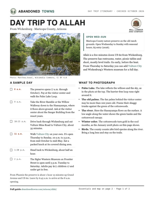
Download the PDF (640 KB)Allah is a few minutes down US 60 from Wickenburg. The preserve has restrooms, water, picnic tables and short, mostly level trails. Go early, before the heat. From Thursday to Saturday you can add Vulture City and Wickenburg's Western museum for a full day.
A sample day
- The preserve opens (7 a.m. through October). Pay at the visitor center and walk the Palm Lake Loop.
- Take the River Ramble or the Willow Walkway down to the Hassayampa, where it flows above ground. Ask at the visitor center about the Sanger Building from the resort years.
- Drive back through Wickenburg and out Vulture Mine Road to Vulture City, about 35 minutes.
- Walk Vulture City on your own. It's open Thursday to Sunday, 10 a.m. to 3 p.m., from mid-October to mid-May. Eat a packed lunch at its covered dining area.
- Head back to Wickenburg, about half an hour.
- The Sigler Western Museum on Frontier Street is open until 5 p.m. Tuesday to Saturday. Adults pay $17; children 17 and under get in free.
From Phoenix the preserve is about 1 hour 15 minutes up Grand Avenue and US 60. Leave by 6:45 a.m. to arrive at the 8 a.m. opening.
What to photograph and film
- Palm Lake. The lake reflects the willows and the sky, as in the photo at the top. The barrier-free loop runs right around it.
- The old palms. The fan palms behind the visitor center may be more than 100 years old. Frame their shaggy trunks against the green of the cottonwoods.
- The river. Here the Hassayampa flows on the surface. A low angle along the water shows the green banks and the cottonwood canopy.
- Winter color. The cottonwoods turn gold in the cool months, as the January 2018 photo on this page shows.
- Birds. The county counts 280 bird species along the river. Bring a long lens and stay on the trails.
Map & directions
Getting there
Wickenburg is about 4 miles up the highway. From Phoenix, the route follows Grand Avenue and US 60 all the way. The preserve entrance is on the west side of US 60.


Base map: USGS The National Map (public domain). Routes: OSRM on © OpenStreetMap contributors data (ODbL), computed October 2026. Times assume dry roads.
- From downtown Wickenburg, take Wickenburg Way (US 60) east through the roundabout.1.7 mi
- Continue southeast on the Wickenburg–Phoenix Highway. The preserve entrance is on the right, the west side of the highway.2.5 mi
- From downtown Phoenix, take Van Buren Street west to Grand Avenue.0.7 mi
- Follow Grand Avenue (US 60) northwest across the West Valley. It becomes the Wickenburg–Phoenix Highway.34.5 mi
- At Wittmann, keep right on US 60 and continue northwest past Morristown.14.4 mi
- The entrance is on the west side of the highway. The route goes just past it to turn around and comes back to it on the right.0.2 mi
Road and safety notes
- US 60 is paved all the way from Phoenix and Wickenburg.
- The preserve is closed Monday and Tuesday. Pets aren't allowed.
- Summer days are very hot. From May through October the preserve opens at 7 a.m., so go early.
- The station ruins are beside an active railroad. Stay off the tracks.
Photos
Allah in photos
Visitor reports
Been to Allah?
Been there lately? Tell the next visitor what you found: whether you could get in, the state of the road and what's still standing. Photos are welcome. We read every report before it appears here.
Mill, lumber and company
More mill, lumber and company ghost towns
The nearest in Arizona.

 Guide
Sundad
33.18, -113.24Maricopa County, Arizona
A desert health colony from the 1920s that never took off. What's left is a scatter of foundations on federal land, and its name spelled out in rocks…
 Guide
Agua Caliente
32.99, -113.32Maricopa County, Arizona
Hot springs that drew missionaries, travelers and resort guests for two centuries, until irrigation wells drained them. The 1897 hotel still stands…
Nearby
Other sites near Allah
Straight-line distance from the townsite to other mapped sites in our Arizona index.
- Vulture Mine6.9 mi SW · Maricopa
- Vulture City11.2 mi SW · Maricopa
- Constellation11.8 mi NE · Yavapai
- Octave14.9 mi N · Yavapai
- Briggs15.3 mi NE · Yavapai
- Weaver15.7 mi N · Yavapai
- Stanton16.5 mi N · Gila
- Stanton16.5 mi N · Yavapai
Sources
Sources and credits
- ghosttowns.com, "Allah": fact sheet fields (roads, legal description, climate, best time, post office dates).
- Wikipedia, "Allah, Arizona", retrieved October 2026: coordinates and elevation (GNIS), the name, John Sanger and the 1913 resort, the YMCA camp, the post office and postmaster, the 1960 population, the station ruins. It cites the 1913 Yuma Examiner, the 1922 Arizona Republican, Elwood Lloyd's Arizonology (1933) and Russell True's Dude Ranching in Arizona (2016).
- Maricopa County Parks and Recreation, "Hassayampa River Preserve: History": Frederick Brill, the Garden of Allah years, Allah Station, the Sanger Building, the palms, The Nature Conservancy and the county.
- Maricopa County Parks and Recreation, "Hassayampa River Preserve", with its fees and directions pages, October 2026: days, seasonal hours, entry fee, pets, address and entrance.
- The Nature Conservancy, "Hassayampa River Preserve": the 2017 partnership with Maricopa County.
- Wikipedia, "Santa Fe, Prescott and Phoenix Railway", retrieved October 2026: the Peavine's 1895 opening and its operation today by BNSF.
- Maricopa County Parks and Recreation, "Trails", "Picnicking" and "Park Rules", as of October 2026: trail lengths and ratings, picnic areas, restroom water, guided walks, pets, trail, permit and model-aircraft rules.
- Vulture City Ghost Town, official site, and its "Plan Your Visit" page, as of October 2026: season, days, hours, covered dining area.
- Sigler Western Museum, "Admission & Accessibility": hours and admission, as of October 2026.
- Routes: OSRM on OpenStreetMap data, October 2026. Hours and fees checked against the county's pages on October 19, 2026.
Photo and map credits
- Palm Lake, June 2026: Matthew.kowal, Wikimedia Commons, CC BY 4.0
- Palms among the cottonwoods, 2025: Secuiro, Wikimedia Commons, CC0
- The Hassayampa flowing above ground in the preserve, 2026: Matthew.kowal, Wikimedia Commons, CC BY 4.0
- Palm Lake in December 2009: John Menard from Phoenix, USA, Wikimedia Commons, CC BY-SA 2.0
- The river in January 2018: Sheila Sund from Salem, United States, Wikimedia Commons, CC BY 2.0
- A trail through the mesquite bosque, 2026: Matthew.kowal, Wikimedia Commons, CC BY 4.0
- USGS Wickenburg sheet, 1964: Allah on the railroad, with Palm Lake and the ranch buildings to the north: U.S. Geological Survey, USGS catalog, Public domain
- Area base map, topo and aerial imagery: USGS The National Map (public domain).
- Historic maps: USGS Historical Topographic Map Collection (public domain): Phoenix 1954, 1:250,000; Wickenburg 1964, 1:24,000; Phoenix North 1988, 1:100,000.