 Abandoned

Overview
The gold camp at the top of the hill

Yarnell sits at about 4,780 feet at the top of Yarnell Hill, where AZ 89 climbs 1,300 feet in four miles out of the desert north of Wickenburg. Gold turned up early in these mountains. In 1863 a party led by Pauline Weaver and A. H. Peeples found placer gold on Rich Hill, a few miles southeast, and Charles Genung found gold at the site of Yarnell about 1865.
The town is named for Harrison Yarnell, a prospector who developed a mine here in 1873. His 1916 obituary says he took a fortune in gold from the Yarnell mine, then spent it all digging for a bigger deposit he believed lay within a few miles of it. An undated listing dates the post office to 1892 and describes the old camp's remains as tailings and a foundation, about half a mile from today's town.
Yarnell never emptied. The highway through town was paved in 1933 and for years carried traffic from Phoenix to Prescott. Ranching, some mining and services for travelers and retirees kept it going. On June 30, 2013, the Yarnell Hill Fire burned through town and killed 19 members of the Granite Mountain Hotshots, the deadliest wildfire in Arizona's history. The town rebuilt, and about 570 people lived here in 2020.
Timeline
Gold camp, highway town, fire

- A party led by Pauline Weaver and A. H. Peeples finds placer gold on Rich Hill, a few miles southeast.
- Charles Genung finds gold at the future site of Yarnell.
- Harrison Yarnell develops the Yarnell mine. The camp around it takes his name.
- The first USGS sheet of the area shows no Yarnell, only a road over the pass beside Antelope Peak.
- A post office opens.
- Harrison Yarnell dies in Prescott. His obituary says the fortune he took from the mine all went back into the ground.
- The highway through Yarnell, then US 89, is paved. For years it is the main road from Phoenix to Prescott and northern Arizona.
- The Catholic Action League of Arizona builds the Shrine of St. Joseph of the Mountains.
- Alessio Carraro, builder of Tovrea Castle in Phoenix, shapes a boulder garden in Yarnell. He dies in 1964.
- Dry lightning starts the Yarnell Hill Fire on BLM land near town.
- The fire overruns the Granite Mountain Hotshots, killing 19 men, and burns through Yarnell. The sheriff's office counts 127 buildings destroyed in town.
- The fire is declared contained at about 8,400 acres.
- Granite Mountain Hotshots Memorial State Park is dedicated two miles south of town.
- The census counts 570 people in Yarnell, down from 649 in 2010.
June 2013
The Yarnell Hill Fire


Dry lightning started the fire on the evening of June 28, 2013, on Bureau of Land Management land near town. On June 30 it overran the Granite Mountain Hotshots, a Prescott Fire Department crew. Nineteen men died. The crew's lookout, Brendan McDonough, was not with them and survived. The same day the fire reached Yarnell.
By the time it was declared contained on July 10, the fire had burned about 8,400 acres. The Yavapai County Sheriff's Office counted 127 buildings destroyed in Yarnell and two in Peeples Valley. FEMA's damage assessment counted 93 destroyed homes.
Two investigations followed. The state Forestry Division's report in September 2013 found no evidence of negligence or recklessness. In December the Industrial Commission of Arizona blamed the Forestry Division for putting property ahead of safety and fined it $559,000.
Granite Mountain Hotshots Memorial State Park was dedicated in 2016, two miles south of town.
The park's trail starts from a parking area on southbound AZ 89. It runs about 3.5 miles to the site where the crew died, so the full walk is about 7 miles. The park also has an overlook and a remembrance wall where visitors leave mementos. Arizona State Parks lists it open sunrise to sunset, with free entry. In town, Yarnell Hill Fire Memorial Park stands across from the fire department's administration building, with etched metal signs about the fire and what it did to Yarnell and Peeples Valley.
What's here
Shrines, a grotto and the old camp


Yarnell is a lived-in town, so most of what you'll see is homes and small businesses along AZ 89. The Shrine of St. Joseph of the Mountains, built in 1939, sets life-size religious figures among the boulders along a short trail of the stations of the cross. Up the same road, Alessio Carraro, who built Tovrea Castle in Phoenix in 1928, spent his last years shaping Carraro's Grotto: painted boulders, stairs and a bedroom tucked into the rocks. He died in 1964 and the grotto fell to vandals and weeds. A 2011 account says new owners were willing to show it. We couldn't confirm its status today.
The mining camp is harder to find. An undated listing describes its remains as tailings and a foundation, half a mile out of present-day Yarnell, and a 2022 account puts Harrison Yarnell's mine near Antelope Creek. We haven't confirmed the exact site or who owns it, so don't go looking on private land.
The historic maps below show the town arrive. The 1887 sheet has no Yarnell, just a road over the pass beside Antelope Peak between a stop called Antelope in Peeples Valley and the camp of Stanton below. By 1903 Yarnell is marked at the head of the pass, with Yarnell Spring high on the mountain to the east and the Planet Saturn Mine down Fools Gulch. The 1954 sheet shows US 89 climbing through Glen Ilah and Yarnell, with the Yarnell Cone Mine below the grade. On the 1969 sheet the town is a full grid of streets along the highway.
- Shrine of St. Joseph of the Mountains (1939)
- Carraro's Grotto (status unknown)
- Yarnell Hill Fire Memorial Park
- Old Texaco station
- Mine tailings and a foundation (undated listing)
- Granite Mountain Hotshots Memorial State Park, 2 mi south


Historic maps
Yarnell on USGS maps, 1887–1981
Crops from the USGS Historical Topographic Map Collection, centered on the townsite. Each sheet shows what surveyors mapped that year; compare them with today's topo and aerial on this page.

Day trip
Plan a day trip to Yarnell from Wickenburg
Take it with you
Day trip itinerary
The essentials, the sample day with boxes to tick, what to photograph and the coordinates, on two printable pages. Handy where there's no signal.
Download the PDF (505 KB)Yarnell is a paved 40-minute drive from Wickenburg. Two miles south of town, Granite Mountain Hotshots Memorial State Park has a trail to the site where 19 firefighters died in 2013. The full walk takes four hours or more, so start in the morning and save the town for the afternoon.
A sample day
- Leave Wickenburg on US 93, then AZ 89 north through Congress and up the grade, about 40 minutes.
- Start up the Hotshots Trail. Granite plaques set every 600 feet each tell the story of one of the 19 men.
- Reach the observation deck and the Tribute Wall. The Fatality Site lies 400 feet below.
- Walk down the Journey Trail to the Fatality Site, then turn back. The climb out and the walk to the trailhead take about two hours.
- Lunch in Yarnell.
- See the Shrine of St. Joseph of the Mountains on Shrine Road and the Yarnell Hill Fire Memorial Park in town.
- Drive back to Wickenburg, about 40 minutes. In Congress, Ghost Town Road leads to the cemeteries of old Congress if you have time.
From Phoenix the drive is about two hours by Grand Avenue and Wickenburg. Leave by 6 a.m. to start the trail around 8.
What to photograph and film
- The plaques. Nineteen granite plaques set in the rocks along the trail each carry a photo and a story. Shoot them straight on to keep the text readable.
- The observation deck. The Fatality Site and its 19 chained gabions lie 400 feet below the deck. A longer lens isolates them against the slope.
- The Tribute Wall. Visitors leave stickers, patches and other mementos. Close-ups of single objects say more than a wide shot.
- The shrine. Life-size figures stand among granite boulders, as in the 1991 photos on this page. The shade under the boulders is deep, so expose for the figures.
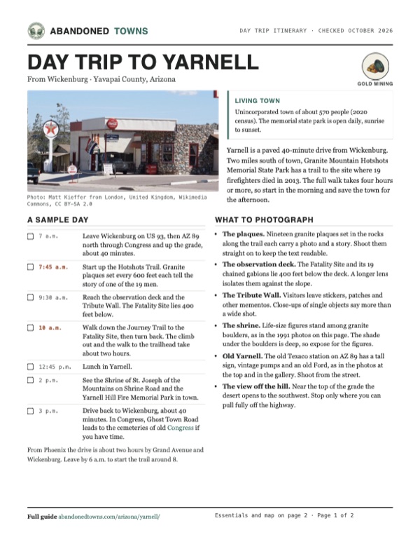
- Old Yarnell. The old Texaco station on AZ 89 has a tall sign, vintage pumps and an old Ford, as in the photos at the top and in the gallery. Shoot from the street.
- The view off the hill. Near the top of the grade the desert opens to the southwest. Stop only where you can pull fully off the highway.
Map & directions
Getting there
Wickenburg is the closest town, about 40 minutes away. From Phoenix, the route runs up Grand Avenue to Wickenburg and joins the same road. Both finish on AZ 89, through Congress and up the grade of Yarnell Hill. It's paved all the way.


Base map: USGS The National Map (public domain). Routes: OSRM on © OpenStreetMap contributors data (ODbL), computed October 2026. Times assume dry roads.
- From downtown Wickenburg, take Tegner Street and turn right on Wickenburg Way (US 60).0.2 mi
- Follow the US 93 bypass north through its roundabouts.5.9 mi
- Bear right onto AZ 89, the Wickenburg–Prescott Highway, through Congress and up the grade of Yarnell Hill.18.3 mi
- Continue on AZ 89, which becomes Broadway through town.0.9 mi
- From downtown Phoenix, take Van Buren Street to Grand Avenue and follow it (US 60) northwest to Wickenburg.53.5 mi
- In Wickenburg, follow the US 93 bypass north through its roundabouts.5.9 mi
- Bear right onto AZ 89 through Congress and up Yarnell Hill into town.19.2 mi
Road and safety notes
- AZ 89 is paved all the way. On Yarnell Hill it climbs 1,300 feet in four miles, with tight curves on the way up. Take it slowly.
- The memorial park trail is about 7 miles round trip. Start early in summer, carry plenty of water, and remember the park closes at sunset.
- Homes are private property, and we haven't confirmed who owns the old mine site. Stay on public roads and marked trails.
- Wickenburg is the nearest full-size town for fuel and supplies. Phoenix drive times assume light traffic on Grand Avenue.
Photos
Yarnell in photos
Visitor reports
Been to Yarnell?
Been there lately? Tell the next visitor what you found: whether you could get in, the state of the road and what's still standing. Photos are welcome. We read every report before it appears here.
Gold mining
More gold mining ghost towns
The nearest in Arizona.

 Guide
Weaver
34.16, -112.71Yavapai County, Arizona
The first camp of the 1863 Rich Hill gold strike, named for the guide Pauline Weaver. Its people moved to nearby Octave around 1900, leaving a stone…
 Guide
Octave
34.14, -112.71Yavapai County, Arizona
The company town of the Octave Mine, which took over Weaver's post office in 1900. The wartime order that closed gold mines in 1942 ended its run…
Nearby
Other sites near Yarnell
Straight-line distance from the townsite to other mapped sites in our Arizona index.
- Stanton4.0 mi S · Gila
- Stanton4.0 mi S · Yavapai
- Weaver5.2 mi SE · Yavapai
- Octave5.9 mi S · Yavapai
- Congress Mine6.1 mi W · Yavapai
- Congress6.3 mi W · Yavapai
- Placerita6.7 mi NE · Yavapai
- Congress Junction9.2 mi SW · Yavapai
Sources
Sources and credits
- ghosttowns.com, "Yarnell": fact sheet fields (roads, legal description, climate, best time, remains, post office date).
- Wikipedia, "Yarnell, Arizona", retrieved October 2026: elevation, Genung and Harrison Yarnell, the 1933 paving, the grade, population, the shrine and memorial parks, the town's economy.
- Wikipedia, "Yarnell Hill Fire", retrieved October 2026: ignition, acreage, buildings destroyed, deaths, containment and the investigations.
- Arizona State Parks, "Granite Mountain Hotshots Memorial State Park", checked October 2026: location, hours, free entry, trail length, 2016 dedication.
- Arizona State Parks, "Hotshots: Trails" and "Area Attractions", as of October 2026: trail segments, climb, stairs, time to allow, parking, portable restrooms, no water or trash cans, dogs, the plaques, the Tribute Wall, the gabions, restaurants in Yarnell.
- Arizona State Parks, FAQ, as of October 2026: the ban on recreational drones in state parks.
- azfamily.com, "Yarnell, where the Granite Mountain Hotshots made their stand" (June 2022): Rich Hill, the mine near Antelope Creek, the 1939 shrine.
- Darla Anderson, "From Tovrea Castle in Phoenix to Carraro's Grotto in Yarnell", Sharlot Hall Museum Days Past (July 2011): Alessio Carraro and his grotto.
- Find a Grave, "Harrison Yarnell": birth and death dates and his 1916 Hassayampa Miner obituary.
- Yarnell Elementary School District #52 (Model Creek School), checked October 2026: 2026–27 board records, as a current sign of the community.
- Coordinates: USGS GNIS feature 14039. Legal description: BLM PLSS survey grid. Routes: OSRM on OpenStreetMap data, October 2026. Status checked against the sources above on October 19, 2026.
Photo and map credits
- The welcome sign on AZ 89, 2009: Jonathanmallard, Wikimedia Commons, CC BY 3.0
- "The Place" bar, 2015: Matt Kieffer from London, United Kingdom, Wikimedia Commons, CC BY-SA 2.0
- An old Ford at the Texaco station, 2015: marksontok from Peoria, AZ, USA, Wikimedia Commons, CC BY 2.0
- Looking southwest from the top of Yarnell Hill: Alan Stark, Wikimedia Commons, CC BY-SA 2.0
- The Yarnell Hill Fire from the south, July 1, 2013: U.S. Department of Agriculture, Wikimedia Commons, CC BY 2.0
- Yarnell Hill Fire Memorial Park, 2021: Kurt Florman, Wikimedia Commons, CC BY-SA 4.0
- St. Joseph and the Christ child at the shrine, 1991: John Margolies, Wikimedia Commons, Public domain
- The crucifix at the shrine, 1991: John Margolies, Wikimedia Commons, Public domain
- AZ 89 at the top of the Yarnell grade, 2013: Chris English, Wikimedia Commons, CC BY-SA 3.0
- The old Texaco station, 2015: Matt Kieffer from London, United Kingdom, Wikimedia Commons, CC BY-SA 2.0
- USGS Congress sheet, 1903: Yarnell at the head of the pass, with Antelope Peak to the east and the Planet Saturn Mine below: U.S. Geological Survey, USGS catalog, Public domain
- Area base map, topo and aerial imagery: USGS The National Map (public domain).
- Historic maps: USGS Historical Topographic Map Collection (public domain): Prescott 1887, 1:250,000; Congress 1903, 1:125,000; Prescott 1954, 1:250,000; Yarnell 1969, 1:24,000; Bradshaw Mts 1981, 1:100,000.