 Abandoned

Overview
The first town in Arkansas
Davidsonville was laid out in 1815 on the west bank of the Black River, near where the Spring and Eleven Point rivers come in. A group of businessmen planned it as a new trade center for the region, which was then still part of Missouri Territory. It started out as Lawrence and was renamed Davidsonville by 1817. It stood on an old Native American site; the courthouse was apparently built on top of an old mound.
For a decade it was the leading town of northeast Arkansas. It was the seat of Lawrence County, which then took in about a third of the present state. The first post office in Arkansas opened here on June 28, 1817, the territory's first federal land office followed in 1820, and in 1822 the town put up Arkansas's first courthouse, a two-story brick building on the square. A ferry linked it to the road to Memphis. It was never large: a traveler in 1820 counted ten to fifteen houses, and the Encyclopedia of Arkansas says the population never passed a few hundred.
The town lost out to the roads. The Southwest Trail, the main route across the territory, was moved to higher ground, and new towns grew on it. The land office moved away (to Napoleon in 1821 by one account, to Batesville in 1828 by another), and the county seat moved to Jackson in 1829 or 1830. Floods, isolation and the rise of Pocahontas and Batesville did the rest. By statehood in 1836 Davidsonville was essentially abandoned. A story from the 1960s that cholera emptied it has been disproved.
Video
An evening on the townsite trail
A couple stopping overnight in the campground on April 26, 2026, the date in the title, walk the park at sunset: the lake beside the campground, then the Historic Townsite Trail, with its town map, lot and street markers in the grass, wayside panels on the excavations, the steel frame outlining the courthouse on Courthouse Square, and the old stone tablet calling the park the oldest town site in Arkansas. The video ends at their campsite. The stone tablet says the first courthouse was built here in 1815; the Encyclopedia of Arkansas dates the courthouse and jail to 1822.
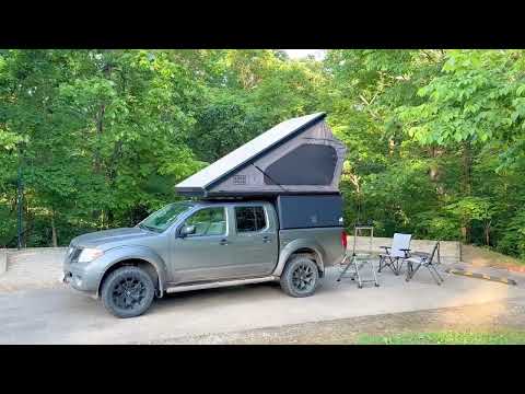 Play “Davidsonville Historic State Park, Arkansas, April 26 2026” from YouTube
Timeline
1815 to 1836
- A Native American mound is built on the site; the 1822 courthouse was later put on top of it. Archaeologists trace use of the site back to about 4000 B.C.
- The town is founded as Lawrence on the west bank of the Black River, in Missouri Territory, by businessmen hoping to break from St. Louis and Ste. Genevieve. It is called Davidsonville by 1817.
- Platted in late 1815 or early 1816 as the seat of Lawrence County, which then covers about the northern third of present-day Arkansas.
- The first post office in what became Arkansas opens here, with Adam Richie as postmaster.
- James Boyd's plat of the town is made official. Davidsonville becomes part of the new Arkansas Territory.
- The territory's first federal land office opens in the town. A traveler counts ten to fifteen houses.
- A two-story brick courthouse, the first in Arkansas, is built on the town square, with a log jail to its northwest.
- The land office leaves. The Encyclopedia of Arkansas says it moved to Napoleon in 1821; Wikipedia says Batesville in 1828.
- The county seat moves to Jackson. The Encyclopedia of Arkansas says 1829; the University of Arkansas project says 1830.
- By statehood the town is essentially abandoned. A family ferry across the Black River runs here until the 1930s.
- The legislature passes Act 418 in 1957 to preserve the site. The University of Arkansas project says local families donated most of it; the Encyclopedia of Arkansas says the site was bought in 1959.
- The site is listed on the National Register of Historic Places, as Old Davidsonville State Historic Monument. Wikipedia gives 1974; the University of Arkansas project says 1969.
- The Arkansas Archeological Survey uncovers part of the courthouse foundation, confirming it stood at the center of town.
- New excavations, led by Kathleen H. Cande, find a blacksmith shop, houses and other buildings.
What's left
A town under the grass
Very little shows above ground. The townsite, once a grid of streets around a central square with the courthouse in the middle, looks like a grassy field with a few trees. The park's buildings were first put on the townsite, then moved to nearby ridges, and the site was cleared in the 1980s so archaeologists could work. Digs in 1979 and 1980 found part of the courthouse foundation, and digs from 2004 found a blacksmith shop and houses on the town lots. The Encyclopedia of Arkansas says the digs are still turning up streets, foundations and artifacts.
The Historic Townsite Trail, three quarters of a mile and rated easy by the state, loops past twelve wayside exhibits marking where the courthouse, post office and other buildings stood. Photos from April 2016 show tall steel frames on the townsite, outlining the size of vanished buildings, with paths and lot markers between them. There are two small cemeteries. A plaque in the park, photographed in 2011, names the town for John Davidson, who represented the county in the Missouri territorial legislature in 1816, and says Stephen F. Austin held the first territorial court here in 1820. It dates the courthouse to 1815, earlier than the 1822 the other sources give. The visitor center has an audio tour, a replica 1820s hunter-trapper flatboat and artifacts from the digs.
- Platted townsite with wayside exhibits at building sites
- Courthouse foundation site on the old square
- Two small cemeteries
- Artifacts from the digs in the visitor center


The historic maps below show how the site was forgotten and found again. The 1934 Powhatan sheet has no town at all: the spot is marked Scotts Ferry, with Cox Ferry just upstream. The 1957 regional sheet labels it Old Davidsonville State Park, and the 1983 sheet shows the park on AR 166 beside the Black River.
Historic maps
Davidsonville on USGS maps, 1934–1983
Crops from the USGS Historical Topographic Map Collection, centered on the townsite. Each sheet shows what surveyors mapped that year; compare them with today's topo and aerial on this page.

Day trip
Plan a day trip to Davidsonville from Pocahontas
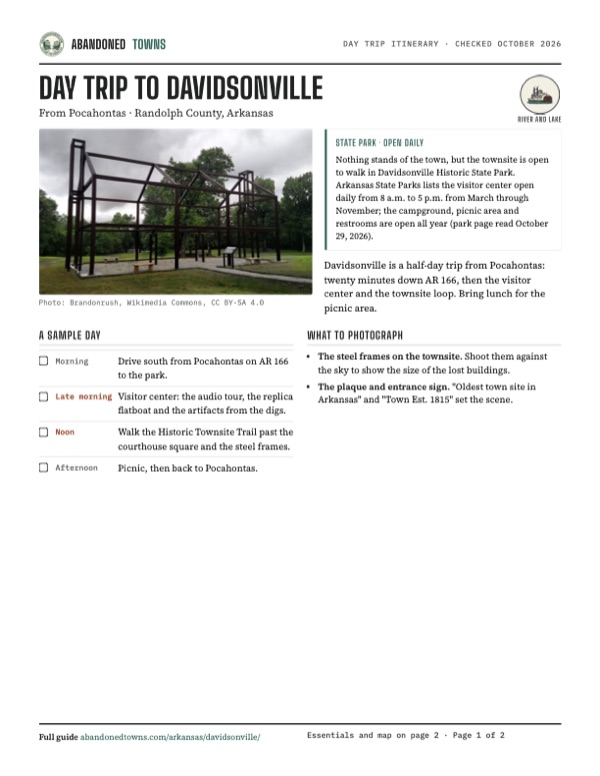
Take it with you
Day trip itinerary
The essentials, the sample day with boxes to tick, what to photograph and the coordinates, on two printable pages. Handy where there's no signal.
Download the PDF (423 KB)Davidsonville is a half-day trip from Pocahontas: twenty minutes down AR 166, then the visitor center and the townsite loop. Bring lunch for the picnic area.
A sample day
- Drive south from Pocahontas on AR 166 to the park.
- Visitor center: the audio tour, the replica flatboat and the artifacts from the digs.
- Walk the Historic Townsite Trail past the courthouse square and the steel frames.
- Picnic, then back to Pocahontas.
What to photograph and film
- The steel frames on the townsite. Shoot them against the sky to show the size of the lost buildings.
- The plaque and entrance sign. "Oldest town site in Arkansas" and "Town Est. 1815" set the scene.
Map & directions
Getting there
Pocahontas is the closest town with services. The route from Pocahontas follows AR 166 south to the park; the route from Little Rock comes in from the west on AR 361. Both end at the park, 25 metres from the mapped townsite. They were computed from OpenStreetMap and haven't been driven by us.


Base map: USGS The National Map (public domain). Routes: OSRM on © OpenStreetMap contributors data (ODbL), computed October 2026. Times assume dry roads.
- From downtown Pocahontas, take West Broadway Street (AR 90) a block.0.1 mi
- Turn right on US 62 and US 67.0.4 mi
- Bear right on South Bettis Street (US 62).2.0 mi
- Turn left on AR 166 and follow it south.8.0 mi
- Turn left into the park and follow the park road to the townsite.0.6 mi
- From the State Capitol, take West 7th Street, South Chester Street and West 3rd Street to South Broadway.1.4 mi
- Follow South Broadway (US 70), West 7th Street and Bishop Lindsey Avenue to the interstate.1.6 mi
- Merge onto I-30.0.8 mi
- Take exit 143B for US 67 and US 167.0.7 mi
- Merge onto I-40 briefly.0.9 mi
- Keep left onto I-57 (US 167) and follow I-57 and US 67 north.120.1 mi
- Take the exit ramp.0.4 mi
- Turn left on US 63.10.4 mi
- Turn right on South 3rd Street (AR 25), then left on Elm Street (AR 117).0.5 mi
- Turn right on North 4th Street (AR 361) and follow it to the park.5.3 mi
- Turn right into the park and follow the park road to the townsite.0.6 mi
Road and safety notes
- We have no dated report on road surfaces. The park's address is on AR 166 (8047 Hwy. 166 South).
- The visitor center keeps shorter hours from December to February and closes on New Year's Day, Thanksgiving, Christmas Eve and Christmas Day.
Photos
Davidsonville in photos
Visitor reports
Been to Davidsonville?
Been there lately? Tell the next visitor what you found: whether you could get in, the state of the road and what's still standing. Photos are welcome. We read every report before it appears here.
River and lake
More river and lake ghost towns
The nearest in Arkansas.

 Guide
Chalk Bluff
36.48, -90.16Clay County, Arkansas
A ferry crossing and village where the St. Francis River cuts through Crowley's Ridge. It saw Civil War fighting in 1862 and 1863, and its people…
 Guide
Cadron Settlement
35.11, -92.55Faulkner County, Arkansas
A frontier town laid out in 1818 where Cadron Creek meets the Arkansas River. It nearly became the territorial capital, held a county seat twice, and…
Nearby
Other sites near Davidsonville
Straight-line distance from the townsite to other mapped sites in our Arkansas index.
- Sneed19.7 mi S · Jackson
- Buck Snort29.0 mi SE · Craighead
- Credit30.0 mi S · Craighead
- Moko48.7 mi NW · Fulton
- Chalk Bluff54.7 mi NE · Clay
- Harness78.5 mi W · Stone
- Slonikers Mill79.6 mi S · St. Francis
- Palestine82.3 mi S · St. Francis
Sources
Sources and credits
- Wikipedia, "Davidsonville Historic State Park", read October 29, 2026: 163 acres, the 1815 founding, the mound under the courthouse, the post office, land office and courthouse firsts, the Southwest Trail moved, the land office to Batesville in 1828, the county seat's moves from 1829, abandonment by 1836, Act 418 of 1957, the 1974 listing, the clearing in the 1980s, the grassy townsite and two cemeteries, the coordinates.
- Mike Polston, "Davidsonville (Randolph County)," Encyclopedia of Arkansas, updated March 17, 2026: Lawrence in 1815, the June 28, 1817 post office, the 1820 land office and its move to Napoleon the next year, the 1822 courthouse and jail, the ferry to the 1930s, a few hundred people, the 1820 house count, the reasons for decline, the disproved cholera story, the 1957 law and 1959 purchase.
- University of Arkansas CAST, "About Davidsonville", September 30, 2013: the founders, county seat to 1830, Boyd's plat of 1819, the 1957 donation, the 1969 listing, the 1979–1980 and 2004–2009 excavations.
- Arkansas State Parks, "Davidsonville Historic State Park", read October 29, 2026: address, phone, visitor center hours, holidays, campground and trails, the visitor center exhibits, the digs.
- Arkansas State Parks, "Historic Townsite Trail", read October 29, 2026: three quarters of a mile, easy, twelve wayside exhibits.
- Plaque "Old Davidsonville State Park, Oldest Town Site in Arkansas," read from the June 2011 photo: John Davidson in 1816, Stephen F. Austin's court in 1820, the courthouse dated 1815, the Davis and Sloan donation.
- Wikimedia Commons, Davidsonville Historic State Park: photos by Thomas R. Machnitzki (June 11, 2011) and Brandonrush (April 29, 2016) of the townsite, the steel frames, the well and the plaque.
- Elevation: USGS 3D Elevation Program point query. Routes: OSRM on OpenStreetMap data, October 2026. Not field-checked.
- My Corner Online, "Davidsonville Historic State Park, Arkansas, April 26 2026", YouTube, posted May 2, 2026: an evening walk on the Historic Townsite Trail, dated April 26, 2026 in its title (the video on this page); checked against its captions and storyboard frames.
Photo and map credits
- A steel frame outlining a two-story building on the townsite, with a wayside exhibit, April 2016: Brandonrush, Wikimedia Commons, CC BY-SA 4.0
- Another steel frame on the townsite among the oaks, April 2016: Brandonrush, Wikimedia Commons, CC BY-SA 4.0
- The townsite path leading to one of the steel frames, April 2016: Brandonrush, Wikimedia Commons, CC BY-SA 4.0
- Lot markers and a wayside exhibit on the grassy townsite, April 2016: Brandonrush, Wikimedia Commons, CC BY-SA 4.0
- A mulch path across the townsite, April 2016: Brandonrush, Wikimedia Commons, CC BY-SA 4.0
- The park entrance sign, "Town Est. 1815", June 2011: Thomas R. Machnitzki, Wikimedia Commons, CC BY 3.0
- The plaque "Oldest town site in Arkansas": the first post office (June 28, 1817), the first courthouse (it says built in 1815), the first land office (1820), and the land donated by the Davis and Sloan families, June 2011: Thomas R. Machnitzki, Wikimedia Commons, CC BY 3.0
- Sign at the old well: "the source of drinking water for the town of old Davidsonville, 1815–1829", June 2011: Thomas R. Machnitzki, Wikimedia Commons, CC BY 3.0
- The brick-lined well behind its fence, June 2011: Thomas R. Machnitzki, Wikimedia Commons, CC BY 3.0
- Area base map, topo and aerial imagery: USGS The National Map (public domain).
- Historic maps: USGS Historical Topographic Map Collection (public domain): Powhatan 1934, 1:62,500; Poplar Bluff 1957, 1:250,000; Poplar Bluff 1960, 1:250,000; Cherokee Village 1983, 1:100,000.