 Abandoned

Overview
A boom town kept in arrested decay

Gold turned up in the hills north of Mono Lake in 1859. One of the finders, W. S. Bodey, died in a blizzard that November, and the camp kept a respelled version of his name. For years it stayed small. Then in 1876 the Standard Company hit a profitable ore body, and a second strike in the Bodie Mine in 1878 set off a rush.
By 1879 estimates put Bodie at 7,000 to 10,000 people. The 1880 census counted 5,417. Nine stamp mills crushed ore, and bullion went to Carson City. The town had a Wells Fargo bank and, at the peak, 65 saloons along Main Street. The mines produced about $34 million in gold and silver between 1860 and 1941.
The good ore ran out within a few years. The town shrank through the 1880s, the Standard Consolidated closed in 1913, and a 1932 fire burned much of the business district. The last mine shut in 1942, and the 1950 census counted no one. The state took over in 1962. Today about 110 buildings stand in what the park calls arrested decay: repaired enough to stay up, but not restored. A 1999 study put visitors at about 200,000 a year.
Video
A day in the park
A couple on an Eastern Sierra road trip drive the last 3 unpaved miles in, pay at the gate, walk the town with the $3 self-guided booklet and look through windows at furnished rooms. The Methodist church is closed for stabilization while they are there. They watch the history film in the red barn, take the guided tour of the Standard stamp mill, which is otherwise off limits, and walk up to the cemetery. A friend gets dizzy from the altitude on the mill tour, and they close with tips such as bringing water, food, layers and cash. The stamp mill tour they took is over for 2026, the park says.
 Play “Bodie State Historic Park - What Survived In California’s Wildest Gold Town?” from YouTube
Timeline
Eighty years of Bodie

- A party of prospectors that includes W. S. Bodey finds gold north of Mono Lake. Bodey dies in a blizzard that November, and the camp takes a version of his name.
- The Standard Company strikes a profitable ore body. The boom starts the next year.
- A post office opens. The Standard Pioneer Journal of Mono County prints its first issue on October 10.
- Rich ore in the neighboring Bodie Mine brings a second rush.
- Estimates put the town at 7,000 to 10,000 people and about 2,000 buildings.
- The census counts 5,417 residents.
- Ore production peaks at $3.1 million for the year.
- The Methodist church goes up. It still stands.
- The cyanide process arrives around 1890. In 1892 the Standard Company's hydroelectric plant at Dynamo Pond powers its 20-stamp mill.
- The Standard Consolidated Mine closes.
- A fire burns much of the business district.
- War Production Board order L-208 closes the last mine. The post office closes the same year, and mining never resumes.
- Bodie becomes a National Historic Landmark district on July 4.
- The legislature creates Bodie State Historic Park.
What's left
What you'll see


Most visitors walk the grid of dirt streets around Main and Green Streets. The 1882 Methodist church is still standing; the Catholic church built the same year burned in 1928. In a visit video posted in September 2026 the Methodist church was closed for stabilization. A sign beside it says the building has developed a visible lean to the north and east, and that the work to straighten it and fit a permanent steel system inside its walls is "slated for completion by fall 2026." The Miners Union Hall is now the park museum, open part of the year. Interiors of houses, stores and hotels remain as they were left, stocked with goods. The Standard stamp mill stands on the hillside east of town. The park runs tours of the mill, but says mill tours are over for 2026.
Near the cemetery, the mortuary is the only building in town built of red brick three courses thick. The 1958 USGS sheet below marks the town grid, the cemetery, and mine workings on Bodie Bluff and Silver Hill, including the Red Cloud Mine, with the Geiger Grade road coming in from the west.
- Methodist church (1882)
- Miners Union Hall museum
- Standard stamp mill
- Main Street blocks
- Houses with furnishings
- Cemetery and brick mortuary
- Vehicles and mining equipment


Historic maps
Bodie on USGS maps, 1909–1998
Crops from the USGS Historical Topographic Map Collection, centered on the townsite. Each sheet shows what surveyors mapped that year; compare them with today's topo and aerial on this page.

Day trip
Plan a day trip to Bodie from Bridgeport
Take it with you
Day trip itinerary
The essentials, the sample day with boxes to tick, what to photograph and the coordinates, on two printable pages. Handy where there's no signal.
Download the PDF (441 KB)From Bridgeport, Bodie is about an hour each way, and the town is big enough to fill most of a day. There's drinking water and restrooms but no food or gas, so pack a lunch and fill the tank before you leave 395.
A sample day
- Leave Bridgeport. Head south on US 395 and turn onto CA 270, about an hour in all.
- The park opens. Buy the tour book and start on Main Street.
- Walk Green Street to the Methodist church and look into the houses along the side streets.
- Picnic lunch near the parking area.
- Visit the Miners Union Hall museum if it's open, then walk up to the cemetery.
- Head back to Bridgeport. The park closes at 4 p.m. from November 1 to May 1 and at 6 p.m. the rest of the year.
Coming from Reno? It's about 3 hours 35 minutes each way, so leave by 5:30 a.m. or plan to stay in Bridgeport.
What to photograph and film
- The Methodist church. The 1882 steeple is the tallest thing in town. Shoot it from Green Street with the hills behind.
- Through the windows. Rooms still hold furniture and goods. Press the lens to the glass to cut reflections.
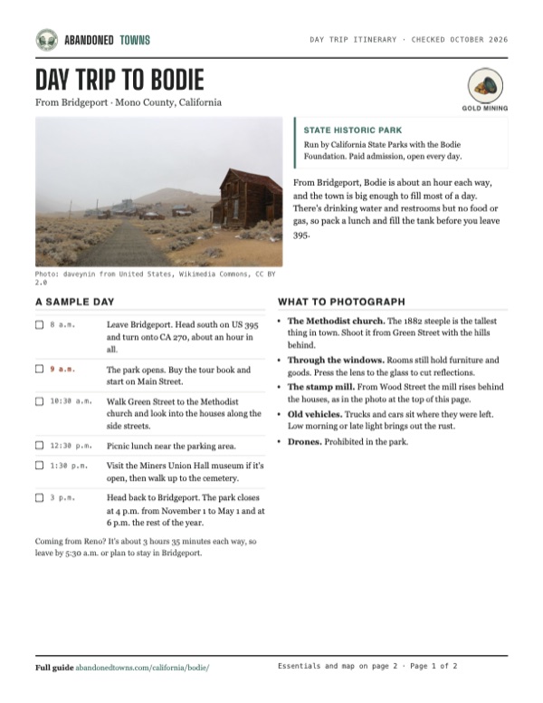
- The stamp mill. From Wood Street the mill rises behind the houses, as in the photo at the top of this page.
- Old vehicles. Trucks and cars sit where they were left. Low morning or late light brings out the rust.
- Drones. Prohibited in the park.
Map & directions
Getting there
Bridgeport, on US 395, is the nearest town. From there, drive south on 395 and turn east on CA 270, Bodie Road, which climbs into the Bodie Hills. The last 3 miles are unpaved. From Reno, the drive runs south through Carson City on I-580 and US 395.


Base map: USGS The National Map (public domain). Routes: OSRM on © OpenStreetMap contributors data (ODbL), computed October 2026. Times assume dry roads.
- Head south on Main Street, US 395.6.9 mi
- Turn left onto Bodie Road, CA 270. The pavement ends about 3 miles before town.12.5 mi
- Continue on Bypass Road and Bodie Road into the park.1.8 mi
- Follow the park road to Standard Street and the parking area.1.6 mi
- From central Reno, take I-80 to exit 15, then I-580 and US 395 south through Carson City.36 mi
- Stay on US 395 (South Carson Street) south toward Bridgeport.78 mi
- In Bridgeport, follow Main Street, US 395, south.6.7 mi
- Turn left onto Bodie Road, CA 270, and follow it to the park.15.9 mi
Road and safety notes
- The last 3 miles of road are unpaved and can be rough. The park asks drivers to slow down.
- In winter the road is usually snowbound, and the park is reached on skis, snowshoes or snowmobile. Snowmobiles must stay on designated roads.
- There's no food or gas at Bodie. Fill up in Bridgeport.
- Weather at 8,370 feet changes fast. Call the park about road conditions before you go.
Photos
Bodie in photos
Visitor reports
Been to Bodie?
Been there lately? Tell the next visitor what you found: whether you could get in, the state of the road and what's still standing. Photos are welcome. We read every report before it appears here.
Gold mining
More gold mining ghost towns
The nearest in California.

 Guide
Columbia
38.03, -120.41Tuolumne County, California
Columbia preserves brick storefronts, a schoolhouse and working shops in the southern mines. The historic park is part of a living community.
 Guide
North Bloomfield
39.37, -120.90Nevada County, California
A gold camp first called Humbug that grew to about 2,000 people around the biggest hydraulic mine in California. The 1884 Sawyer decision shut the…
Nearby
Other sites near Bodie
Straight-line distance from the townsite to other mapped sites in our California index.
- Dog Town10.5 mi W · Mono
- Masonic11.7 mi NW · Mono
- Lundy17.8 mi SW · Mono
- Belfort19.8 mi NW · Mono
- Mono Mills22.6 mi S · Mono
- Bennettville23.3 mi SW · Mono
- Benton39.9 mi SE · Mono
- Hites Cove60.3 mi SW · Mariposa
Sources
Sources and credits
- ghosttowns.com, "Bodie": fact sheet fields (roads, climate, best time, remains).
- Wikipedia, "Bodie, California", retrieved October 2026: discovery, boom, census figures, production, mills, Wells Fargo bank and saloons, churches, Miners Union Hall museum, brick mortuary, 1932 fire, 1942 closure, post office, landmark and park dates, standing buildings and interiors, visitor numbers (citing a 1999 study), climate.
- California State Parks, Bodie SHP, official site: hours, fees and peak-rate note, road and winter access, restrooms, water, pets, drones, museum and tours, the end of 2026 stamp mill tours, address and phone, as of October 19, 2026.
- The Places Where We Go, "Bodie State Historic Park - What Survived In California’s Wildest Gold Town?", YouTube, uploaded September 12, 2026: the video on this page; the Methodist church closed for stabilization and the sign beside it about its lean and the fall 2026 completion date (read from the video's frames).
- Coordinates: Wikipedia (from USGS GNIS). Elevation: USGS 3D Elevation Program point query. Routes: OSRM on OpenStreetMap data, October 2026.
Photo and map credits
- Wood Street, with the stamp mill behind: daveynin from United States, Wikimedia Commons, CC BY 2.0
- The town from the hillside in snow, and the park sign: daveynin from United States, Wikimedia Commons, CC BY 2.0
- Bodie around 1890: William Thompson, Virginia City, Nevada., Wikimedia Commons, Public domain
- The Methodist church, built in 1882, outside and in: daveynin from United States, Wikimedia Commons, CC BY 2.0
- The Standard stamp mill: Daniel Mayer, Wikimedia Commons, CC BY-SA 3.0
- Brick and frame buildings in 1972: Dick Rowan, Wikimedia Commons, Public domain
- The county barn: King of Hearts, Wikimedia Commons, CC BY-SA 4.0
- The leaning Swazey Hotel on Main Street, 1989: LBM1948, Wikimedia Commons, CC BY-SA 4.0
- Inside a Bodie saloon: Jon Sullivan, Wikimedia Commons, Public domain
- A truck at the old gas pumps: NevadaBay, Wikimedia Commons, CC BY-SA 4.0
- An abandoned car: Chris Willis from Palo Alto, California, USA, Wikimedia Commons, CC BY 2.0
- Buildings and cars in 1930, catalogued by the archive as the Masonic hall: Unknown photographerUnknown photographer, Wikimedia Commons, Public domain
- Topo map, area base map and aerial imagery: USGS The National Map (public domain).
- Historic maps: USGS Historical Topographic Map Collection (public domain): Bridgeport 1909, 1:125,000; Bridgeport 1920, 1:125,000; Bodie 1958, 1:62,500; Bridgeport 1985, 1:100,000; Bodie 1998, 1:24,000.