 Abandoned

Overview
The Yellow Aster's town

Randsburg sits at about 3,500 feet in the Rand Mountains, west of US 395 and about 17 miles south of Ridgecrest. A ridge separates it from its neighbor, Johannesburg. On April 25, 1895, three prospectors, Frederic Mooers, John Singleton and Charles Burcham, found gold here at what became the Yellow Aster mine. The camp that formed was first called Rand Camp.
It grew fast. The Rand Mining District was set up that December, the first post office opened in 1896, and by the end of that year the renamed Randsburg had more than 1,500 people. By October 1897 the district had produced over $600,000 in gold. A railroad from Johannesburg to Kramer Junction opened in 1898, and the Yellow Aster got its first stamp mill in 1899. Pay was poor, and miners struck in 1903.
The Yellow Aster closed in 1918, reopened in 1921 and ran on and off until 1933, then again from 1940 to 1956. Glamis Gold bought it in 1983 and worked it until 2006. The town never emptied. Forty-five people lived here at the 2020 census, and most visitors come between autumn and spring, especially for Old West Days in September.
Timeline
A century of the Yellow Aster

- Frederic Mooers, John Singleton and Charles Burcham find gold at the Yellow Aster. The camp is first called Rand Camp.
- The Rand Mining District is created.
- The first post office opens. By the end of the year the camp is Randsburg, with more than 1,500 people.
- The district has produced more than $600,000 in gold.
- The Randsburg Railway opens from Johannesburg to Kramer Junction, with a stop at Atolia.
- The Yellow Aster's first stamp mill opens.
- Miners strike over poor pay.
- The Yellow Aster closes in 1918, reopens in 1921 and runs on and off until 1933. John Cummings & Co. works it from 1940 to 1956.
- Glamis Gold buys the Yellow Aster and works it again. Operations end for good by 2006.
- The census counts 45 people, down from 69 in 2010 and 77 in 2000.
- Flash floods hit eastern Kern County, including Randsburg and Johannesburg. Redrock–Randsburg Road and the local water system are damaged.
- Kern County closes Redrock–Randsburg Road from Highway 14 to Highway 395 for storm damage. It is still listed as closed in October 2026.
What's here
Main street and the mine


Randsburg's main street, Butte Avenue, keeps about a dozen historic buildings, among them the White House Saloon, by a travel guide updated in July 2026. The same guide says the General Store's original building, with its soda fountain, has been closed since 2022, and that operating days in town "can be irregular, particularly during the week." The Loop, a Tehachapi paper, reported in September 2026 that the store's last owners now run The Vault up the street, and that the town's few shops are usually open only on weekends and holidays.
The Rand Desert Museum, at 161 Butte Avenue, lists its hours as Saturday and Sunday, 11 a.m. to 2 p.m., and by appointment. The Loop's writer found it closed on a Sunday in September 2026, so don't plan a trip around it.
Off-roaders come over the Thanksgiving and New Year's Day weekends and use the town's legal off-road trail, by Wikipedia's account. The Loop reported in September 2026 that the rules on where and when off-road vehicles may go are changing, so check the current rules before you ride. Old West Days, usually on the third weekend of September, brings gunfights, gold panning, bands and vendors. The July 2026 guide says the September 2025 event was disrupted by the flood; the 2026 event was on September 19.
The historic maps below show the district's growth. The 1903 and 1911 sheets mark Randsburg with Johannesburg next door and the Yellow Aster Mine and Government Peak to the south, and the 1903 sheet names the Valverde Mine to the north-east. The 1947 sheet adds Garlock, Atolia and Red Mountain, and the 1967 sheet shows a tailings pond west of town.
- Butte Avenue's historic buildings
- White House Saloon
- Rand Desert Museum
- Yellow Aster mine workings
- Rand Mining District landmark (No. 938)


Historic maps
Randsburg on USGS maps, 1903–1976
Crops from the USGS Historical Topographic Map Collection, centered on the townsite. Each sheet shows what surveyors mapped that year; compare them with today's topo and aerial on this page.

Day trip
Plan a day trip to Randsburg from Ridgecrest
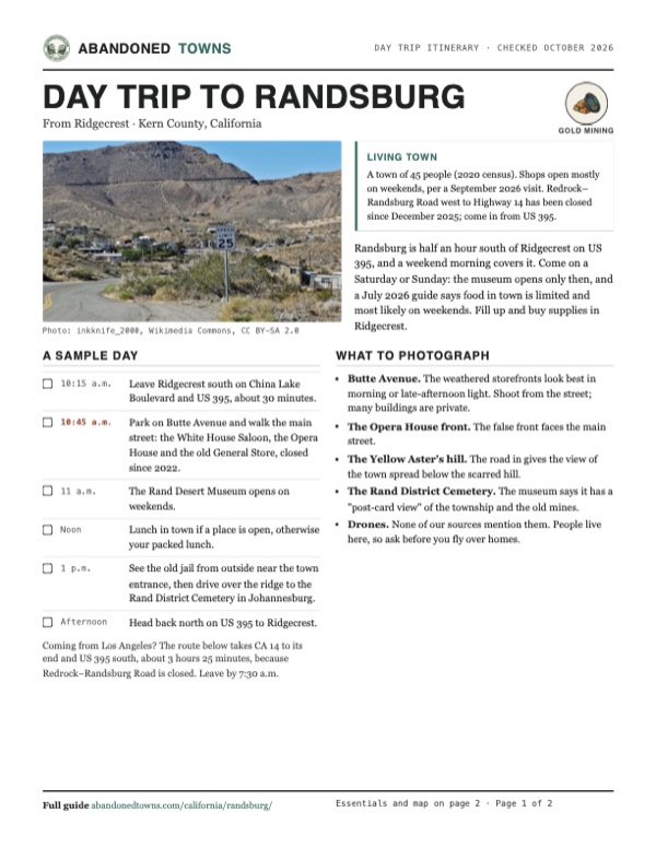
Take it with you
Day trip itinerary
The essentials, the sample day with boxes to tick, what to photograph and the coordinates, on two printable pages. Handy where there's no signal.
Download the PDF (663 KB)Randsburg is half an hour south of Ridgecrest on US 395, and a weekend morning covers it. Come on a Saturday or Sunday: the museum opens only then, and a July 2026 guide says food in town is limited and most likely on weekends. Fill up and buy supplies in Ridgecrest.
A sample day
- Leave Ridgecrest south on China Lake Boulevard and US 395, about 30 minutes.
- Park on Butte Avenue and walk the main street: the White House Saloon, the Opera House and the old General Store, closed since 2022.
- The Rand Desert Museum opens on weekends.
- Lunch in town if a place is open, otherwise your packed lunch.
- See the old jail from outside near the town entrance, then drive over the ridge to the Rand District Cemetery in Johannesburg.
- Head back north on US 395 to Ridgecrest.
Coming from Los Angeles? The route below takes CA 14 to its end and US 395 south, about 3 hours 25 minutes, because Redrock–Randsburg Road is closed. Leave by 7:30 a.m.
What to photograph and film
- Butte Avenue. The weathered storefronts look best in morning or late-afternoon light. Shoot from the street; many buildings are private.
- The Opera House front. The false front faces the main street.
- The Yellow Aster's hill. The road in gives the view of the town spread below the scarred hill.
- The Rand District Cemetery. The museum says it has a "post-card view" of the township and the old mines.
- Drones. None of our sources mention them. People live here, so ask before you fly over homes.
Map & directions
Getting there
Ridgecrest is half an hour north on US 395, paved all the way. The shortcut from CA 14, Redrock–Randsburg Road, has been closed since December 2025, so our Los Angeles route stays on CA 14 to its end and comes back south on US 395, the way The Loop's writer drove in September 2026. Both routes turn off US 395 onto the short paved road into town.


Base map: USGS The National Map (public domain). Routes: OSRM on © OpenStreetMap contributors data (ODbL), computed October 2026. Times assume dry roads.
- Head south on South China Lake Boulevard (US 395 Business).6.1 mi
- Turn left onto US 395 and continue south.13.8 mi
- Turn right onto Redrock–Randsburg Road into town, then right on Burma Avenue and Rand Road.1.3 mi
- From downtown Los Angeles, take US 101 north to I-5 north.24.5 mi
- Take exit 161A onto CA 14 and follow it north to its end at US 395. Redrock–Randsburg Road, the shorter way east, is closed.119.7 mi
- Take the US 395 South exit toward San Bernardino and follow US 395 south.28.0 mi
- Turn right onto Redrock–Randsburg Road into town, then right on Burma Avenue and Rand Road.1.3 mi
Road and safety notes
- From Ridgecrest the route is paved all the way on US 395.
- Flash floods on September 18–19, 2025 damaged Redrock–Randsburg Road and other roads in eastern Kern County. Kern County Public Works lists it closed from Highway 14 to Highway 395 since December 24, 2025, for storm damage, with "no expected opening date at this time" (list read October 19, 2026). It lists Garlock Road as closed to through traffic. Don't go around road-closed signs.
- The September 2025 floods also damaged the Rand Communities Water District's system. Bring your own water.
- Summers are very hot. Most visitors come between autumn and spring.
- People live here. Stay out of yards and off the mine workings.
Photos
Randsburg in photos
Visitor reports
Been to Randsburg?
Been there lately? Tell the next visitor what you found: whether you could get in, the state of the road and what's still standing. Photos are welcome. We read every report before it appears here.
Gold mining
More gold mining ghost towns
The nearest in California.

 Guide
Garlock
35.40, -117.79Kern County, California
A water stop called Cow Wells that became a mill town when Eugene Garlock hauled in a stamp mill for the Randsburg gold rush. Water piped to…
 Guide
Ballarat
36.05, -117.22Inyo County, California
A supply town for the Panamint Range mines that held about 500 people in 1898 and was nearly empty by 1917. A prospector called Seldom Seen Slim…
Nearby
Other sites near Randsburg
Straight-line distance from the townsite to other mapped sites in our California index.
- Johannesburg1.3 mi E · Kern
- Red Mountain2.4 mi E · San Bernardino
- Garlock7.8 mi W · Kern
- Freeman Junction21.2 mi NW · Kern
- Leliter25.5 mi N · Kern
- Sageland32.2 mi W · Kern
- Valley Wells38.0 mi NE · Inyo
- Claraville38.2 mi W · Kern
Sources
Sources and credits
- ghosttowns.com, "Randsburg": fact sheet fields (roads, best time).
- Wikipedia, "Randsburg, California", retrieved October 2026: the Yellow Aster discovery and history, the mining district and landmark No. 938, population, gold output, the railroad, the strike, Glamis Gold, climate, tourism, weekend shops, Western Days, the 2000, 2010 and 2020 censuses, elevation.
- KGET, "Kern County Board of Supervisors expected to declare local emergency due to September flooding" (2025): the September 18–19 floods in Randsburg and Johannesburg, damage to Redrock–Randsburg Road and the Rand Communities Water District.
- BakersfieldNow, "Kern County road closures persist post-storm" (November 22, 2025): CHP's report of Redrock–Randsburg Road among several closures.
- Kern County Public Works, road status and closures, read October 19, 2026: Redrock–Randsburg Road closed from Highway 14 to Highway 395 since December 24, 2025, with no expected opening date; Garlock Road closed to through traffic.
- The Loop, "Randsburg, 2026" (Mel White, September 26, 2026): the road off CA 14 still closed, the drive in on US 395, shops usually open on weekends, the General Store's closure and The Vault, the museum closed on her visit, Old West Days on September 19, changing off-road rules.
- Rand Desert Museum, official site, read October 2026: hours and address.
- CalExplornia, "Randsburg" (updated July 2026): Butte Avenue's buildings, the General Store closed since 2022, irregular hours, the 2025 Old West Days disruption.
- Rand Desert Museum, "Contact / Visit" and "Rand District Cemetery", read October 21, 2026: weekend hours, appointments by email, the cemetery in Johannesburg and its view. CalExplornia, read the same day: food, time on site, parking, shade and the jail, for the day trip.
- Elevation from a USGS 3D Elevation Program point query. Routes: OSRM on OpenStreetMap data, October 2026. Status checked against the sources above on October 19, 2026.
Photo and map credits
- Randsburg from the road in, below the Yellow Aster's hill, 2015: inkknife_2000, Wikimedia Commons, CC BY-SA 2.0
- The Opera House front, 2005: Pretzelpaws, Wikimedia Commons, CC BY-SA 3.0
- Randsburg in winter, around 1900, by C. C. Pierce: C. C. Pierce, Wikimedia Commons, Public domain
- Card players inside the Yellow Aster Saloon, a tent saloon, around 1900: C. C. Pierce, Wikimedia Commons, Public domain
- What is left of the north side of Butte Avenue, 2015: inkknife_2000, Wikimedia Commons, CC BY-SA 2.0
- A group outside the Elite Theater, around 1897 to 1900: C. C. Pierce, Wikimedia Commons, Public domain
- The north end of Butte Avenue, 2015: inkknife_2000, Wikimedia Commons, CC BY-SA 2.0
- Restored storefronts on Butte Avenue, 2015: inkknife_2000, Wikimedia Commons, CC BY-SA 2.0
- Area base map, topo and aerial imagery: USGS The National Map (public domain).
- Historic maps: USGS Historical Topographic Map Collection (public domain): Randsburg 1903, 1:62,500; Randsburg 1911, 1:62,500; Trona 1947, 1:250,000; Johannesburg 1967, 1:24,000; Cuddeback Lake 1976, 1:100,000.