 Abandoned

Overview
A camp on private land

Officially it was the Granada Relocation Center, but the people held there called it Amache, after its post office. The name came from Amache Prowers, a Cheyenne woman married to the rancher John Wesley Prowers, for whom the county is named. Unlike the other nine War Relocation Authority camps, Amache was built on private land, ranches taken cheaply after the Dust Bowl. Its people came mostly from California: Sonoma County and the Bay Area, the San Joaquin Valley and southwest Los Angeles, through the Merced and Santa Anita assembly centers.
Amache opened in August 1942 before it was finished, and the first arrivals helped complete it. At its peak in February 1943 it held 7,318 people, the smallest of the ten camps but the tenth-largest town in Colorado. It had schools, a hospital, police and fire departments, a co-op store, a silkscreen shop and farms that grew 4 million pounds of vegetables in 1943, all inside barbed wire with eight guard towers. Governor Ralph Carr, by Wikipedia's account, was the only governor who did not oppose a camp in his state.
The camp closed on October 15, 1945. Each person left with $25 and a train ticket. The barracks were removed, but Amache, alone among the camps, had concrete foundations, and they remain. A Granada High School group, the Amache Preservation Society, has cared for the site since 1990, and in 2024 it became Amache National Historic Site.
Video
A drive around the camp grid
A visitor starts at the honor roll and the flagpoles by the entrance panels and walks the short trail of signs there, then drives the camp's dirt roads through grass, brush and old trees to the barracks, the water tower and the guard tower, and on to the cemetery. The creator saw only one or two other cars in about an hour on the site. The creator says rangers staff the museum in Granada and lead tours; the Park Service says the museum is run by the Amache Preservation Society, which says it offers no guided site tours at this time.
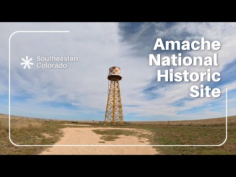 Play “Amache National Historic Site - Touring the Grounds of the former Granada War Relocation Center” from YouTube
Timeline
Three years at Amache

- President Roosevelt signs Executive Order 9066. Exclusion zones on the West Coast apply only to people of Japanese descent.
- The government takes the XY and Koen ranches and other private land near Granada, much of it by condemnation. Amache is the only War Relocation Authority camp built on private land.
- Construction begins with a workforce of nearly a thousand, including incarcerees who come early to help. The NPS gives June 12; its history page says late June.
- The Granada Relocation Center opens. People come from the Merced and Santa Anita assembly centers in California.
- Population peaks at 7,318, making Amache the tenth-largest population center in Colorado and the smallest of the ten camps.
- Amache High School is completed, over protests that Colorado tax money should not school Japanese Americans.
- Camp farmers grow 4 million pounds of vegetables, enough to feed the camp with a surplus.
- 441 Nisei from Amache join the U.S. Army. A memorial in the camp cemetery names 31 who died.
- The last residents leave. Each is given $25 and a train ticket. In all, 10,331 people passed through Amache.
- The Amache Preservation Society, a Granada High School group, begins work on the site.
- Listed on the National Register (May 18, 1994) and named a National Historic Landmark (February 10, 2006).
- The Amache National Historic Site Act is signed. The site joins the National Park System on February 15, 2024.
What's left
What you'll see

The Park Service describes the site as a cemetery, a monument, building foundations and restored and reconstructed buildings, with interpretive panels throughout. Visitors are met at the entrance by flagpoles and an Honor Roll Memorial, which lists the Amache residents who served in the military in World War II, according to the Preservation Society and a Park Service photo caption. The roads of the camp still run in a grid across the hill, and the concrete foundations of the barracks blocks lie along them in the grass. A restored barrack and recreation hall, a rebuilt water tower and an octagonal guard tower, a design used only at Amache, stand on the site; a visit video posted November 2025 says the barrack and recreation hall can be entered only when park staff are there.
The cemetery is in the southwest corner, with the granite monument dedicated in September 1945. The War Relocation Authority's caption for its photo of the stone says it names 148 residents who died, among them 31 Nisei soldiers; Wikipedia describes it as a memorial to the 31 Amache soldiers who died in the war. The roads are not labeled and individual barracks blocks are not marked, so the Amache Preservation Society's downloadable driving tour and map help. The site is an active archaeological site; leave any artifact where you find it.
The 1953 Granada sheet below marks "Camp Amache (Aban'd)" with its grid of blocks, the water tank, a pumping station and the cemetery to the southwest. The 1890 sheet shows the same ground as empty prairie south of the Santa Fe railroad and the town of Granada.
- Concrete barracks foundations and the road grid
- Cemetery and its 1945 granite monument
- Honor Roll Memorial and flagpoles at the entrance
- Restored barrack and recreation hall
- Reconstructed water tower and guard tower
- Interpretive panels


Visiting
The site and the museum

The Park Service says the site is open in daylight and not gated, and lists no visitor center. Bring water: there is none on site, and no restroom. The Amache Preservation Society advises long pants and closed-toed shoes for walking beyond the entrance kiosk or the cemetery, a walking stick for the uneven ground and the snakes, and an early-morning or evening visit in summer, away from lightning storms.
The Amache Museum, run by the Preservation Society and staffed by Granada High School students, is at 205 E. Goff Ave. in Granada. Its posted hours are 8:00 am to 4:00 pm, Monday through Friday, Saturday by appointment, closed Sunday and major holidays. It has a restroom. Granada has one restaurant, a food truck and a convenience store; the nearest lodging is in Holly, about 10 miles east, with more in Lamar.
Historic maps
Amache on USGS maps, 1890–1984
Crops from the USGS Historical Topographic Map Collection, centered on the townsite. Each sheet shows what surveyors mapped that year; compare them with today's topo and aerial on this page.

Day trip
Plan a day trip to Amache from Lamar
Take it with you
Day trip itinerary
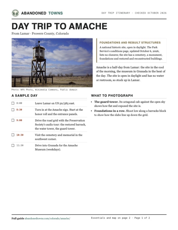
The essentials, the sample day with boxes to tick, what to photograph and the coordinates, on two printable pages. Handy where there's no signal.
Download the PDF (434 KB)Amache is a half-day from Lamar: the site in the cool of the morning, the museum in Granada in the heat of the day. The site is open in daylight and has no water or restroom, so stock up in Lamar.
A sample day
- Leave Lamar on US 50/385 east.
- Turn in at the Amache sign. Start at the honor roll and the entrance panels.
- Drive the road grid with the Preservation Society's audio tour: the restored barrack, the water tower, the guard tower.
- Visit the cemetery and memorial in the southwest corner.
- Drive into Granada for the Amache Museum (weekdays).
What to photograph and film
- The guard tower. Its octagonal cab against the open sky shows how flat and exposed the site is.
- Foundations in a row. Shoot low along a barracks block to show how the slabs line up down the grid.
Map & directions
Getting there
Lamar, on US 50, is the nearest larger town. The Park Service directions: from Lamar, drive east on US 385/50 for 17.5 miles and turn right at the brown Amache sign onto County Road 23 5/10; from Granada, drive west a mile and turn left there. From Colorado Springs, take I-25 to Pueblo and US 50 east down the Arkansas Valley.


Base map: USGS The National Map (public domain). Routes: OSRM on © OpenStreetMap contributors data (ODbL), computed October 2026. Times assume dry roads.
- From downtown Lamar, take West Elm Street and turn left on South Main Street (US 287/385).0.2 mi
- Turn right on East Olive Street (US 50/385) and follow it east toward Granada.16.3 mi
- Turn right at the Amache sign onto County Road 23 5/10 into the site.1.0 mi
- From downtown Colorado Springs, take South Nevada Avenue to I-25.1.3 mi
- Follow I-25 south to Pueblo.38.1 mi
- Leave at exit 101 and follow CO 47.4.8 mi
- Take East 4th Street (CO 96) to US 50.0.7 mi
- Follow US 50 east down the Arkansas Valley to Lamar.115.9 mi
- In Lamar, follow the US 50 truck route on Maple Street and North 2nd Street.0.5 mi
- Turn left on East Olive Street (US 50/385) toward Granada.16.1 mi
- Turn right at the Amache sign onto County Road 23 5/10 into the site.1.0 mi
Road and safety notes
- Turn at the brown Amache sign onto County Road 23 5/10. The Preservation Society says the main entrance is almost a mile in, just past W. Amache Rd.
- The roads inside the site are not labeled. The Park Service asks visitors to stay on the roads and says there are no established trails; the Preservation Society describes a short walking trail with picnic tables at the main entrance.
- There is no internet and only limited cell service at the park (NPS).
- Inside the site the roads are dirt, as a visit video posted November 2025 shows.
Photos
Amache in photos
Visitor reports
Been to Amache?
Been there lately? Tell the next visitor what you found: whether you could get in, the state of the road and what's still standing. Photos are welcome. We read every report before it appears here.
Nearby
Other sites near Amache
Straight-line distance from the townsite to other mapped sites in our Colorado index.
- Brandon28.1 mi N · Kiowa
- Able29.4 mi W · Bent
- Caddoa34.7 mi W · Bent
- Boggsville48.1 mi W · Bent
- Bent's Old Fort National Historic Site59.9 mi W · Otero
- Vona89.4 mi N · Kit Carson
- Bloom92.3 mi W · Otero
- Arriba99.4 mi NW · Lincoln
Sources
Sources and credits
- Wikipedia, "Granada War Relocation Center", read October 29, 2026: the coordinates, private land and condemnation, the opening on August 27, 1942, the peak of 7,318 in February 1943, Amache Prowers, Governor Carr, the high school protests, the eight towers, 4 million pounds of vegetables, 441 Nisei soldiers and the memorial with 31 names, the Preservation Society since 1990, the 1994, 2006, 2022 and 2024 designations.
- ghosttowns.com, Amache: fact sheet (county, 2WD roads, climate, best time, remains) and history: August 1942 to October 1945, 7,318 at the peak, fire and police departments, the high school.
- NPS, Amache Basic Information (updated November 17, 2025), Current Conditions (updated October 6, 2026) and Directions (updated January 26, 2026), read October 29, 2026: daylight hours, no gate, what the site holds (a cemetery, a monument, foundations, the road network, a barrack, a recreation hall, a guard tower and a water tower), no water, restrooms or visitor center, no internet and limited cellular access, no established trails, snakes and sharp plants, the address, the directions, the phone.
- NPS, Amache History & Culture (updated June 18, 2026): the name from the post office, 7,318 at the peak, tenth-largest in Colorado, 10,331 in all, the Merced and Santa Anita centers, the XY and Koen ranches, construction from June 1942, closing on October 15, 1945, $25 and a train ticket.
- Amache Preservation Society, Visiting and Know before you go, read October 29, 2026: the museum address and hours, the driving tour, the entrance past W. Amache Rd., the Honor Roll Memorial of residents who served in the military, the walking trail and picnic tables at the entrance, the restored 12H barrack, 11F recreation hall, guard tower and water tower, unlabeled roads, clothing and water, restrooms, the restaurant, food truck and lodging, the active archaeological site.
- Roadside Oddities - America's Unique Destinations, "Amache National Historic Site - Touring the Grounds of the former Granada War Relocation Center", YouTube, posted November 15, 2025: the video on this page; the honor roll and flags, the entrance trail, the dirt roads, the barracks, water tower and guard tower, entry to the barrack and recreation hall only when staff are there, the cemetery.
- War Relocation Authority caption of Hikaru Iwasaki's October 1945 photo of the cemetery monument (via Commons): dedicated September 6, 1945, with 148 names including 31 Nisei soldiers.
- Commons photos by the National Park Service (2020, 2021), Jeffrey Beall (2013), Coasterlover1994 (2019) and Coloradopreservation (2015); War Relocation Authority photos by Tom Parker, Joseph McClelland, Charles E. Mace and Hikaru Iwasaki (1942 to 1945), via the National Archives.
- Elevation: USGS 3D Elevation Program point query. Routes: OSRM on OpenStreetMap data, October 2026.
Photo and map credits
- The reconstructed octagonal guard tower, February 2020: NPS Photo, Wikimedia Commons, Public domain
- The entrance panels and the camp site beyond, August 2019: Coasterlover1994, Wikimedia Commons, CC BY-SA 4.0
- The honor roll and flagpoles, August 2021: NPS Photo, Wikimedia Commons, Public domain
- A dirt road past the guard tower toward a barrack, August 2015: Coloradopreservation, Wikimedia Commons, CC BY-SA 4.0
- Restored barrack, water tower and guard tower: NPS Photo, Wikimedia Commons, Public domain
- A concrete foundation outline in the grass, August 2013: Jeffrey Beall from Colorado, USA, Wikimedia Commons, CC BY-SA 2.0
- A foundation among bare trees, February 2021: NPS Photo, Wikimedia Commons, Public domain
- Children and barracks at the Granada center, June 1943: Joseph McClelland, Wikimedia Commons, Public domain
- Typical family quarters, July 1943: Charles E. Mace, Wikimedia Commons, Public domain
- Amache High School commencement, June 24, 1943: Joseph McClelland, Wikimedia Commons, Public domain
- The camp from above, December 9, 1942: Tom Parker, Wikimedia Commons, Public domain
- First arrivals at the Granada station, August 28, 1942: Tom Parker, Wikimedia Commons, Public domain
- The last residents leave from Granada, October 15, 1945: Hikaru Iwasaki, Wikimedia Commons, Public domain
- The granite memorial in the cemetery, October 1945: Hikaru Iwasaki, Wikimedia Commons, Public domain
- Topo map, area base map and aerial imagery: USGS The National Map (public domain).
- Historic maps: USGS Historical Topographic Map Collection (public domain): Granada 1890, 1:125,000; Granada 1953, 1:24,000; Lamar 1984, 1:100,000.