 Abandoned

Overview
The camp that briefly outgrew Aspen

In the spring of 1880 two Leadville prospectors, Charles Culver and W. F. Coxhead, found silver in the upper Castle Creek Valley. Twenty-three more prospectors soon joined them, and within two weeks they had formed a Miners' Protective Association, built a courthouse and laid out streets. The camp was first called Castle Forks City. Its post office opened as Ashcroft that August.
For a few years Ashcroft was larger than Aspen and closer to the railroad at Crested Butte. Wikipedia puts the 1883 population near 2,000, and some accounts go as high as 3,500 by 1885. The ore was shallow, though, and the rich strikes of 1884 were at Aspen. People left fast, some of them hauling their cabins along. By 1912 fewer than 50 remained, and the post office closed that November.
Ashcroft later served as part of a ski venture, a 10th Mountain Division training ground and a TV set. Stuart Mace, who ran sled dogs from the lodge across the road, looked after it from 1948. Since 1974 the Aspen Historical Society has managed the townsite under a Forest Service permit, and it went on the National Register in 1975.
Video
Ashcroft in 30 seconds
An 1880 silver camp that for a few years was bigger than Aspen: Castle Creek, a false-front building, an empty log interior and the townsite the Aspen Historical Society looks after today.
Timeline
Boom, bust and a long afterlife

- Charles B. Culver and W. F. Coxhead come over from Leadville and find silver in the upper Castle Creek Valley. The camp is called Castle Forks City.
- Twenty-three more prospectors join them. A Miners' Protective Association builds a courthouse and lays out streets.
- The Ashcroft post office opens.
- The post office is called Chloride from August 1881 until January 1882, then Ashcroft again.
- By Wikipedia's account the town reaches about 2,000 people, with two newspapers, a school, sawmills, a small smelter and many saloons. H.A.W. Tabor, part owner of nearby mines, is said to visit.
- The ore proves shallow. Residents start moving to Aspen by 1883, some taking their cabins, and a rich strike there in 1884 draws more away.
- Fewer than 50 residents remain. The post office closes in November.
- The Highland Bavarian Lodge, the area's first ski venture, takes in Ashcroft.
- The Army's 10th Mountain Division trains near Ashcroft.
- Stuart Mace builds Toklat Lodge across the road and runs a sled-dog operation. His family looks after the townsite.
- Ashcroft gets false fronts as a set for the TV series Sgt. Preston of the Yukon.
- The Forest Service lets the Aspen Historical Society manage the site.
- Ashcroft is listed on the National Register of Historic Places.
What's left
What you'll see


A path leads through the meadow past log buildings, some on their original sites and some moved here and restored. Shrubs mark old foundations. Signs explain the town, and docents are on hand in summer. The post office is an original building on its original site, but the historical society notes it isn't the first post office. As the town shrank, the post office moved into this smaller building.
The 1893 sheet below shows a cluster of buildings on Castle Creek. The 1909 and 1911 sheets add the Montezuma Mine up the valley to the southwest and a road up Express Creek toward Taylor Pass. The 1960 sheet marks Toklat Lodge just north of the townsite.
- Post office
- Restored and relocated log buildings
- Foundation sites
- Interpretive signs
- Gift shop (summer)


Historic maps
Ashcroft on USGS maps, 1893–1983
Crops from the USGS Historical Topographic Map Collection, centered on the townsite. Each sheet shows what surveyors mapped that year; compare them with today's topo and aerial on this page.

Day trip
Plan a day trip to Ashcroft from Aspen
Take it with you
Day trip itinerary
The essentials, the sample day with boxes to tick, what to photograph and the coordinates, on two printable pages. Handy where there's no signal.
Download the PDF (567 KB)Ashcroft is about half an hour from Aspen and an easy morning. In summer a docent is on hand and the gift shop is open. Bring food and water from town; we found no food service at the townsite itself.
A sample day
- Drive out of Aspen to the roundabout and up Castle Creek Road, about half an hour.
- Pay at the honor box, then walk the meadow trails: the post office, the log buildings and the interpretive signs.
- In summer, talk to the docent and visit the gift shop. Join a guided tour if one is scheduled.
- Back down to Aspen. The historical society's Wheeler/Stallard Museum and Holden/Marolt museum cover the rest of the valley's story.
What to photograph and film
- The meadow panorama. Step back across the meadow to fit the buildings against the mountains, as in the 2017 panorama in the gallery.
- The "Slow Ghosts Ahead" sign. It stands beside Castle Creek Road at the townsite.
- Log corners. The cabins show their notched log construction up close.
- Drones. The site is national forest land under a permit. The historical society's page doesn't cover drones, so ask before flying.
Map & directions
Getting there
Aspen is the place to start. Castle Creek Road leaves the roundabout at the west entrance to Aspen and climbs 11 miles up the valley to the townsite. From Denver, the route runs west on I-70 to Glenwood Springs and up Highway 82 to the same roundabout.


Base map: USGS The National Map (public domain). Routes: OSRM on © OpenStreetMap contributors data (ODbL), computed October 2026. Times assume dry roads.
- From downtown Aspen, follow Main Street (CO 82) west, then 7th Street and Hallam Street to the roundabout.1.3 mi
- Take Castle Creek Road from the roundabout and follow it up the valley to Ashcroft.11.2 mi
- From downtown Denver, take the 6th Avenue Freeway west to I-70.11.4 mi
- Follow I-70 west to Glenwood Springs.144.9 mi
- Take CO 82 through Glenwood Springs and up the Roaring Fork Valley to the roundabout at Aspen.40.4 mi
- Take Castle Creek Road from the roundabout to Ashcroft.11.1 mi
Road and safety notes
- The Aspen Historical Society puts the townsite 11 miles up Castle Creek Road from the roundabout at the west entrance to Aspen.
- In winter the Forest Service directs skiers 11 miles up Castle Creek Road to the Ashcroft Ski Area winter gate. The Nordic area beyond runs under a Forest Service permit, with more than 35 km of groomed trails.
- Dogs are not allowed in the ghost town.
- Denver drive times assume an open I-70 and light traffic.
Photos
Ashcroft in photos
Visitor reports
Been to Ashcroft?
Been there lately? Tell the next visitor what you found: whether you could get in, the state of the road and what's still standing. Photos are welcome. We read every report before it appears here.
Silver mining
More silver mining ghost towns
The nearest in Colorado.

 Guide
Crystal
39.06, -107.10Gunnison County, Colorado
Crystal’s summer cabins stand beyond the famous riverside powerhouse. Both the village and the mill include private property.
 Guide
Lulu City
40.45, -105.85Grand County, Colorado
Low-grade silver and difficult transport ended Lulu City’s mining hopes. The site is now reached on foot in Rocky Mountain National Park.
Nearby
Other sites near Ashcroft
Straight-line distance from the townsite to other mapped sites in our Colorado index.
- Aspen10.0 mi N · Pitkin
- Independence11.0 mi E · Pitkin
- Gothic12.1 mi SW · Gunnison
- Rocky Mountain Biological Laboratory12.1 mi SW · Gunnison
- Lenado13.2 mi N · Pitkin
- Pittsburg15.7 mi SW · Gunnison
- Crested Butte15.8 mi SW · Gunnison
- Crystal16.2 mi W · Gunnison
Sources
Sources and credits
- Aspen Historical Society, "Ashcroft Ghost Town", read October 2026: location, hours, admission, dogs, gift shop, trails and signs, Forest Service permit, the 1880 discovery, the move to Aspen, the 1912 population, the ski lodge, the 10th Mountain Division, Stuart Mace, the post office building.
- Aspen Historical Society, "Tours", read October 2026: year-round self-guided access, summer docents, the 1.5-hour guided tour from the welcome cabin.
- Wikipedia, "Ashcroft, Colorado", retrieved October 2026: post office dates and names (it gives both November 20 and November 30, 1912, for the closing), population figures, Tabor, the 1884 Aspen strike, the TV series, the 1975 National Register listing.
- USDA Forest Service, "Ashcroft Nordic Ski Area" (last updated December 16, 2025): the winter gate 11 miles up Castle Creek Road, groomed trails, the Pine Creek Cookhouse, no restrooms or drinking water.
- ghosttowns.com, "Ashcroft": fact sheet fields (roads, climate, best time, remains).
- Elevation: USGS 3D Elevation Program point query. Routes: OSRM on OpenStreetMap data, October 2026.
Photo and map credits
- The townsite in its meadow, 2017: Lorie Shaull from Washington, United States, Wikimedia Commons, CC BY-SA 2.0
- Ashcroft in snow, September 1941: Marion Post Wolcott, Wikimedia Commons, Public domain
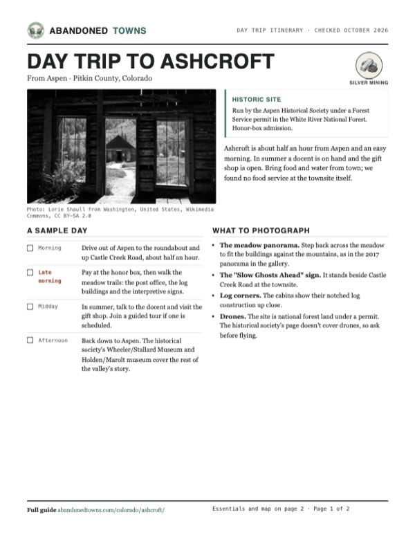
- Looking out from a log building, 2017: Lorie Shaull from Washington, United States, Wikimedia Commons, CC BY-SA 2.0
- The "Slow Ghosts Ahead" sign, 2017: Lorie Shaull from Washington, United States, Wikimedia Commons, CC BY-SA 2.0
- Inside a log building, 2017: Lorie Shaull from Washington, United States, Wikimedia Commons, CC BY-SA 2.0
- Log buildings in fall, 2007: John Holm from Leadville, CO, USA, Wikimedia Commons, CC BY 2.0
- A two-story false-front building, 1983: rjones0856, Wikimedia Commons, CC BY 2.0
- Castle Creek, with a false-front building beyond, 1977: Robert W. McLeod, Wikimedia Commons, CC BY-SA 4.0
- Topo map, area base map and aerial imagery: USGS The National Map (public domain).
- Historic maps: USGS Historical Topographic Map Collection (public domain): Aspen 1893, 1:62,500; Mount Jackson 1909, 1:125,000; Mount Jackson 1911, 1:125,000; Hayden Peak 1960, 1:24,000; Leadville 1983, 1:100,000.