 Abandoned

Overview
New Jerusalem on the Estero

Cyrus Teed was a doctor who began preaching in New York in the 1870s, took the name Koresh, the Hebrew form of Cyrus, and built a following in Chicago. His faith, Koreshanity, held that the universe exists inside a giant hollow sphere, with people living on its inner surface. In 1893 or 1894 (the state marker and the park disagree) he brought about 200 followers from Chicago to the Estero River to build a New Jerusalem. Teed imagined a city of ten million.
What they built was a busy colony. The Koreshans lived communally and celibately and ran a bakery, a printing house, a store, a sawmill, boat and cement works and a power plant that sold electricity to their neighbors. They kept a farm, a nursery and a botanical garden and staged art and music. Wikipedia counts more than 250 residents at the peak, from 1903 to 1908.
Teed died in 1908 at 69, and with few new members the colony dwindled. In 1961 the last four members deeded 305 acres to the state. Hedwig Michel, the last official member, lived in Planetary Court until her death in 1982. The settlement is now the historic district of Koreshan State Park, with 11 buildings dating from 1882 to 1920 kept as the colony left them, not rebuilt.
Video
A Saturday walk through the settlement
A visitor walks the historic settlement on a sunny Saturday: the open-sided machine shop with its belt-driven tools, small frame cottages, the bakery, the historical marker on the College of Life, the two-story Planetary Court and rooms furnished with period pieces and old photographs. He then follows the River Trail along the Estero River, past stands of bamboo and a small bridge, to the campground.
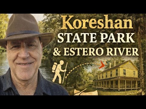 Play “Koreshan State Park” from YouTube
Timeline
From Chicago to the Estero River

- Cyrus Teed, a doctor preaching in New York, takes the name Koresh and gathers his first followers.
- Teed moves to Chicago; his followers set up a commune there in 1888.
- The Koreshans move to the Estero River to build their New Jerusalem. The 1963 state marker says 1893; the park says 1894, with 200 followers.
- The peak: more than 250 residents, and about 4,000 believers elsewhere, by Wikipedia's count. The colony runs a bakery, printing house, store, boat works, cement works, sawmill and a power plant.
- The Unity forms its own Progressive Liberal Party for county elections and starts the American Eagle newspaper.
- Teed dies at 69. Membership begins to fall.
- Hedwig Michel, who fled Nazi Germany, joins the Unity.
- The printing press burns, ending the Flaming Sword. The same year the fire marshal orders the Dining Hall, once the tallest building in the area, torn down.
- The last four members deed 305 acres to the State of Florida.
- Koreshan State Historic Site opens.
- The Koreshan Unity Settlement Historic District is listed on the National Register on May 4.
- Hedwig Michel, the last official member, dies. She is the only Koreshan buried in the park.
What's left
What you'll see


The park counts 11 buildings on the National Register, from 1882 to 1920. Planetary Court and the Founder's House show how the Koreshans lived, and Damkohler's cottage stands for the German settler whose land they built on. The Bakery, the New Store, the Large and Small Machine Shops and the Generator Building show their trades; the park also points to the 1929 Fairbanks-Morse engine in the industrial area. The Art Hall, with its stage and the colony's hollow-earth model, shows the cultural side. The Art Hall, Founder's House, Planetary Court, Large Machine Shop and Generator Building are accessible.
The grounds are part of the story too: Victorian gardens, bamboo groves the Koreshans planted, and exotic trees from around the world. The River Trail runs 0.44 miles along the Estero River from Monkey Puzzle Island in the settlement to the picnic area; with the Blue Trail it makes a 0.64-mile loop back to the settlement. Gopher tortoises live among the buildings.
Today's USGS map shows the park as a wooded block between the Estero River and Corkscrew Road, just west of US 41, with golf-course subdivisions on its western edge. Wikipedia's point sits in the middle of it. The 1958 Estero sheet below shows the settlement's buildings as a cluster just west of US 41 and south of the river, a dirt track running west from them to the Koreshan Unity Cemetery, and Estero across the highway and the railroad.
- Planetary Court (1904)
- Founder's House
- Damkohler cottage
- Art Hall
- Bakery and New Store
- Large and Small Machine Shops, Generator Building
- Victorian gardens and the Koreshans' bamboo along the Estero River
- Hedwig Michel's grave


Historic maps
Koreshan on USGS maps, 1956–1985
Crops from the USGS Historical Topographic Map Collection, centered on the townsite. Each sheet shows what surveyors mapped that year; compare them with today's topo and aerial on this page.

Day trip
Plan a day trip to Koreshan from Fort Myers
Take it with you
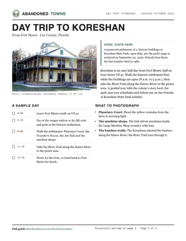
Day trip itinerary
The essentials, the sample day with boxes to tick, what to photograph and the coordinates, on two printable pages. Handy where there's no signal.
Download the PDF (538 KB)Koreshan is an easy half day from Fort Myers, half an hour down US 41. Walk the historic settlement first, while the buildings are open (8 a.m. to 5 p.m.), then take the River Trail along the Estero River to the picnic area. A guided tour tells the colony's story best; the park says tour schedules and tickets are on the Friends of Koreshan State Park website.
A sample day
- Leave Fort Myers south on US 41.
- Pay at the ranger station or by QR code and park at the historic settlement.
- Walk the settlement: Planetary Court, the Founder's House, the Art Hall and the machine shops.
- Take the River Trail along the Estero River to the picnic area.
- Picnic by the river, or head back to Fort Myers for lunch.
What to photograph and film
- Planetary Court. Shoot the yellow verandas from the lawn in morning light.
- The machine shops. The belt-driven machines inside the Large Machine Shop reward a wide lens.
- The bamboo trails. The Koreshans planted the bamboo along the Estero River; the River Trail runs through it.
Map & directions
Getting there
Fort Myers is the nearest city. US 41, the Tamiami Trail, runs south from downtown to Estero, and the park entrance is on Corkscrew Road just west of it. From Tampa, take I-75 south to exit 123 and Corkscrew Road west.


Base map: USGS The National Map (public domain). Routes: OSRM on © OpenStreetMap contributors data (ODbL), computed October 2026. Times assume dry roads.
- From downtown Fort Myers, take Heitman Street and Victoria Avenue to Cleveland Avenue.0.4 mi
- Turn left on Cleveland Avenue (US 41) and follow it south as the Tamiami Trail to Estero.15.3 mi
- Turn right on Corkscrew Road.0.3 mi
- Turn right into the park.0.2 mi
- From downtown Tampa, take East Zack Street and North Nebraska Avenue to the Selmon Expressway ramp.0.6 mi
- Follow the Lee Roy Selmon Expressway (SR 618, toll) east.7.8 mi
- Take exit 15A to I-75 south.0.5 mi
- Follow I-75 south.132.3 mi
- Take exit 123 and turn right on Corkscrew Road (CR 850).2.6 mi
- Turn right into the park.0.2 mi
Road and safety notes
- Both routes follow highways and city streets to the entrance on Corkscrew Road. Parking is at the ranger station, the historic settlement, the picnic area and the boat ramp (park page).
- The ranger station is open 9 a.m. to 5 p.m. Wednesday through Sunday; when it is closed, day-use fees are paid online or by QR code.
Photos
Koreshan in photos
Visitor reports
Been to Koreshan?
Been there lately? Tell the next visitor what you found: whether you could get in, the state of the road and what's still standing. Photos are welcome. We read every report before it appears here.
Nearby
Other sites near Koreshan
Straight-line distance from the townsite to other mapped sites in our Florida index.
- Punta Rassa12.4 mi W · Lee
- Fort Denaud28.8 mi NE · Hendry
- Harker29.9 mi E · Collier
- Bermont35.6 mi N · Charlotte
- Deep Lake39.8 mi SE · Collier
- Jerome41.8 mi SE · Collier
- Hall City43.2 mi NE · Glades
- Liverpool43.5 mi N · DeSoto
Sources
Sources and credits
- Wikipedia, "Koreshan State Historic Site", retrieved October 2026: the location at US 41 and Corkscrew Road, the coordinates, the 1961 deed, the National Register listing of May 4, 1976.
- Wikipedia, "Koreshan Unity", retrieved October 2026: Teed and the name Koresh, New York and Chicago, the 1894 move, the 1903–1908 peak of more than 250 residents and 4,000 believers, the city of ten million, the power plant, the 1906 party and newspaper, the 1949 press fire, Hedwig Michel (1940, 1961, 1982), the 1967 opening.
- Florida State Parks, Koreshan State Park, archived September 22, 2026: hours, the ranger station closed Mondays and Tuesdays from August 21, 2026, the campground closed since October 31, 2025, the $5 fee, address and phone, guided tours via the Friends group, the 1929 Fairbanks-Morse engine, the bamboo and gardens.
- Florida State Parks, Koreshan "Hours & Fees", archived March 5, 2026: the settlement hours, the fee table, the $10 guided tours.
- Florida State Parks, Koreshan "Experiences & Amenities", archived February 7, 2026: the 11 National Register buildings of 1882 to 1920 and their names, the accessible buildings, restrooms, parking, the River and Blue trails, gopher tortoises.
- Florida State Parks, Koreshan "History", archived November 14, 2025: 200 followers from Chicago in 1894, the hollow-sphere belief, the colony's trades, Teed's death in 1908 at 69, the last four members and 305 acres in 1961.
- ghosttowns.com, "Koreshan": original buildings rather than replicas, Damkohler's donated acreage, the Dining Hall torn down in 1949 on the fire marshal's order, the climate, best time and road.
- Florida Board of Parks and Historic Memorials, marker F-97 "Koreshan Unity Settlement" (1963), read from Ebyabe's photo of April 2010: the 1893 move, communal and celibate life, the farm, nursery and botanical garden, art and music, the 1961 gift to the state.
- Elevation: USGS 3D Elevation Program point query. Routes: OSRM on OpenStreetMap data, October 2026.
- Southern Mike, "Koreshan State Park", YouTube, posted January 9, 2026: a walk through the settlement and along the River Trail (the video on this page); checked against its captions and storyboard frames.
Photo and map credits
- Planetary Court, December 2023: kitmasterbloke, Wikimedia Commons, CC BY 2.0
- The Founder's House, December 2023: kitmasterbloke, Wikimedia Commons, CC BY 2.0
- The Art Hall from its garden path, April 2010: Ebyabe, Wikimedia Commons, CC BY-SA 3.0
- Inside the Art Hall: stage, flags and rows of chairs, April 2010: Ebyabe, Wikimedia Commons, CC BY-SA 3.0
- White frame buildings the photographer labels the bakery and store, December 2023: kitmasterbloke, Wikimedia Commons, CC BY 2.0
- The Large Machine Shop, December 2023: kitmasterbloke, Wikimedia Commons, CC BY 2.0
- Machinery inside the Large Machine Shop, December 2023: kitmasterbloke, Wikimedia Commons, CC BY 2.0
- A tin-clad building the photographer labels the Power House, December 2023: kitmasterbloke, Wikimedia Commons, CC BY 2.0
- Damkohler's cottage, December 2023: kitmasterbloke, Wikimedia Commons, CC BY 2.0
- A small cottage the photographer labels the Caretaker's House, December 2023: kitmasterbloke, Wikimedia Commons, CC BY 2.0
- The Schlender cottage, April 2010: Ebyabe, Wikimedia Commons, CC BY-SA 3.0
- A rustic wooden footbridge in the gardens, December 2023: kitmasterbloke, Wikimedia Commons, CC BY 2.0
- The Estero River under the trees, December 2023: kitmasterbloke, Wikimedia Commons, CC BY 2.0
- The 1963 state marker, April 2010: Ebyabe, Wikimedia Commons, CC BY-SA 3.0
- Topo map, area base map and aerial imagery: USGS The National Map (public domain).
- Historic maps: USGS Historical Topographic Map Collection (public domain): West Palm Beach 1956, 1:250,000; Estero 1958, 1:24,000; Naples 1985, 1:100,000.