 Abandoned

Overview
The mill town on the Yankee Fork

Custer sits on a narrow bench beside the Yankee Fork of the Salmon River, about 9 miles up a forest road from the highway at Sunbeam. Prospectors found the General Custer lode in August 1876, weeks after the general died at the Little Bighorn, and sold it to an English firm. Sam Holman, a Harvard law graduate who had become Bonanza's justice of the peace, saw that the mine would need a town of its own and laid out Custer below the mill site in early 1879. Wikipedia instead dates the settlement to 1877; the National Register nomination says Holman cleared its site in summer 1878. The 30-stamp mill started in December 1880, and people poured in.
By the late 1880s the town had three general stores, five saloons, a hotel, two Chinese laundries and a Wells Fargo office, with a small Chinatown at the south end because a local rule kept Chinese residents outside the town limits. The General Custer mine ran smoothly for more than a decade and produced about eight million dollars. After the British company failed in 1892, the Lucky Boy company revived the mines in 1895, and Custer took the post office and school from fire-struck Bonanza. Its peak was about 600 people in 1896.
The Lucky Boy and the mill closed in 1904. A dozen families hung on until the Sunbeam mine closed in April 1911, and then the town emptied. The Forest Service took the site over in 1966, and since 1990 it has run it with Idaho Parks and Recreation as the Land of the Yankee Fork Historic Area. Visitors get a free walking tour of 23 stops from Memorial Day to Labor Day.
Timeline
From the General Custer lode to a state park
- The first serious prospecting on the Yankee Fork. Settlement waits until about 1877, when Bonanza is laid out.
- James Baxter, E. K. Dodge and Morton McKeim find the General Custer lode, named for the general killed that June.
- Sam Holman, a Harvard law graduate turned prospector and Bonanza's first justice of the peace, lays out Custer below the mill site.
- The General Custer mill is finished. The town fills with tents, log cabins and board-and-batten stores.
- Custer's peak by one account: more than a hundred commercial buildings and homes, five saloons, a Wells Fargo office and a Chinatown at the south end.
- Fire hits Bonanza, the district's business center two miles downstream.
- An avalanche kills three Johnson sisters, Olga, Annie and Josephine. Their graves are a stop on the walking tour.
- The British-owned Dickens-Custer Company shuts down after mismanaging its funds.
- The Lucky Boy company takes over the mines. Custer gains the post office and the school from Bonanza and peaks at about 600 people in 1896.
- A second fire burns a block of Bonanza. Its merchants move to Custer.
- J. F. Davis starts building the schoolhouse, today's museum.
- The Lucky Boy mine and the General Custer mill close after about a million dollars of ore.
- About 12 families are left in 1910. The Sunbeam mine closes in April 1911, and Custer is a ghost town.
- Unemployed families move into the empty town and prospect for gold. The assay office and the transportation building date from these years.
- The Yankee Fork dredge works the valley below Bonanza.
- Tuff and Edna McGown open the Custer Museum in the schoolhouse.
- Fire destroys the blacksmith shop and the jail.
- The Challis National Forest takes ownership of the townsite.
- The Custer Historic District, 29 acres, is listed on the National Register of Historic Places.
- Idaho Parks and Recreation joins the Forest Service in running the site as the Land of the Yankee Fork Historic Area. The schoolhouse is restored; the Empire Saloon follows in 1998.
What's left
The walking tour


When the historic district was nominated in 1974, the Forest Service had already cleared most of the town as a fire hazard, around 1960, and only a few buildings stood: the ore bin at the General Custer mill, the schoolhouse, the Empire Saloon, two log dwellings and some frame buildings and outbuildings. Those survivors are what the tour covers. The 1900 schoolhouse is the museum and the starting point. The Empire Saloon, a tall, narrow board-and-batten building restored in 1998, is the gift shop. The McKenzie house, the log showpiece of 1880, the Pfeiffer house with its picket fence, the Charlie Raines cabin, the Frank Tully cabin and the Brockman cabin still stand, along with a 1930s assay office and a 1930s garage that now hold displays. Stone ruins mark the cabin of Louise "Miss Lou" Short, the only known stone building in town. The rest of the 23 stops are sites: the blacksmith shop and jail lost to fire in 1964, the livery, the bawdy house, the stores and the Casto and McGee saloon.
On the historic maps below, the 1919 Custer sheet shows Custer and Bonanza as clusters of buildings on the Yankee Fork with the wagon road between them. The 1957 Challis sheet marks the Lucky Boy mines above town, the Sunbeam mine, the Bonanza guard station and the dredge downstream, and the 1963 Custer sheet draws the few buildings left on the bench beside the road.
- Schoolhouse and museum (1900)
- Empire Saloon (restored 1998)
- McKenzie house (1880)
- Pfeiffer house
- Charlie Raines cabin
- Frank Tully cabin
- Brockman cabin
- Assay office (1930s)
- Transportation building (1930s)
- Ice house
- Stone cabin ruins
- Johnson graves and flagpole grave
- Mill machinery


Historic maps
Custer on USGS maps, 1919–1982
Crops from the USGS Historical Topographic Map Collection, centered on the townsite. Each sheet shows what surveyors mapped that year; compare them with today's topo and aerial on this page.

Day trip
Plan a day trip to Custer from Challis
Take it with you
Day trip itinerary
The essentials, the sample day with boxes to tick, what to photograph and the coordinates, on two printable pages. Handy where there's no signal.
Download the PDF (595 KB)This summer plan assumes a Wednesday through Sunday, when the interpretive center is open. From Challis, Custer is a full day: nearly two hours each way along the Salmon River, with the Yankee Fork dredge and Bonanza on the last ten miles. Start at the park's interpretive center on the edge of town, which has the museum and the maps.
A sample day
- Open the day at the Land of the Yankee Fork Interpretive Center in Challis.
- Drive US 93 and ID 75 up the Salmon River to Sunbeam, then Yankee Fork Road.
- Look at the Yankee Fork dredge and Bonanza from the route on the way up; check separately for tour availability.
- Custer. Lunch at the picnic tables, then the walking tour from the schoolhouse.
- Head back down the Yankee Fork and the Salmon River to Challis.
From Boise, allow more than four hours each way. Stanley, 21 miles away, is the closest place to stay.
What to photograph and film
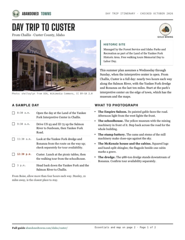
- The Empire Saloon. Its painted gable faces the road. Afternoon light from the west lights the front.
- The schoolhouse. The yellow museum with the mining machinery in front of it. Step back across the road for the whole building.
- The stamp battery. The cams and stems of the mill machinery make close-ups against the sky.
- The McKenzie house and the cabins. Squared logs and hand-split shingles; the flagpole beside one cabin marks a grave.
- The dredge. The 988-ton dredge stands downstream of Bonanza. Confirm tour availability separately.
Map & directions
Getting there
Challis has the park's interpretive center; Stanley is closer to Custer. The route from Challis follows the Salmon River on ID 75 to Sunbeam, then Yankee Fork Road (Forest Road 013) up past the dredge and Bonanza to Custer. From Boise the drive runs through Lowman and Stanley. These are route-planner directions, not a current report of road conditions; check with the Forest Service before leaving the highway.


Base map: USGS The National Map (public domain). Routes: OSRM on © OpenStreetMap contributors data (ODbL), computed October 2026. Times assume dry roads.
- From downtown Challis, take South 7th Street and Main Street to US 93.0.5 mi
- Turn right onto US 93, the Salmon River Scenic Byway, heading south.2.3 mi
- Continue onto ID 75 and follow the Salmon River upstream to the Sunbeam Dam overlook.41.9 mi
- Turn right onto Yankee Fork Road, Forest Road 013, past the dredge and Bonanza to Custer.10.0 mi
- From West Main Street downtown, take North 5th Street, West Idaho Street and North 15th Street to West State Street.1.1 mi
- Follow West State Street northwest out of the city.7.1 mi
- Take the ramp onto ID 55, Horseshoe Bend Road, and follow ID 55 north through Horseshoe Bend to Banks.33.7 mi
- Turn right onto Banks Lowman Road to Lowman.33.3 mi
- Turn left onto ID 21, the Ponderosa Pine Scenic Route, to Stanley.58.2 mi
- At the end of the road turn left onto ID 75, the Salmon River Scenic Byway, to Sunbeam.13.0 mi
- Turn left onto Yankee Fork Road, Forest Road 013, to Custer.10.0 mi
Road and safety notes
- Yankee Fork Road leaves ID 75 at the Sunbeam Dam overlook, 11 miles east of Stanley and 42 miles west of Challis by the Forest Service's count, and reaches Custer in about 9 miles. The agency pages don't describe the surface. Snow can restrict winter travel.
- The Custer Motorway is a different, historic route from Challis. The chamber gives vehicle advice on an undated page; confirm conditions with the Forest Service before considering it.
- Vault toilets only, and no drinking water at the site. Fuel and food are in Stanley and Challis.
- Lodging is about 21 miles away in Stanley. Campgrounds line the valley.
- Stay out of the old workings and the dredge ponds. The Lucky Boy mines sit on the hill above town.
Photos
Custer in photos
Visitor reports
Been to Custer?
Been there lately? Tell the next visitor what you found: whether you could get in, the state of the road and what's still standing. Photos are welcome. We read every report before it appears here.
Gold mining
More gold mining ghost towns
The nearest in Idaho.

 Guide
Atlanta
43.80, -115.13Elmore County, Idaho
A gold and silver camp of 1864 at the head of the Middle Fork of the Boise River, about 40 miles of forest road from the nearest highway. About 500…
 Guide
Idaho City
43.83, -115.83Boise County, Idaho
In 1864 Idaho City was the largest town in the Northwest, with about 7,000 people. By 1920 it had 104. It never quite emptied, and its brick and…
Nearby
Other sites near Custer
Straight-line distance from the townsite to other mapped sites in our Idaho index.
Sources
Sources and credits
- Wikipedia, "Custer, Idaho", retrieved October 2026: coordinates, GNIS elevation, the 1981 listing, 29 acres and seven contributing buildings, the state park.
- Salmon-Challis National Forest, "Custer Ghost Town", updated June 18, 2025: the free tours and their season, the museum and saloon, the timeline from 1879 to 1998, the 23 walking-tour stops and the lodging distance to Stanley.
- Salmon-Challis National Forest, "Custer Town Site Interpretive Site", updated February 18, 2025: no fee, vault toilets, no potable water, directions from Stanley and Challis via Forest Road 013.
- Idaho Parks and Recreation, "Land of the Yankee Fork State Park", updated October 19, 2026: the interpretive center address, hours and fees, the motor vehicle entrance fee, the dredge, Custer Days and the 600 peak.
- National Register of Historic Places nomination, "Custer Historic District" (Idaho State Historical Society, 1974; listed 1981): the legal description, the 1888 business count and Chinatown, the eight million dollars, the Dickens-Custer and Lucky Boy companies, the 1904 closure, the 1960 clearing and the surviving buildings.
- Legends of America, "Bonanza and Custer, Idaho", updated March 2023: the 1876 discovery, Sam Holman, the December 1880 mill, the 1896 peak, the 1910 families, the April 1911 Sunbeam closure and the dredge's history.
- Challis Chamber of Commerce, "Custer Motorway": the route from Challis, the late June to early fall season and the high-clearance advice.
- Wikivoyage, "Custer Ghost Town": the motorway's 1879 date, tolls to 1889 and 35-mile length, gold panning, picnic tables and no lodging on site.
- Elevation: USGS 3D Elevation Program point query. Routes: OSRM on OpenStreetMap data, October 2026.
Photo and map credits
- The Empire Saloon and Yankee Fork Road, July 2007: shelleylyn from USA, Wikimedia Commons, CC BY-SA 2.0
- The schoolhouse museum, 2006: Stephen Marks, Wikimedia Commons, Public domain
- A weathered outbuilding with ore cars and mill parts, September 2008: Bas van Oorschot, Wikimedia Commons, CC BY-SA 3.0
- Log cabin and flagpole, August 2023: Stevecvh, Wikimedia Commons, CC BY-SA 4.0
- Stamp battery cams, 2023: Stevecvh, Wikimedia Commons, CC BY-SA 4.0
- Topo map, area base map and aerial imagery: USGS The National Map (public domain).
- Historic maps: USGS Historical Topographic Map Collection (public domain): Custer 1919, 1:125,000; Challis 1957, 1:250,000; Custer 1963, 1:24,000; White Cloud Peaks 1982, 1:100,000.