 Abandoned

Overview
The county seat in a mountain gulch

Silver City sits on Jordan Creek at about 6,170 feet in the Owyhee Mountains of southwest Idaho, below War Eagle Mountain. The state historical society counts the Poorman lode and other War Eagle Mountain mines among the territory's exceptionally rich properties. Silver City grew up in the gulch below them in 1864 and took the county seat from Ruby City in 1867. In the 1880s, by Wikipedia's count, it held about 2,500 people and 75 businesses, with Idaho's first daily newspaper, the Owyhee Avalanche, and a telegraph office.
The census still found 976 people in 1900, but in 1934 the county seat went down the mountain to Murphy, the Idaho Hotel closed around 1942, and by 1950 the census counted 110. About 70 buildings still stand, all privately owned, and a 2023 BLM notice says many are still in use. The whole district went onto the National Register in 1972, the year Edward Jagels bought the Idaho Hotel and reopened it.
The town has no gas station. It is reached by an unpaved road that its official site says is closed from November 1 until the Friday before Memorial Day. In summer the hotel serves breakfast, lunch and family-style dinners on weekends and rents rooms, and the BLM runs a free campground beside Jordan Creek.
Video
Silver City in 30 seconds
The silver town of the Owyhee Mountains: a survey view toward Florida Mountain, the county seat's painted storefronts, false fronts on a covered boardwalk and Washington Street.
Timeline
Silver, a county seat and a hotel

- Owyhee County is created on December 31. The Idaho Hotel, by its own history, opens in Ruby City, a short way down Jordan Creek.
- Silver City is founded after silver is found on War Eagle Mountain, above the town.
- The hotel's new wing is taken apart and hauled to Silver City on sleds and skids. The county seat moves from Ruby City to Silver City in 1867; the town's own site says 1866.
- Telegraph service reaches the town and the Owyhee Avalanche becomes Idaho's first daily newspaper, by the state historical society's account. The town's site dates both to 1874.
- Silver City peaks at about 2,500 people and 75 businesses, by Wikipedia's and the town site's count. The 1880 census lists 593.
- The schoolhouse is built. It now holds a museum.
- The census counts 976 people.
- After an election, the county seat moves to Murphy.
- The Idaho Hotel closes.
- The census counts 110 people.
- The Silver City Historic District, 10,240 acres, joins the National Register of Historic Places on May 19. In the spring Edward Jagels buys the Idaho Hotel, and it reopens for visitors.
- The hotel's current owners buy it from Jagels. The hotel's page says 2001; its older brochure says 2000.
- Lightning fires burn in the Owyhee Mountains. On August 25, as the Flint Fire grows about eight miles northwest of Triangle, the sheriff's office lists Silver City at Level 2, "SET", for evacuation; crews later pull Big Grass Fire hose lays out of the Silver City area. Both fires are fully contained by September 14, and on October 14 the BLM lifts its Big Grass Fire closure of public land in Owyhee County. We found no report of damage in town.
What's here
Seventy buildings on Jordan Creek


Counts run from about 70 standing buildings (Wikipedia) to about 75 structures from the 1860s to the early 1900s (the town's site and a 2023 BLM notice). The best known is the Idaho Hotel, part of which was hauled up from Ruby City in 1866; its owners say many sections are still closed because they haven't been restored. The 1892 schoolhouse holds a museum that the Idaho Heritage Trust says is open in summer. Our Lady of Tears church, the Masonic Hall built over Jordan Creek and dozens of houses line the streets. The town's site counts four separate burial areas nearby and almost a dozen cemeteries in the area. All the buildings are private, so stay on the streets unless a sign or an owner invites you in.
The 1892 USGS sheet in the historic maps below shows Silver City between Florida Mountain and War Eagle Mountain, with the Trade Dollar, Black Jack and Poorman mines around it and De Lamar and Dewey over the ridge to the northwest. The 1965 sheet adds Ruby City (Site), the Morning Star Mine, the Pioneer Cemetery and a campground, and the 1990 sheet shows the town's tight cluster of buildings where Jordan Creek bends below Telegraph Hill.
- Idaho Hotel (1860s)
- Schoolhouse and museum (1892)
- Our Lady of Tears church
- Masonic Hall over Jordan Creek
- About 70 private houses and shops
- Pioneer Cemetery and other burial grounds


Historic maps
Silver City on USGS maps, 1892–1990
Crops from the USGS Historical Topographic Map Collection, centered on the townsite. Each sheet shows what surveyors mapped that year; compare them with today's topo and aerial on this page.

Day trip
Plan a day trip to Silver City from Murphy
Take it with you
Day trip itinerary
The essentials, the sample day with boxes to tick, what to photograph and the coordinates, on two printable pages. Handy where there's no signal.
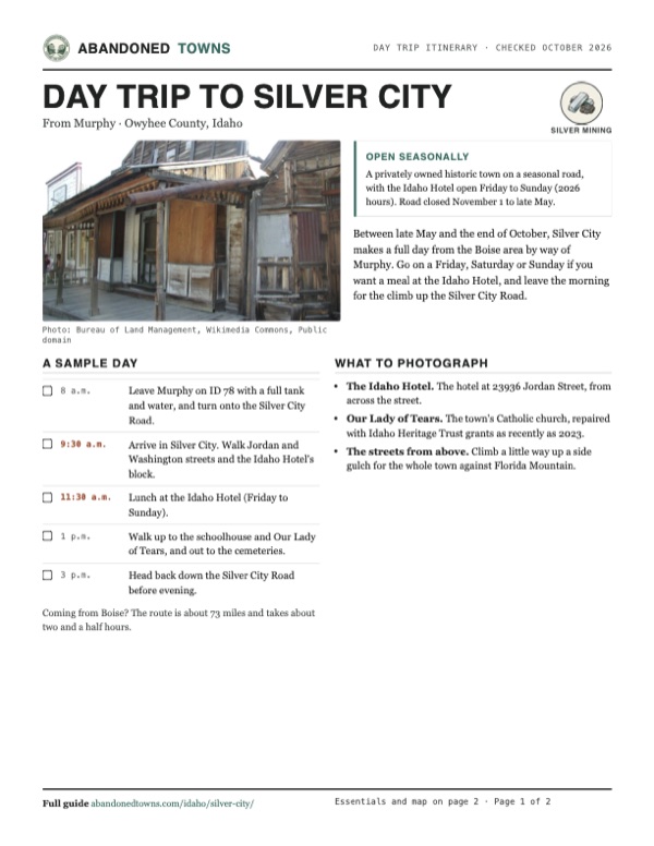
Download the PDF (565 KB)Between late May and the end of October, Silver City makes a full day from the Boise area by way of Murphy. Go on a Friday, Saturday or Sunday if you want a meal at the Idaho Hotel, and leave the morning for the climb up the Silver City Road.
A sample day
- Leave Murphy on ID 78 with a full tank and water, and turn onto the Silver City Road.
- Arrive in Silver City. Walk Jordan and Washington streets and the Idaho Hotel's block.
- Lunch at the Idaho Hotel (Friday to Sunday).
- Walk up to the schoolhouse and Our Lady of Tears, and out to the cemeteries.
- Head back down the Silver City Road before evening.
Coming from Boise? The route is about 73 miles and takes about two and a half hours.
What to photograph and film
- The Idaho Hotel. The hotel at 23936 Jordan Street, from across the street.
- Our Lady of Tears. The town's Catholic church, repaired with Idaho Heritage Trust grants as recently as 2023.
- The streets from above. Climb a little way up a side gulch for the whole town against Florida Mountain.
Map & directions
Getting there
Murphy, the county seat, is the nearest town. The route runs south on ID 78 and then about 19 miles up the Silver City Road, which the town's site says is closed from November 1 until the Friday before Memorial Day. From Boise, the route crosses the Treasure Valley on I-84 and county roads to ID 45 and ID 78. There is no gas in Silver City, so fill up before you leave the highway.

Base map: USGS The National Map (public domain). Routes: OSRM on © OpenStreetMap contributors data (ODbL), computed October 2026. Times assume dry roads.
- From Murphy, follow ID 78 (Marsing Murphy Road, then Murphy Grandview Road) southeast.4.7 mi
- Turn right on the Silver City Road and follow it up into the mountains.19.2 mi
- At the end of the road, turn left on Jordan Creek Road, then follow Jordan, Avalanche and Washington streets into town.0.8 mi
- From downtown, take Main, 6th and Front streets onto the Boise Connector (US 20/26).5.5 mi
- Join I-84 west and leave at exit 42.6.9 mi
- Go south on Ten Mile Road, then west on Victory Road.2.3 mi
- Turn left on Black Cat Road and head south.5.1 mi
- Turn right on Deer Flat Road and head west.6.0 mi
- Turn left on 12th Avenue South, ID 45, and follow it south.12.5 mi
- Continue on ID 78 through Murphy.14.3 mi
- Turn right on the Silver City Road.19.2 mi
- Turn left on Jordan Creek Road and follow the town streets to the center.0.8 mi
Road and safety notes
- The town's site says the road is closed from November 1 until the Friday before Memorial Day. Owyhee County says it expects the Silver City Road to reopen by Memorial Day weekend each year, and that the county commissioners or sheriff may close roads as warranted.
- Visit Idaho described the road in 2017 as crushed gravel, "suitable for most cars", with an SUV or truck more comfortable on the upper stretches. We have no newer source on its condition.
- There is no gas or service station in Silver City. Fill up before you leave ID 78.
- The BLM's Silver City Campground is free, with a 14-day limit. Bring your own water: the BLM warns not to use Jordan Creek's water, which may contain mercury.
- The routes are computed from OpenStreetMap and haven't been driven by us.
Photos
Silver City in photos
Visitor reports
Been to Silver City?
Been there lately? Tell the next visitor what you found: whether you could get in, the state of the road and what's still standing. Photos are welcome. We read every report before it appears here.
Silver mining
More silver mining ghost towns
The nearest in Idaho.

 Guide
Bayhorse
44.40, -114.31Custer County, Idaho
A silver and lead camp that peaked at about 300 people in the 1880s and emptied when its mines closed in 1915. The state bought it in 2006, and it is…
 Guide
Gilmore
44.46, -113.27Lemhi County, Idaho
A lead and silver town at the head of the Lemhi Valley that grew around the end of a Montana railroad, then emptied when the Depression closed its…
Nearby
Other sites near Silver City
Straight-line distance from the townsite to other mapped sites in our Idaho index.
- Ruby City0.6 mi N · Owyhee
- Dewey2.2 mi NW · Owyhee
- De Lamar5.0 mi W · Owyhee
- Neal49.0 mi NE · Ada
- Wickahoney54.1 mi SE · Owyhee
- Pearl61.6 mi N · Gem
- Grasmere61.8 mi SE · Owyhee
- Idaho City72.0 mi NE · Boise
Sources
Sources and credits
- ghosttowns.com, "Silver City": fact sheet fields (county, road, climate, best time, remains).
- Wikipedia, "Silver City, Idaho", retrieved October 2026: the 1864 founding, War Eagle Mountain, the 1880s population and businesses, the census figures, the county seat, the newspaper and telegraph, the hotel, about 70 private buildings on BLM-managed land, no gas station, coordinates and elevation. "Silver City Historic District (Idaho)": the May 19, 1972 listing and 10,240 acres.
- Idaho State Historical Society, Reference Series No. 336, "Owyhee County" (1975): the county's creation, the 1867 move from Ruby City, the Avalanche as Idaho's first daily on August 31, 1875, the Poorman lode, almost a thousand people in 1900, the 1934 move to Murphy.
- Historic Silver City Idaho, the town's official site, with its road information and Idaho Hotel pages, read October 20, 2026: the road closure dates, about 75 structures, the 1866 county-seat date, the 1874 telegraph and newspaper date, the burial areas, and the hotel's history, 2026 hours sheet, 2026 dinner menu, 2025 room rates and policies, phone, undated seasons page and 2013 brochure (closing in mid-October, the 2000 sale).
- Owyhee County Road & Bridge, read October 20, 2026: the Silver City Road reopening by Memorial Day weekend and who may close roads.
- BLM, "Silver City Campground": no fee, 14-day limit, bring your own water. BLM press release, October 16, 2023: about 75 structures.
- CBS2 (KBOI), "Flint Fire grows after lightning strikes in Owyhee County", August 25, 2026, and "Big Grass Fire nears full containment", August 30, updated September 14, 2026: Silver City at Level 2, firefighters in town, full containment.
- BLM, "BLM lifts Big Grass Fire temporary closure in Owyhee County", October 14, 2026.
- Steve Graepel, "Silver City and Other Owyhee Treasures," Visit Idaho, July 6, 2017: the road's crushed gravel and vehicles, private property, the Masonic Hall over Jordan Creek.
- Idaho Heritage Trust, "Silver City Schoolhouse": built 1892, museum open in summer. "Our Lady of Tears": the church and its 1995, 2020 and 2023 grants.
- Photos: Wikimedia Commons, credited below each one; the four modern photos are the BLM's own. Three were taken with a camera whose clock was not set, so their only date is the BLM's Flickr posting in June 2015; the fourth carries only a July 2016 file date. Elevation: USGS 3D Elevation Program point query. Routes: OSRM on OpenStreetMap data, October 2026. Not field-checked.
Photo and map credits
- Silver City in 1892, with mine workings on the slopes above: Unknown author, Wikimedia Commons, Public domain
- Looking west to Florida Mountain, undated HAER survey photo: Library of Congress (Historic American Engineering Record), Wikimedia Commons, Public domain
- False-front buildings and a covered boardwalk, undated BLM photo posted in 2015: Bureau of Land Management, Wikimedia Commons, Public domain
- Painted wooden buildings on a town street, undated BLM photo posted in 2015: Bureau of Land Management, Wikimedia Commons, Public domain
- A weathered house on Washington Street, undated BLM photo posted in 2015: Bureau of Land Management, Wikimedia Commons, Public domain
- The side of a painted two-story building, BLM photo posted in July 2016: mypubliclands, Wikimedia Commons, Public domain
- Area base map, topo and aerial imagery: USGS The National Map (public domain).
- Historic maps: USGS Historical Topographic Map Collection (public domain): Silver City 1892, 1:125,000; Silver City 1965, 1:62,500; Murphy 1986, 1:100,000; Silver City 1990, 1:24,000.