 Abandoned

Overview
The capital the river took

Kaskaskia began in 1703 as a French Jesuit mission among the Kaskaskia people, near where the Kaskaskia River met the Mississippi. It grew into the main town of the Illinois Country: farmers sent flour down to New Orleans, voyageurs set out from here for the Missouri, and Fort de Chartres went up nearby in 1718. Louis XV gave the church a bell in 1741. When George Rogers Clark took the town from the British on July 4, 1778, the villagers rang it, and it later became known as the Liberty Bell of the West.
Kaskaskia was capital of the Illinois Territory from 1809 and the first capital of the state in 1818. It peaked at about 7,000 people before the government moved to Vandalia in 1819. Then the river went to work. Steamboat crews had stripped the banks of trees for fuel, and the banks eroded. After the flood of 1844 people moved the town south. In April 1881 the river broke through into the lower Kaskaskia River channel and began running east of the town instead of west. The old townsite, the statehouse among it, went into the river, and what was left of Kaskaskia ended up on the Missouri side. The state line stayed where it was, so the island is still Illinois.
The village was rebuilt on the island. The church was moved and rebuilt in 1893, and a brick shrine for the bell followed in 1948. Population drifted down from 112 in 1950 to 9 in 2000, and the Great Flood of 1993 put the village under nine feet of water. It counted 21 people in 2020. Kaskaskia keeps an Illinois area code and a Missouri ZIP code, Illinois maintains its roads, and the only way in by road is a bridge from Missouri.
Timeline
Mission, capital, island

- French Jesuits found a mission among the Kaskaskia people near the mouth of the Kaskaskia River. A fur trading post follows.
- The congregation builds its first stone church.
- The French build Fort de Chartres nearby and bring the first enslaved Africans to work the lead mines across the river.
- Louis XV sends a bell for the church, cast at La Rochelle.
- France cedes the Illinois Country to Britain after the French and Indian War. Kaskaskia stays a French-speaking village.
- George Rogers Clark takes the town for Virginia with about 200 men. The church bell is rung, and is later called the Liberty Bell of the West.
- Kaskaskia becomes capital of the new Illinois Territory.
- The Illinois Herald, the first newspaper in Illinois, is printed here.
- First state capital of Illinois, with the first constitutional convention and legislature. The capital moves to Vandalia in 1819. The peak population of about 7,000 dates from before the move.
- After the Great Flood of 1844 residents move the town south.
- The Mississippi breaks into the Kaskaskia River channel and runs east of the town. The old townsite is lost and Kaskaskia is left on the Missouri side of the river, still in Illinois.
- The Church of the Immaculate Conception is moved and rebuilt in the new village.
- The brick memorial building for the bell goes up.
- Population 112 in 1950, 79 in 1970, 33 in 1980.
- The Great Flood puts the village under about nine feet of water, up to the roofs.
- Nine residents in 2000, the fewest of any Illinois village; 21 in 2020.
- The Illinois DNR schedules its 55th annual Independence Day ceremony at the bell memorial (release of June 23, 2025).
Sources differ on the bell's weight: 650 pounds in the Illinois DNR's 2025 release, 140 pounds in Wikipedia's article on the memorial.
What's left
A church, a bell and a few houses

Nothing of the colonial town survives on the ground; the 1881 river took the old site. Today's village is a small grid of streets in the middle of farm fields on the island. The red brick Church of the Immaculate Conception, moved here and rebuilt in 1893, stands out over the flat fields. Beside it stands the Kaskaskia Bell State Memorial, a brick building of 1948 that the state opens from sunrise to sunset every day. Inside are the bell and murals of Kaskaskia's history. The bell was carried off its stand by the floods of 1973 and 1993, which widened a crack found in 1948, and it can no longer be rung.
The rest is a handful of houses, which are private, and fields. Coming in from St. Mary, Missouri, the road crosses the old bed of the Mississippi on a small bridge; before 1881 the river ran here, and now it is a small stream.
The historic maps below show the island settled into its new shape. The 1915 and 1947 Chester sheets mark the village grid with Okaw Landing on the river to the east, and Dozaville (Pujol on the 1947 sheet) to the southwest. The 1970 and 1993 Kaskaskia sheets add the Kaskaskia Cemetery west of the village.
- Church of the Immaculate Conception (rebuilt 1893)
- Kaskaskia Bell State Memorial (1948) and the 1741 bell
- The old Mississippi channel at the St. Mary bridge
- A few houses (private)


Historic maps
Kaskaskia on USGS maps, 1915–1993
Crops from the USGS Historical Topographic Map Collection, centered on the townsite. Each sheet shows what surveyors mapped that year; compare them with today's topo and aerial on this page.

Day trip
Plan a day trip to Kaskaskia from Chester
Take it with you
Day trip itinerary
The essentials, the sample day with boxes to tick, what to photograph and the coordinates, on two printable pages. Handy where there's no signal.
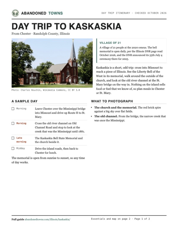
Download the PDF (454 KB)Kaskaskia is a short, odd trip: cross into Missouri to reach a piece of Illinois. See the Liberty Bell of the West in its memorial, walk around the outside of the church, and look at the old river channel at the St. Mary bridge on the way in. Nothing on the island sells food or fuel that we know of, so plan meals in Chester or St. Mary.
A sample day
- Leave Chester over the Mississippi bridge into Missouri and drive up Route H to St. Mary.
- Cross the old river channel on Old Channel Road and stop to look at the creek that was the Mississippi until 1881.
- The Kaskaskia Bell State Memorial and the church beside it.
- Drive the island roads, then back to Chester for lunch.
What to photograph and film
- The church and the memorial. The red brick spire against a big sky over flat fields.
- The old channel. From the bridge, the narrow creek that was once the Mississippi.
Map & directions
Getting there
Chester, across the Mississippi, is the closest Illinois town, but the drive goes through Missouri: over the Chester bridge, up to St. Mary, then across the old river channel onto the island. From St. Louis, take I-55 south and US 61 to St. Mary.


Base map: USGS The National Map (public domain). Routes: OSRM on © OpenStreetMap contributors data (ODbL), computed October 2026. Times assume dry roads.
- From downtown Chester, follow IL 3 (Swanwick Street, West Holmes Street, Lehmen Drive).0.6 mi
- Turn left on Bridge Bypass Road and follow IL 150 across the Mississippi into Missouri, where it becomes MO 51.4.8 mi
- Turn right on Route H.6.8 mi
- At the end of the road turn right on US 61 (Mulberry Street, then 2nd Street) in St. Mary.0.9 mi
- Turn right on Route U, which becomes Old Channel Road over the old river channel.0.7 mi
- Turn left on South Kings Highway across the island.3.7 mi
- Turn left on 5th Street, right on Illinois Street and left on 2nd Street into the village.0.5 mi
- From downtown St. Louis, take 14th Street, Chouteau Avenue and Truman Parkway to I-55.1.8 mi
- Take I-55 south.57.1 mi
- Take exit 150 and turn left on MO 32.4.9 mi
- Turn right on US 61 (Sainte Genevieve Drive, then 2nd Street) to St. Mary.8.8 mi
- Turn left on Route U, which becomes Old Channel Road over the old river channel.0.7 mi
- Turn left on South Kings Highway across the island.3.7 mi
- Turn left on 5th Street, right on Illinois Street and left on 2nd Street into the village.0.5 mi
Road and safety notes
- The only road onto Kaskaskia Island is from St. Mary, Missouri. The Illinois DNR directs visitors along Missouri Highway 61 to the Old Channel Bridge, then about five miles following the Kaskaskia Bell markers.
- The island is in the Mississippi floodplain behind a levee. It flooded in 1973 and 1993; check river levels before you go.
- Homes and fields on the island are private. Stay on public roads.
Photos
Kaskaskia in photos
Visitor reports
Been to Kaskaskia?
Been there lately? Tell the next visitor what you found: whether you could get in, the state of the road and what's still standing. Photos are welcome. We read every report before it appears here.
Nearby
Other sites near Kaskaskia
Straight-line distance from the townsite to other mapped sites in our Illinois index.
Sources
Sources and credits
- Wikipedia, "Kaskaskia, Illinois", retrieved October 2026: the 1703 mission, the 1714 church, Fort de Chartres, the 1741 bell, the 1778 capture, the territorial and state capital, the Illinois Herald, the 7,000 peak, the 1844 move, the 1881 channel change, the 1893 church, the census counts (112, 79, 33, 9, 21), the 1993 flood, the area code, ZIP code and roads.
- Wikipedia, "Kaskaskia Bell State Memorial", retrieved October 2026: the 140-pound bell cast at La Rochelle, the 1948 building, the floods of 1973 and 1993, the crack.
- Illinois DNR, Kaskaskia Bell State Memorial, read October 29, 2026: sunrise-to-sunset hours, self-guided tours, the 1st Street address, the office phone, the bell and murals, no fee listed, no alerts posted.
- Illinois DNR, "Celebrate Independence Day at the Kaskaskia Bell State Memorial", June 23, 2025: the 55th annual ceremony on July 4, 2025, the 650-pound bell, 203 First St., access only from Missouri via St. Mary and the Old Channel Bridge.
- ghosttowns.com, "Kaskaskia": road (2WD), best time, remains (a few houses).
- Historic maps: USGS Historical Topographic Map Collection. Elevation: USGS 3D Elevation Program point query. Routes: OSRM on OpenStreetMap data, October 2026.
Photo and map credits
- The Church of the Immaculate Conception, July 2007: Charles Houchin, Wikimedia Commons, CC BY 3.0
- The church tower, September 2012: Nyttend, Wikimedia Commons, Public domain
- The Liberty Bell of the West in its memorial, July 2012: Kbh3rd, Wikimedia Commons, CC BY-SA 3.0
- Kaskaskia under the Great Flood, with the church in the water, August 2, 1993: SSgt Paul Griffin, Wikimedia Commons, Public domain
- The old Mississippi channel at the St. Mary causeway, September 2012: Nyttend, Wikimedia Commons, Public domain
- The old state house, late 1880 or early 1881: Photographer unknown (in The Making of Illinois, 1900), Wikimedia Commons, Public domain
- Kaskaskia, engraving published 1857: Meyer's Universum, vol. 18 (Bibliographisches Institut, Hildburghausen), Wikimedia Commons, Public domain
- A crossroads at Dozaville on Kaskaskia Island, December 2017: TheCatalyst31, Wikimedia Commons, CC0
- Topo map, area base map and aerial imagery: USGS The National Map (public domain).
- Historic maps: USGS Historical Topographic Map Collection (public domain): Chester 1915, 1:62,500; Chester 1947, 1:62,500; Kaskaskia 1970, 1:24,000; Kaskaskia 1993, 1:24,000.