 Abandoned

Overview
A Cornish copper village on the Keweenaw

Central sits on a ridge above US 41, about five miles northeast of Phoenix in the middle of the Keweenaw Peninsula. In 1854 an agent of the Cliff Mine found native copper in a pit dug by prehistoric miners, and the Central Mining Company was formed that year. Mining began in 1856, the lode paid from the start, and from 1865 to 1894 the mine sent out more than a million pounds of copper a year.
The village grew to about 1,200 people at its peak, by the counts of the historical society and Northern Michigan University, mostly immigrants from Cornwall. (Wikipedia gives a far smaller figure, over 130 residents in 1868.) It had a post office, a hotel, a school, a store, a doctor and the Methodist church of 1868, whose square battlemented tower is the village landmark.
In 1894 the miners hit a fault that cut off the vein. The company searched for it for a few years, then closed the mine in 1898 after nearly 52 million pounds of copper. Families left for other mines; about 100 people remained in 1905, and the last permanent resident left in 1952. Some houses became summer cottages. Since 1996 the Keweenaw County Historical Society has owned 38 acres of the village and has been restoring the miners' houses. Each year on the last Sunday in July, descendants of Central's families come back for a reunion service in the old church.
Video
Museum houses and the powder house
A couple visit on a sunny summer day: the visitor center's old photographs and maps of the mine, two miners' houses furnished as museums, with steep, narrow stairs and a low-ceiling warning, the church with its square tower and the frame houses along the road, old log-boom timbers on display, and a trail through the woods to the roofless stone walls of the powder house.
 Play “Central Mine in the UP” from YouTube
Timeline
From a prehistoric pit to the 1898 closing
- John Shawson, an agent of the Cliff Mine, finds native copper in a pit dug by prehistoric miners, and the Central Mining Company is organized.
- Mining begins in 1856, and the lode pays in its first year. The village is settled around 1857.
- The mine produces more than a million pounds of copper a year, sometimes over two million.
- The Methodist Episcopal church is built, with a battlemented tower in the Cornish style of many of the miners' families.
- A post office named Central Mine opens on December 8.
- Telephone lines reach Central.
- Central is the only fully working mine left in Keweenaw County.
- Miners strike a fault that cuts off the lode. A few years of searching fail to find it again.
- The mine closes after producing nearly 52 million pounds of copper, and families begin to leave.
- The church closes in 1903. About 100 people are left by 1905. The post office closes in 1904 by Wikipedia's account, or 1909 by Northern Michigan University's.
- Descendants hold the first Central reunion at the church, by NMU's account. The reunion is still held on the last Sunday in July.
- The last permanent resident leaves.
- The Central Mine Historic District is listed on the National Register on June 28.
- The Keweenaw County Historical Society acquires 38 acres of the old village and starts restoring houses.
- The society closes its sites for the season. It lists the 2027 visitor center season as June 20 to October 10.
What's there
Church, miners' houses and rock piles


About 20 frame buildings still stand, with scattered ruins around them. The church is in nearly original condition. The historical society's visitor center has exhibits and a video on the mine and the families who lived here, and House 61 is furnished with the kitchen gear of a Central household. The Central Memorial Garden is across the street from the visitor center.
Two trails opened in 2005, a quarter mile and a half mile long, lead through the woods past house foundations and the site of the schoolhouse to a view of the valley from the top of the upper rock pile. In the woods stand the stone powder house and the ruins of Engine House No. 2, which ran from 1875 to 1898; NMU's photos show the engine house posted as dangerous, with no trespassing. Some of the houses are lived in, at least in summer: the society asks visitors to respect the privacy of residents.
The old maps show the village as it emptied. The 1940 Central sheet draws a cluster of buildings at the road junction north of Highway 41 and the railroad, with the Central fire tower to the northeast. The 1948 Eagle Harbor sheet shows the same scatter of houses with Central Lake just east, and the 1985 Hancock sheet names Central on US 41 between Phoenix and Copper Falls.
- Methodist Episcopal church (1868)
- About 20 frame houses and buildings
- Visitor center and House 61
- Powder house (ruin)
- Engine House No. 2 ruins (posted, no trespassing)
- House foundations and the schoolhouse site
- Rock piles
- Memorial garden


Historic maps
Central on USGS maps, 1940–1985
Crops from the USGS Historical Topographic Map Collection, centered on the townsite. Each sheet shows what surveyors mapped that year; compare them with today's topo and aerial on this page.

Day trip
Plan a day trip to Central from Calumet
Take it with you
Day trip itinerary
The essentials, the sample day with boxes to tick, what to photograph and the coordinates, on two printable pages. Handy where there's no signal.
Download the PDF (441 KB)Central is an easy summer outing from Calumet, about half an hour up US 41. Give it two hours: the visitor center, the church, the miners' houses and the two short trails. The visitor center runs from mid-June to early October; the society lists the 2027 season as June 20 to October 10.
A sample day
- Drive up US 41 from Calumet and turn left on Central Road.
- Start at the visitor center, then see House 61 and the church.
- Walk the two trails to the rock pile overlook.
What to photograph and film
- The church tower. Its battlements stand out against the sky from the road below.
- The restored houses. Green and yellow frame houses along the gravel street.
- The powder house. Stone walls and a yellow-brick doorway in the woods.
Map & directions
Getting there
Central is on US 41, the main road up the Keweenaw. From Calumet, follow US 41 northeast for about 17 miles and turn left on Central Road. From Houghton, take US 41 north through Calumet.


Base map: USGS The National Map (public domain). Routes: OSRM on © OpenStreetMap contributors data (ODbL), computed October 2026. Times assume dry roads.
- Leave on Sixth Street, then turn right on Pine Street (M 203).0.9 mi
- Turn left on US 41, which runs as Stanton Avenue and Mohawk Street for about a mile.6.0 mi
- Continue northeast on US 41.11.0 mi
- Turn left on Central Road.0.2 mi
- From Shelden Avenue (US 41), take Front Street and Reservation Street.1.0 mi
- Turn left on East White Street, then right at the end of the road on North Lincoln Drive (US 41).0.8 mi
- Follow US 41 north to Calumet.11.1 mi
- Continue on US 41, which runs as Stanton Avenue and Mohawk Street for about a mile.6.0 mi
- Continue northeast on US 41.11.0 mi
- Turn left on Central Road.0.2 mi
Road and safety notes
- The routes are computed from OpenStreetMap and haven't been driven by us.
- The site is open year-round, but the visitor center and its restrooms only run from mid-June to early October.
- Some houses at Central are private; stay on the public road and the society's trails.
Photos
Central in photos
Visitor reports
Been to Central?
Been there lately? Tell the next visitor what you found: whether you could get in, the state of the road and what's still standing. Photos are welcome. We read every report before it appears here.
Copper mining
More copper mining ghost towns
The nearest in Michigan, then the nearest elsewhere.

 Guide
Nonesuch
46.76, -89.62Ontonagon County, Michigan
A copper mine that opened and closed five times and made money in only three years. Its foundations lie in the woods of the Porcupine Mountains, on a…
 Guide
Clemenceau
34.74, -112.03Yavapai County, Arizona
James Douglas's smelter town of 1917 in the Verde Valley, emptied when the smelter closed in 1937 and taken into Cottonwood in 1960. Its 1923 school…
Nearby
Other sites near Central
Straight-line distance from the townsite to other mapped sites in our Michigan index.
Sources
Sources and credits
- Keweenaw County Historical Society, "Central Mine Site", read October 29, 2026: 1,200 people, the 1854 opening and 1898 closing, nearly 52 million pounds of copper, the 38 acres bought in 1996, the 2027 season and hours, free admission, the address, the visitor center, House 61, the 2005 trails, the garden, the church of 1868 to 1903 and the reunion, residents' privacy, and the October 12, 2026 closing notice.
- Wikipedia, "Central Mine Historic District", retrieved October 2026: Shawson's find, mining from 1856, over 130 residents in 1868, 1887, the 1898 closing, the last resident in 1952, about 20 frame buildings, the National Register date and coordinates.
- Wikipedia, "Houghton Township, Michigan" (where "Central, Michigan" leads), retrieved October 2026: the post office dates.
- Northern Michigan University, Beaumier U.P. Heritage Center, "Central Mine", read October 29, 2026: the prehistoric pit, yearly output 1865–1894, the fault, settlement about 1857, telephone, about 100 people in 1905, the 1909 post office closing, reunions since 1907, the powder house and Engine House No. 2.
- National Park Service, Keweenaw National Historical Park, "Museums and Heritage Centers": Central Mine as a Keweenaw Heritage Site, once home to over 1,200 people.
- The Adventures of Mr. & Mrs. B., "Central Mine in the UP", YouTube, posted August 22, 2018: the visitor center, the two museum houses and the trail to the powder house (the video on this page); checked against its captions and storyboard frames.
- Photos: Wikimedia Commons, credited below. Elevation: USGS 3D Elevation Program point query. Routes: OSRM on OpenStreetMap data, October 2026. Not field-checked.
Photo and map credits
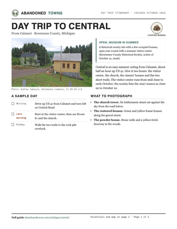
- A gravel street through Central with a restored yellow building and a green house, August 2009: Andrew Jameson, Wikimedia Commons, CC BY-SA 3.0
- The Methodist church with its battlemented tower, August 2009: Andrew Jameson, Wikimedia Commons, CC BY-SA 3.0
- A restored two-story miner's house, August 2009: Andrew Jameson, Wikimedia Commons, CC BY-SA 3.0
- The stone powder house with its brick doorway, August 2009: Andrew Jameson, Wikimedia Commons, CC BY-SA 3.0
- Area base map, topo and aerial imagery: USGS The National Map (public domain).
- Historic maps: USGS Historical Topographic Map Collection (public domain): Central 1940, 1:31,680; Eagle Harbor 1948, 1:24,000; Hancock 1985, 1:100,000.