 Abandoned

Overview
A steamer stop under the Sleeping Bear

Glen Haven began in 1857, when C. C. McCarty built a sawmill and an inn on the beach and called the place Sleeping Bearville. In 1878 the Northern Transit Company, whose Lake Michigan steamers needed a refueling stop, took over the settlement as a cordwood station, with David H. Day as its agent.
Day soon bought most of the property, village and all, and for decades Glen Haven was his town. He lived in the Sleeping Bear Inn, married the innkeeper's daughter, and in the early 1920s started a cherry cannery near the dock. The 1881 plat shows 11 buildings, including the inn, the store and a blacksmith shop. Ships stopped calling around 1918, and the dock closed in 1931.
Congress created Sleeping Bear Dunes National Lakeshore in 1970, and by the mid-1970s the Park Service had bought the village. The last resident left in 2007. Today the general store, the blacksmith shop and the cannery, now a boat museum, are open in season, with the beach a few steps away. The Park Service calls it the best-preserved cordwood station on the eastern shore of Lake Michigan.
Timeline
Glen Haven, 1857 to today

- C. C. McCarty builds a sawmill and an inn on the beach west of Glen Arbor. The settlement is called Sleeping Bearville.
- A dock is added, and McCarty builds a second sawmill on Little Glen Lake.
- Philo Chamberlain's Northern Transit Company takes over Glen Haven as a cordwood station for its steamers. D. H. Day becomes its agent there.
- Day buys the company's holdings, village included. A plat map shows 11 buildings, among them the inn, the general store, a blacksmith shop, a wagon shop and a school.
- A life-saving station is built. It moves to its present site in 1931 and closes in 1941.
- Day starts the Glen Haven Canning Company near the dock. Ships stop calling about 1918, and the dock closes in 1931.
- Congress authorizes Sleeping Bear Dunes National Lakeshore on October 21.
- The National Park Service has bought the village, though some residents keep the right to stay.
- The Glen Haven Village Historic District joins the National Register of Historic Places on June 24.
- The last resident is evicted through eminent domain in November.
What's left
What you'll see


The village is small and easy to walk. The Park Service lists the Sleeping Bear Inn, the general store, the blacksmith shop, the cannery and boat museum, and the Maritime Museum among its buildings. The store sells snacks and souvenirs. At the blacksmith shop, volunteers show how a nail is made, when a blacksmith is available. The beach is right behind the buildings, and the Sleeping Bear Heritage Trail passes through.
The old USGS sheets below follow the village through the 20th century. The 1957 sheet shows Glen Haven between D. H. Day State Park and Glen Lake State Park, with the Sleeping Bear Dunes rising to the west; by 1983 it sits inside the national lakeshore.
- Sleeping Bear Inn
- General store
- Blacksmith shop
- Cannery boat museum
- Maritime Museum


Historic maps
Glen Haven on USGS maps, 1954–1983
Crops from the USGS Historical Topographic Map Collection, centered on the townsite. Each sheet shows what surveyors mapped that year; compare them with today's topo and aerial on this page.

Day trip
Plan a day trip to Glen Haven from Empire
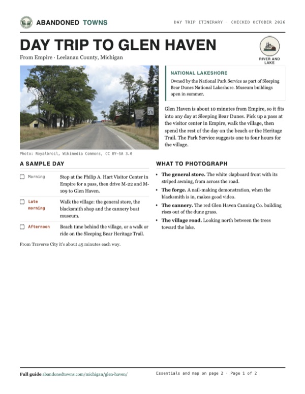
Take it with you
Day trip itinerary
The essentials, the sample day with boxes to tick, what to photograph and the coordinates, on two printable pages. Handy where there's no signal.
Download the PDF (519 KB)Glen Haven is about 10 minutes from Empire, so it fits into any day at Sleeping Bear Dunes. Pick up a pass at the visitor center in Empire, walk the village, then spend the rest of the day on the beach or the Heritage Trail. The Park Service suggests one to four hours for the village.
A sample day
- Stop at the Philip A. Hart Visitor Center in Empire for a pass, then drive M-22 and M-109 to Glen Haven.
- Walk the village: the general store, the blacksmith shop and the cannery boat museum.
- Beach time behind the village, or a walk or ride on the Sleeping Bear Heritage Trail.
From Traverse City it's about 45 minutes each way.
What to photograph and film
- The general store. The white clapboard front with its striped awning, from across the road.
- The forge. A nail-making demonstration, when the blacksmith is in, makes good video.
- The cannery. The red Glen Haven Canning Co. building rises out of the dune grass.
- The village road. Looking north between the trees toward the lake.
Map & directions
Getting there
Empire, home of the park's Philip A. Hart Visitor Center, where passes are sold, is the nearest town, about 10 minutes south: M-22 north, then M-109 to Glen Haven. From Traverse City, M-72 west and county roads lead to Glen Arbor, then M-109 west to the village, about 45 minutes. Both routes end where M-109 meets Dune Valley Road, at the map point. The village buildings are a quarter to half a mile north of there, along Glen Haven Road toward the beach.


Base map: USGS The National Map (public domain). Routes: OSRM on © OpenStreetMap contributors data (ODbL), computed October 2026. Times assume dry roads.
- From Niagara Street, turn left onto M-22 (Lacore Road, then Leelanau Highway) and head north.2.1 mi
- Turn left onto M-109 (South Dune Highway) and follow it north to Dune Valley Road. The village is just north, on Glen Haven Road.4.8 mi
- From State and Union Streets, take Grandview Parkway west, then M-72 (Traverse Highway) west.12.4 mi
- Turn right onto Maple City Road (CR 667), then left onto Kasson Center Road, which becomes Baatz Road.5.3 mi
- Turn right onto Fritz Road, left onto Burdickville and Dunns Farm Roads, and bear left onto Macfarlane Road.6.2 mi
- At the end, turn right onto M-22 (Glen Lake Road) into Glen Arbor.2.8 mi
- Turn left onto M-109 (Western Avenue, then West Harbor Highway) to Dune Valley Road. The village is just north, on Glen Haven Road.2.0 mi
Road and safety notes
- An undated listing rates the roads 2WD.
- Every visitor needs a park entrance pass, displayed in the vehicle. Passes are sold at the Philip A. Hart Visitor Center, the Platte River and D. H. Day campgrounds, some area businesses and Recreation.gov. The park is cashless.
- Leashed pets may go outside, but not into the historic buildings.
Photos
Glen Haven in photos
Visitor reports
Been to Glen Haven?
Been there lately? Tell the next visitor what you found: whether you could get in, the state of the road and what's still standing. Photos are welcome. We read every report before it appears here.
River and lake
More river and lake ghost towns
The nearest, in other states.

 Guide
Delhi
44.02, -88.80Winnebago County, Wisconsin
A trading town on the Fox River, laid out in 1849 with a main street called Broadway and a hotel of 22 rooms. Better bridges and the railroad took…
 Guide
Baltimore
40.17, -87.44Warren County, Indiana
A river village laid out in 1829 on the west bank of the Wabash. It once had 70 people and kept a post office until 1865. Photos from 2007 show its…
Nearby
Other sites near Glen Haven
Straight-line distance from the townsite to other mapped sites in our Michigan index.
- Aral9.7 mi S · Benzie
- Interlochen21.8 mi SE · Grand Traverse
- Northport25.8 mi NE · Leelanau
- Walton40.5 mi SE · Grand Traverse
- Holy Island48.0 mi NE · Charlevoix
- Wetzell49.0 mi E · Antrim
- Cutcheon55.8 mi SE · Missaukee
- Deward59.1 mi E · Crawford
Sources
Sources and credits
- ghosttowns.com, "Glen Haven": fact sheet fields (roads, climate).
- Wikipedia, "Glen Haven, Michigan", retrieved October 2026: the 1881 purchase, the life-saving station, the national lakeshore, the 1983 NRHP listing, the 2007 eviction, coordinates and elevation.
- NPS, "Glen Haven Historic Village", updated April 3, 2025: McCarty, Sleeping Bearville, the Northern Transit Company and its refueling station, Day and the inn, the 1881 plat, the cannery, the dock, the Park Service purchase, the buildings standing today.
- NPS, "Glen Haven General Store", updated October 15, 2026: 2026 season and hours, what it sells, restrooms and vending machines nearby in summer.
- NPS, "Glen Haven Blacksmith Shop", updated September 18, 2026: season and volunteer schedule.
- NPS, "Visit Glen Haven Historic Village", updated December 18, 2025: best-preserved cordwood station, summer-only interiors, time to allow, pets, accessibility and accessible restrooms, no fee beyond the park pass.
- NPS, Glen Haven Historic Village, official page, updated September 25, 2024: the nail-making demonstration, the Heritage Trail, mailing address and phone.
- NPS, Sleeping Bear Dunes fees, updated July 28, 2026: pass prices, cashless payment, where to buy, display rule.
- Routes: OSRM on OpenStreetMap data, October 2026.
Photo and map credits
- Looking north along the road through the village, 2011: Royalbroil, Wikimedia Commons, CC BY-SA 3.0
- The general store, 2007: MJCdetroit, Wikimedia Commons, CC BY 3.0
- Inside the blacksmith shop, 2022: Sbflorio, Wikimedia Commons, CC BY-SA 4.0
- The cannery boat museum, 2022: Sbflorio, Wikimedia Commons, CC BY-SA 4.0
- The life-saving station at Sleeping Bear Point, now the Maritime Museum, from the beach, June 2022: Sbflorio, Wikimedia Commons, CC BY-SA 4.0
- Topo map, area base map and aerial imagery: USGS The National Map (public domain).
- Historic maps: USGS Historical Topographic Map Collection (public domain): Manitowoc 1954, 1:250,000; Empire 1957, 1:62,500; Glen Haven 1983, 1:25,000.