 Abandoned
Overview
The town that was bought and buried
Times Beach began in 1925 as a newspaper promotion. The St. Louis Star-Times carved a triangle of Meramec River floodplain into small lots and sold them for $67.50 with a six-month subscription, as summer getaways for St. Louis families. Route 66 came through along its south edge in 1926. By 1980 the census counted 2,041 people.
The town couldn't afford to pave its 23 miles of dirt roads. From 1972 it paid a waste oil hauler, Russell Bliss, to spray them against the dust. Some of his oil had been mixed with waste he had collected from a chemical plant in Verona, Missouri, and it carried dioxin. The danger surfaced slowly, through dead horses at a stable Bliss had oiled in 1971 and a federal investigation. In December 1982, just as the EPA finished testing the soil, the Meramec flooded the town. On December 23 the CDC advised that no one should move back.
In February 1983 the EPA announced a buyout of the whole town. The state disincorporated Times Beach in 1985, the EPA counts the last residents as relocated by the end of 1986, and demolition was finished by 1992. An incinerator on the site burned contaminated soil from across eastern Missouri until 1997. Two years later the land opened as Route 66 State Park. The 1935 roadhouse at the end of the bridge is the park's visitor center and the only building left from the town's time.
Video
The last mayor's story
In a sit-down interview, Marilyn Leistner, the last mayor of Times Beach, tells how the town learned of the dioxin, paid for its own first test and pushed for the buyout, and how its children were kept apart at other schools. The video opens on the park's trails, old Route 66 and the bridge. It ends with Leistner touring the park's visitor center in the 1935 roadhouse. She shows where her desk was when the building held government offices after the contamination, and points out photos of the 1982 flood, the water tower and an aerial view of the streets, which were named for trees and flowers. The history is Leistner's own account. She dates the buyout announcement to December 22, 1983; the EPA announced it on February 22, 1983, the date on the video's own news clip. The news clips are credited at the end to Bruce Lixey's 1993 documentary.
 Play “Times Beach: 42 Years Later” from YouTube
Timeline
Resort, Route 66, dioxin and a park

- The St. Louis Star-Times lays out a summer resort on the Meramec floodplain and offers 20-by-100-foot lots for $67.50 with a six-month subscription. The state park's history dates the offer to 1926.
- Route 66 is designated through Missouri, along the south edge of the new town.
- The steel truss bridge carrying Route 66 over the Meramec is completed.
- The Bridgehead Inn opens at the east end of the bridge. It later runs as Steiny's Inn, from 1946 by the state park's account or 1947 by Legends of America's.
- Waste oil hauler Russell Bliss sprays oil on the arena at Shenandoah Stable to keep down the dust. Over the following months 62 horses there die or have to be put down.
- Times Beach, too poor to pave its 23 miles of dirt roads, pays Bliss to oil them against dust. Some of his oil has been mixed with dioxin-laden waste from a chemical plant in Verona, Missouri.
- The census counts 2,041 people.
- The EPA finishes soil sampling a day before the Meramec floods the town. On December 23 the CDC recommends that no one move back.
- The EPA announces a buyout of 800 homes and 30 businesses, about $36.7 million in all, most of it federal.
- Governor John Ashcroft disincorporates the town by executive order. The EPA says the last residents were relocated by the end of 1986.
- Demolition is complete.
- An incinerator built on the site runs from March 1996 to June 1997. It burns 265,354 tons of dioxin-contaminated soil and debris from 27 eastern Missouri sites, Times Beach among them.
- The 419-acre Route 66 State Park opens on the townsite.
- The EPA removes Times Beach from the Superfund list.
- The old Route 66 bridge is closed as unsafe.
- The bridge deck is removed to take weight off the steel truss.
- An EPA reassessment finds no significant health risk to park visitors or workers.
- Great Rivers Greenway and the Army Corps of Engineers are working on permits to restore the bridge for walkers and cyclists.
What's left
What you'll see


Nothing of the houses or streets is left to see. Wikipedia notes that a grass-covered mound in the park holds the debris of the demolished buildings. The park's trails, which the state describes as hard-surfaced and mostly level, loop through the woods and fields of the old townsite inside the river bend.
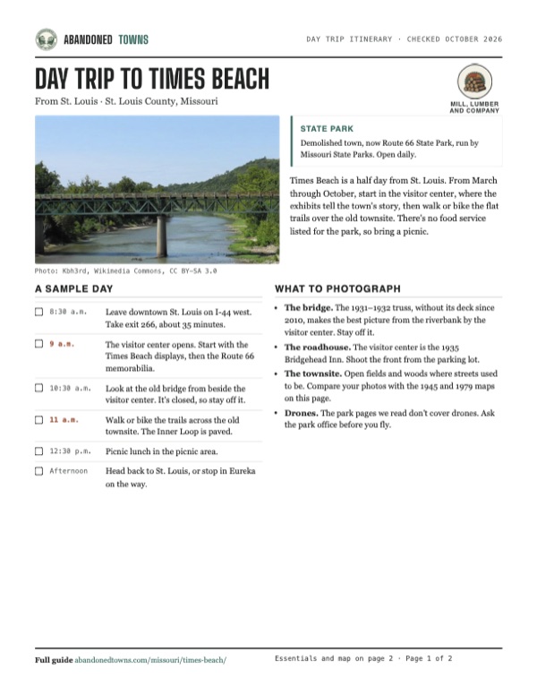
The visitor center is the old Bridgehead Inn, a 1935 roadhouse on Route 66. Its display area covers the highway and, according to Missouri State Parks, the history of Times Beach as a summer resort and as an environmental cleanup. Beside it, the steel truss of the 1931–1932 Route 66 bridge still spans the Meramec. Its deck was removed in 2010, and the state says the bridge "is no longer open to vehicle or pedestrian traffic." Great Rivers Greenway's project page says permits for restoring it as a walking and cycling bridge were still being worked out in 2026.
The historic maps below show the town as it grew. The 1931 sheet has a grid of streets fanning out toward the river bend, with scattered houses. The 1954 sheet, with later revisions printed in purple, shows fuller blocks, trailer parks on the west side and a divided highway along the south edge, and the 1979 photo-map shows the town from the air a few years before the buyout, with the divided highway along its southern edge.
- Visitor center in the 1935 Bridgehead Inn
- Old Route 66 roadway
- Meramec River bridge truss (closed, no deck)
- Trails on the townsite
- Grass mound over demolition debris


Historic maps
Times Beach on USGS maps, 1931–1979
Crops from the USGS Historical Topographic Map Collection, centered on the townsite. Each sheet shows what surveyors mapped that year; compare them with today's topo and aerial on this page.

Day trip
Plan a day trip to Times Beach from St. Louis
Take it with you
Day trip itinerary
The essentials, the sample day with boxes to tick, what to photograph and the coordinates, on two printable pages. Handy where there's no signal.
Download the PDF (508 KB)Times Beach is a half day from St. Louis. From March through October, start in the visitor center, where the exhibits tell the town's story, then walk or bike the flat trails over the old townsite. There's no food service listed for the park, so bring a picnic.
A sample day
- Leave downtown St. Louis on I-44 west. Take exit 266, about 35 minutes.
- The visitor center opens. Start with the Times Beach displays, then the Route 66 memorabilia.
- Look at the old bridge from beside the visitor center. It's closed, so stay off it.
- Walk or bike the trails across the old townsite. The Inner Loop is paved.
- Picnic lunch in the picnic area.
- Head back to St. Louis, or stop in Eureka on the way.
What to photograph and film
- The bridge. The 1931–1932 truss, without its deck since 2010, makes the best picture from the riverbank by the visitor center. Stay off it.
- The roadhouse. The visitor center is the 1935 Bridgehead Inn. Shoot the front from the parking lot.
- The townsite. Open fields and woods where streets used to be. Compare your photos with the 1945 and 1979 maps on this page.
- Drones. The park pages we read don't cover drones. Ask the park office before you fly.
Map & directions
Getting there
The park is just off I-44 at exit 266, next to Eureka and about 35 minutes from downtown St. Louis. Both routes below end at the visitor center on North Outer Road.


Base map: USGS The National Map (public domain). Routes: OSRM on © OpenStreetMap contributors data (ODbL), computed October 2026. Times assume dry roads.
- From downtown Eureka, take South Central Avenue and East 4th Street to I-44 east.0.8 mi
- Follow I-44 east across the Meramec River.1.7 mi
- Take exit 266 and continue on North Outer Road to the visitor center on the left.0.6 mi
- From downtown St. Louis, follow 14th Street, Chouteau Avenue and Truman Parkway to I-44 west.1.7 mi
- Follow I-44 west.22.9 mi
- Take exit 266 and bear right onto North Outer Road to the visitor center on the left.0.5 mi
Road and safety notes
- The old Route 66 bridge over the Meramec is closed to cars and pedestrians. Use I-44.
- Missouri State Parks posts a tick advisory for the park. Stay on the trails and check yourself afterwards.
- The townsite sits on the Meramec floodplain. Check the park's status map for closures after high water.
- St. Louis drive times assume light traffic on I-44.
Photos
Photos
Visitor reports
Been to Times Beach?
Been there lately? Tell the next visitor what you found: whether you could get in, the state of the road and what's still standing. Photos are welcome. We read every report before it appears here.
Mill, lumber and company
More mill, lumber and company ghost towns
The nearest, in other states.

 Guide
Vishnu Springs
40.43, -90.89McDonough County, Illinois
A healing-spring resort in a wooded ravine that drew crowds in the 1880s and was all but abandoned by the 1920s. Its hotel, built in 1889 or 1890…
 Guide
Mudlavia Springs
40.34, -87.29Warren County, Indiana
A spring found in a ditch in 1884 became a grand mud-bath resort that drew guests from around the world. The great hotel burned in 1920, its…
Nearby
Other sites near Times Beach
Straight-line distance from the townsite to other mapped sites in our Missouri index.
Sources
Sources and credits
- Wikipedia, "Times Beach, Missouri", retrieved October 2026: the 1925 promotion, census figures, Russell Bliss, the Verona plant waste and the road oiling, the Shenandoah horses, the 1982 flood and CDC advice, buyout figures, disincorporation, demolition, the park, the 2012 retest, the debris mound, coordinates.
- Legends of America, "Times Beach", updated April 2026: Route 66, the bridge dates and 2009 closing, the Bridgehead Inn and Steiny's Inn, the stable horses, the 1972–1976 road oiling, the 1999 park opening, I-44 exit 266.
- Missouri State Parks, Route 66 State Park, with its hours, general information, visitor center, accessibility and picnicking pages, October 2026: hours, address, phone, exhibits, bridge closure, trails, restrooms, shelters, the 1926 lot offer.
- US EPA, Times Beach Superfund site and its cleanup activities page: relocation finished by the end of 1986, the incinerator's dates, tonnage and 27 sites, cleanup completed 1997, the park in 1999, deletion from the list in 2001, the 2012 reassessment.
- Great Rivers Greenway, Route 66 bridge project, October 2026: the 2010 deck removal, restoration plans and 2026 permit work.
- Gateway Explorer, "Times Beach: 42 Years Later", YouTube, uploaded March 26, 2024 (filmed March 4, 2024, by its description): the video on this page; Marilyn Leistner's account and her tour of the visitor center.
- Elevation: USGS 3D Elevation Program point query. Routes: OSRM on OpenStreetMap data, October 2026.
Photo and map credits
- The Route 66 truss bridge over the Meramec River at Times Beach, August 2011: Kbh3rd, Wikimedia Commons, CC BY-SA 3.0
- The Route 66 State Park visitor center, the former Bridgehead Inn roadhouse, January 2017: Mitchazenia, Wikimedia Commons, CC BY-SA 4.0
- Times Beach's street grid between the railroad and the Meramec, 1945 USGS sheet: U.S. Geological Survey, USGS catalog, Public domain
- Topo map, area base map and aerial imagery: USGS The National Map (public domain).
- Historic maps: USGS Historical Topographic Map Collection (public domain): Manchester SE 1931, 1:24,000; Manchester 1945, 1:24,000; Manchester 1954, 1:24,000; Manchester 1979, 1:24,000.