 Abandoned

Overview
Montana's first gold camp and first capital

Bannack sits on Grasshopper Creek in the dry hills west of Dillon. On July 28, 1862, John White and his party found gold on the creek, the first major strike in what became Montana. By the next year more than 3,000 people had crowded into the gulch, and the town took its name from the Bannock people of the region. When Congress created Montana Territory in May 1864, Bannack became its first capital.
It didn't hold the title long. Gold found at Alder Gulch in May 1863 had already drawn many prospectors east to Virginia City, and the capital moved there too. Bannack stayed on as a smaller town and as the county seat, building a brick courthouse in 1875, a Masonic hall over a schoolhouse in 1874 and a Methodist church in 1877. The railroad passed it by in 1880 for Dillon, which took the county seat the next year. Dr. John Meade turned the empty courthouse into a hotel in 1890, and gold dredges chewed through the creek bed from 1895, taking hundreds of the oldest buildings with them.
The school closed in the 1940s and the last residents had gone by the 1970s. The state made Bannack a park in 1954, and it became a National Historic Landmark in 1961. Montana Fish, Wildlife & Parks calls it the best preserved of Montana's ghost towns. More than 50 buildings line Main Street, and in a 2026 notice the agency said most of them are open to the public.
Video
Bannack in 30 seconds
Montana's first territorial capital, born in the 1862 gold strike: Main Street, the Hotel Meade, the 1874 Masonic hall and school, and the state park today.
Timeline
From gold strike to state park

- John White and his party find gold on Grasshopper Creek. It is Montana's first major gold discovery.
- More than 400 prospectors are on the creek, by Legends of America's count.
- Bannack passes 3,000 people. In May, miners find gold at Alder Gulch, about 80 miles east, and many of Bannack's prospectors head there.
- Vigilantes hang Sheriff Henry Plummer and his deputies Buck Stinson and Ned Ray at Bannack, without a trial.
- Congress creates Montana Territory. Bannack is its first capital, and the first legislature meets there. The capital soon moves on to Virginia City.
- Bannack Masonic Lodge No. 16 builds a two-storey hall with the lodge upstairs and the school below. Classes meet there for nearly 70 years.
- The brick Beaverhead County courthouse goes up on Main Street.
- The Methodist church is built, the first building in Bannack made only for worship.
- The Utah and Northern Railway ends at Terminus, now Dillon, instead of Bannack. The population is down to 250.
- The county seat moves to Dillon and the courthouse stands empty.
- Dr. John Meade buys the old courthouse and turns it into the Hotel Meade.
- Electric gold dredges revive Bannack for a time. Legends of America says five worked the creek for about ten years and destroyed several hundred buildings from the 1860s.
- The school closes. Wikipedia says the town was abandoned in the 1940s or early 1950s; its last residents left in the 1970s.
- The Beaverhead County Museum acquires the land in 1953. Bannack becomes a state park on August 15, 1954.
- Bannack is named a National Historic Landmark. It joins the National Register of Historic Places on October 15, 1966.
- The first Bannack Days. The 50th was held on July 18 and 19, 2026.
Record and legend
Sheriff Plummer and the vigilantes
Bannack's best-known story is a hanging. Henry Plummer arrived in Bannack in January 1863 and was elected sheriff a few months later. He was accused of secretly leading a gang of road agents. On January 10, 1864, vigilantes from Bannack and Virginia City hanged Plummer and two of his deputies, Buck Stinson and Ned Ray, at Bannack without a trial. In all, 22 people accused of belonging to the gang were tried informally and hanged by the Montana vigilantes, by Wikipedia's count; Legends of America puts it at about 24.
The early accounts claimed the gang killed more than 100 people. Only eight of those deaths are documented.
Some modern historians doubt the gang existed at all. We give the hangings as record and the gang's body count as legend. Among the vigilantes was Nathaniel Langford, later the first superintendent of Yellowstone National Park.
What's left
Main Street on Grasshopper Creek

At Bannack you can walk into many of the buildings. The two-storey brick Hotel Meade, built as the county courthouse, keeps its curving staircase. The Masonic hall stands over the old schoolroom, and the 1877 Methodist church has its pointed-arch window. Between them are log cabins, false-front stores and houses, with the cemetery on the slope north of town. Walking tours start at the visitor center.
The old USGS sheets show the town shrinking along the creek. The 1952 Bannack sheet, labelled "First Territorial Capitol," draws a row of buildings along the road on the north bank, the cemetery above it, Hangmans Gulch to the north and lode mines on the slopes to the south. The 1962 sheet marks gold and palladium mines on both sides of Grasshopper Creek, and the 1983 map adds Road Agents Rock to the north.
- Hotel Meade (1875 courthouse)
- Masonic hall and school (1874)
- Methodist church (1877)
- Log cabins and houses
- False-front stores
- Cemetery
- Dredge pond (skating in winter)
- Visitor center


Historic maps
Bannack on USGS maps, 1952–1983
Crops from the USGS Historical Topographic Map Collection, centered on the townsite. Each sheet shows what surveyors mapped that year; compare them with today's topo and aerial on this page.

Day trip
Plan a day trip to Bannack from Dillon
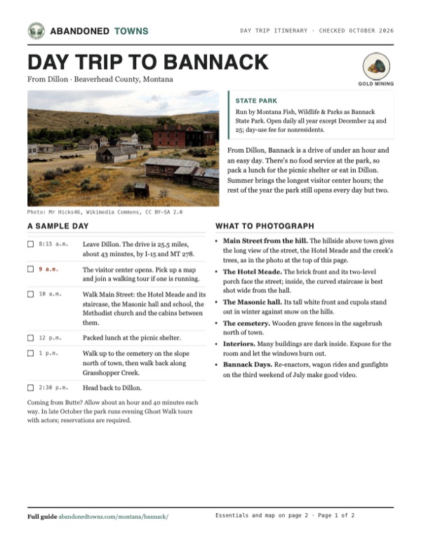
Take it with you
Day trip itinerary
The essentials, the sample day with boxes to tick, what to photograph and the coordinates, on two printable pages. Handy where there's no signal.
Download the PDF (509 KB)From Dillon, Bannack is a drive of under an hour and an easy day. There's no food service at the park, so pack a lunch for the picnic shelter or eat in Dillon. Summer brings the longest visitor center hours; the rest of the year the park still opens every day but two.
A sample day
- Leave Dillon. The drive is 25.5 miles, about 43 minutes, by I-15 and MT 278.
- The visitor center opens. Pick up a map and join a walking tour if one is running.
- Walk Main Street: the Hotel Meade and its staircase, the Masonic hall and school, the Methodist church and the cabins between them.
- Packed lunch at the picnic shelter.
- Walk up to the cemetery on the slope north of town, then walk back along Grasshopper Creek.
- Head back to Dillon.
Coming from Butte? Allow about an hour and 40 minutes each way. In late October the park runs evening Ghost Walk tours with actors; reservations are required.
What to photograph and film
- Main Street from the hill. The hillside above town gives the long view of the street, the Hotel Meade and the creek's trees, as in the photo at the top of this page.
- The Hotel Meade. The brick front and its two-level porch face the street; inside, the curved staircase is best shot wide from the hall.
- The Masonic hall. Its tall white front and cupola stand out in winter against snow on the hills.
- The cemetery. Wooden grave fences in the sagebrush north of town.
- Interiors. Many buildings are dark inside. Expose for the room and let the windows burn out.
- Bannack Days. Re-enactors, wagon rides and gunfights on the third weekend of July make good video.
Map & directions
Getting there
Dillon is the closest town, about 43 minutes away by I-15 and MT 278. From Butte, I-15 runs south past Dillon to the same turnoff. Both routes end on Bannack Bench Road and Bannack Road, which lead to the park.


Base map: USGS The National Map (public domain). Routes: OSRM on © OpenStreetMap contributors data (ODbL), computed October 2026. Times assume dry roads.
- From South Idaho Street, take East Glendale Street and South Atlantic Street (I-15 Business) south.1.6 mi
- Join I-15 south.2.5 mi
- Take the exit for MT 278 and turn right, heading west on MT 278.17.6 mi
- Turn left on Bannack Bench Road.2.9 mi
- Turn left on Bannack Road to the park.1.0 mi
- From West Iron Street in uptown Butte, head to the interstate.1.9 mi
- Merge onto I-15/I-90.2.7 mi
- Keep right on I-15 south, past Dillon.61.7 mi
- Take the exit for MT 278 and turn right, heading west on MT 278.17.6 mi
- Turn left on Bannack Bench Road.2.9 mi
- Turn left on Bannack Road to the park.1.0 mi
Road and safety notes
- The routes are computed from OpenStreetMap and haven't been driven by us. We have no dated source on the surface of Bannack Bench Road and Bannack Road.
- Drinking water is available in the summer season only, by FWP's account. Bring your own the rest of the year.
- During Bannack Days, on the third weekend of July, parking is limited. In 2026 FWP ran shuttle vans from the far lots and asked visitors to carpool and leave pets at home.
- The park is closed on December 24 and 25. In winter the dredge pond becomes a skating rink, usually from January to early March, weather permitting.
Photos
Bannack in photos
Visitor reports
Been to Bannack?
Been there lately? Tell the next visitor what you found: whether you could get in, the state of the road and what's still standing. Photos are welcome. We read every report before it appears here.
Gold mining
More gold mining ghost towns
The nearest in Montana.

 Guide
Nevada City
45.31, -111.97Madison County, Montana
A gold camp of 1863 in Alder Gulch, where the Montana Vigilantes got their start. It was a ghost town by 1876. Collectors filled it with buildings…
 Guide
Virginia City
45.30, -111.94Madison County, Montana
The gold town of 1863 that became Montana's territorial capital, home of the vigilantes and Boot Hill. About 200 people still live here, and in…
Nearby
Other sites near Bannack
Straight-line distance from the townsite to other mapped sites in our Montana index.
- Hecla30.9 mi N · Beaverhead
- Glendale34.9 mi N · Beaverhead
- Melrose35.9 mi NE · Silver Bow
- Laurin44.7 mi E · Madison
- Nevada City51.0 mi E · Madison
- Union City51.4 mi E · Madison
- Virginia City52.4 mi E · Madison
- Mammoth59.0 mi NE · Madison
Sources
Sources and credits
- Montana Fish, Wildlife & Parks, "Bannack State Park", read October 20, 2026: 2026 hours and the October 13 change, visitor center hours, December closures, fees, address, phone, amenities, water, pets, campground, walking tours, Ghost Walk, ice skating, the 1862 discovery, 3,000 people by 1863, first territorial capital, more than 50 buildings, park elevation.
- Whitehall Ledger, "Bannack State Park to host 50th annual Bannack Days", July 1, 2026, from Montana FWP: 2026 Bannack Days dates, hours and admission, parking and shuttles, the event's start in 1976, most buildings open to the public.
- Wikipedia, "Bannack, Montana", retrieved October 2026: coordinates, the name, Plummer and the vigilantes, the documented deaths, 1880 population and railroad, abandonment and last residents, the 1953 purchase, landmark and register dates, 60 structures, the 1877 church, climate normals.
- Wikipedia, "Dillon, Montana", retrieved October 2026: Dillon began as Terminus, the temporary end of the Utah and Northern Railway, and was renamed in 1881.
- Legends of America, "Bannack, Montana", updated August 2026: 400 prospectors in 1862, the 1864 area population, the territory and the first legislature, Stinson and Ray, the 1874 Masonic hall and school, the 1875 courthouse, the 1881 county seat move, Dr. Meade's hotel, the dredges, the school's closing, the August 15, 1954 park date.
- ghosttowns.com, "Bannack": fact sheet fields (county, roads, climate, best time).
- Wikimedia Commons, Methodist Church file page: the church as the first building in Bannack built only for worship.
- Photos: Wikimedia Commons, credited below each one. Elevation: USGS 3D Elevation Program point query. Routes: OSRM on OpenStreetMap data, October 2026. Not field-checked.
Photo and map credits
- Bannack from the hillside, August 2014: Mr Hicks46, Wikimedia Commons, CC BY-SA 2.0
- The Hotel Meade, August 2017: Drown Soda, Wikimedia Commons, CC BY-SA 4.0
- The Hotel Meade and a false-front building, August 2017: Drown Soda, Wikimedia Commons, CC BY-SA 4.0
- Inside the Hotel Meade: the hall and curved staircase, August 2017: Drown Soda, Wikimedia Commons, CC BY-SA 4.0
- The Masonic hall and school, February 2016: Mark Holloway from Anaconda, Montana, Wikimedia Commons, CC BY 2.0
- The 1877 Methodist church and a log building beside it, July 2009: Raymond Hitchcock from Seattle, Washington, USA, Wikimedia Commons, CC BY-SA 3.0
- Log buildings along Main Street, August 2014: Mr Hicks46, Wikimedia Commons, CC BY-SA 2.0
- A log house below the hills, July 2021: Meanolduglyogre, Wikimedia Commons, CC BY-SA 4.0
- Wooden grave fences in the cemetery, February 2016: Mark Holloway from Anaconda, Montana, Wikimedia Commons, CC BY 2.0
- Area base map, topo and aerial imagery: USGS The National Map (public domain).
- Historic maps: USGS Historical Topographic Map Collection (public domain): Bannack 1952, 1:24,000; Dillon 1962, 1:250,000; Dillon 1983, 1:100,000.