 Abandoned

Overview
The last gold rush, at the end of the road

Jarbidge sits at the bottom of the Jarbidge River canyon near the north end of the Jarbidge Mountains, about 10 miles south of the Idaho border. Gold was found here in 1909, in one of the last gold rushes of the American frontier, and by 1911 nearly 2,000 people had crowded into the canyon. The name comes from a Shoshone word meaning "devil"; the story goes that the Shoshone thought the hills were haunted.
On December 5, 1916, Ben Kuhl shot the mail-wagon driver Fred Searcy and took about $4,000, which was never found. The crime is remembered as the last stagecoach robbery in the United States. A bloody palm print on a letter helped convict Kuhl, the first time palm prints were used as evidence in an American courtroom. He was paroled in 1945.
Mine equipment went to the war effort during World War I, and mining ended in 1932. The town never quite emptied. It's a base for hunters, campers and anglers near the Jarbidge Wilderness, and it keeps its old jail and a community hall that works as an unofficial museum.
Timeline
Rush, robbery and the long quiet

- Gold is found in the Jarbidge River canyon, one of the last gold rushes of the American frontier.
- The population swells to nearly 2,000. A presidential proclamation takes the townsite out of the national forest, and the town's jail is built after it.
- Ben Kuhl kills mail-wagon driver Fred Searcy and takes about $4,000, in what Wikipedia calls the last stagecoach robbery in the United States.
- Kuhl's trial opens. A bloody palm print on a letter from the mail pouch is the first palm print used as evidence in a US courtroom. His death sentence is later commuted to life.
- Much of the mining equipment is cannibalized for the war effort.
- Mining stops altogether.
- Permits to remove gold are issued again.
What's left
What you'll see


The town strings along one road at the canyon bottom. Most buildings are occupied homes, old and new, and an undated listing notes a few old ruins if you look closely. The small jail, built after 1911, once held Ben Kuhl. The community hall carries state historical marker No. 153, which calls it the Jarbidge Commercial Hall, built by citizens after the town reached 1,500 people in 1910. Travel Nevada says it escaped a fire that leveled 22 other businesses and homes. It's now the town's unofficial museum, free with donations welcome, open for events such as Jarbidge Days and the Fourth of July and otherwise by appointment. The Red Dog Saloon and the Outdoor Inn stand on the main street.
The 1943 USGS sheet in the next section shows the town squeezed into the canyon, with mines on the slopes above it.
- Jail
- Community hall, the old Commercial Hall (museum)
- Red Dog Saloon
- Post office
- Old ruins


Historic maps
Jarbidge on USGS maps, 1943–1986
Crops from the USGS Historical Topographic Map Collection, centered on the townsite. Each sheet shows what surveyors mapped that year; compare them with today's topo and aerial on this page.

Day trip
Plan a day trip to Jarbidge from Twin Falls
Take it with you
Day trip itinerary
The essentials, the sample day with boxes to tick, what to photograph and the coordinates, on two printable pages. Handy where there's no signal.
Download the PDF (654 KB)Jarbidge is a long day from Twin Falls and a better overnight. Summer and fall are the best months. The town has a saloon, an inn with a bar and restaurant, and few other services.
A sample day
- Leave Twin Falls on US 93 south, then turn east onto Three Creek Road.
- Drop into the canyon on North Fork Charleston Road and arrive in Jarbidge.
- See the old jail and the community hall, and read the markers. The hall opens for events or by appointment.
- Lunch in town, then start back while there's daylight.
Coming from Elko? The route via Deeth crosses the mountains on county roads that get no winter maintenance. Go only in the snow-free months.
What to photograph and film
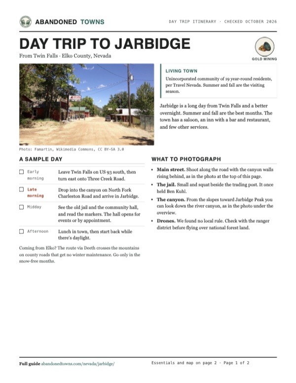
- Main street. Shoot along the road with the canyon walls rising behind, as in the photo at the top of this page.
- The jail. Small and squat beside the trading post. It once held Ben Kuhl.
- The canyon. From the slopes toward Jarbidge Peak you can look down the river canyon, as in the photo under the overview.
- Drones. We found no local rule. Check with the ranger district before flying over national forest land.
Map & directions
Getting there
The usual way in is from Twin Falls, Idaho, on US 93 and Three Creek Road, whose last 18 miles are unimproved. From Elko the routed drive is I-80 to Deeth, then county roads 747 and 748 over the mountains; the Elko-side roads get no winter maintenance. Either way, plan on gravel and slow going.


Base map: USGS The National Map (public domain). Routes: OSRM on © OpenStreetMap contributors data (ODbL), computed October 2026. Times assume dry roads.
- Head out on Shoshone Street and Washington Street South, ID 74.2.3 mi
- Turn right on Orchard Drive West, which becomes East 3700 North.4.9 mi
- Turn left on US 93 and head south.22.2 mi
- Turn left on 1520 North, which becomes Three Creek Road.7.7 mi
- Follow Three Creek Road. The final 18 miles are unimproved.47.2 mi
- Continue on North Fork Charleston Road down into Jarbidge.8.9 mi
- Head east on Idaho Street to I-80.2.0 mi
- Take I-80 east to exit 333.29.8 mi
- Follow the Deeth–Charleston Road, County Route 747, north.43.7 mi
- Bear right onto the Charleston–Jarbidge Road, County Route 748, over the mountains into Jarbidge.28.1 mi
Road and safety notes
- No paved road comes within about 20 miles of Jarbidge.
- The Elko-side county roads get no winter maintenance and are often closed from October or November to June or July. Three Creek Road is usually open all year.
- Roads turn to mud after rain or snowmelt. Carry a spare, water and a paper map.
- Services are limited and no hours are published. Fill your tank before leaving Twin Falls or Elko.
Photos
Jarbidge in photos
Visitor reports
Been to Jarbidge?
Been there lately? Tell the next visitor what you found: whether you could get in, the state of the road and what's still standing. Photos are welcome. We read every report before it appears here.
Gold mining
More gold mining ghost towns
The nearest in Nevada.

 Guide
Charleston
41.67, -115.51Elko County, Nevada
An 1876 gold camp in the high country between Elko and Jarbidge, first called Mardis after a founder who was murdered. Old cabins stand beside the…
 Guide
Berlin
38.88, -117.61Nye County, Nevada
A company mining town on the west side of the Shoshone Range, founded in 1897 and empty by about 1911. The state has kept its mill, machine shop and…
Nearby
Other sites near Jarbidge
Straight-line distance from the townsite to other mapped sites in our Nevada index.
- Rowland13.4 mi W · Elko
- Charleston14.6 mi S · Elko
- Gold Creek18.2 mi SW · Elko
- Patsville27.4 mi W · Elko
- Mountain City27.5 mi W · Elko
- Rio Tinto28.4 mi W · Elko
- Afton31.9 mi SE · Elko
- North Fork33.6 mi SW · Elko
Sources
Sources and credits
- ghosttowns.com, "Jarbidge": fact sheet fields (roads, climate, best time, remains, post office days, undated), hunting and fishing.
- Wikipedia, "Jarbidge, Nevada", retrieved October 2026: location, 1909 rush, name, peak population, World War I and 1932, 2013 permits, the usual route, unimproved miles and winter closures.
- Wikipedia, "Ben Kuhl": the 1916 robbery, the palm print, sentence and 1945 parole.
- Historical Marker Database, Jarbidge jail marker: the 1911 proclamation, the jail, Kuhl as its best-known prisoner.
- Travel Nevada, "Jarbidge Community Hall" (undated), read October 2026: the hall as unofficial museum, the fire it escaped, free entry with donations, opening for events or by appointment, 19 year-round residents.
- Jarbidge Community Association, "Local Businesses", October 2026: inn, saloon, trading post, motel, RV park and gas station.
- State historical marker No. 153, Jarbidge Commercial Hall (photo on this page): the hall's origin and the 1910 population.
- USDA Forest Service, Pine Creek Campground (updated July 2025): sites, no fee, June to October season, location, ranger district office and phone.
- Coordinates: Wikipedia (from USGS GNIS). Elevation: USGS 3D Elevation Program point query. Routes: OSRM on OpenStreetMap data, October 2026.
Photo and map credits
- Main street, looking north: Famartin, Wikimedia Commons, CC BY-SA 3.0
- Jarbidge, looking south: Mark Hufstetler, Wikimedia Commons, CC BY-SA 3.0
- The jail and trading post: Famartin, Wikimedia Commons, CC BY-SA 3.0
- The Jarbidge River canyon from the slopes of Jarbidge Peak: Famartin, Wikimedia Commons, CC BY-SA 3.0
- The Red Dog Saloon: Visitor7, Wikimedia Commons, CC BY-SA 3.0
- The community hall: Famartin, Wikimedia Commons, CC BY-SA 3.0
- State marker No. 153 for the Commercial Hall: Famartin, Wikimedia Commons, CC BY-SA 4.0
- The post office: Visitor7, Wikimedia Commons, CC BY-SA 3.0
- Topo map, area base map and aerial imagery: USGS The National Map (public domain).
- Historic maps: USGS Historical Topographic Map Collection (public domain): Jarbidge 1943, 1:62,500; Wells 1955, 1:250,000; Wells 1961, 1:250,000; Jarbidge North 1986, 1:24,000.