 Abandoned

Overview
A town under the lake, and out again

St. Thomas began on January 8, 1865, when Mormon settlers sent by Brigham Young laid it out near the mouth of the Muddy River, where it meets the Virgin. Six years later a survey moved the state line and put the settlement in Nevada, which asked for back taxes in gold. The settlers left for Utah. Others took over their farms, Latter-day Saint families came back in the 1880s, and St. Thomas grew into a farm town of about 500 with a school, stores and a hotel. It was also a stop on the Arrowhead Trail, an early motor road.
Hoover Dam ended it. In the 1930s the federal government bought the town for the reservoir, and most people moved to Overton. The water reached the streets in 1937 and 1938. On June 11, 1938, Hugh Lord, the last resident, rowed away from his house. The cemetery was moved to Overton.
Drought has turned that around. The National Park Service says the town came back above water in 2002, and on October 23, 2026 the lake stood at 1,037.22 feet. The townsite is at about 1,150 feet. A 2.5-mile loop now crosses the old streets, past foundations, steps and walls on ground that was lake bed for decades.
Video
A hot morning on the old streets
A YouTuber drives his Jeep to the end of the road, expecting to reach the townsite, and walks the rest of the way across the dry lakebed. He follows old roads lined with brush past concrete foundations, the standing walls of what he takes to be the Hannig store, and the school's foundation and steps, comparing them with old photos. His on-screen thermometer climbs from 89°F to 102°F. He set out early but says he carried less water than he should have; the Park Service warns that heat kills. The history in the narration is the creator's own; the timeline below follows the Park Service and our other sources.
 Play “Explore the ABANDONED Town That Disappeared Beneath Lake Mead” from YouTube
Timeline
From Mormon mission to lake bed

- Mormon settlers sent by Brigham Young found St. Thomas near the mouth of the Muddy River. Thomas Smith leads them.
- John Wesley Powell's first Colorado River expedition ends at the settlement.
- A survey moves the state line and puts the Muddy River settlements in Nevada. Nevada asks for back taxes in gold, and the Mormon settlers leave for Utah rather than pay.
- New Latter-day Saint settlers return. St. Thomas grows into a farm town of about 500 and later becomes a stop on the Arrowhead Trail, an early auto road.
- The federal government buys the town and its land for the reservoir behind Hoover Dam, then called Boulder Dam. Most residents move to nearby Overton.
- A photograph shows the two-story school standing empty.
- Lake Mead's water reaches the town.
- Hugh Lord, the last resident, rows away from his house.
- Falling lake levels bring the town back above water, by the National Park Service's account.
- Lake Mead stands at 1,038.50 feet, below its July 2022 record low.
- The lake reads 1,037.22 feet, about 110 feet below the townsite.
What's left
What you'll see


Nothing stands to roof height. What's left is concrete: knee-high and waist-high foundation walls, steps that once led into buildings, cisterns and slabs, with the stumps of burned trees along what was Main Street. The school's foundation and front steps are the easiest to recognize; a 2006 Park Service photo holds an old picture of the building up against them. The Hanig ice cream parlor keeps a wall with a concrete pillar. A visitor whose account was last updated in June 2023 found the hotel reduced to bricks scattered around a foundation.
The 1886 and 1926 USGS sheets in the next section show Saint Thomas near the river, with a railroad line running up the valley of Muddy Creek on the 1926 sheet. By 1953 the same ground is blue: the lake covers the townsite, with Overton Beach to the south.
- School foundation and steps
- Hanig ice cream parlor walls
- House and store foundations
- Cisterns and slabs
- Burned tree stumps along Main Street


Status
Above the water line

Whether you can walk St. Thomas depends on Lake Mead. The 1926 USGS sheet puts a benchmark of 1,150 feet in town, and the national elevation model gives about the same. The Bureau of Reclamation's daily report put the lake at 1,037.22 feet on October 23, 2026, about 110 feet lower. A month earlier, on September 16, the lake had dropped below its July 2022 record low, and Reclamation's study at the time projected about 1,034.74 feet by the end of the year.
The trail itself is the Park Service's. Its page, updated January 7, 2026, rates the 2.5-mile round trip moderate, with 85 feet of climb, and says the trail is not maintained. The park closes several strenuous trails each summer for heat, from May 15 to September 30; the 2026 list on the alerts page doesn't include St. Thomas. The Park Service still warns that heat kills and asks summer hikers to go early in the morning or in the evening.
Historic maps
St. Thomas on USGS maps, 1886–1953
Crops from the USGS Historical Topographic Map Collection, centered on the townsite. Each sheet shows what surveyors mapped that year; compare them with today's topo and aerial on this page.

Day trip
Plan a day trip to St. Thomas from Overton
Take it with you
Day trip itinerary
The essentials, the sample day with boxes to tick, what to photograph and the coordinates, on two printable pages. Handy where there's no signal.
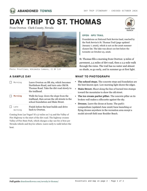
Download the PDF (491 KB)St. Thomas fills a morning from Overton: 9 miles of pavement, 3.5 miles of dirt road, then a 2.5-mile walk through the ruins. The trail has no water and almost no shade, so go early, and in summer go at first light.
A sample day
- Leave Overton on SR 169, which becomes Northshore Road, and turn onto Old St. Thomas Road. Take the dirt road slowly to the trailhead.
- Walk the loop: down the slope from the trailhead, then across the old streets to the school foundation and Main Street.
- Finish before the heat builds and drive back to Overton.
Coming from Las Vegas? It's 57 miles on I-15 and the Valley of Fire Highway to the start of the dirt road. The highway crosses Valley of Fire State Park, which charges a day-use fee of $10 per Nevada vehicle and $15 for others. Leave early to walk before the heat.
What to photograph and film
- The school steps. The concrete steps and foundation are the best-known spot. Low morning light shows the edges.
- Main Street. Shoot along the line of burned tree stumps toward the mountains to show the old street.
- The ice cream parlor pillar. The concrete pillar on its broken wall makes a silhouette against the sky.
- Drones. Leave the drone at home. The park's compendium (updated June 2026) bans launching or flying drones anywhere in the recreation area except a model aircraft field near Boulder Beach.
Map & directions
Getting there
From Overton, head south on SR 169, which becomes Northshore Road; the Park Service puts the turn onto Old St. Thomas Road just past mile post 46. From Las Vegas, take I-15 north to exit 75 and the Valley of Fire Highway. Both routes below end where Old St. Thomas Road leaves the pavement. The trailhead is about 3.5 miles farther, at the end of that dirt road.


Base map: USGS The National Map (public domain). Routes: OSRM on © OpenStreetMap contributors data (ODbL), computed October 2026. Times assume dry roads.
- Head south on North Moapa Valley Boulevard, SR 169.7.2 mi
- It becomes Northshore Road. Keep right at the fork, then turn left onto Old St. Thomas Road, where the route ends. The trailhead is about 3.5 miles on, at the end of this dirt road.1.8 mi
- From downtown, take 6th Street, Ogden Avenue, 4th Street, Casino Center Boulevard, Bonanza Road, Main Street and Washington Avenue to I-15.1.8 mi
- Take I-15 north, the Las Vegas Freeway, to exit 75.31.6 mi
- Turn right onto the Valley of Fire Highway and follow it to Northshore Road.23.5 mi
- Turn right onto Northshore Road, then left onto Old St. Thomas Road, where the route ends. The trailhead is about 3.5 miles on.0.1 mi
Directions go to the St. Thomas trailhead at the end of Old St. Thomas Road, where the drive ends, not to the townsite.
Road and safety notes
- Old St. Thomas Road is dirt for about 3.5 miles to the trailhead by OpenStreetMap, whose mappers tagged it rough, flood-prone and 4WD only after a survey in February 2022. A visitor whose account was last updated in June 2023 called it 3.3 miles, met large rocks, deep ruts, washouts and soft sand, and managed only about 5 mph in a sedan; he recommends a truck or SUV. A Vegas PBS guide of November 2024 says to bring a vehicle that can handle bumpy dirt roads.
- Monsoon rains from July to September can flood the park's roads and leave sharp rocks and deep mud behind, the Park Service warned in August 2026. Take care at wash crossings.
- There's no water, shade or other service at the trailhead. Carry all the water you need.
- Keep your park pass or receipt in the car; rangers may check it.
Photos
St. Thomas in photos
Visitor reports
Been to St. Thomas?
Been there lately? Tell the next visitor what you found: whether you could get in, the state of the road and what's still standing. Photos are welcome. We read every report before it appears here.
Farm and ranch
More farm and ranch ghost towns
The nearest, in other states.

 Guide
Wolf Hole
36.76, -113.55Mohave County, Arizona
A small ranching and farming settlement on the Arizona Strip that had a post office for about ten years. Older reports list one house and some…
 Guide
Tuweep
36.42, -113.07Mohave County, Arizona
A handful of homesteads in a remote valley north of the Grand Canyon, with a post office from 1929 to 1950. The Park Service kept the name for its…
Nearby
Other sites near St. Thomas
Straight-line distance from the townsite to other mapped sites in our Nevada index.
- Simonsville7.9 mi NW · Clark
- Saint Joseph8.6 mi NW · Clark
- Gold Butte15.9 mi SE · Clark
- Byron20.0 mi NW · Clark
- Rioville21.9 mi S · Clark
- Crystal21.9 mi W · Clark
- Bonelli's Ferry22.1 mi S · Clark
- Garnet28.3 mi W · Clark
Sources
Sources and credits
- ghosttowns.com, "St. Thomas": fact sheet fields (roads, climate, best time, remains), the January 8, 1865 founding, fewer than 500 residents, the Arrowhead Trail, the move to Overton.
- Wikipedia, "St. Thomas, Nevada", revision of October 16, 2026: Thomas Smith, about 500 at the peak, Pah-Ute County, Powell's 1869 expedition, the 1871 departure, the 1880s resettlement, Hugh Lord, the cemetery moved to Overton, coordinates (GNIS).
- National Park Service, "St. Thomas", updated June 4, 2025: the town's end, Hugh Lord rowing away on June 11, 1938, rules on foundations and artifacts, ranger phone numbers.
- National Park Service, "Hike the St. Thomas Trail", updated January 7, 2026: length, climb, rating, not maintained, trailhead past mile post 46, no water, pets, rules, heat advice.
- National Park Service, Lake Mead "Alerts and Conditions", updated August 20, 2026: the 2026 summer trail closures and the monsoon road warning.
- National Park Service, Lake Mead "Fees and Passes", updated June 25, 2026: entrance fees.
- Bureau of Reclamation, Lower Colorado daily reservoir levels, read October 24, 2026: Lake Mead at 1,037.22 feet on October 23, 2026.
- Fox Weather, "Lake Mead plunges to historic low", September 17, 2026: 1,038.50 feet on September 16, the July 2022 record, Reclamation's end-of-year projection.
- Vegas PBS, "Hike Through History: St. Thomas Ghost Town", November 21, 2024: the dirt road and the vehicle it needs.
- Las Vegas Then and Now, "St. Thomas Ghost Town from Las Vegas", updated June 22, 2023: a first-hand account of the slow dirt road, the foundations, cisterns and stairs, and the hotel's scattered bricks.
- Lake Mead NRA Public Affairs, Wikimedia Commons: the Park Service's note that the town resurfaced in 2002. Other photo descriptions date the school (May 13, 1934), the bus (1925–27) and the rising water (1937–38).
- National Park Service, Lake Mead "Superintendent's Compendium", updated June 11, 2026 (update signed June 8, 2026): the drone ban and the one designated model aircraft field.
- Nevada State Parks, "Valley of Fire State Park", read October 24, 2026: day-use entrance fees.
- RicRecon Adventures, "Explore the ABANDONED Town That Disappeared Beneath Lake Mead", YouTube, posted September 19, 2026: the video on this page; the walk from the road's end to the foundations, the store walls and the school steps, and the heat.
- Old St. Thomas Road and the trailhead: OpenStreetMap, October 2026 (the road's dirt surface, 4WD-only and flood-prone tags are from a survey of February 2022). Land: BLM national surface management map, queried October 24, 2026 (National Park Service).
- Elevation: USGS 3D Elevation Program point query. Routes: OSRM on OpenStreetMap data, October 2026, to the start of Old St. Thomas Road.
Photo and map credits
- A concrete wall and pillar on the townsite, July 2014: Prosfilaes, Wikimedia Commons, CC BY 3.0
- The Gentry general store on Main Street, around 1900: Lake Mead NRA Public Affairs, Wikimedia Commons, CC BY-SA 2.0
- The abandoned school, May 13, 1934: Lake Mead NRA Public Affairs, Wikimedia Commons, CC BY-SA 2.0
- The townsite from the air, its streets and foundations on dry ground, May 2015: Lake Mead NRA Public Affairs, Wikimedia Commons, CC BY-SA 2.0
- The St. Thomas school bus, between 1925 and 1927: Lake Mead NRA Public Affairs, Wikimedia Commons, CC BY-SA 2.0
- Lake Mead's water reaching the town, 1937–38: Lake Mead NRA Public Affairs, Wikimedia Commons, CC BY-SA 2.0
- An old photo of the school held up at its foundation, March 2006: Lake Mead NRA Public Affairs, Wikimedia Commons, CC BY-SA 2.0
- Foundations and burned tree stumps along Main Street, January 2017: Andrew Cattoir (Lake Mead National Recreation Area), Wikimedia Commons, Public domain
- The Hanig ice cream parlor's wall and pillar, February 2017: Andrew Cattoir (Lake Mead National Recreation Area), Wikimedia Commons, Public domain
- The school's front steps, April 2019: Andrew Cattoir (Lake Mead National Recreation Area), Wikimedia Commons, Public domain
- Knee-high foundation walls, April 2019: Andrew Cattoir (Lake Mead National Recreation Area), Wikimedia Commons, Public domain
- Topo map, area base map and aerial imagery: USGS The National Map (public domain). Historic sheets: USGS Historical Topographic Map Collection (public domain).
- Historic maps: USGS Historical Topographic Map Collection (public domain): Saint Thomas 1886, 1:250,000; Bonelli 1926, 1:96,000; Overton Beach 1953, 1:62,500.