 Abandoned

Overview
The town that turned down the railroad

Prospectors found gold in the Jicarilla Mountains in the late 1870s. Wikipedia credits John J. Baxter, a California forty-niner. Legends of America says a man named John Wilson found it first and left it to Jack Winters and Harry Baxter. Within a year there was a tent camp by a stream lined with white oaks. A post office opened in 1880. Baxter and his partner Winters sold the Homestake and South Homestake claims for $300,000 each, and the Old Abe became the big mine. By 1890 more than 2,000 people lived here, with about 50 businesses, four newspapers, an opera house, a bank and plenty of saloons. Billy the Kid and Pat Garrett both knew the town.
In the late 1890s two railroads planned lines toward White Oaks. The town's businessmen wouldn't give the concessions the railroad wanted, so the tracks went through Carrizozo, 12 miles west. As the mines played out, people followed the railroad. By 1910 about 200 remained.
White Oaks never quite emptied. A few people still live there among the survivors: Brown's Store, the 1893 Hoyle House, the 1895 brick schoolhouse and the No Scum Allowed Saloon.
Timeline
Boom, bypass and a long fade

- Prospectors find gold in the Jicarilla Mountains, on what becomes Baxter Mountain. Accounts differ on who found it first. Within a year a tent camp stands by a stream lined with white oaks.
- A post office opens. The July census counts about 800 people.
- Baxter and a prospector named Winters sell the Homestake and South Homestake claims for $300,000 each. The Old Abe becomes the largest mine.
- Starr's Opera House is finished.
- The town passes 2,000 people. Accounts put the peak at 2,500 to 4,000.
- The Hoyle House is built.
- The brick schoolhouse is built.
- The Santa Fe and the El Paso and Northeastern both plan lines toward White Oaks. Local businesses won't make the concessions asked, and the railroad builds through Carrizozo, 12 miles west, instead.
- About 200 people remain.
- Susan McSween Barber, the "Cattle Queen of New Mexico," dies. She had moved to White Oaks and is buried in its old cemetery.
- The White Oaks Historic District is listed on the National Register.
Legend and record
Hoyle's Folly
Watt Hoyle, an owner of the Old Abe mine, built a two-story Victorian brick house in 1893. The story told about it is that he built it for a fiancée who refused to come to White Oaks, which is why it was called Hoyle's Folly. Legends of America tells the story; we haven't seen a record of the bride. It adds that Hoyle lived in the house with his older brother and sister-in-law before moving to Denver in the 1890s.
The National Register district covers about 1,822 acres, but only six buildings were sound enough to count as contributing.
What's left
What you'll see
Brown's Store (1893), the Hoyle House and the 1895 brick schoolhouse, which closed in 1947, still stand. Islands magazine (May 2025) lists the White Oaks Schoolhouse Museum and the White Oaks Miner's Home Museum as self-guided stops. The No Scum Allowed Saloon is the one old saloon still serving. Susan McSween Barber and Governor William McDonald are buried in the old cemetery. An unpaved, well-kept forest road leads on northwest to the ghost towns of Jicarilla and Ancho.
The historic maps below show the mines around the town. The 1955 sheet marks abandoned workings on Baxter Mountain and in White Oaks Canyon, the 1973 sheet a mine beside NM 349 and the Cedarvale Cemetery, and the 1981 sheet mines on Baxter Mountain.
- Brown's Store
- Hoyle House (1893)
- Brick schoolhouse (1895)
- No Scum Allowed Saloon
- Cemetery


Historic maps
White Oaks on USGS maps, 1934–1981
Crops from the USGS Historical Topographic Map Collection, centered on the townsite. Each sheet shows what surveyors mapped that year; compare them with today's topo and aerial on this page.

Day trip
Plan a day trip to White Oaks from Carrizozo
Take it with you
Day trip itinerary
The essentials, the sample day with boxes to tick, what to photograph and the coordinates, on two printable pages. Handy where there's no signal.
Download the PDF (445 KB)White Oaks is under half an hour from Carrizozo, and a weekend afternoon covers it: a slow look at the old brick buildings from NM 349, then lunch at the No Scum Allowed Saloon. People live here and most buildings are private, so the town is seen from the road. Come Saturday or Sunday, when the saloon serves food.
A sample day
- Leave Carrizozo north on US 54, then turn right on County Road A044, which becomes NM 349, about 25 minutes.
- Drive slowly through town. Look for Brown's Store, the 1893 Hoyle House and the 1895 brick schoolhouse from the road.
- Lunch at the No Scum Allowed Saloon, in a building of 1884.
- Head back down NM 349 to Carrizozo.
Coming from Albuquerque? It's about 3 hours 15 minutes by I-25 and US 380, so leave by 8:45 a.m. for a noon arrival.
What to photograph and film
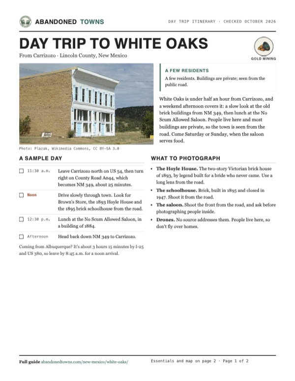
- The Hoyle House. The two-story Victorian brick house of 1893, by legend built for a bride who never came. Use a long lens from the road.
- The schoolhouse. Brick, built in 1895 and closed in 1947. Shoot it from the road.
- The saloon. Shoot the front from the road, and ask before photographing people inside.
- Drones. No source addresses them. People live here, so don't fly over homes.
Map & directions
Getting there
Carrizozo is the closest town, 12 miles away. Head north out of town on US 54 and turn right onto NM 349, which runs into White Oaks. An undated listing rates the road 2WD.


Base map: USGS The National Map (public domain). Routes: OSRM on © OpenStreetMap contributors data (ODbL), computed October 2026. Times assume dry roads.
- From central Carrizozo, take Central Avenue (US 54) north.3.7 mi
- Turn right on County Road A044, which becomes NM 349, into White Oaks.8.2 mi
- From downtown Albuquerque, take I-25 south.85.4 mi
- Exit onto US 380 east and follow it to Carrizozo.65.1 mi
- Turn left on Central Avenue (US 54).3.3 mi
- Turn right on County Road A044, which becomes NM 349, into White Oaks.8.2 mi
Road and safety notes
- People still live in White Oaks. Treat the buildings as private and stay on the road unless a business is open.
- The forest road northwest to Jicarilla and Ancho is unpaved.
Photos
White Oaks in photos
Visitor reports
Been to White Oaks?
Been there lately? Tell the next visitor what you found: whether you could get in, the state of the road and what's still standing. Photos are welcome. We read every report before it appears here.
Gold mining
More gold mining ghost towns
The nearest in New Mexico, then the nearest elsewhere.

 Guide
Elizabethtown
36.62, -105.28Colfax County, New Mexico
E-town rose after the 1866 gold discoveries and briefly became Colfax County’s seat. Stone walls and a cemetery outlasted the mining town.
 Guide
Dos Cabezas
32.18, -109.61Cochise County, Arizona
A stage stop that became a gold camp and then a copper boomtown. Adobe ruins still line AZ 186, 15 miles from Willcox.
Nearby
Other sites near White Oaks
Straight-line distance from the townsite to other mapped sites in our New Mexico index.
- Robsart5.6 mi W · Lincoln
- Jicarilla9.3 mi NE · Lincoln
- Ancho13.0 mi N · Lincoln
- Fort Stanton21.4 mi SE · Lincoln
- Lincoln27.0 mi SE · Lincoln
- Placitas27.0 mi SE · Lincoln
- Hollywood30.0 mi S · Lincoln
- Adobe Ranch33.5 mi W · Socorro
Sources
Sources and credits
- ghosttowns.com, "White Oaks": fact sheet fields (road, climate, best time, remains).
- Wikipedia, "White Oaks, New Mexico", retrieved October 2026: Baxter, claims, 1880 census, post office, opera house, businesses and newspapers, peak of 4,000, the two railroads, National Register date, acreage and contributing buildings, saloon, burials, NM 349.
- Legends of America, "White Oaks: The Liveliest Town in the Territory," updated November 2025, with notes from a 2008 visit: 1890 and peak population, production, Old Abe, 1910 population, Brown's Store, schoolhouse, Hoyle House story, remaining residents, road to Jicarilla and Ancho.
- Emily Frantz, "A Mostly Abandoned Gold Rush Town In New Mexico Is Home To One Of America's Top Ten Cowboy Bars," Islands, May 28, 2025: a few residents, the saloon operating, the schoolhouse and miner's home museums.
- Elevation: USGS 3D Elevation Program point query. Routes: OSRM on OpenStreetMap data, October 2026.
- No Scum Allowed Saloon, official site, read October 21, 2026: hours, food hours, full bar, special-request openings, address and phone, the 1884 building. It shows no date.
Photo and map credits
- A two-story stone commercial building, 2009: Plazak, Wikimedia Commons, CC BY-SA 3.0
- The 1973 USGS White Oaks South sheet: U.S. Geological Survey, USGS catalog, Public domain
- The 1934 Capitan sheet: U.S. Geological Survey, USGS catalog, Public domain
- Area base map, topo and aerial imagery: USGS The National Map (public domain).
- Historic maps: USGS Historical Topographic Map Collection (public domain): Capitan 1934, 1:48,000; Roswell 1955, 1:250,000; White Oaks South 1973, 1:24,000; Carrizozo 1981, 1:100,000.