 Abandoned

Overview
A land company town in a natural arena
In 1905 the Patterson Land Company of Minnesota bought more than a million acres of railroad land between Bismarck and Jamestown, and in 1906 it started a town about 35 miles northeast of Bismarck. The first postmaster, Harry A. Mutchler, named it Arena for the shallow basin it sits in, with hills all around. The Northern Pacific's Pingree–Wilton branch came through in 1910.
Arena was always small. At its best, about 1920, it had some 150 people, two general stores, a bank, a hardware store, a butcher, a pool hall, a livery, a sale barn, five cream-buying stations, twin grain elevators, a depot and a baseball team. Mennonite farmers who had settled four miles south in 1904 traded there. The Depression and the Dust Bowl cut it to about 35 people by 1935. The brick school closed in 1961, and the last resident lived briefly in a small yellow house in the 1980s. The post office lasted until 1996. In 2022 a Bismarck photographer reported that someone had moved into town again.
What draws photographers now is St. John's Lutheran Church, a white wooden church on the edge of town. Its cinder-block foundation began to give way years ago, and visitors have watched it tilt a little further each year.
Then and now
Arena from the air, 1971 and 2023
Arena had about 150 people around 1920 and about 35 by 1935, and its brick school closed in 1961. On August 3, 1971, a U.S. Department of Agriculture survey plane photographed the town with the railroad that came through in 1910 still in place, grain elevators beside the tracks, and a few buildings along the townsite's streets north of the highway. The second photograph comes from the federal farm survey of September 17, 2023.
The highway and the section roads are where they were. The tracks have since been taken up: by 2015 Ghosts of North Dakota found the elevator the only sign left of the railroad, and the later photograph shows the grade as a line of trees and grass. The school was torn down in the 1990s and the post office closed in 1996, and fewer buildings stand on the townsite now.


1971: U.S. Department of Agriculture; scan by the North Dakota Department of Water Resources, source, Public domain. 2023: U.S. Department of Agriculture NAIP, via USGS The National Map, source, Public domain. Both photographs cover the same 1.6 by 1.2 km and were lined up on 17 points on road and street junctions, the highway, the railroad and a farmstead, to within about 1 m. Labels: the railroad and the elevators from the guide's history and Ghosts of North Dakota's 2016 report, the rest from what the photographs show.
Video
Filming the church before it falls
On a summer day in 2024, a traveler films St. John's Lutheran Church from the main road, its tower still upright and its side walls sagging outward, then the twin wooden elevators across the highway and the cemetery down the road. He points out that the land on both sides is private and stays on the road. The creator first posted this visit on his earlier channel, Midwest Ghost Town, and reposted it here.
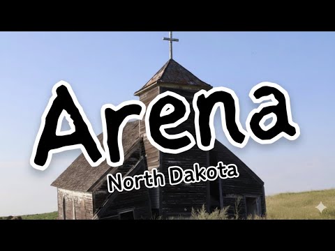 Play “Abandoned: The Empty Streets of Arena, ND” from YouTube
Timeline
From land company town to empty basin

- Mennonite families from Marion, South Dakota, settle about four miles south.
- The Patterson Land Company of Minnesota buys more than a million acres of railroad land between Bismarck and Jamestown.
- The post office opens with Harry A. Mutchler as postmaster. He names the town Arena for the shallow basin it sits in, ringed by hills.
- The Northern Pacific builds its Pingree–Wilton branch through town.
- Arena peaks at about 150 people. At one time or another it has two general stores, a bank, a hardware store, five cream-buying stations, a pool hall and grain elevators.
- About 35 people are left after the Depression and the Dust Bowl.
- The two-story brick school closes and children ride the bus to Wing. It is torn down in the 1990s.
- The last resident lives briefly in the small yellow house.
- The post office closes. Wikipedia says vandals burned the store that housed it that year; a reader of Ghosts of North Dakota recalled the fire in the 1980s.
- A house has been moved onto blocks in town. St. John's Lutheran Church's foundation walls have collapsed on both sides.
- Visitors report the church tilting more each year. In August 2022 it has slumped forward and lost trim from the steeple front.
What's left
Church, elevator and a few houses

Ghosts of North Dakota, which first came here in 2004, described the town in September 2016, from a visit made by 2015: the church with its foundation walls collapsed on both sides and the center beam held up by a row of columns, the block chimney fallen in the yard behind, a one-room school that had been moved in, the small yellow house, and the grain elevator, the only sign left of the railroad. A house had just been moved onto cinder blocks. Readers wrote in over the next six years: the house on blocks still empty in August 2018 and August 2019, the church tilting more in 2019, and in August 2022 slumped forward with two trim boards gone from the steeple front. A Bismarck photographer wrote in May 2022 that it was deteriorating fast. Legends of America, updated April 2026, lists the church, the elevators, an old wooden building and a few houses. The newest first-hand look is a video of a 2024 visit, posted January 12, 2026: the church leaning with its side walls pushed out, a frame school or house nearby, and the two tall wooden elevators across the highway.
St. John's Cemetery is 0.7 mile northeast of town on 392nd Street NE, and the Mennonite Zion Cemetery is 3.8 miles south on the same road.
On the historic maps below, the 1954 McClusky sheet shows Arena on the Northern Pacific line beside Harriet Lake, east of Wing. The 1979 sheet labels the line Burlington Northern and marks gravel pits, the Arena State Game Management Area and waterfowl production areas on the sloughs around the town.
- St. John's Lutheran Church
- Grain elevator
- One-room school, moved in
- Small yellow house, home of the last resident in the 1980s
- House moved onto blocks (2015)
- Railcar and outbuildings
- St. John's Cemetery, 0.7 mile northeast


Photo walk
Three visits to Arena: 2004, 2013 and 2015
Ghosts of North Dakota photographed Arena in May 2004, again on Memorial Day weekend 2013, and once more in 2015, a visit they wrote up in September 2016. Seen in order, their pictures show the church going from white to bare grey wood while its foundation gives way. The houses, school and elevators change more slowly.
In 2004 the town was already empty. The brick school had been torn down, and the old street ran past the church and a yellow house sheltered by two spruces. Nine years later the cracked street still led past the moved-in schoolhouse toward the same house and church, and in 2015 a gravel lane ran from the yellow house to the church.


The church still had white paint on its siding in 2004, and its front doorway stood open. Inside were pressed-tin walls and arched windows, some boarded with plywood. By 2015 the paint was mostly gone and the front had a pair of doors.


The trouble was under the floor. In 2004 a few blocks had fallen into the basement from one wall. In 2013 the cinder-block foundation was crumbling and the outhouse behind the church had collapsed. By 2015 both sides of the foundation had fallen in, leaving the church on a row of posts.


The yellow house, where the last resident lived for a time in the 1980s, had blankets in its windows in 2004. Vandals had been in by 2013, and in 2015 the inside looked much as it had eleven years earlier. Nearby, a yellow-brick house was more overgrown on each visit.


Across the road, the grain elevators were the last sign of the railroad. The small one-room schoolhouse that had been moved into town looked solid in 2013.


In 2004 old cars were rusting on the townsite beside a collapsing shed.


Historic maps
Arena on USGS maps, 1954–1979
Crops from the USGS Historical Topographic Map Collection, centered on the townsite. Each sheet shows what surveyors mapped that year; compare them with today's topo and aerial on this page.

Map & directions
Getting there
Wing, 7 miles west, is the nearest town. From Bismarck the route goes north on US 83 and east on ND 14 to Wing, then ND 36 and 392nd Street NE into Arena.

Base map: USGS The National Map (public domain). Routes: OSRM on © OpenStreetMap contributors data (ODbL), computed October 2026. Times assume dry roads.
- From Railroad Avenue in Wing, turn left onto ND 14.0.2 mi
- Turn left onto ND 36.6.1 mi
- Turn right onto 392nd Street NE into Arena.1.1 mi
- From East Rosser Avenue downtown, turn left onto North 9th Street, ND 1804, which becomes State Street.1.8 mi
- Take the ramp onto US 83 north.22.8 mi
- Leave US 83 at the ND 14 exit and continue east on ND 14 through Wing.21.7 mi
- Turn right onto ND 36.6.1 mi
- Turn right onto 392nd Street NE into Arena.1.1 mi
Road and safety notes
- The road into town is rated 2WD, and the main road runs through it.
- 392nd Street NE continues past town to St. John's Cemetery (0.7 mile northeast) and the Mennonite Zion Cemetery (3.8 miles south).
- There are no services in Arena.
Photos
Arena in photos
Great thanks go out to Ghosts of North Dakota, Troy Larson and Terry Hinnenkamp, who released their photographs into the public domain so that their work on North Dakota's abandoned places can live on.
Visitor reports
Been to Arena?
Been there lately? Tell the next visitor what you found: whether you could get in, the state of the road and what's still standing. Photos are welcome. We read every report before it appears here.
Railroad and road
More railroad, road and fort ghost towns
The nearest in North Dakota.

 Guide
Hamberg
47.76, -99.52Wells County, North Dakota
Hamberg had 187 people in 1930 and 11 in 2020. In 2008 its two-storey school, false-fronted stores and steepled church still lined quiet dirt…
 Guide
Merricourt
46.21, -98.76Dickey County, North Dakota
Named from a novel and built by the railroad in 1891, Merricourt peaked at 153 people in 1940. By its centennial two were left. Its bank, its WPA…
Nearby
Other sites near Arena
Straight-line distance from the townsite to other mapped sites in our North Dakota index.
Sources
Sources and credits
- ghosttowns.com, "Arena": county, 2WD road, climate, best time, the remaining church, school, elevator and houses, a dated reader photo of the main street (August 22, 2009).
- Wikipedia, "Arena, North Dakota", retrieved October 2026: coordinates, the January 1906 founding, the name, the 150 maximum, the post office to 1996 and the store fire, the businesses on 1924 postcards, the remains in 2018, the house on blocks.
- Legends of America, "Arena, North Dakota Ghost Town", updated April 2026: the Patterson Land Company, the January 23, 1906 post office and Harry A. Mutchler, the 1910 railroad, the businesses, 150 in 1920 and 35 in 1935, the 1961 school closing, the Mennonite settlement, the remains, the cemeteries and their distances.
- Troy Larson, Ghosts of North Dakota, "How Much Longer for Ghost Town Arena?", September 19, 2016: the church's foundation, the moved school, the yellow house and last resident, the house on blocks, the elevator; reader reports of 2017, August 26, 2018, August 12, 2019 and August 7, 2022; reader dates for the store fire.
- Bismarck-Mandan Blog, "The Arena church is not doing so well these days", April 26, 2016: the collapsing foundation and the missing No Trespassing sign.
- Bismarck-Mandan Blog, "Arena winter walkabout", May 3, 2022: a January 2022 visit: the church deteriorating fast, someone moved into town.
- Midwest Small Town, "Abandoned: The Empty Streets of Arena, ND", YouTube, posted January 12, 2026, of a 2024 visit: the video on this page; the church's condition, the twin elevators, private land on both sides of the road.
- Photos: Troy Larson and Terry Hinnenkamp, Ghosts of North Dakota, "How Much Longer for Ghost Town Arena?", September 19, 2016 (a revisit the post puts twelve years after the first; the 2015 list below already used a frame from it, so we date it 2015), "Arena: Nine Years Later", May 27, 2013 (Memorial Day weekend 2013) and "Arena, ND", May 15, 2004 (a May 2004 visit); public domain (CC0) by the authors' release of August 29, 2022. The photo walk draws on these posts' descriptions of each visit.
- Ghosts of North Dakota, "20 True Ghost Towns: Population Zero", October 30, 2015: Arena listed with population zero; it uses a frame from the visit written up in 2016, which dates that visit to 2015 or earlier.
- Elevation: USGS 3D Elevation Program point query. Routes: OSRM on OpenStreetMap data, October 2026.
Photo and map credits
- St. John's Lutheran Church on the prairie, June 2008: Andrew Filer from Seattle (ex-Minneapolis), Wikimedia Commons, CC BY-SA 3.0
- The church's sagging front, September 2016: Rosenbergh, Wikimedia Commons, CC BY-SA 4.0
- Arena's last street, looking northwest, 2015: Ghosts of North Dakota, source, CC0 1.0
- St. John's Lutheran Church, 2015: Ghosts of North Dakota, source, CC0 1.0
- The church's collapsed cinder-block foundation wall, 2015: Ghosts of North Dakota, source, CC0 1.0
- Inside the church: arched windows, pressed-tin walls and a bare floor, 2015: Ghosts of North Dakota, source, CC0 1.0
- The back of the church, with blocks of its fallen chimney in the grass, 2015: Ghosts of North Dakota, source, CC0 1.0
- The small one-room school, moved to Arena from elsewhere, 2015: Ghosts of North Dakota, source, CC0 1.0
- The yellow house, home of Arena's last resident in the 1980s, 2015: Ghosts of North Dakota, source, CC0 1.0
- Inside the yellow house, 2015: Ghosts of North Dakota, source, CC0 1.0
- A house newly moved onto blocks, 2015: Ghosts of North Dakota, source, CC0 1.0
- The wooden grain elevators, 2015: Ghosts of North Dakota, source, CC0 1.0
- St. John's Lutheran Church, May 2013: Ghosts of North Dakota, source, CC0 1.0
- St. John's Lutheran Church with much of its white paint, May 2004: Ghosts of North Dakota, source, CC0 1.0
- Arena's cracked main street, with the church at the far end and a yellow house at left, May 2004: Ghosts of North Dakota, source, CC0 1.0
- A car grille on its side in the grass, a North Dakota license plate still on it, May 2004: Ghosts of North Dakota, source, CC0 1.0
- A cellar entrance with its door ajar, May 2013: Ghosts of North Dakota, source, CC0 1.0
- Across the townsite to St. John's church, the yellow house and its spruces at left, May 2004: Ghosts of North Dakota, source, CC0 1.0
- The cracked old street past the moved-in schoolhouse, the yellow house and church beyond, May 2013: Ghosts of North Dakota, source, CC0 1.0
- The yellow house beside its spruce, with the church at the end of the lane, 2015: Ghosts of North Dakota, source, CC0 1.0
- The front of St. John's, its paint peeling and its doorway open, May 2004: Ghosts of North Dakota, source, CC0 1.0
- The front of St. John's under a summer sky, 2015: Ghosts of North Dakota, source, CC0 1.0
- Inside the church: pressed-tin walls and arched windows, two boarded with plywood, May 2004: Ghosts of North Dakota, source, CC0 1.0
- The church basement, with fallen cinder blocks against one wall, May 2004: Ghosts of North Dakota, source, CC0 1.0
- Fallen blocks under the church, its basement open to daylight, May 2013: Ghosts of North Dakota, source, CC0 1.0
- The church basement with its walls fallen in and the floor held up on posts, 2015: Ghosts of North Dakota, source, CC0 1.0
- Looking down the basement stairs to the fallen blocks, 2015: Ghosts of North Dakota, source, CC0 1.0
- The collapsed outhouse behind the church, May 2013: Ghosts of North Dakota, source, CC0 1.0
- St. John's from the side, its walls bare grey wood, 2015: Ghosts of North Dakota, source, CC0 1.0
- The church from the back corner, buildings in the distance, 2015: Ghosts of North Dakota, source, CC0 1.0
- The yellow house and its spruce beside the old street, May 2013: Ghosts of North Dakota, source, CC0 1.0
- The yellow house, with its hipped roof, dormer and broken windows, May 2013: Ghosts of North Dakota, source, CC0 1.0
- The yellow-brick house with a fuel tank, among trees coming into leaf, May 2004: Ghosts of North Dakota, source, CC0 1.0
- The yellow-brick house, holes in its roof, among trees, May 2013: Ghosts of North Dakota, source, CC0 1.0
- The yellow-brick house almost hidden by shrubs, 2015: Ghosts of North Dakota, source, CC0 1.0
- The twin wooden elevators and the small white schoolhouse across the prairie, May 2004: Ghosts of North Dakota, source, CC0 1.0
- The moved-in schoolhouse with its peeling white paint and a streetlight pole, May 2013: Ghosts of North Dakota, source, CC0 1.0
- The wooden elevators and a steel-sided grain building, 2015: Ghosts of North Dakota, source, CC0 1.0
- The weathered wooden elevators, close up, 2015: Ghosts of North Dakota, source, CC0 1.0
- A sagging wooden shed with a car body on its side, May 2004: Ghosts of North Dakota, source, CC0 1.0
- A rusted early car body and a cream can in the grass, May 2004: Ghosts of North Dakota, source, CC0 1.0
- 1971 aerial photograph: U.S. Department of Agriculture; scan by the North Dakota Department of Water Resources, source, Public domain
- 2023 aerial photograph: U.S. Department of Agriculture NAIP, via USGS The National Map, source, Public domain
- Topo map, area base map and aerial imagery: USGS The National Map (public domain).
- Historic maps: USGS Historical Topographic Map Collection (public domain): McClusky 1954, 1:250,000; McClusky 1979, 1:100,000.