 Abandoned

Overview
A company town in the coal fields

Thurber sits in the northwest corner of Erath County, about 75 miles west of Fort Worth. William and Harvey Johnson began mining coal here in December 1886. In 1888 they sold out to the founders of the Texas and Pacific Coal Company, led by Robert Dickey Hunter, and the new town took the name of H. K. Thurber, one of the New York backers. The company owned everything. A brick plant followed in 1897.
The town peaked between 1918 and 1920, with perhaps 8,000 to 10,000 people. Then the market went away. Railroads switched from coal to oil, and after oil was found at nearby Ranger in 1917 the company turned to oil too, renaming itself Texas Pacific Coal and Oil in 1918. Wage cuts led to a strike in 1926 and 1927, and many miners left. The brick plant closed in 1930, the office in 1933 and the company stores in 1935. By the late 1930s the town was nearly empty.
The Handbook of Texas counted 8 people in 2000. The brick smokestack is the landmark you see from I-20. Tarleton State University runs the W. K. Gordon Center for Industrial History of Texas at the exit. The Smokestack Restaurant is inside the last Thurber-brick building downtown, and the New York Hill Restaurant stands where the town's Episcopal church was.
Timeline
Coal, bricks and a strike

- William Whipple Johnson and Harvey Johnson begin mining coal here.
- The Johnsons sell to the founders of the Texas and Pacific Coal Company, led by Robert Dickey Hunter. The town is named for H. K. Thurber of New York, one of the backers.
- A brick plant opens. Thurber bricks become the company's second product.
- Oil is found at nearby Ranger, and the company turns its attention to oil.
- The company becomes the Texas Pacific Coal and Oil Company.
- Peak years. Perhaps 8,000 to 10,000 people live in the company town.
- Wage cuts bring a strike. Many miners leave, and by the end of 1927 no union miners are left in Texas.
- The brick plant closes in 1930, the general office in 1933 and the company stores in 1935.
- Thurber is nearly empty.
- The Handbook of Texas counts 8 people in 2000. Wikipedia gives 48 for the 2010 census, without a citation.
What's here
A smokestack, a church and a museum


Little of the company town survives, and what does is near exit 367. The smokestack stands beside the Smokestack Restaurant, which the Gordon Center says is in the last Thurber-brick building downtown. St. Barbara's Catholic Church has been restored, and a furnished miner's house and an old rail car stand nearby. The New York Hill Restaurant sits on the site of the town's Episcopal church. Thurber Cemetery holds over a thousand graves.
The W. K. Gordon Center tells the town's story with photos, artifacts and film of Thurber people at work and at play. It has reconstructions of a mercantile store, a livery stable, the bandstand, the 655-seat opera house and the Snake Saloon.
- Brick smokestack
- St. Barbara's Catholic Church (restored)
- Miner's house
- Rail car
- Old fire station
- Thurber Cemetery, over 1,000 graves
- Smokestack and New York Hill restaurants
- W. K. Gordon Center museum
The historic maps show the town come and go. The 1891 sheet, surveyed in 1889, marks only "Coal Mines" south of the Texas and Pacific line between Strawn and Gordon. By 1959 the mines are a scatter of mine dumps and quarries, and the map names the Stack, Thurber Cemetery, Italian Hill, New York Hill and Thurber Lake beside the highway.


Historic maps
Thurber on USGS maps, 1891–1959
Crops from the USGS Historical Topographic Map Collection, centered on the townsite. Each sheet shows what surveyors mapped that year; compare them with today's topo and aerial on this page.

Day trip
Plan a day trip to Thurber from Stephenville
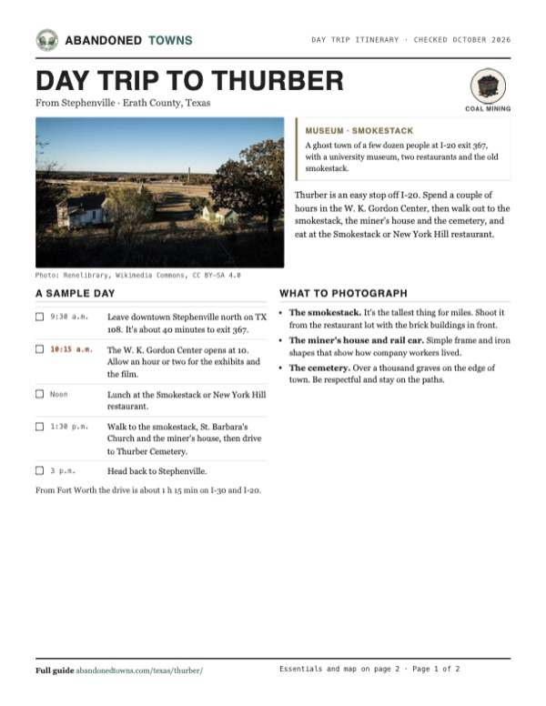
Take it with you
Day trip itinerary
The essentials, the sample day with boxes to tick, what to photograph and the coordinates, on two printable pages. Handy where there's no signal.
Download the PDF (482 KB)Thurber is an easy stop off I-20. Spend a couple of hours in the W. K. Gordon Center, then walk out to the smokestack, the miner's house and the cemetery, and eat at the Smokestack or New York Hill restaurant.
A sample day
- Leave downtown Stephenville north on TX 108. It's about 40 minutes to exit 367.
- The W. K. Gordon Center opens at 10. Allow an hour or two for the exhibits and the film.
- Lunch at the Smokestack or New York Hill restaurant.
- Walk to the smokestack, St. Barbara's Church and the miner's house, then drive to Thurber Cemetery.
- Head back to Stephenville.
From Fort Worth the drive is about 1 h 15 min on I-30 and I-20.
What to photograph and film
- The smokestack. It's the tallest thing for miles. Shoot it from the restaurant lot with the brick buildings in front.
- The miner's house and rail car. Simple frame and iron shapes that show how company workers lived.
- The cemetery. Over a thousand graves on the edge of town. Be respectful and stay on the paths.
Map & directions
Getting there
Thurber is right on I-20 at exit 367 (Thurber/Mingus). Stephenville is the closest city with full services, and Fort Worth is a little over an hour east.


Base map: USGS The National Map (public domain). Routes: OSRM on © OpenStreetMap contributors data (ODbL), computed October 2026. Times assume dry roads.
- From downtown Stephenville, head north on North Graham Street, TX 108. Stay on TX 108 north.23.7 mi
- Turn left onto I-20 west.2.7 mi
- Take exit 367 and follow the I-20 service road to Thurber.0.3 mi
- From downtown Fort Worth, take 7th Street and Summit Avenue to the West Freeway, I-30 west.2.2 mi
- Follow I-30 west, then merge onto I-20 west.67.1 mi
- Take exit 367 and follow the I-20 service road to Thurber.0.3 mi
Road and safety notes
- Paved all the way. Thurber is at I-20 exit 367, signed Thurber/Mingus.
- From the east, the Gordon Center says to turn left under the overpass, then left onto the service road; the museum is on the right.
- The houses that remain are private. Stick to the museum, the restaurants, the church grounds and the cemetery.
Photos
Thurber in photos
Visitor reports
Been to Thurber?
Been there lately? Tell the next visitor what you found: whether you could get in, the state of the road and what's still standing. Photos are welcome. We read every report before it appears here.
Coal mining
More coal mining ghost towns
The nearest, in other states.

 Guide
Lehigh
34.47, -96.22Coal County, Oklahoma
The first coal camp in what is now Coal County, with three railroads and an opera house by 1905. The mines and the cotton failed in the 1920s, and…
 Guide
Dawson
36.66, -104.77Colfax County, New Mexico
A Phelps Dodge coal town of about 6,000 people, where two explosions killed nearly 400 miners. The town is gone. Its cemetery, with rows of white…
Nearby
Other sites near Thurber
Straight-line distance from the townsite to other mapped sites in our Texas index.
Sources
Sources and credits
- Handbook of Texas Online, "Thurber, TX": founding, company history, peak population, strike, closure dates, 2000 population, distance from Fort Worth.
- Wikipedia, "Thurber, Texas", retrieved October 2026: remains (smokestack, St. Barbara's, restaurants, cemetery of over a thousand graves), 2010 population, coordinates.
- W. K. Gordon Center for Industrial History of Texas and its Plan your visit page, as of October 2026: hours, admission, address, phone, exhibits, directions from exit 367, nearby restaurants and their hours.
- ghosttowns.com, "Thurber": listing and fact-sheet cross-check.
- Elevation: USGS 3D Elevation Program point query. Routes: OSRM on OpenStreetMap data, October 2026. Status checked against the sources above on October 19, 2026.
Photo and map credits
- The smokestack, 2013: Nicolas Henderson from Coppell, Texas, Wikimedia Commons, CC BY 2.0
- The Thurber Historic District, 2016: Renelibrary, Wikimedia Commons, CC BY-SA 4.0
- The restored miner's house, 2014: Renelibrary, Wikimedia Commons, CC BY-SA 3.0
- A vine-covered two-story brick building, 2016: David Layne from Texas, Wikimedia Commons, CC BY 2.0
- The New York Hill Restaurant sign above I-20: Nicolas Henderson from Coppell, Texas, Wikimedia Commons, CC BY 2.0
- An old rail car, 2014: Renelibrary, Wikimedia Commons, CC BY-SA 3.0
- The old fire station, 2019: Renelibrary, Wikimedia Commons, CC BY-SA 4.0
- Area base map, topo and aerial imagery: USGS The National Map (public domain).
- Historic maps: USGS Historical Topographic Map Collection (public domain): Palo Pinto 1891, 1:125,000; Palo Pinto 1918, 1:125,000; Gordon 1959, 1:62,500.