 Abandoned
Overview
A boom that lasted a summer
Molson was a promoter's town. George Meacham and John W. Molson, of the Canadian banking and brewing family, laid it out in 1900, after gold ore turned up in the hills along the border. About 300 people came that year and a post office opened in July. By June 1901 only 12 were left, and the Molson company withdrew after spending $170,000.
The Great Northern Railway arrived in 1905 and gave the place a second life. A quarrel over the townsite in 1909 sent residents half a mile north to build New Molson. The Depression finished both. The rails to Oroville came up in 1931 and the line to Curlew in 1935.
In 1960 Harry Sherling began gathering the old buildings and machinery on the original townsite into an outdoor museum. The brick school in Central Molson, which had 110 to 120 pupils in the 1950s, closed in 1969 and became a second museum in 1982.
Timeline
Old Molson, New Molson
- Promoter George B. Meacham and investor John W. Molson, an officer of the Molson Bank, found the town. About 300 people arrive.
- The Molson post office opens, with Walter F. Schuyler as postmaster.
- Only 12 residents remain. The Molson company pulls out after investing $170,000.
- The Great Northern Railway reaches Molson. Passenger trains start the next month.
- After a dispute with townsite owner J. H. McDonald, residents move half a mile north and start New Molson.
- The 23-room New Imperial Hotel opens in New Molson. It burns in 1923.
- The three-story Hotel Tonasket burns.
- The railroad to Oroville is abandoned in 1931 and the line to Curlew in 1935.
- The last small-scale mining ends.
- Harry Sherling opens the Old Molson Ghost Town Museum on the original townsite.
- The post office closes. Mail goes through Oroville.
- The brick Molson school becomes the Schoolhouse Museum.
What's left
What you'll see

Old Molson is an open-air museum of pioneer buildings, farm machinery and mining equipment. The bank, offices and cabins have windows full of household goods and photographs. You can drive right into the grounds, which are flat and mostly gravel. Two blocks north, the brick schoolhouse keeps a classroom and library, with volunteers who once taught or studied there.
The 1902 USGS sheet below shows Molson just south of the boundary line before the railroad came, with the Poland China Mine to the east. The 1957 sheet shows two clusters of buildings along the road beside Molson Lake, with a cemetery to the southwest.
- Molson State Bank
- Log cabins and offices
- Farm and mining machinery
- Schoolhouse Museum


Historic maps
Molson on USGS maps, 1902–1957
Crops from the USGS Historical Topographic Map Collection, centered on the townsite. Each sheet shows what surveyors mapped that year; compare them with today's topo and aerial on this page.

Day trip
Plan a day trip to Molson from Oroville
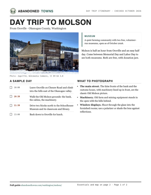
Take it with you
Day trip itinerary
The essentials, the sample day with boxes to tick, what to photograph and the coordinates, on two printable pages. Handy where there's no signal.
Download the PDF (555 KB)Molson is half an hour from Oroville and an easy half day. Come between Memorial Day and Labor Day to see both museums. Both are free, with donation jars.
A sample day
- Leave Oroville on Chesaw Road and climb into the hills east of the Okanogan valley.
- Walk the Old Molson grounds: the bank, the cabins, the machinery.
- Drive two blocks north to the Schoolhouse Museum and its classroom and library.
- Back down to Oroville for lunch.
What to photograph and film
- The main street. The false fronts of the bank and the customs house, with machinery lined up in front, are the classic Old Molson picture.
- Machinery. Old farm and mining equipment stands in the open with the hills behind.
- Window displays. Shoot through the glass into the furnished rooms; use a polarizer or shade the lens against reflections.
Map & directions
Getting there
Oroville, on US 97 at the Canadian border, is the closest town. Chesaw Road climbs east out of town to the Molson turnoff. From Wenatchee, US 97 runs up the Columbia and Okanogan valleys to Oroville.


Base map: USGS The National Map (public domain). Routes: OSRM on © OpenStreetMap contributors data (ODbL), computed October 2026. Times assume dry roads.
- From downtown Oroville, take Central Avenue West and Cherry Street onto Chesaw Road.0.5 mi
- Follow Chesaw Road east into the hills.9.2 mi
- Turn left on Molson Road and follow it to Molson.5.4 mi
- From downtown Wenatchee, take South Wenatchee Avenue to US 2/US 97.3.5 mi
- Follow US 97 north up the Columbia and Okanogan valleys toward Oroville.131.1 mi
- Take Eastside Oroville Road, then turn right on Chesaw Road.10.3 mi
- Turn left on Molson Road and follow it to Molson.5.4 mi
Road and safety notes
- From Oroville, the museums say to follow the signs from Main and Central toward Chesaw Road, then turn left on Molson Road after about 10 miles.
- The museums don't plow and say Molson is likely to be snowed in during winter.
- The schoolhouse has disabled parking, a ramp and a chair lift to the main floor. Most ghost-town buildings have a step up and no ramp.
Photos
Molson in photos
Visitor reports
Been to Molson?
Been there lately? Tell the next visitor what you found: whether you could get in, the state of the road and what's still standing. Photos are welcome. We read every report before it appears here.
Nearby
Other sites near Molson
Straight-line distance from the townsite to other mapped sites in our Washington index.
Sources
Sources and credits
- Molson Museums, including its Hours & Access, History and Schoolhouse pages, checked October 2026: hours and seasons, fees, restrooms, accessibility, snow, directions, the 1898 founding date, the school's 1969 closing, tea room and gift shop, events.
- Okanogan County Historical Society, museums: lists the Molson Museum and Old Molson and links the museums' site.
- Wikipedia, "Molson, Washington", retrieved October 2026: founders, post office dates, populations, $170,000 withdrawal, railroad dates, New Molson, hotels, mining end, Sherling's museum, school enrollment, free admission.
- Islands, Molson guide: schoolhouse museum since 1982, volunteer guides, disabled parking and stairs, drive-in grounds, no snow removal.
- Elevation: USGS 3D Elevation Program point query. Routes: OSRM on OpenStreetMap data, October 2026.
Photo and map credits
- Old Molson in snow, March 2013: Jpgolf14, Wikimedia Commons, CC BY-SA 3.0
- Topo map, area base map and aerial imagery: USGS The National Map (public domain).
- Historic maps: USGS Historical Topographic Map Collection (public domain): Osoyoos 1902, 1:125,000; Mt Bonaparte 1957, 1:62,500.