 Abandoned

Overview
The town that meant to beat Mobile

Blakeley sits on a bluff on the east bank of the Tensaw River, in the Mobile-Tensaw delta about 6.6 road miles north of Spanish Fort. Josiah Blakeley, a Connecticut man living in Mobile, had the town surveyed in 1813, just as the area came under American control. He thought the deep water here beat the shallow harbor at Mobile, where a sandbar on the Dog River sometimes blocked ships. The Mississippi Territory incorporated the town on January 6, 1814. Blakeley died the next year.
After Alabama became a state in 1819 the town boomed. It became the Baldwin County seat in 1820 and a port of entry in 1822. It had a newspaper, the Blakeley Sun, stores, hotels and shipyards that built some of the first steamboats in Alabama. The Encyclopedia of Alabama says the population rose from 1,200 to 2,700 during 1822 alone and peaked at about 4,000, when Mobile had 2,800. The park's own marker is more cautious: at least 2,000 by the mid-1820s, about as many as Mobile.
Then it fell apart. Yellow fever hit in 1822, 1826 and 1828. Land speculation pushed prices up, and Mobile improved its harbor. People left, some taking their houses with them to Mobile. By the 1840s Blakeley was effectively a ghost town, though it stayed the county seat until 1868. In between, in April 1865, Union troops stormed the three-mile line of Confederate earthworks around it on the day Lee surrendered in Virginia. The park keeps the cemetery, the courthouse foundation and several miles of those earthworks.
Timeline
Boom town, ghost town, battlefield, park
- Woodland people hunt and fish on the land that is now the park, as far back as 2,500 years ago by the park's count.
- The Apalachees, a people from Florida allied with the French, build a village here. British and Spanish settlers farm the land later.
- Josiah Blakeley of Connecticut settles in Mobile, then under Spain, and starts buying land in the Mobile-Tensaw delta.
- The area comes under American control. In May a surveyor lays out Blakeley's town, and in June the first ten lots sell for $1,000.
- The Mississippi Territory incorporates the town. The park dates its founding to 1814.
- Josiah Blakeley dies before the town takes off.
- The Blakeley Sun is printed here, the fourth newspaper started in Alabama.
- Blakeley becomes the seat of Baldwin County, and the new state incorporates it.
- The town is made a US port of entry. Yellow fever strikes, and again in 1826 and 1828.
- The peak. The Encyclopedia of Alabama puts it at about 4,000 people in the early 1820s; the park's marker says at least 2,000 by the mid-1820s.
- A post office opens under the name Blakeley.
- The Reingard House, built here in 1820, is taken apart and shipped to Mobile.
- The two-story brick courthouse goes up, with the jail on the ground floor.
- By the park's marker, Blakeley is effectively a ghost town, though still the county seat.
- Union troops besiege Fort Blakeley and storm it on April 9, the day Lee surrenders at Appomattox.
- The post office closes.
- The county seat moves to Daphne.
- The 3,800-acre Blakeley Historic Site is listed on the National Register of Historic Places.
- Mobile schoolteacher Mary Grice starts a private nonprofit foundation to save the site.
- The legislature creates the Historic Blakeley Authority, a state agency, to run Historic Blakeley State Park.
- Congress names Blakeley a Class A Civil War site.
- Archaeologists from the University of South Alabama dig the courthouse site. State funding for the park is suspended the same year.
April 1865
The last charge


By 1865 Blakeley had only a few dozen families, by the park's count, or about 100 people, by the Encyclopedia of Alabama's. But it guarded the road to Mobile, the last major Southern city still in Confederate hands. Confederate troops dug a three-mile line of trenches in a broad arc in front of the town, anchored by nine forts called redoubts, with both ends on the Tensaw River. Redoubts Five to Nine, more than half the line, were held mostly by inexperienced conscripts of the 62nd and 63rd Alabama Infantry.
Union troops besieged the line for a week, from April 2 by most accounts (the park's USCT trail page says April 1). They dug three lines of trenches, each closer than the last, linked by zigzag approach trenches. Late on April 9, 1865, some 16,000 of them charged. The park's battlefield guide puts the defenders at about 3,500; the Encyclopedia of Alabama gives the garrison as 4,000. The park counts about 20,000 men in the fight in all.
Between 5:30 and 6 p.m. about 2,500 Union soldiers converged on Redoubt Four, at the center of the line. Three Medals of Honor were later awarded for that fight alone.
The line broke and Fort Blakeley surrendered. It was the largest Civil War battle fought in Alabama, and it ended that same day, hours after Lee surrendered at Appomattox. Wikipedia counts about 150 Union dead and 650 wounded, and 75 Confederate dead with more than 2,800 captured. Mobile was occupied on April 12. Harper's Weekly called the assault "probably the last charge of this war."
Black soldiers of the United States Colored Troops made up one of the largest such contingents in any Civil War battle: over 4,000 by the park's count, about 5,000 by Wikipedia's. Most of them had been enslaved. Three lines of their trenches survive on a separate park tract, now the USCT Heritage Trail.
What's left
A cemetery, a foundation and miles of trenches


Little of the town stands. Many of its buildings were taken apart and moved to Mobile. What survives is in the woods of the park. Washington Square was the heart of the old town. Today it has what the park calls "ghost structures", frame outlines of homes and businesses of about 1820, and a reproduction of an Apalachee house of the 1700s nearby. A few steps away a wooden shelter covers the foundation of Baldwin County's first courthouse and jail. The park's map dates it to about 1820; its marker says the courthouse was authorized in 1820 but not built until about 1833. Blakeley Cemetery holds many of the first settlers and a memorial to those who fell in the battle. The Encyclopedia of Alabama adds the outlines of the old streets.
The earthworks are the biggest survival. The park calls the battlefield one of the best preserved in the country, with several miles of intact Confederate and Union trenches, rifle pits and gun emplacements. Redoubt Four is the only place where the park has rebuilt the obstructions in front of the line and some features inside it. Monuments to the Alabama and Missouri units stand near Redoubt Six.
- Blakeley Cemetery and battle memorial
- Courthouse and jail foundation, about 1820–1833
- Washington Square and its ghost structures
- Reproduction Apalachee house
- Jury Oak remains and the Hiding Tree
- Confederate line with nine redoubts
- Union siege lines, batteries and zigzag trenches
- Rifle pits
- USCT trenches on the Heritage Trail
The 1941 and 1953 USGS sheets below both mark Blakeley on the riverbank, with Blakeley Cemetery to the east and the words "Civil War trenches" southeast of town. The older 1921 Army sheet spells it Blakely and shows a handful of buildings along the road near the river.


Legend and record
The Jury Oak and the Hiding Tree
Blakeley's best-known stories are about trees. Before the courthouse was built, the story goes, court met under a tree called the Jury Oak, with the judge presiding from one of its limbs, and condemned men were hanged from a second tree nearby. A 2019 marker from the William G. Pomeroy Foundation and the Alabama Folklife Association tells the tale, and the park's Jury Oak Pavilion shelters what is left of the tree. Another oak, with a hollow base, is said to have hidden Confederate soldiers after the fort fell.
Treat all three as legends. No record we found confirms them, and the park's own guide says "according to legend" for both the Jury Oak and the Hiding Tree.
Historic maps
Blakeley on USGS maps, 1921–1953
Crops from the USGS Historical Topographic Map Collection, centered on the townsite. Each sheet shows what surveyors mapped that year; compare them with today's topo and aerial on this page.

Day trip
Plan a day trip to Blakeley from Spanish Fort
Take it with you
Day trip itinerary
The essentials, the sample day with boxes to tick, what to photograph and the coordinates, on two printable pages. Handy where there's no signal.
Download the PDF (474 KB)Blakeley was an 1820s river port that rivaled Mobile. In April 1865 one of the last battles of the Civil War was fought around it, and the townsite and battlefield are now Historic Blakeley State Park, on the Tensaw River north of Spanish Fort. Start in the old town, walk the river boardwalk, then drive the battlefield. The park's pages list no restaurant, so bring a picnic, and book any boat cruise ahead.
A sample day
- Drive north from Spanish Fort on AL 225.
- The park opens. Get the battlefield tour brochure at the gatehouse.
- Drive about 2 miles to Franklin Street and walk the old town: the frame outlines of about 1820 at Washington Square, the first courthouse and jail foundation, and the pavilion over the legendary Jury Oak.
- Walk the quarter-mile E.O. Wilson Boardwalk on the Tensaw and find the Hiding Tree, a hollow oak of Confederate legend.
- Drive the brochure's battlefield tour, which starts from the entrance: Redoubt Six and its Alabama and Missouri monuments, the Stockton Road Redan, and Redoubt Four, scene of the heaviest fighting on April 9, 1865.
- Picnic, then Blakeley Cemetery, with early settlers' graves and a memorial to the battle's dead.
- A booked delta cruise, or the 3-mile USCT Heritage Trail, past trenches dug by Black Union troops, at 6955 Cloverleaf Landing Road. Get its gate code at the gatehouse; it closes at 5 p.m.
What to photograph and film
- Redoubt Four. The most open part of the line, with the park's rebuilt obstructions and log walls. Shoot along the line to show the ground the attack crossed.
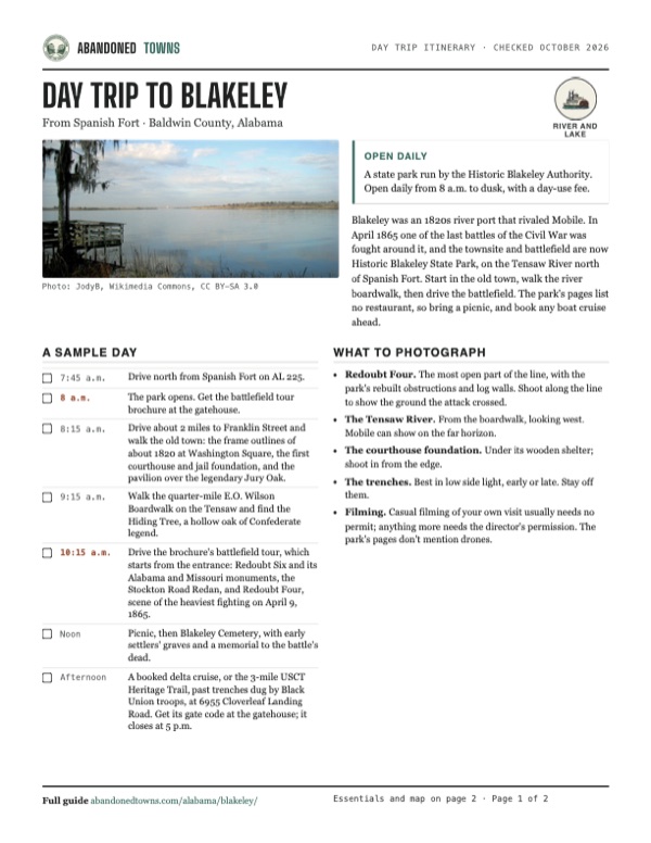
- The Tensaw River. From the boardwalk, looking west. Mobile can show on the far horizon.
- The courthouse foundation. Under its wooden shelter; shoot in from the edge.
- The trenches. Best in low side light, early or late. Stay off them.
- Filming. Casual filming of your own visit usually needs no permit; anything more needs the director's permission. The park's pages don't mention drones.
Map & directions
Getting there
Spanish Fort is the closest city, 6.6 road miles away. From Mobile the route crosses under the Mobile River in the Bankhead Tunnel and over the head of the bay on the causeway. Both routes run north on AL 225 to the park entrance and end on Franklin Street, near Washington Square in the old town.

Base map: USGS The National Map (public domain). Routes: OSRM on © OpenStreetMap contributors data (ODbL), computed October 2026. Times assume dry roads.
- From central Spanish Fort, follow Spanish Main to its end.1.1 mi
- Turn left on AL 225 and follow it north.3.4 mi
- Turn left into the park on Forever Wild Trail, then right on Upper Shay Branch Road. It becomes Old Blakeley Road and then Washington Avenue, to Franklin Street near Washington Square.2.1 mi
- From downtown Mobile, take St. Louis Street and North Joachim Street to Government Street (US 98).0.6 mi
- Follow US 98 through the Bankhead Tunnel and onto I-10 (Jubilee Parkway).3.1 mi
- Exit onto the Mobile Bay Causeway (US 90 and US 98), which becomes Battleship Parkway.4.5 mi
- Keep left on Spanish Fort Boulevard (US 90).0.8 mi
- Turn left on AL 225 and follow it north.4.4 mi
- Turn left into the park and follow Forever Wild Trail, Upper Shay Branch Road, Old Blakeley Road and Washington Avenue to Franklin Street.2.1 mi
Road and safety notes
- The entrance and gatehouse are at 34745 State Highway 225.
- Hikers, bikers and horseback riders share the park roads. Keep to the posted speed limit.
- The USCT Heritage Trail is outside the main park, about 2 miles north at 6955 Cloverleaf Landing Road, Bay Minette. You need a car to get there and a gate code from the main gatehouse.
- Part of the Skirmish Line Trail runs through the Harper tent campground and, by the park's battlefield tour brochure, closes at 5 p.m. every day.
- The park asks visitors not to walk on the earthworks.
Photos
Blakeley in photos
Visitor reports
Been to Blakeley?
Been there lately? Tell the next visitor what you found: whether you could get in, the state of the road and what's still standing. Photos are welcome. We read every report before it appears here.
River and lake
More river and lake ghost towns
The nearest in Alabama.

 Guide
St. Stephens
31.56, -88.04Washington County, Alabama
A Spanish fort, then the capital of the Alabama Territory, with more than 500 houses by 1819. The town emptied within a generation. Its streets and…
 Guide
Claiborne
31.54, -87.52Monroe County, Alabama
A fort on a river bluff became one of early Alabama's busiest towns, with three future governors and a visit from Lafayette. The county seat left…
Nearby
Other sites near Blakeley
Straight-line distance from the townsite to other mapped sites in our Alabama index.
- Belle Fontaine22.1 mi E · Baldwin
- Beaver Mills24.2 mi NW · Mobile
- Deer Park40.6 mi NW · Washington
- Wakefield44.5 mi N · Washington
- St. Stephens56.6 mi N · Washington
- Claiborne60.2 mi NE · Monroe
- Clarkesville68.2 mi N · Clarke
- Failetown82.1 mi N · Clarke
Sources
Sources and credits
- ghosttowns.com, "Blakeley": fact sheet fields (road, climate, best time).
- Wikipedia, "Blakeley, Alabama", retrieved October 2026: the Dog River bar, county seat to 1868, post office 1826–1866, the Apalachee village, NRHP listing, coordinates (GNIS).
- Wikipedia, "Historic Blakeley State Park", retrieved October 2026: Mary Grice and the 1976 foundation, 1981 state park, 2011 funding cut, 1993 Class A designation, picnic areas, 4.5 miles north of Spanish Fort.
- Wikipedia, "Battle of Fort Blakeley", retrieved October 2026: siege dates, casualties and prisoners, about 5,000 USCT soldiers, timing against Appomattox, Mobile occupied April 12.
- Encyclopedia of Alabama, "Blakeley" (Grant D. Hiatt, updated January 2024): the 1813 survey and first lots, 1814 incorporation, Josiah Blakeley's death, the Blakeley Sun, steamboats, 1822 population, the 4,000 peak, yellow fever years, speculation, about 100 people by the Civil War, 16,000 attackers and a 4,000-man garrison, what remains.
- Historic Blakeley State Park, blakeleypark.com: home page (hours, admission, address, phone, pets, trails, acreage), "About Us" (1974 NRHP site, 1981 authority, the town's decline, the battle, about 20,000 men, Medals of Honor), "Tours", "USCT Heritage Trail", "Trails", "OnCell Tour", "Cruise Options", "Filming" and "Events" (programs listed into December 2026), "Self-Guided Battlefield Tour" and the 2026 park map (restrooms, vending, Washington Square), all read October 21, 2026. The hours and admission prices are the same in the Internet Archive copy of the home page of July 3, 2026.
- Historic Blakeley State Park, 2026 visitors guide and map (PDF dated August 10, 2026) and battlefield self-guided tour (PDF dated May 2019), read October 2026: the Woodland and Apalachee past, the cemetery, courthouse site, Washington Square, Jury Oak and Hiding Tree legends, boardwalk, Delta Explorer, trail mileage, the redoubts, the 3,500 defenders, the Redoubt Four fight and reconstructions, the Skirmish Line Trail closing time.
- Markers "The Town of Blakeley" and "Site of Baldwin County's First Courthouse" (Historic Blakeley State Park, 2017), as transcribed and photographed (April 2019) by the Historical Marker Database: 131864 and 131830. Joseph Chastang, port of entry, the 2,000 estimate, the Reingard House, harbor improvements at Mobile, a ghost town by the 1840s, the courthouse dates and the 2011 dig.
- William G. Pomeroy Foundation, "Legendary Oaks" marker (2019, with the Alabama Folklife Association): the Jury Oak and Hanging Tree story.
- Elevation: USGS 3D Elevation Program point query. Routes: OSRM on OpenStreetMap data, October 2026.
Photo and map credits
- The Tensaw River from the park, with Mobile on the far horizon, November 2008: JodyB, Wikimedia Commons, CC BY-SA 3.0
- Looking out through the rebuilt walls of Redoubt Four, May 2008: Kevin King from Pensacola, FL, US of A, Wikimedia Commons, CC BY 2.0
- Log walls around a gun port at Redoubt Four, May 2008: Kevin King from Pensacola, FL, US of A, Wikimedia Commons, CC BY 2.0
- A log-lined Union approach trench, May 2008: Kevin King from Pensacola, FL, US of A, Wikimedia Commons, CC BY 2.0
- Plank walls looking out over the battlefield from the Confederate side, May 2008: Kevin King from Pensacola, FL, US of A, Wikimedia Commons, CC BY 2.0
- Confederate earthworks seen from the Union side, May 2008: Kevin King from Pensacola, FL, US of A, Wikimedia Commons, CC BY 2.0
- A trail along the Confederate line, May 2008: Kevin King, Wikimedia Commons, CC BY 2.0
- Blakeley Cemetery, August 2013: Julie334, Wikimedia Commons, CC BY-SA 3.0
- The storming of Fort Blakeley, Harper's Weekly, 1865 (hand-colored copy): Unknown author, Wikimedia Commons, Public domain
- Army engineers' map of the lines, 1865: United States. Army. Corps Of Engineers, Wikimedia Commons, Public domain
- Area base map, topo and aerial imagery: USGS The National Map (public domain).
- Historic maps: USGS Historical Topographic Map Collection (public domain): Fairhope 1921, 1:62,500; Blakeley 1941, 1:31,680; Bridgehead 1953, 1:24,000.