 Abandoned

Overview
Where Alabama began

St. Stephens grew on a limestone bluff where the Tombigbee River's rapids stopped boats, about 67 miles north of Mobile. Spain built Fort San Esteban there in 1789 and handed it to the United States in 1799. A trading house for the Choctaw, a land office and a federal court followed, and in 1807 the Mississippi Territory chartered the town.
The boom came fast. The Encyclopedia of Alabama counts nine houses in 1815 and more than 500 by 1819, with two hotels, the first chartered bank in what became Alabama and its first school. From 1817 to 1819 the town was the capital of the Alabama Territory, and the first legislature met at the Douglass Hotel.
It lost the capital to Cahaba in 1819. Yellow fever came back through the 1820s and 1830s, and shallow-draft boats no longer had to stop at the rapids. By 1833 most residents had moved two miles west to a new St. Stephens. The old town was in ruins by the Civil War, and the park says it lay almost untouched until archaeologists took an interest in the 1980s. New St. Stephens is a small living community with 415 people in 2020; the old townsite has no residents.
Video
A summer weekend at the park
Two RV travelers spend a cloudy summer day at St. Stephens Historical Park. They show the quarry lake from above and from the shore, the swim beach and its posted rules, the Cedar Ridge campground and the St. Stephens Community Day 2026 festival at the pavilion. They walk the Indian Bath Trail to the spring-fed rock basins, pass a historical marker and an interpretive panel, and drive out to the Jockey Club campground and the boat ramp on the Tombigbee. A local in the video tells of a curse on the town and says nothing at all is left. The curse is a legend. Archaeologists have mapped the old streets, foundations and cisterns, though no buildings stand.
 Play “We Came for the Campground...Stayed for the History!” from YouTube
Timeline
Fort, capital and ruin

- The Choctaw call the limestone bluff above the Tombigbee River Hobucakintopa. In 1772 the surveyor Bernard Romans notes that the river's rapids make it a likely place to settle.
- Spain builds Fort San Esteban on the bluff, about 67 miles north of Mobile. One ghost town directory gives 1769; Wikipedia, the Encyclopedia of Alabama and the 1922 stone marker give 1789.
- The Treaty of San Lorenzo puts the border at the 31st parallel. Spain leaves, and on May 5, 1799 Lt. John McLary raises the U.S. flag (Encyclopedia of Alabama; Wikipedia gives February 5, 1799 for the transfer).
- A U.S. trading house for the Choctaw opens by 1803. George Strother Gaines runs it from 1805. An old Spanish warehouse becomes a land office and post office in January 1805.
- The Mississippi Territory charters the town on January 8, 1807. Washington Academy, called Alabama's first school, is chartered in 1811.
- Houses go from nine in 1815 to about 40 in 1816, then to more than 500 by 1819, with about twenty stores, two hotels and the Tombeckbe Bank.
- St. Stephens is the capital of the Alabama Territory. The first legislature meets at the Douglass Hotel in January 1818. In 1819 the capital moves to Cahaba.
- Yellow fever returns, and shallow-draft boats no longer need to stop at the rapids. By 1833 the old town is a small village.
- By now most residents have moved two miles west to a new St. Stephens, at what the Encyclopedia of Alabama calls a railroad crossroads. By the Civil War the old town is in ruins.
- The Alabama Centennial Commission and the people of Washington County set a stone marker on the site, dated September 28, 1922.
- The Old St. Stephens Site is listed on the National Register of Historic Places on December 29, 1970.
- The St. Stephens Historical Commission is incorporated in 1988. A 1999 state grant pays for mapping the old streets, foundations, cellar holes and cisterns.
- St. Stephens Historical Park holds the townsite, a 70-acre quarry lake, trails, cabins and campgrounds. New St. Stephens counted 415 people in 2020.
What's left
What you'll see


No building of the old town is standing. The park says the site sat almost undisturbed for more than a century, which makes it one of the richest archaeological sites in Alabama. A 1999 grant mapped its streets, building foundations, cellar holes and cisterns. Digs were open to the public in the past; the park's museum page now says they are on hold until it can arrange professional supervision again.
Self-guided walking tours of the townsite are open daily, and guided tours can be booked by phone. The Archaeology Trail starts at an open shelter with the 1922 stone marker in front. Its plaque reads that the Spanish fort dates from 1789, passed to the United States in 1799 and that the town became the territorial capital in 1817. A walled grave plot with an obelisk stands nearby. A short walk from a parking area leads to the Indian Baths, two basins in the rock filled by springs. The park says recent study points to European tools rather than Native American ones.
The park's museum is in the 1854 Washington County Courthouse in today's St. Stephens, open Thursdays from 10 a.m. to 2 p.m. On the 1972 USGS sheet below, big quarries cut the bluff where the 70-acre lake now lies, with the Old St. Stephens and Crawford cemeteries in the woods to the south. The 1953 sheet shows a landing on the river northeast of the Saint Stephens crossroads.
- Street lines, foundations, cellar holes and cisterns (unexcavated)
- 1922 stone marker and the Archaeology Trail shelter
- Walled grave plot with an obelisk
- Old St. Stephens Cemetery
- The Indian Baths
- 1854 courthouse museum (in today's St. Stephens)


Historic maps
St. Stephens on USGS maps, 1953–1984
Crops from the USGS Historical Topographic Map Collection, centered on the townsite. Each sheet shows what surveyors mapped that year; compare them with today's topo and aerial on this page.

Day trip
Plan a day trip to St. Stephens from Jackson
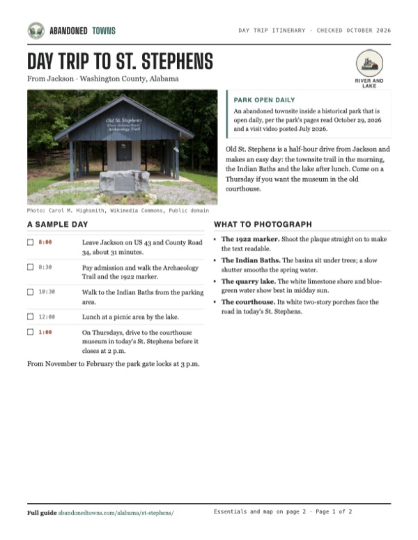
Take it with you
Day trip itinerary
The essentials, the sample day with boxes to tick, what to photograph and the coordinates, on two printable pages. Handy where there's no signal.
Download the PDF (511 KB)Old St. Stephens is a half-hour drive from Jackson and makes an easy day: the townsite trail in the morning, the Indian Baths and the lake after lunch. Come on a Thursday if you want the museum in the old courthouse.
A sample day
- Leave Jackson on US 43 and County Road 34, about 31 minutes.
- Pay admission and walk the Archaeology Trail and the 1922 marker.
- Walk to the Indian Baths from the parking area.
- Lunch at a picnic area by the lake.
- On Thursdays, drive to the courthouse museum in today's St. Stephens before it closes at 2 p.m.
What to photograph and film
- The 1922 marker. Shoot the plaque straight on to make the text readable.
- The Indian Baths. The basins sit under trees; a slow shutter smooths the spring water.
- The quarry lake. The white limestone shore and blue-green water show best in midday sun.
- The courthouse. Its white two-story porches face the road in today's St. Stephens.
Map & directions
Getting there
Jackson is the closest town with services, about half an hour away by US 43 and County Road 34. From Mobile the drive runs north on I-65 and US 43, about an hour and a half. The park notes that some GPS units don't know its address: search for St. Stephens United Methodist Church and follow the signs from there.


Base map: USGS The National Map (public domain). Routes: OSRM on © OpenStreetMap contributors data (ODbL), computed October 2026. Times assume dry roads.
- From downtown Jackson, turn left on Commerce Street (AL 177).0.1 mi
- Continue on College Avenue (AL 177).0.8 mi
- Bear left onto AL 69.0.5 mi
- Turn left, then left again onto US 43.4.8 mi
- Continue straight onto County Road 34, which becomes Saint Stephens Avenue.6.3 mi
- Bear right on Howell Road at the Methodist church.0.1 mi
- Bear right on Cement Plant Road.0.6 mi
- Turn right on Old St. Stephens Road to the townsite.1.2 mi
- From downtown Mobile, follow Saint Louis and North Royal streets to the ramp.0.4 mi
- Take North Water Street and Telegraph Road (US 90/US 98).0.2 mi
- Continue on I-165 and take exit 1B.5.0 mi
- Merge onto I-65 north.9.2 mi
- Take the ramp to US 43.0.7 mi
- Follow US 43 north.44.5 mi
- Take the ramp and turn left on County Road 34, which becomes Saint Stephens Avenue.6.0 mi
- Bear right on Howell Road at the Methodist church.0.1 mi
- Bear right on Cement Plant Road.0.6 mi
- Turn right on Old St. Stephens Road to the townsite.1.2 mi
Road and safety notes
- The park's own directions: from US 43, take County Road 34 to the St. Stephens United Methodist Church, bear right on Howell Road and Cement Plant Road, then turn right on Old St. Stephens Road.
- The ghost town directory listing says a paved road reaches the village and a dirt road leads to the old town and fort site. The park roads in a video posted July 2026 are partly gravel and partly paved.
- The gate locks at closing time: 7 p.m. from March to October, 3 p.m. from November to February.
Photos
St. Stephens in photos
Visitor reports
Been to St. Stephens?
Been there lately? Tell the next visitor what you found: whether you could get in, the state of the road and what's still standing. Photos are welcome. We read every report before it appears here.
River and lake
More river and lake ghost towns
The nearest in Alabama.

 Guide
Claiborne
31.54, -87.52Monroe County, Alabama
A fort on a river bluff became one of early Alabama's busiest towns, with three future governors and a visit from Lafayette. The county seat left…
 Guide
Blakeley
30.74, -87.92Baldwin County, Alabama
In the 1820s Blakeley was about as big as Mobile, across the bay. Yellow fever emptied it, and in April 1865 one of the last battles of the Civil War…
Nearby
Other sites near St. Stephens
Straight-line distance from the townsite to other mapped sites in our Alabama index.
- Wakefield12.1 mi S · Washington
- Clarkesville15.2 mi NE · Clarke
- Failetown25.8 mi N · Clarke
- Deer Park28.7 mi SW · Washington
- Claiborne30.7 mi E · Monroe
- Choctaw Corner31.0 mi NE · Clarke
- Beaver Mills42.1 mi S · Mobile
- Nadawah53.9 mi E · Monroe
Sources
Sources and credits
- ghosttowns.com, "St. Stephens": fact sheet fields (county, road, climate, best time, remains), the paved road to the village and the dirt road to the old town, the 1769 fort date and the 1817 capital.
- Wikipedia, "St. Stephens, Alabama", retrieved October 2026: Hobucakintopa and Romans in 1772, the 1789 fort, the February 5, 1799 transfer, the 1803 trading house, the January 8, 1807 charter, the 1818 post office, the capital years, the decline, the National Register listing of December 29, 1970, the 1988 commission and 1999 grant, the courthouse, the 2020 census (415).
- Herbert J. "Jim" Lewis, "Old St. Stephens", Encyclopedia of Alabama (published September 4, 2008, updated April 17, 2024): Fort San Esteban 1789, McLary and May 5, 1799, Gaines, the 1805 land office and post office, house counts from 1815 to 1819, the hotels, bank and academy, the Douglass Hotel sessions, yellow fever, the 1833 new town, ruins by the Civil War, the 1999 mapping.
- St. Stephens Historical Park: home page, "Historical Sites", "St. Stephens Museum", "Contact Us", "Maps", "Recreation", "Facilities", "Cabins", "RV Sites" and "Tent Camping", read October 29, 2026: park and office hours, the phone, general admission, the directions, self-guided and guided tours, no standing buildings, digs on hold, the Indian Baths, the 70-acre quarry lake and swim beach, trails, lodging prices, the museum in the 1854 courthouse open Thursdays.
- Encyclopedia of Alabama, "St. Stephens Historical Park" (media page, updated November 25, 2025): the townsite as a park with fishing, camping and hiking.
- Carol M. Highsmith, photographs of Old St. Stephens Park, May 14, 2010 (Library of Congress): the 1922 marker text, the trail shelter, the grave plot and the Indian Baths.
- EpicRvAdventures, "We Came for the Campground...Stayed for the History!", YouTube, posted July 16, 2026: the video on this page; the park open for camping and its Community Day 2026, the swim beach rules, gravel and paved park roads, the Indian Bath Trail.
- Elevation: USGS 3D Elevation Program point query. Routes: OSRM on OpenStreetMap data, October 2026.
Photo and map credits
- The Old St. Stephens Archaeology Trail shelter and the 1922 marker, May 2010: Carol M. Highsmith, Wikimedia Commons, Public domain
- The 1922 marker: Spanish fort 1789, U.S. 1799, territorial capital 1817, May 2010: Carol M. Highsmith, Wikimedia Commons, Public domain
- A walled grave plot with an obelisk, May 2010: Carol M. Highsmith, Wikimedia Commons, Public domain
- The Indian Baths, May 2010: Carol M. Highsmith, Wikimedia Commons, Public domain
- The rock basins of the Indian Baths, May 2010: Carol M. Highsmith, Wikimedia Commons, Public domain
- The restored Washington County Courthouse, home of the museum, March 2010: RuralSWAlabama, Wikimedia Commons, CC BY-SA 3.0
- Area base map, topo and aerial imagery: USGS The National Map (public domain).
- Historic maps: USGS Historical Topographic Map Collection (public domain): Hattiesburg 1953, 1:250,000; Saint Stephens 1972, 1:24,000; Waynesboro 1984, 1:100,000.