 Abandoned

Overview
A capital on a floodplain

Cahaba sits on low ground where the Cahaba River runs into the Alabama, about 14 road miles southwest of Selma. Gov. William Wyatt Bibb picked the spot for Alabama's capital in 1818, and the town was laid out on a grid the next year. By 1821 it had about 1,000 people, stores, a state bank, hotels, two ferries and two newspapers. Montgomery then had 600.
The site flooded, and people blamed it for fevers. The legislature moved the capital to Tuscaloosa in 1826. Cahaba held on as the Dallas County seat and boomed again in the 1840s and 1850s as a cotton port. In 1860 the census counted 1,920 people, about 64% of them African American.
The Civil War took its railroad, and a warehouse on the riverbank became a prison for Union soldiers. In 1866 the county seat went to Selma. Freed people stayed for a time and made the old courthouse a Republican meeting hall, but the population fell to a few hundred. Houses were pulled down and their bricks carted to Selma. By 1903 most of the town was gone. The Alabama Historical Commission now runs the site as Old Cahawba Archaeological Park, and the commission's own page calls it Alabama's most famous ghost town.
Timeline
Capital, cotton port, prison town, park

- A Mississippian-period village stands at the meeting of the Alabama and Cahaba rivers. It lies under the later town.
- Gov. William Wyatt Bibb wins a free federal land grant at the river mouth and persuades the territorial assembly to make Cahaba the seat of government.
- The town is laid out on a grid and the land office moves in. Lots that sold for $1.25 an acre fetch $60 to $70 within weeks.
- Cahaba is working as Alabama's capital, in a two-story brick statehouse.
- About 1,000 people live here, against 600 in Montgomery.
- The Marquis de Lafayette visits. The state spends about $17,000 to entertain him, more than the capitol cost.
- The legislature votes to move the capital to Tuscaloosa, effective February 1, 1826. Sources date the vote to 1825 or January 1826.
- Cotton and river traffic bring a second boom. St. Luke's Episcopal Church goes up in 1854, and a railroad arrives in 1859.
- The census counts 1,920 people, about 64% of them African American.
- A half-built cotton warehouse becomes the Cahaba Federal Prison, known as Castle Morgan. More than 3,000 Union prisoners are held there at the end.
- A flood covers the town and the prison yard.
- The county seat moves to Selma.
- The population falls to about 300 (the census table gives 431). Freed people meet at the empty courthouse to organize politically.
- St. Luke's is taken apart and moved 15 miles to Martin's Station. Sources give 1876 and 1878.
- Most buildings are gone, sold for salvage or burned. Their bricks go to Selma.
- The Kirkpatrick mansion, once Stephen Barker's house, burns. Its two-story brick slave quarters survive.
- Old Cahawba is listed on the National Register of Historic Places.
- The Alabama Historical Commission takes charge and later opens Old Cahawba Archaeological Park.
- Archaeologists find the prison's foundations and the buried footprint of St. Luke's.
- The Alabama Historical Commission, the Cahawba Advisory Committee and Auburn University's Rural Studio take St. Luke's apart at Martin's Station to rebuild it at Old Cahawba.
- The Cahaba Foundation gives the park 27 more acres.
1863–1865
The prison in the cotton warehouse

Work on a big brick cotton warehouse beside the Alabama River started in the late 1850s and was never finished. In mid-1863 the Confederacy made it a permanent prison camp for about 500 men. Union prisoners called it Castle Morgan. The walls were 14 feet high and the building measured 193 by 116 feet, with a 12-foot stockade around it. Its roof was never completed.
After prisoner exchanges stopped in 1864 it filled up. By the end of the war it held more than 3,000 men on less than a third of an acre, under 7 square feet each. The Encyclopedia of Alabama counts 147 deaths among about 5,000 prisoners, just under 3%. That was low for a Confederate camp; Andersonville lost more than 30%.
Many of the freed Cahaba prisoners boarded the steamboat Sultana at Vicksburg in April 1865. Its boilers exploded near Memphis, and about 800 of the dead had come from Cahaba.
The prison was pulled down and its bricks taken to Selma. Archaeologists found its foundations in 1986. They sit on the bluff above the river, where Bibb had wanted his permanent statehouse.
What's left
Streets without a town


The streets are still there, laid out in 1819 with names of trees running one way and names of notable men the other. Along them the park points out the Crocheron columns, all that is left of the mansion where Generals Nathan Bedford Forrest and James Wilson talked about a prisoner exchange after the Battle of Selma. On the north edge of town stand the two-story brick slave quarters that Stephen Barker built behind his house (1860 by the Cahawba Advisory Committee's list, 1861 by the commission's marker). After the war the Kirkpatrick family bought the place and turned the emptying town into a farm. The house burned in 1935, and a grandson made the quarters his home, adding columns and a back wing; the marker says the columns were removed in 2017. The Fambro/Arthur house was bought in 1894 by D. Ezekiel Arthur, a former slave. His family lived in it until 1994 by one account and the late 1990s by the site director's. Its foundation is fragile, and in December 2024 a Danger Keep Out sign stood in front of it.
St. Luke's Episcopal Church, built in 1854 and moved away in the 1870s, is back on the townsite. Other stops are the Perine well, once called the deepest artesian well in the world, the ruins of the Methodist church, the old capital cemetery and the "New" cemetery of 1851. The park also keeps a stone marker from the state's centennial in 1921, put up just as most of the last buildings were being torn down for salvage.
- Street grid of 1819
- Crocheron columns
- Barker slave quarters, 1860–1861
- Fambro/Arthur house, about 1841
- St. Luke's Episcopal Church, 1854
- Methodist church ruins
- Perine well and Face well
- Cahaba Federal Prison foundations
- Old capital cemetery and the 1851 "New" cemetery
- 1921 centennial marker
The 1958 and 1987 USGS sheets below both show the grid between Clear Creek and the Alabama River, with cemeteries southwest of town and a flowing well to the south. The 1987 sheet adds a boat ramp on the riverbank.


Legend and record
The light in the cedar maze
Cahaba's best-known ghost story is set in the spring of 1862. A young couple walking in the cedar maze behind Col. C. C. Pegues' house saw a glowing white ball floating a few feet above the path. When the man reached for it, it darted away and vanished. Others said they saw it too. The tale was retold in 13 Alabama Ghosts and Jeffrey, the 1969 book by Kathryn Tucker Windham and Margaret Gillis Figh, and the Cahawba Advisory Committee, which supports the park, still tells it. Treat it as a legend. Even the old telling settles on a will-o'-the-wisp.
Historic maps
Cahaba on USGS maps, 1953–1987
Crops from the USGS Historical Topographic Map Collection, centered on the townsite. Each sheet shows what surveyors mapped that year; compare them with today's topo and aerial on this page.

Day trip
Plan a day trip to Cahaba from Selma
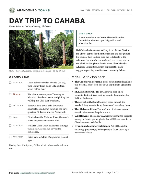
Take it with you
Day trip itinerary
The essentials, the sample day with boxes to tick, what to photograph and the coordinates, on two printable pages. Handy where there's no signal.
Download the PDF (693 KB)Old Cahawba is an easy half day from Selma. Start at the visitor center for the museum and the self-guided brochures, then walk or bike the old streets to the columns, the church, the wells and the prison site on the bluff. Pack a picnic for the river. The Cahawba Advisory Committee, which supports the park, suggests spending an afternoon in nearby Selma.
A sample day
- Leave Selma on Dallas Avenue (AL 22), then County Road 9 and Cahaba Road, about half an hour.
- The visitor center opens (Thursday to Monday). See the museum and pick up the walking and Civil War brochures.
- Borrow a bike or walk the downtown streets: the Crocheron columns, the slave quarters, St. Luke's and the Perine well.
- Picnic above the Alabama River, then walk out to the prison site on the bluff.
- Walk the Clear Creek nature trail through the old town commons, or visit the cemeteries.
- Drive back to Selma. The grounds close at 5 p.m.
Coming from Montgomery? Allow about an hour and a half each way.
What to photograph and film
- The Crocheron columns. Brick columns standing alone in a clearing. Shoot from low down to put them against the sky.
- St. Luke's Church. The 1854 church, back on its townsite. Its front faces east, so come in the morning for light on the facade.
- The street grid. Straight, empty roads through the woods. A long lens stacks up the rows of trees along them.
- The Alabama River. The bluff and picnic area look out over the river where the prison stood.
- Wildflowers. The Cahawba Advisory Committee suggests spring for the old garden plants that still bloom here, from Cherokee roses to daffodils.
- Drones and commercial shoots. Ask at the visitor center (334-872-8058) before you fly a drone or set up a commercial shoot.
Map & directions
Getting there
Selma is the closest city, about half an hour away. From Montgomery the route follows US 80 west to Selma. Both leave Selma on Dallas Avenue (AL 22) and turn south on Dallas County 9 to Cahaba Road and the park.


Base map: USGS The National Map (public domain). Routes: OSRM on © OpenStreetMap contributors data (ODbL), computed October 2026. Times assume dry roads.
- From downtown Selma, take Lauderdale Street.0.2 mi
- Turn left on Dallas Avenue (AL 22) and head west out of town.8.6 mi
- Turn left on Dallas County 9.3.4 mi
- At the end of the road, turn left on Cahaba Road.1.4 mi
- Turn right on 1st Street South to Oak Street, inside the park.0.3 mi
- From downtown Montgomery, take Washington Avenue and South Court Street to I-85, then the ramps at exit 171 onto I-65.2.1 mi
- Follow I-65 (with US 82) south.3.6 mi
- Take exit 167 onto US 80 and follow it west to Selma.44.8 mi
- Turn left on Dallas Avenue (AL 22) and head west.8.6 mi
- Turn left on Dallas County 9.3.4 mi
- At the end of the road, turn left on Cahaba Road, then right on 1st Street South to Oak Street.1.7 mi
Road and safety notes
- The commission's own directions: AL 22 west from Selma for 9 miles, left on County Road 9 for 5 miles, then left on County Road 2 into Old Cahawba. Its mileages differ a little from the route above.
- The park has five miles of level roads. Cruiser bikes can be borrowed free with paid admission, first come, first served, against a valid driver's license.
- Old Cahawba is an archaeological preserve. Metal detecting and digging are not allowed, and pets must be on a leash.
- The town stands on a floodplain where two rivers meet. It flooded often in its own day, so check before driving out after heavy rain.
Photos
Cahaba in photos
Visitor reports
Been to Cahaba?
Been there lately? Tell the next visitor what you found: whether you could get in, the state of the road and what's still standing. Photos are welcome. We read every report before it appears here.
Nearby
Other sites near Cahaba
Straight-line distance from the townsite to other mapped sites in our Alabama index.
- Prairie Bluff21.7 mi SW · Wilcox
- Stanton31.2 mi N · Chilton
- Ruthven32.3 mi S · Wilcox
- Nadawah35.0 mi S · Monroe
- Washington38.0 mi E · Autauga
- Arcola42.2 mi NW · Hale
- Aigleville44.3 mi W · Marengo
- Choctaw Corner46.5 mi SW · Clarke
Sources
Sources and credits
- ghosttowns.com, "Cahaba": fact sheet fields (road, climate, best time, remains).
- Wikipedia, "Cahaba, Alabama", retrieved October 2026: statehouse, street names, 1860–1880 census figures, February 1865 flood, Crocheron mansion meeting, St. Luke's, Fambro/Arthur house, Kirkpatrick quarters, NRHP listing, the Pegues ghost book, coordinates (GNIS).
- Encyclopedia of Alabama, "Cahaba" (Herbert J. Lewis, updated August 2025): Mississippian village, 1818–1819 founding, land prices, 1821 population, Lafayette's visit, capital move, 1866 county seat, freedmen's politics, 1975 transfer to the Historical Commission, 2011 land gift, what the park shows.
- Encyclopedia of Alabama, "Cahaba Federal Prison" (W. Jayson Hill, updated March 2025): prison dates, size, numbers held, deaths, the Sultana, the 1986 dig.
- Alabama Historical Commission, "Old Cahawba" (archived copies of May 11, 2026 and October 11, 2026) and "Plan Your Visit" (archived copy of April 17, 2026): hours, closed days, admission and passes, military families, address, phone, directions, park roads and bikes, tours, visitor center, accessibility, rules, "Alabama's most famous ghost town". The live site did not answer when we checked.
- Cahawba Advisory Committee, cahawba.com, pages "Old Cahawba Park", "Getting to Old Cahawba", "Old Cahawba Today", "St. Lukes Church", "The Fambro House" and "Pegues' Ghost" (archived copies, July to September 2025): the park's list of sites, the 1921 marker, the nature trail, the brochures, the 1851 cemetery, spring flowers, St. Luke's moves (1876, 15 miles; the 1986 find; the 2006–2007 return), the Fambro/Arthur house (Ezekiel Arthur's purchase in 1894, the family there until the late 1990s, the fragile foundation), the Pegues story, the afternoon in Selma, the 5 p.m. visitor-center closing.
- Alabama Historical Commission marker "Behind the Big House," as transcribed and photographed (June 2020) by the Historical Marker Database: Stephen Barker, the slave quarters, Kirk-View farm, the 1935 fire, the columns and back wing added afterward and the columns' removal in 2017.
- Wikipedia, "13 Alabama Ghosts and Jeffrey", retrieved October 2026: the 1969 book by Kathryn Tucker Windham and Margaret Gillis Figh.
- Photo pages on Wikimedia Commons (each photo's credit links to its page): the 2024 photographs of the schoolhouse and the Fambro/Arthur house, including the Danger Keep Out sign.
- Elevation: USGS 3D Elevation Program point query. Routes: OSRM on OpenStreetMap data, October 2026.
Photo and map credits
- The Crocheron columns: RuralSWAlabama, Wikimedia Commons, CC BY-SA 3.0
- The Barker slave quarters, July 2011: Leigh T Harrell, Wikimedia Commons, CC BY-SA 3.0
- St. Luke's Church from the east, October 2010: Altairisfar (Jeffrey Reed), Wikimedia Commons, CC BY-SA 3.0
- St. Luke's porch and nave, October 2010: Altairisfar (Jeffrey Reed), Wikimedia Commons, CC BY-SA 3.0
- An abandoned frame schoolhouse with a tin roof, December 2024: Brian.S.W, Wikimedia Commons, CC BY-SA 4.0
- The Fambro/Arthur house behind a wire fence and a Danger Keep Out sign, December 2024: Brian.S.W, Wikimedia Commons, CC BY-SA 4.0
- The Kirkpatrick house, March 1934: W. N. Manning, Photographer., Wikimedia Commons, Public domain
- The Crocheron mansion, photographed by Silas Orlando Trippe before it burned: Silas Orlando Trippe, Wikimedia Commons, Public domain
- Brick stores on Vine Street, published 1908: Anna M. Gayle Fry, Wikimedia Commons, Public domain
- Castle Morgan, drawn from memory, 1888: Jesse Hawes, Wikimedia Commons, Public domain
- Area base map, topo and aerial imagery: USGS The National Map (public domain).
- Historic maps: USGS Historical Topographic Map Collection (public domain): Montgomery 1953, 1:250,000; Selma 1958, 1:62,500; Selma SE 1975, 1:24,000; Blackwell Bend 1987, 1:24,000.