 Abandoned

Overview
A river port at the mouth of the Bill Williams

Aubrey Landing stood where the Bill Williams River ran into the Colorado, on the Arizona bank about 14 miles northeast of today's Parker. It began as a steamboat landing before 1865 and grew into Aubrey City, the river port for the mines of the Bill Williams Mining District, about 10 to 12 miles away. Its unknown founder named it for François Xavier Aubry, a Santa Fe trader who had crossed the Colorado upstream in 1853. Early mapmakers often spelled his name Aubrey, and the spelling stuck.
The town had a rough start. A break in copper prices in 1865 left it almost deserted, but enough people stayed for a post office to open in October 1866. Aubrey City never grew the way its owners hoped. It had a hotel, a saloon, a general store and the usual mining-camp buildings, and it kept a small population for about another decade. The post office closed in November 1886, and the town was abandoned soon after. No population count survives in the sources we found.
The Bureau of Reclamation built Parker Dam just below the old confluence between 1934 and 1938, and Lake Havasu rose over the townsite. The lake is kept between 445 and 450 feet, so the site stays under water even in drought years. There is nothing left to see but the water over it.
Timeline
From landing to lakebed


- François Xavier Aubry, a Santa Fe trader, crosses the Colorado about 20 miles north of the Bill Williams mouth on his way back to New Mexico. He is killed in a fight the next year.
- Amiel Whipple's railroad survey along the 35th parallel passes the site.
- Lt. Joseph Ives's expedition up the Colorado in the steamboat Explorer makes its Camp 33 here.
- Aubrey Landing is built at the confluence and grows into Aubrey City, a river port for the Bill Williams mines. Its founder is unknown.
- A break in copper prices leaves the town almost deserted.
- Edward Fairman draws a map of the confluence and a view of "Aubrey City, Williams Fork." Both are now in the Bancroft Library.
- The Aubrey post office opens.
- The town still hasn't grown the way its owners hoped. It has a hotel, a saloon, a general store and mining-camp buildings.
- The post office closes, and the town is abandoned soon after.
- The USGS Parker map shows the two rivers meeting at benchmark 391. No town is marked.
- The Bureau of Reclamation builds Parker Dam just below the old confluence.
- Lake Havasu fills behind the dam and covers the townsite.
- The USGS Gene Wash map names the shore just north of the old confluence Larned Landing.
- Lake Havasu is still held between 445 and 450 feet, so the site stays under water.
Location
Where Aubrey stood
Every account puts Aubrey at the mouth of the Bill Williams River, on the east bank of the Colorado and the north bank of the Bill Williams. The USGS place-name record doesn't. Its point, which Wikipedia's infobox repeats, sits about 3.5 miles up the Bill Williams arm of the lake, in the next township east. The Wikipedia article itself calls that point wrong and, from Edward Fairman's 1866 map and drawing of the town, places Aubrey just north of Parker Dam.
Other evidence points the same way. An undated listing gives the township as T11N R18W, which takes in the old confluence but not the USGS point. T. Mickelson's 1975 article "Steamers docked at Aubrey's Landing," as summarized in the University of Arizona's Arizona and the Southwest index, says the site of present Parker Dam was a commercial port. And the 1911 USGS Parker sheet in the historic maps below shows the two rivers meeting at benchmark 391, about half a mile above the dam site.
We use a point on the north side of the old Bill Williams channel, about a fifth of a mile east of where it met the Colorado. Treat it as approximate.
Wikipedia's suggested point lands just across the old Colorado channel, which is the state line here, so the BLM survey grid places it in California. Ours is on the Arizona side, in Mohave County. The later maps below show the lake taking over. The 1950 Parker Dam Area sheet has the water filling the confluence, with a ferry crossing above the dam. The 1959 Gene Wash sheet names the shore just north Larned Landing, and today's topo shows shoreline campsites there under the same name.


Historic maps
Aubrey Landing on USGS maps, 1911–1985
Crops from the USGS Historical Topographic Map Collection, centered on the townsite. Each sheet shows what surveyors mapped that year; compare them with today's topo and aerial on this page.
Day trip
Plan a day trip to Aubrey Landing from Parker
Take it with you
Day trip itinerary
The essentials, the sample day with boxes to tick, what to photograph and the coordinates, on two printable pages. Handy where there's no signal.
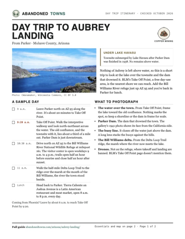
Download the PDF (582 KB)Nothing of Aubrey is left above water, so this is a short trip to look at the lake over the townsite and the dam that drowned it. BLM's Take Off Point, a free day-use area, is the nearest shore we can reach. Add the Bill Williams River refuge just up AZ 95 and you're back in Parker for lunch.
A sample day
- Leave Parker north on AZ 95 along the river. It's about 20 minutes to Take Off Point.
- Take Off Point. Walk the interpretive walkway and look north-northeast across the water. The old confluence, and the townsite with it, lies about a third of a mile out. Parker Dam is just downstream.
- Drive north on AZ 95 to the Bill Williams River National Wildlife Refuge at milepost 161. The visitor center is open weekdays 9 a.m. to 4 p.m.; trails open half an hour before sunrise and close half an hour after sunset.
- Walk the half-mile Delta Loop Trail to the ridge over the marsh at the mouth of the Bill Williams, the river the town stood beside.
- Head back to Parker. Tierra Caliente on Joshua Avenue is a Latin American restaurant and meat market, open 8 a.m. to 8 p.m. every day.
Coming from Phoenix? Leave by about 6 a.m. to reach Take Off Point by 9:20.
What to photograph and film
- The water over the town. From Take Off Point, frame the lake toward the old confluence. Nothing marks the spot, so keep a shoreline or the dam in frame for scale.
- Parker Dam. The dam that drowned the town. The gallery's 1941 photo shows its face from the California side.
- The buoy line. It closes off the water just above the dam. A long lens stacks the buoys against the hills.
- The Bill Williams delta. From the Delta Loop Trail ridge, the marsh where the river now meets the lake.
- Drones. Not on the refuge, where takeoff and landing are banned. BLM's Take Off Point page doesn't mention them.
Map & directions
Getting there
Parker is the closest town. Both routes follow AZ 95 up the Colorado toward Parker Dam and end at Takeoff Point, a lakeshore parking area and boat ramp about a third of a mile south-southwest of the site, across the old Bill Williams channel. There's no town to see, only the water over it.


Base map: USGS The National Map (public domain). Routes: OSRM on © OpenStreetMap contributors data (ODbL), computed October 2026. Times assume dry roads.
- From downtown Parker, follow California Avenue (AZ 95) and turn right onto Rio Vista Highway, still AZ 95.4.4 mi
- Continue north on AZ 95, which becomes Riverside Drive, up the Colorado toward Parker Dam.10.6 mi
- Turn left onto Parker Dam Road, then right at the end of the road, staying on Parker Dam Road.0.7 mi
- Turn right onto Takeoff Point Road to the parking area and boat ramp. The townsite lies under the water to the north-northeast.0.6 mi
- Take I-10 west from downtown Phoenix.125.8 mi
- Leave I-10 at Quartzsite on I-10 Business, follow Main Street, then turn right on Central Boulevard (AZ 95) and follow it north to Parker.35.5 mi
- In Parker, stay on AZ 95 (California Avenue, Rio Vista Highway, then Riverside Drive) north along the river toward Parker Dam.15.8 mi
- Turn onto Parker Dam Road, then right on Takeoff Point Road to the parking area.1.3 mi
Road and safety notes
- The route is on AZ 95 almost all the way. OpenStreetMap marks Parker Dam Road as asphalt and the Takeoff Point parking area as free; it doesn't record the surface of Takeoff Point Road. We haven't driven it.
- An undated listing rates the site 4WD. The route above reaches the shore on highways and a short side road.
- Nothing of the town survives above water, so a visit is a look at the lake.
- A buoy line closes off the water just above Parker Dam (photo below). Keep outside it.
- Summer heat on the river is severe. An undated listing recommends fall and winter.
Photos
The water over Aubrey
Visitor reports
Been to Aubrey Landing?
Been there lately? Tell the next visitor what you found: whether you could get in, the state of the road and what's still standing. Photos are welcome. We read every report before it appears here.
Copper mining
More copper mining ghost towns
The nearest in Arizona.

 Guide
Swansea
34.17, -113.85La Paz County, Arizona
A copper smelting town that boomed in 1909, went broke twice and emptied by 1937. Its adobe ruins are on public land at the end of a long gravel road.
 Guide
Briggs
34.06, -112.48Yavapai County, Arizona
Two tries at copper mining on Castle Creek, in the early 1880s and again in 1890, left a pair of camp names on the map. The way in is a 4WD creek-bed…
Nearby
Other sites near Aubrey Landing
Straight-line distance from the townsite to other mapped sites in our Arizona index.
- Empire Flat6.7 mi SW · La Paz
- Planet10.4 mi E · La Paz
- Liverpool Landing18.4 mi NW · Mohave
- Swansea18.9 mi SE · La Paz
- Bouse22.1 mi S · La Paz
- Poston26.6 mi SW · La Paz
- Signal30.8 mi E · Mohave
- Franconia31.0 mi N · Mohave
Sources
Sources and credits
- ghosttowns.com, "Aubrey Landing": fact sheet fields (roads, legal description, climate, best time, remains, post office dates).
- Wikipedia, "Aubrey Landing, Arizona", retrieved October 2026, citing James and Barbara Sherman, Ghost Towns of Arizona (1969), Joseph Ives's 1861 report and Edward Fairman's 1866 map and drawing: founding, name, Whipple and Ives, mine distances, the 1865 copper slump, buildings, post office, flooding, and the dispute over the USGS location (GNIS 23861).
- Wikipedia, "François Xavier Aubry", retrieved October 2026: his 1853 Colorado crossing, his death in 1854, the "Aubrey" spelling.
- Wikipedia, "Parker Dam" and "Lake Havasu", retrieved October 2026: dam construction 1934–1938; the lake held at 445 to 450 feet, citing SFGATE (August 2026).
- University of Arizona Libraries, Arizona and the Southwest index, "Aubrey Landing": T. Mickelson, "Steamers docked at Aubrey's Landing," Mohave (1975), summarized as "site of present Parker Dam was commercial port"; J. M. Barney, "Forgotten towns of Arizona: Aubrey Landing" (1941).
- Location checks: BLM PLSS CadNSDI (Sec. 9, T11N R18W for our point; R17W for the USGS point; California for Wikipedia's suggested point), US Census TIGERweb (Mohave County), and the BLM Surface Management Agency map (Bureau of Reclamation), all queried October 19, 2026.
- Bureau of Land Management, "Take Off Point", as of October 2026: free day use, pit toilets, shade structure, walkway with interpretive signs, fishing piers, fishing license rule.
- US Fish and Wildlife Service, Bill Williams River National Wildlife Refuge, Visit Us, as of October 2026: location at milepost 161, visitor center and trail hours, no fee, restrooms, Delta Loop Trail.
- US Fish and Wildlife Service, "May I fly a drone on a national wildlife refuge?": drone takeoff and landing banned on refuges (50 CFR 27.34).
- Parker Regional Chamber of Commerce, "Tierra Caliente Meat Market, Restaurant and Catering": address and hours, as of October 2026.
- Takeoff Point parking and boat ramp, road surfaces: OpenStreetMap, October 2026. Elevation of the lake surface: USGS 3D Elevation Program point query. Routes: OSRM on OpenStreetMap data, October 2026. Status checked against the sources above on October 19, 2026.
Photo and map credits
- Lake Havasu just above Parker Dam, 2012. Aubrey stood near here, under what is now open water: CWanamaker, Wikimedia Commons, CC BY 3.0
- Parker Dam from the California side, June 1941: Library of Congress, Prints & Photographs Division, Farm Security Administration/Office of War Information Black-and-White Negatives., Wikimedia Commons, Public domain
- The Bill Williams River where it enters Lake Havasu, about 2.5 miles east of the townsite, 2008: John Menard from Phoenix, USA, Wikimedia Commons, CC BY-SA 2.0
- The buoy line above Parker Dam, 2008: Zzyzx, Wikimedia Commons, CC BY 3.0
- Marsh at the mouth of the Bill Williams River, 2012: Dorian Wallender from Lake Havasu City, Arizona, USA, Wikimedia Commons, CC BY-SA 2.0
- The AZ 95 bridge over the mouth of the Bill Williams, 2011: Dorian Wallender from Lake Havasu City, Arizona, USA, Wikimedia Commons, CC BY-SA 2.0
- The 1911 Parker sheet: the two rivers meet at benchmark 391: U.S. Geological Survey, USGS catalog, Public domain
- Topo map, area base map and aerial imagery: USGS The National Map (public domain).
- Historic maps: USGS Historical Topographic Map Collection (public domain): Parker 1911, 1:125,000; Giers Basin 1943, 1:62,500; Parker Dam Area 1950, 1:62,500; Gene Wash 1959, 1:24,000; Parker 1985, 1:100,000.