 Abandoned

Overview
A name on the railroad
Beardsley was a stop on the Santa Fe, Prescott & Phoenix Railway, out in the desert northwest of Phoenix. It took its name from William H. Beardsley, who spent most of his life trying to bring water from the Agua Fria River to this land. Ranchers drove sheep and cattle to its pens for shearing and loading, and for a while it was the junction for a branch line to McMicken, until the junction moved to Ennis, 4.5 miles east.
Beardsley's project started in 1888, stalled for three decades and finally produced a dam in 1927, after he had died. The lake behind it became Lake Pleasant, and the Beardsley Canal still carries its water south across the West Valley. The station did less well. It had a post office only in 1936, and in the 1940s much of it was bulldozed to make room for the railroad. In 1960 it counted 12 people.
For decades Beardsley sat among farm fields. Sun City West has since grown over it, and today the site is a stretch of Grand Avenue lined with houses.
Timeline
From stock pens to suburbs

- The Agua Fria Water and Land Company forms to irrigate land northwest of Phoenix with water from the Agua Fria River. The Beardsley family's construction company gets the job.
- Work starts on a diversion dam and canal. George Beardsley dies in 1895, his brother William takes over, and money runs out in 1896.
- The Santa Fe, Prescott & Phoenix Railway, the "Peavine," opens all the way to Phoenix. A station on it is named for William H. Beardsley.
- Ranchers bring sheep and cattle to pens at Beardsley for dipping, shearing and shipping.
- William Beardsley forms a water conservation district to finance the storage dam, then dies in December, days before the contract is signed.
- The dam on the Agua Fria, by then called Pleasant Dam for engineer Carl Pleasant, is finished. Maricopa County gives 1926–28 for its construction. The Beardsley Canal carries its water south.
- Beardsley has a post office, for that year only.
- Much of what's left is bulldozed to make room for the railroad.
- The USGS sheet still shows a few buildings beside US 60 and the tracks, with a spur curving off to the southwest.
- The census figure, as World Book reported it, is 12 people.
- Farm fields still surround the site. Sun City West has appeared about 2 miles to the east.
- The site sits inside Sun City West, between Grand Avenue and the railroad, with houses on both sides.
Water
Four decades for a dam
The irrigation scheme began in 1888 with the Agua Fria Water and Land Company. Its plan was a storage dam on the Agua Fria, a diversion dam and a system of canals to water about 100,000 acres. The Beardsley family's Agua Fria Construction Company started building in 1892. Sources differ on which brother led it. Wikipedia credits George Beardsley, and a Salt River Stories history credits William.
George died in 1895 and William took over. In 1896 a national slump cut off the money. The land company went bankrupt, but William kept the project alive. Most of the work so far had gone into the diversion dam, later called Camp Dyer, and the canal. The storage dam had only a foundation.
Nearly 30 years later William hired engineer Carl Pleasant, and the storage dam was redesigned as a then-new multiple-arch dam.
In 1925 Beardsley formed a water conservation district that could sell bonds. He died on December 15, five days before the construction contract was signed, and his son Robert took over the project with Pleasant. The dam was built in 1926–28 by Maricopa County's account, and it was finished in October 1927. It was later renamed Waddell Dam, and since 1994 it has been under the water of a larger Lake Pleasant behind the New Waddell Dam. The Beardsley Canal's main line still runs about 33 miles, serving some 60 square miles of the Maricopa Water District.
Site map
Where the station stood
The 1957 USGS sheet in the historic maps below shows Beardsley as a handful of buildings on the south side of the tracks and US 60, in section 29, with a rail spur curving away to the southwest. The 1971 sheet, built on aerial photographs, shows the buildings surrounded by square farm fields. On the 1988 sheet the fields are still there, McMicken Dam sits to the northwest and the first streets of Sun City West appear about 2 miles to the east.
Today's aerial imagery shows no trace of the station. Grand Avenue and the railroad run side by side through housing and a few open lots.
- Nothing of the station or pens
- The railroad, now run by BNSF
- The Beardsley Canal, about 4 miles west


Historic maps
Beardsley on USGS maps, 1954–1988
Crops from the USGS Historical Topographic Map Collection, centered on the townsite. Each sheet shows what surveyors mapped that year; compare them with today's topo and aerial on this page.

Day trip
Plan a day trip to Beardsley from Surprise
Take it with you
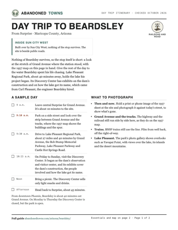
Day trip itinerary
The essentials, the sample day with boxes to tick, what to photograph and the coordinates, on two printable pages. Handy where there's no signal.
Download the PDF (367 KB)Nothing of Beardsley survives, so the stop itself is short: a look at the stretch of Grand Avenue where the station stood, with the 1957 map on this page in hand. Give the rest of the day to the water Beardsley spent his life chasing. Lake Pleasant Regional Park, about 40 minutes away, holds the lake his project began. Its Discovery Center has exhibits on the dam's construction and on how the lake got its name, which came from Carl Pleasant, the engineer Beardsley hired.
A sample day
- Leave central Surprise for Grand Avenue. It's about 10 minutes to the site.
- Park on a side street and look over the strip between Grand Avenue and the tracks, where the 1957 map shows the buildings and the spur.
- Drive to Lake Pleasant Regional Park, about 27 miles and 40 minutes by Grand Avenue, the Bob Stump Memorial Parkway, Lake Pleasant Parkway and Castle Hot Springs Road.
- On Friday to Sunday, visit the Discovery Center. It began as the dam's observation and visitor center, and its exhibits cover the dam's construction, the people involved and how the lake got its name.
- Bring a picnic. The Discovery Center sells only light snacks and drinks.
- Head back to Surprise, about 45 minutes.
From downtown Phoenix, Beardsley is about 40 minutes out Grand Avenue. On Monday to Thursday the Discovery Center is closed, but the park is open.
What to photograph and film
- Then and now. Hold a print or phone image of the 1957 sheet at the site and photograph it against today's street, to show what's gone.
- Grand Avenue and the tracks. The highway and the railroad still run side by side here, as they do on the 1957 map.
- Trains. BNSF trains still use the line. Film from well back, off the right-of-way.
- Lake Pleasant. The park's photo gallery shows overlooks such as Yavapai Point, with views over the lake, its islands and the desert mountains.
Map & directions
Getting there
Beardsley is in the northwest Phoenix suburbs, so any route to Grand Avenue gets you there. Surprise is the closest city center. From downtown Phoenix it's one long drive out Grand Avenue.


Base map: USGS The National Map (public domain). Routes: OSRM on © OpenStreetMap contributors data (ODbL), computed October 2026. Times assume dry roads.
- From central Surprise, take Nash Street south, then Santa Fe Drive and Greenway Road to Grand Avenue (US 60).0.6 mi
- Turn right on Grand Avenue and head northwest to the site, between the highway and the railroad.3.8 mi
- From downtown Phoenix, take Van Buren Street west to Grand Avenue.0.7 mi
- Follow Grand Avenue (US 60) northwest across the West Valley to the site.22.8 mi
Road and safety notes
- Grand Avenue is a paved highway, US 60. Park on a side street rather than stopping on the shoulder.
- The railroad beside the highway is BNSF's line to Phoenix. Stay off the tracks and the right-of-way.
- There is nothing to see on the ground. The historic maps on this page are the best way to picture the place.
Photos
Have photos of Beardsley?
We haven’t added more photographs of Beardsley yet. If you’ve visited, share your photos and a field report below.
Historic photographs of the stock pens survive in local collections.
Visitor reports
Been to Beardsley?
Been there lately? Tell the next visitor what you found: whether you could get in, the state of the road and what's still standing. Photos are welcome. We read every report before it appears here.
Railroad and road
More railroad, road and fort ghost towns
The nearest in Arizona.

 Guide
Maricopa Wells
33.16, -112.08Pinal County, Arizona
The busiest stage stop on the desert road to California, abandoned when the railroads came. It's on Gila River Indian Community land, and little or…
 Guide
Wagoner
34.21, -112.54Yavapai County, Arizona
A stopping place on the Hassayampa River, a mile and a half above the dam that failed in 1890. Its hotel burned in 1942, and the last buildings were…
Nearby
Other sites near Beardsley
Straight-line distance from the townsite to other mapped sites in our Arizona index.
- Marinette7.6 mi SE · Maricopa
- Pioneer Living History Museum17.4 mi NE · Maricopa
- Castle Hot Springs22.2 mi N · Yavapai
- Wranglers Roost Stagecoach Stop23.7 mi NE · Maricopa
- Allah25.7 mi NW · Maricopa
- Columbia26.0 mi N · Yavapai
- Humbug27.4 mi N · Yavapai
- Tip Top28.0 mi N · Yavapai
Sources
Sources and credits
- ghosttowns.com, "Beardsley": fact sheet fields (roads, legal description, climate, best time, remains, post office).
- Wikipedia, "Beardsley, Arizona", retrieved October 2026: coordinates and elevation (GNIS), the 1888 irrigation project, sheep shearing, the 1940s bulldozing, the 1960 population, Sun City West.
- Wikipedia, "Santa Fe, Prescott and Phoenix Railway", retrieved October 2026: the line's March 1895 arrival in Phoenix and its operation today by BNSF.
- Wikipedia, "Waddell Dam", retrieved October 2026: the Agua Fria Water and Land Company, the Beardsley brothers, Carl Pleasant, the 1925 district, the 1927 dam, the Beardsley Canal.
- Salt River Stories (Arizona State University), William M. Bercu, "Beardsley Arizona": the station's namesake, the stock pens, the McMicken branch junction and its move to Ennis, the canal.
- USGS historical topographic maps: Phoenix 1:250,000 (1954), McMicken Dam 1:24,000 (1957 and 1971), Phoenix North 1:100,000 (1988).
- Maricopa County Parks, "Lake Pleasant Regional Park", "Fees" and "Discovery Center", as of October 2026: entrance hours, Discovery Center days and hours, vehicle fee, exhibits, snacks, overlooks.
- Maricopa County Parks, "Waddell Dam", as of October 2026: the "Carl" Pleasant Dam, later renamed Waddell Dam, built between 1926 and 1928.
- Day-trip drive times between Beardsley, Lake Pleasant and Surprise: OSRM on OpenStreetMap data, October 2026.
- Routes: OSRM on OpenStreetMap data, October 2026. Status checked against current USGS aerial imagery on October 19, 2026.
Photo and map credits
- The 1957 McMicken Dam sheet: Beardsley's buildings beside US 60 and the tracks, with the spur curving southwest: U.S. Geological Survey, USGS catalog, Public domain
- Area base map, topo and aerial imagery: USGS The National Map (public domain).
- Historic maps: USGS Historical Topographic Map Collection (public domain): Phoenix 1954, 1:250,000; McMicken Dam 1957, 1:24,000; McMicken Dam 1971, 1:24,000; Phoenix North 1988, 1:100,000.