 Abandoned
Overview
Rubber, cotton, then pecans

Continental sits on the east bank of the Santa Cruz River about 25 miles south of Tucson, at the edge of Green Valley. It began in 1915 or 1916 as the company town of the Intercontinental Rubber Company, which planted guayule, a desert shrub whose sap makes rubber, in case war cut off imports from Asia. Wikipedia says President Woodrow Wilson asked the company, backed by Bernard Baruch, Joseph Kennedy and J. P. Morgan, to grow it.
The company built adobe houses for the farmers, a processing plant, a school, a church, a store and a post office, which opened in 1917. When World War I ended, so did the need for guayule, and the project was abandoned. In 1922 Queen Wilhelmina of the Netherlands bought the farm and rented the fields to cotton growers. The post office closed in 1929.
In 1948 or 1949, by different accounts, Keith Walden's Farmers Investment Co. bought the Continental Farm. It switched from cotton to pecans in 1965, and Wikipedia calls its orchards the largest pecan grove in the world. Continental never emptied. Several of the old adobes are still lived in, the 1918 schoolhouse is the community center, and the cemetery sits inside a newer subdivision. An undated listing calls it a ghost town; we'd call it a former company town that Green Valley grew around.
Timeline
From guayule to pecans
- The Continental Cemetery is first used, by Wikipedia's account. Its oldest marked grave dates from 1918.
- The USGS Patagonia sheet shows only the Canoa land grant, the Santa Cruz River and Brown's Ranch here.
- After the Mexican Revolution, the Continental-Mexican Rubber Company moves north and becomes the Intercontinental Rubber Company.
- The company starts the Continental Farm to grow guayule, a desert shrub that yields rubber. Sources give both years.
- A post office opens.
- A schoolhouse is built, along with large adobe homes for the farmers.
- With World War I over, the guayule project is abandoned.
- Queen Wilhelmina of the Netherlands buys the farm and rents the fields to cotton farmers.
- The USGS Helvetia sheet shows Continental beside the Southern Pacific, with fields on both sides of the river.
- The post office closes.
- The Army opens Camp Continental, a camp for German prisoners of war, built for 250 prisoners and 40 guards.
- Keith Walden's Farmers Investment Co. buys the Continental Farm. Sources give both years.
- The company switches from cotton to pecans. By 1969 it has more than 6,000 acres of trees.
- A new Continental School opens a mile east. The old schoolhouse becomes the Continental Community Center.
What's left
An old farm town inside a new suburb


The 1918 schoolhouse is the landmark. It was replaced in the 1990s by a new school a mile to the east, then refurbished as the Continental Community Center. Several of the adobe houses built for the farmers around 1918 are still homes. The Continental Cemetery lies northeast of the old school, now ringed by the Madera Reserve subdivision. Wikipedia says local Native people regard it as a holy site. Nothing is left of Camp Continental, the World War II prisoner camp that stood beside the Bull Farms, and the farm's land became the Quail Creek development in 1989.
The historic maps below show the town arrive and the suburbs close in. The 1904 sheet shows open range on the Canoa grant. The 1926 sheet marks Continental beside the Southern Pacific with cultivated fields around it. The 1958 sheet shows a grid of buildings, a landing strip and a river gaging station. By 1981 the map shows orchards along the river, the cemetery east of town and Green Valley's streets to the west.
- 1918 schoolhouse, now the Continental Community Center
- Adobe homes from about 1918, privately owned
- Continental Cemetery, in use since 1903
- Pecan orchards of the old Continental Farm
- The railroad the farm was built beside


Historic maps
Continental on USGS maps, 1904–2004
Crops from the USGS Historical Topographic Map Collection, centered on the townsite. Each sheet shows what surveyors mapped that year; compare them with today's topo and aerial on this page.

Day trip
Plan a day trip to Continental from Tucson
Take it with you
Day trip itinerary
The essentials, the sample day with boxes to tick, what to photograph and the coordinates, on two printable pages. Handy where there's no signal.
Download the PDF (314 KB)Continental itself is a short stop: the 1918 schoolhouse, a few old adobes and the cemetery, all inside a newer suburb. Make a day of it from Tucson with the Titan Missile Museum, just off I-19 on the way down, and a picnic in Madera Canyon, up the road from the old town. The adobes are private homes, so look from the street.
A sample day
- Leave downtown Tucson on Congress Street to I-10 east, then take I-19 south.
- Take exit 69 and turn west on Duval Mine Road to the Titan Missile Museum, which opens at 9:45.
- The first silo tour, 45 minutes, booked online ahead. Or look around the topside display for $7.
- Continue south on I-19 to exit 63. Take Continental Road east across the Santa Cruz River, then Whitehouse Canyon Road into the old town.
- See the 1918 schoolhouse, now the community center, and the old adobes from the street. Then the cemetery to the northeast. Keep it quiet and leave everything as you find it.
- Drive about 11 miles up Whitehouse Canyon Road to Madera Canyon. Pay the $8 day fee and picnic by the creek.
- Walk from the picnic areas. The Forest Service's visitor information station is usually open Friday to Sunday.
- Drive back down the canyon and north on I-19 to Tucson.
In summer the Titan Missile Museum opens Thursday to Monday only, by reservation. Check before you go.
What to photograph and film
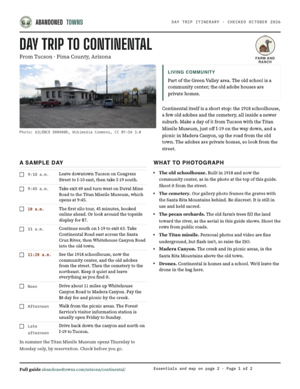
- The old schoolhouse. Built in 1918 and now the community center, as in the photo at the top of this guide. Shoot it from the street.
- The cemetery. Our gallery photo frames the graves with the Santa Rita Mountains behind. Be discreet. It is still in use and held sacred.
- The pecan orchards. The old farm's trees fill the land toward the river, as the aerial in this guide shows. Shoot the rows from public roads.
- The Titan missile. Personal photos and video are fine underground, but flash isn't, so raise the ISO.
- Madera Canyon. The creek and its picnic areas, in the Santa Rita Mountains above the old town.
- Drones. Continental is homes and a school. We'd leave the drone in the bag here.
Map & directions
Getting there
Continental is next to Green Valley, a couple of minutes from I-19. From Tucson, take I-19 south to exit 63. Both routes follow Continental Road east across the river and end on Whitehouse Canyon Road by the old town. Everything here is paved. The old adobes are private homes, so look from the street.


Base map: USGS The National Map (public domain). Routes: OSRM on © OpenStreetMap contributors data (ODbL), computed October 2026. Times assume dry roads.
- From Green Valley, take Calle de Las Casitas to West Continental Road.0.4 mi
- Follow Continental Road east across the Santa Cruz River.1.4 mi
- Turn right onto Whitehouse Canyon Road, then right again into the old town.0.4 mi
- From downtown Tucson, take Congress Street west to I-10 east, then exit 260 onto I-19 south.2.2 mi
- Follow I-19 south and take exit 63, Continental Road.23.8 mi
- Turn left onto Continental Road and follow it east across the Santa Cruz River.1.2 mi
- Turn right onto Whitehouse Canyon Road, then right again into the old town.0.4 mi
Road and safety notes
- All roads to Continental are paved.
- The adobe houses are private homes. Look from the street and don't walk onto the properties.
- The cemetery is surrounded by a subdivision. Visit respectfully.
- Summers are hot. Fall through spring is the best time to visit.
Photos
Continental in photos
Visitor reports
Been to Continental?
Been there lately? Tell the next visitor what you found: whether you could get in, the state of the road and what's still standing. Photos are welcome. We read every report before it appears here.
Farm and ranch
More farm and ranch ghost towns
The nearest in Arizona.

 Guide
Arivaca
31.58, -111.33Pima County, Arizona
An old ranch and mining town in the hills north of the Mexican border. It came close to emptying in the 20th century, but it never did, and its 1879…
 Guide
Tres Alamos
32.07, -110.34Cochise County, Arizona
A farming settlement and stage stop on the San Pedro River, where Tres Alamos Wash comes in. It declined after the railroad reached Benson in 1880. A…
Nearby
Other sites near Continental
Straight-line distance from the townsite to other mapped sites in our Arizona index.
- Twin Buttes6.2 mi NW · Pima
- Helvetia10.9 mi E · Pima
- Rosemont Camp14.2 mi E · Pima
- Greaterville14.5 mi SE · Pima
- Kentucky Camp15.5 mi SE · Pima
- Tubac16.2 mi S · Santa Cruz
- Alto17.7 mi S · Santa Cruz
- Salero19.9 mi S · Santa Cruz
Sources
Sources and credits
- ghosttowns.com, "Continental": fact sheet fields (roads, legal description, climate, best time, post office years).
- Wikipedia, "Continental, Arizona", retrieved October 2026: coordinates and elevation, the 1916 founding and Wilson's request, the buildings, Queen Wilhelmina, Bull Farms, Camp Continental, FICO and pecans, the school and cemetery today.
- Green Valley Pecan Co. (Farmers Investment Co.), "About", 2026: the 1915 founding of Continental Farms, the Queen's purchase and cotton, the 1949 purchase, the switch to pecans, acreage by 1969, the 2021 change to in-shell sales.
- University of Arizona, "Guayule history" fact sheet: the Continental-Mexican Rubber Company, its investors and its move north as Intercontinental Rubber.
- Jim Forte Postal History, Pima County post offices: Continental (1917–1929).
- Wikimedia Commons, "Continental, Arizona": photo descriptions of the community center, cemetery and fields (2014).
- Titan Missile Museum, "Directions & Hours", read October 21, 2026: address, exit 69, seasonal days and hours, holiday closures.
- Titan Missile Museum, "Plan Your Visit", read October 21, 2026: silo tour length and prices, online-only tickets, topside access, restrooms, stairs, shoes, food and photography rules.
- Coronado National Forest, "Madera Canyon Recreation Area" (updated May 19, 2025): day-use fee and hours, vault toilets, drinking water, picnic tables, paved canyon road, directions from exit 63, visitor station days.
- Coronado National Forest, "Passes" (updated October 1, 2026): Coronado and interagency passes valid at the Madera Canyon sites.
- Elevation: USGS 3D Elevation Program point query. Routes: OSRM on OpenStreetMap data, October 2026.
Photo and map credits
- The Continental Community Center, built as the town's school in 1918: $1LENCE D00600D, Wikimedia Commons, CC BY-SA 3.0
- Signs at the community center gate: $1LENCE D00600D, Wikimedia Commons, CC BY-SA 3.0
- Continental Cemetery, with the Santa Rita Mountains behind: $1LENCE D00600D, Wikimedia Commons, CC BY-SA 3.0
- An old canal and bridge in an abandoned field near Quail Creek: $1LENCE D00600D, Wikimedia Commons, CC BY-SA 3.0
- Topo map, area base map and aerial imagery: USGS The National Map (public domain).
- Historic maps: USGS Historical Topographic Map Collection (public domain): Patagonia 1904, 1:125,000; Helvetia 1926, 1:62,500; Sahuarita 1958, 1:62,500; Green Valley 1981, 1:24,000; Green Valley 2004, 1:24,000.