 Abandoned

Overview
A gold company's headquarters, rebuilt by volunteers

Kentucky Camp sits in Kentucky Gulch on the east side of the Santa Rita Mountains, about ten road miles from Sonoita. It grew out of the Greaterville placers, where a gold strike in 1874 drew a rush of miners. By the 1880s the richest gravels were worked out.
Engineer James Stetson planned to store seasonal runoff and wash the remaining gravel with water under pressure. With money from George McAneny he formed the Santa Rita Water and Mining Company in 1902. The company dug about 5.5 miles of ditch, laid more than 2.5 miles of pipe and drove two tunnels to bring water from Bear Spring, then built an adobe headquarters, houses, an assay office and a barn here. The first hydraulic test ran in Boston Gulch in August 1904. Nine months later Stetson was dead after a fall from a Tucson hotel window, and the venture never recovered.
Ranchers used the buildings from the 1920s to the 1960s, then the camp sat empty for about 20 years. The Forest Service took it over in 1989, and volunteers have been restoring it since 1991. Today it's a free day stop on the Arizona Trail, and one of the houses rents as a cabin.
Timeline
From placer gulch to rental cabin
- A placer gold strike on the east slope of the Santa Ritas sets off the Greaterville rush.
- The richest gravels are worked out and most miners leave.
- Investor George McAneny hires engineer James Stetson to study the old placers.
- The Santa Rita Water and Mining Company is incorporated in Tucson.
- Crews build about 5.5 miles of ditch, more than 2.5 miles of pipe, two tunnels and a dam to bring water from Bear Spring.
- The adobe headquarters, houses, assay office and barn go up in Kentucky Gulch, linked by telephone.
- The first hydraulic test runs in Boston Gulch.
- Stetson dies after a fall from a third-story window of the Santa Rita Hotel in Tucson, the day before a stockholders' meeting.
- The company's assets go to a sheriff's sale. McAneny buys them but can't carry on.
- McAneny dies.
- The camp is abandoned by this date.
- Attorney Louis Hummel takes over the property, and it becomes a cattle ranch.
- The ranch is sold to Anamax Mining. Nobody lives at the camp for the next 20 years.
- A land exchange brings the camp into Coronado National Forest.
- Restoration starts with new roofs to save the adobe walls.
- The Kentucky Camp Historic District is listed on the National Register of Historic Places.
- One of the buildings opens as a rental cabin.
- Open year-round. The cabin rents for $75 a night.
Record and rumor
Stetson's fall

On May 20, 1905, James Stetson fell from a third-story window of the Santa Rita Hotel in Tucson. It was the day before a stockholders' meeting. A 1995 Tucson Weekly account says he was carrying about $3,000 in sample gold.
Whether he fell or was pushed has never been settled. We found no record that anyone was charged, so treat the idea of a push as rumor.
McAneny had put about $175,000 into the company. He foreclosed, bought the assets at a sheriff's sale in 1906 and couldn't keep the work going. He died in 1909.
What's there
Five adobes, a cabin and the Arizona Trail


The camp's five adobe buildings date from about 1904. The largest was probably the company headquarters and later the ranch house. Today it rents for day use by groups of up to 50, with a wraparound porch and a small kitchen. A small building behind it held the assay furnace, and a house nearby is thought to have been Stetson's. Photos from 2014 show the barn in ruins with the remains of an early automobile beside it.
The rental cabin sleeps five. It has electricity, propane heat and a basic kitchen, but no running water, so bring your own along with food and bedding. The site has vault toilets, a solar shower, an outdoor sink, drinking water, grills and picnic tables. Camping isn't allowed inside the boundary, but dispersed camping is allowed outside the gates.
The Arizona Trail runs right through the camp on Passage 5, a 16.6-mile stretch between the Apache Springs and Oak Tree Canyon trailheads. Water is usually available here; purify it.
The historic maps below show the setting. The 1904 Patagonia sheet marks Stetson's Dam near Gardner Canyon, with Greaterville to the north. A 1932 Army tactical map labels the camp "McAneny", just north of the Pima–Santa Cruz county line. The 1948 Sonoita sheet shows the cluster of buildings, and the 1958 edition names Kentucky Gulch and Boston Gulch.
- Headquarters building, now a day rental
- Assay office
- Adobe houses, one now the rental cabin
- Barn ruins
- Remains of an early automobile


Historic maps
Kentucky Camp on USGS maps, 1904–1996
Crops from the USGS Historical Topographic Map Collection, centered on the townsite. Each sheet shows what surveyors mapped that year; compare them with today's topo and aerial on this page.

Day trip
Plan a day trip to Kentucky Camp from Sonoita
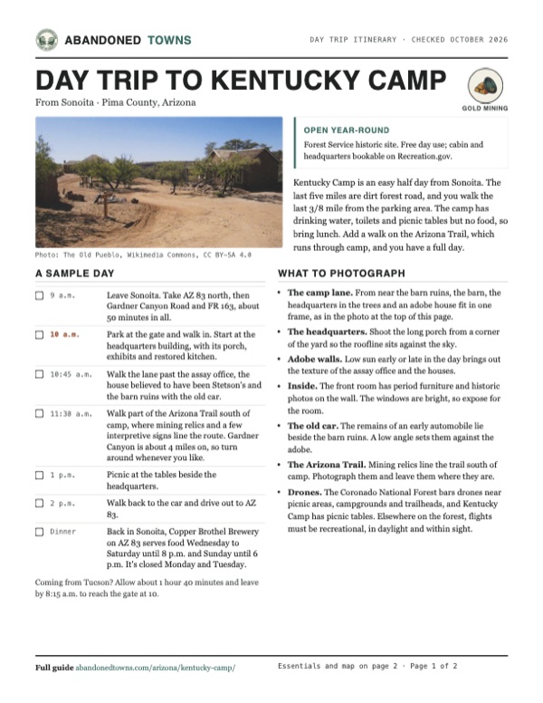
Take it with you
Day trip itinerary
The essentials, the sample day with boxes to tick, what to photograph and the coordinates, on two printable pages. Handy where there's no signal.
Download the PDF (501 KB)Kentucky Camp is an easy half day from Sonoita. The last five miles are dirt forest road, and you walk the last 3/8 mile from the parking area. The camp has drinking water, toilets and picnic tables but no food, so bring lunch. Add a walk on the Arizona Trail, which runs through camp, and you have a full day.
A sample day
- Leave Sonoita. Take AZ 83 north, then Gardner Canyon Road and FR 163, about 50 minutes in all.
- Park at the gate and walk in. Start at the headquarters building, with its porch, exhibits and restored kitchen.
- Walk the lane past the assay office, the house believed to have been Stetson's and the barn ruins with the old car.
- Walk part of the Arizona Trail south of camp, where mining relics and a few interpretive signs line the route. Gardner Canyon is about 4 miles on, so turn around whenever you like.
- Picnic at the tables beside the headquarters.
- Walk back to the car and drive out to AZ 83.
- Back in Sonoita, Copper Brothel Brewery on AZ 83 serves food Wednesday to Saturday until 8 p.m. and Sunday until 6 p.m. It's closed Monday and Tuesday.
Coming from Tucson? Allow about 1 hour 40 minutes and leave by 8:15 a.m. to reach the gate at 10.
What to photograph and film
- The camp lane. From near the barn ruins, the barn, the headquarters in the trees and an adobe house fit in one frame, as in the photo at the top of this page.
- The headquarters. Shoot the long porch from a corner of the yard so the roofline sits against the sky.
- Adobe walls. Low sun early or late in the day brings out the texture of the assay office and the houses.
- Inside. The front room has period furniture and historic photos on the wall. The windows are bright, so expose for the room.
- The old car. The remains of an early automobile lie beside the barn ruins. A low angle sets them against the adobe.
- The Arizona Trail. Mining relics line the trail south of camp. Photograph them and leave them where they are.
- Drones. The Coronado National Forest bars drones near picnic areas, campgrounds and trailheads, and Kentucky Camp has picnic tables. Elsewhere on the forest, flights must be recreational, in daylight and within sight.
Map & directions
Getting there
Sonoita is the closest town. From Tucson, take I-10 east and AZ 83 south. Both routes leave the highway at Gardner Canyon Road and finish on about five miles of dirt forest road. The Forest Service posts signs for Kentucky Camp along AZ 83.


Base map: USGS The National Map (public domain). Routes: OSRM on © OpenStreetMap contributors data (ODbL), computed October 2026. Times assume dry roads.
- Head north on AZ 83.4.1 mi
- Turn left onto Gardner Canyon Road (FR 92).0.8 mi
- Turn right onto East Fish Canyon Road, which becomes FR 163. Stay on the main dirt road.4.4 mi
- At the Kentucky Camp junction, keep left on FR 4045 to the parking lot and gate.0.3 mi
- From downtown Tucson, take Congress Street to I-10 and follow it east to exit 281 for AZ 83.23.7 mi
- Turn right and follow AZ 83 south toward Sonoita.21 mi
- Turn right onto Gardner Canyon Road (FR 92).0.8 mi
- Turn right onto East Fish Canyon Road (FR 163). At the Kentucky Camp junction, keep left on FR 4045 to the parking lot and gate.4.7 mi
Road and safety notes
- The last five miles are dirt. Recreation.gov calls the road passable by passenger car but recommends high clearance.
- No camping inside the Kentucky Camp boundary, and no off-highway vehicles inside it. Dispersed camping is allowed outside the gates.
- Cell service is usually available in the area but may be unreliable at the cabin.
- Check fire restrictions with the Nogales Ranger District before you go. Expect snakes and scorpions in warm months.
Photos
Kentucky Camp in photos
Visitor reports
Been to Kentucky Camp?
Been there lately? Tell the next visitor what you found: whether you could get in, the state of the road and what's still standing. Photos are welcome. We read every report before it appears here.
Gold mining
More gold mining ghost towns
The nearest in Arizona.

 Guide
Greaterville
31.76, -110.75Pima County, Arizona
A placer gold camp from 1874, where water was so scarce it came in on burros. The townsite is private land now, and a forest road crosses it on the…
 Guide
Oro Blanco
31.50, -111.28Santa Cruz County, Arizona
The village that gave its name to the Oro Blanco mining district, a few miles up Ruby Road from Ruby. The record is thin, and we haven't verified…
Nearby
Other sites near Kentucky Camp
Straight-line distance from the townsite to other mapped sites in our Arizona index.
- Greaterville1.4 mi N · Pima
- Rosemont Camp5.6 mi N · Pima
- Fort Buchanan6.4 mi S · Santa Cruz
- Helvetia8.3 mi N · Pima
- Alto12.0 mi SW · Santa Cruz
- Salero13.3 mi SW · Santa Cruz
- Total Wreck13.6 mi NE · Pima
- Continental15.5 mi NW · Pima
Sources
Sources and credits
- ghosttowns.com, "Kentucky Camp": fact sheet fields (roads, legal description, climate, best time, remains). It lists the camp under Santa Cruz County.
- Wikipedia, "Kentucky Camp, Arizona", retrieved October 2026: Greaterville strike, Stetson and McAneny, the buildings, ranch years, 1989 transfer, restoration, county.
- USDA Forest Service, "Kentucky Camp", updated June 12, 2026: coordinates, directions, fees, cabin and headquarters, facilities, caretaker, pets, rules and contacts.
- Recreation.gov, "Kentucky Camp Cabin and Headquarters Building": cabin details, the locked gate, the road advisory and cell coverage, as of October 2026.
- KentuckyCamp.org, "Kentucky Camp Timeline": incorporation date, water system, test run, Stetson's death, sheriff's sale, ranch years and the 1999 cabin rental.
- National Park Service, NRHP record 95001312: listing date and county.
- Arizona Trail Association, "Passage 5: Santa Rita Mountains": passage length, trailheads and water.
- Kevin Franklin, "Out There," Tucson Weekly, December 14, 1995: the sample gold, the unsettled question of Stetson's fall, and early restoration.
- Wikimedia Commons file descriptions for the 2014 photos: building names and the house believed to have been Stetson's.
- USDA Forest Service, "Kentucky Camp" brochure (revised June 2026): parking 3/8 mile from camp, disability access number, toilets, picnic tables, grill, drinking water, pets, summer hazards, OHV traffic and rules, Arizona Trail distance and relics, headquarters exhibits, as of October 2026.
- Friends of Kentucky Camp, newsletter (June 2026): the restored kitchen opened to the public, picnic table and outdoor sink by the headquarters.
- Copper Brothel Brewery, official site: address, kitchen and hours, as of October 2026.
- Coronado National Forest, "Drones / Unmanned Aircraft Systems (UAS)": recreational use only, FAA rules, 400-foot ceiling, daylight and line of sight, no flights near wildlife, campgrounds, picnic areas, trailheads or visitor centers, none in wilderness.
- County check: 2020 Census block for the Forest Service coordinates (Pima County). Elevation: USGS 3DEP. Routes: OSRM on OpenStreetMap data, October 2026. Status checked against the Forest Service page on October 19, 2026.
Photo and map credits
- The camp lane: barn ruins at left, the headquarters behind the trees, an adobe house at right, 2014: The Old Pueblo, Wikimedia Commons, CC BY-SA 4.0
- The assay office, 2014: The Old Pueblo, Wikimedia Commons, CC BY-SA 4.0
- The headquarters, also called the hotel and office building, 2014: The Old Pueblo, Wikimedia Commons, CC BY-SA 4.0
- Inside the headquarters' front room, 2014: The Old Pueblo, Wikimedia Commons, CC BY-SA 4.0
- Barn ruins and the remains of an early automobile, 2014: The Old Pueblo, Wikimedia Commons, CC BY-SA 4.0
- The adobe house believed to have been Stetson's, 2014: The Old Pueblo, Wikimedia Commons, CC BY-SA 4.0
- An adobe house with a long porch, 2009: Leland Jackson, Wikimedia Commons, CC BY 2.0
- A small adobe house, 2014: The Old Pueblo, Wikimedia Commons, CC BY-SA 4.0
- Topo map, area base map and aerial imagery: USGS The National Map (public domain).
- Historic maps: USGS Historical Topographic Map Collection (public domain): Patagonia 1904, 1:125,000; Elgin 1932, 1:62,500; Sonoita 1948, 1:24,000; Sonoita 1958, 1:24,000; Sonoita 1996, 1:24,000.