 Abandoned

Overview
A gold camp at the top of the road

Crown King sits in the pines near the crest of the Bradshaw Mountains, about 5,770 feet up. Prospectors filed the first claim, the Buckeye, in July 1875. The camp grew around the Crowned King mine, and in 1888 the mine and the town shortened the name to Crown King. Estimates of the mine's output run from $1.5 million between 1890 and 1901 to about $2 million in gold in all.
At its height the town had about 500 buildings, with company stores, boarding houses, two Chinese restaurants and a post office. It had electric power by 1897. In 1904 Frank Murphy's Bradshaw Mountain Railroad reached it after a hard climb from Turkey Creek on switchbacks and trestles. The mines never paid as well as hoped. The railroad lost money, and trains stopped running to Crown King in 1926. Much of today's road follows the old grade.
The mines closed in the 1950s, and tourism has been the town's main income since. Crown King never emptied. About 194 people live in its ZIP code, the one-room school still teaches a few children, and the saloon, rebuilt here after being hauled piece by piece from Oro Belle, still serves drinks and food. It is a living village with a ghost-town past.
Timeline
Claims, a railroad and a quiet century

- Rod McKinnon files the Buckeye, the first recorded gold claim in the area.
- The Crowned King mine and the camp around it shorten the name to Crown King. The post office opens that summer; sources give June 29 and July 29.
- The mine produces an estimated $1.5 million, $200,000 of it paid out in dividends.
- The town is electrified and has one telephone.
- Disputes among the owners end in a court-ordered shutdown of the mine.
- The Bradshaw Mountain Railroad reaches Crown King after climbing from Turkey Creek, now Cleator, on switchbacks and trestles.
- Crown King's school opens. A permanent schoolhouse follows in 1916 or 1917; sources give both years.
- The saloon is taken apart at Oro Belle and rebuilt in Crown King. Sources give 1906 and 1910.
- Rail service to Crown King ends. The grade later becomes the road into town.
- The last mines close. Tourism becomes the town's main income.
- The post office closes. It later reopens inside the general store.
- Weeks after a 16,000-acre wildfire, a mudslide closes Crown King Road between Cleator and the Poland Creek bridge.
- Crown King is evacuated for the 9,500-acre Horse Fire. No buildings are lost.
- The Forest Service closes the Senator Highway and nearby forest roads during two weeks of wet weather.
Then and now
What you'll see today


The two-story saloon is the center of town. It was built at Oro Belle, a mining camp nearby, and moved here board by board after the Oro Belle mine played out. Sources date the move to 1906 or 1910. It was a bar and brothel in both towns and today works as a bar, cafe and hotel.
The general store holds the post office. The red one-room schoolhouse dates from 1916 or 1917 and still serves a handful of students from kindergarten to eighth grade. The county library runs a small branch in the back of the school building, and the town cemetery is close by. Most other old buildings are homes or cabins, so look from the road.
The Crowned King mine itself lies north of town. The 1947 sheet in the maps below marks it, with the ranger station and the Senator Highway nearby.
- Crown King Saloon (moved from Oro Belle)
- General store and post office
- One-room schoolhouse (1916–17)
- Library branch
- Cemetery
- Crowned King mine site
- Old railroad grade (now the road)
The historic maps show the town's story in order. The 1887 sheet, drawn just before the name change, has no Crown King at all; it names nearby Alexander, Del Pasco and Moosville. The 1903 sheet, a year before the railroad arrived, shows Crown King on a web of wagon roads with the Lincoln Mill and Towers Ranch nearby. The 1947 and 1969 sheets add the ranger station, the water tank and the cemetery. The 1981 sheet shows the War Eagle, Tiger and Rapid Transit mines in the hills around town.


Historic maps
Crown King on USGS maps, 1887–1981
Crops from the USGS Historical Topographic Map Collection, centered on the townsite. Each sheet shows what surveyors mapped that year; compare them with today's topo and aerial on this page.

Day trip
Plan a day trip to Crown King from Prescott
Take it with you
Day trip itinerary
The essentials, the sample day with boxes to tick, what to photograph and the coordinates, on two printable pages. Handy where there's no signal.
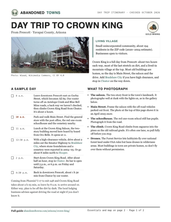
Download the PDF (510 KB)Crown King is a full day from Prescott: about two hours each way, most of the last stretch on dirt, and a lived-in mountain village at the top. Most old buildings are homes, so the day is Main Street, the saloon and the drive. Add Bradshaw City if you have high clearance, and stop in Cleator on the way down.
A sample day
- Leave downtown Prescott east on Gurley Street, which becomes AZ 69. Our router turns off on Antelope Creek and Blue Bell Mine roads, a back way we haven't checked, then climbs Crown King Road from Cleator. It's about 2 hours.
- Park and walk Main Street. Find the general store with the post office, the red one-room schoolhouse and the cemetery nearby.
- Lunch at the Crown King Saloon, the two-story building moved here board by board from Oro Belle. It opens at 11.
- With a high-clearance vehicle, drive about 2 miles out the Senator Highway to Bradshaw City, where stone foundations and a cemetery were reported in 2004–05. Or go about 8 miles north to Hooper.
- Start down Crown King Road. After about half an hour, stop in Cleator. Its bar is open until 5 p.m., or 6 p.m. on Friday and Saturday.
- Back in downtown Prescott, about 1 h 30 min from Cleator by our router.
Coming from Phoenix? I-17 to exit 248 and Crown King Road takes about 2 h 05 min, so leave by 8 a.m. to arrive around 10. Either way, plan to be off the dirt by dark. The local lodging business advises against driving the road at night if you don't know it.
What to photograph and film
- The saloon. The two-story front is the town's landmark. It photographs well at dusk with the lights on, as in the gallery below.
- Main Street. Frame the saloon with the off-road vehicles parked out front. The photo at the top of this page shows it in an April 2025 snow.
- The schoolhouse. The red one-room school still has pupils. Photograph it from the road.
- The climb. Crown King Road climbs from saguaros into the pines on the old railroad grade. It's often one lane, so pull fully off before you stop.
- Drones. The Forest Service lets hobbyists fly over national forest land under FAA rules but bans drones in wilderness areas. Most buildings in town are private homes, so don't fly over them without permission.
Map & directions
Getting there
Prescott is the closest city, about two hours away. From Phoenix, the usual way in is I-17 to the Bumble Bee exit and then about 28 miles of graded dirt road through Cleator and up the old railroad grade. The Prescott route below was computed by OSRM and uses back roads near Mayer that we haven't checked. The other approach from Prescott is the Senator Highway, a 37-mile mountain road for high-clearance vehicles.


Base map: USGS The National Map (public domain). Routes: OSRM on © OpenStreetMap contributors data (ODbL), computed October 2026. Times assume dry roads.
- From downtown Prescott, head east on Gurley Street. It becomes AZ 69. Follow AZ 69 southeast.27.7 mi
- Turn left onto Antelope Creek Road, then right onto Blue Bell Mine Road, a back road we haven't checked.9.6 mi
- At the end of the road in Cleator, turn right onto Crown King Road and follow it up the old railroad grade to Crown King.13.2 mi
- From downtown Phoenix, take 3rd Avenue north to I-10 and follow exit 143A to I-17 north.3.2 mi
- Follow I-17 north and take exit 248, the Bumble Bee exit.47.2 mi
- Turn left onto Bumble Bee Road. It runs north through Bumble Bee as graded dirt, under the names Crown King Road and Bumble Bee Road.10.4 mi
- Stay on Crown King Road through Cleator and up the old railroad grade to Main Street in Crown King.17.7 mi
Road and safety notes
- Crown King Road is graded, county-maintained dirt for about 28 miles from I-17. It is often one lane and washboarded. A local business says a car can do it in normal conditions, but 4WD may be needed in snow or during the July and August monsoon.
- Storms close the road. In July 2012 a mudslide shut it between Cleator and the Poland Creek bridge, and the Forest Service closes the Senator Highway and other forest roads during heavy rain or snow, as it did in March 2025.
- The Senator Highway (Forest Road 52) from Prescott is a separate mountain road. The Forest Service warned in 2022 that a washed-out section near Palace Station was unsafe for low-clearance vehicles. Check the Prescott National Forest alerts page first.
- There is no auto repair between I-17 and Crown King, and cell service is patchy. Carry water, blankets and a first-aid kit, and check your tires before you leave the pavement.
- Avoid driving the road after dark if you don't know it. Expect off-road vehicles, cyclists, cattle and wildlife.
- Large trailers are a bad idea. Parking in town is tight.
Photos
Crown King in photos
Visitor reports
Been to Crown King?
Been there lately? Tell the next visitor what you found: whether you could get in, the state of the road and what's still standing. Photos are welcome. We read every report before it appears here.
Gold mining
More gold mining ghost towns
The nearest in Arizona.

 Guide
Minnehaha
34.16, -112.41Yavapai County, Arizona
A ranch, a post office and a mining camp on the west slope of the Bradshaws, the southernmost of a string of tiny settlements on Minnehaha Flat. A…
 Guide
Humbug
34.05, -112.32Yavapai County, Arizona
A gold camp in a canyon of the southern Bradshaw Mountains whose 1930s buildings outlasted the mine because a caretaker never left. It's private and…
Nearby
Other sites near Crown King
Straight-line distance from the townsite to other mapped sites in our Arizona index.
- Bradshaw City1.2 mi SW · Yavapai
- Fort Misery4.8 mi S · Yavapai
- Hooper4.9 mi NW · Yavapai
- Minnehaha4.9 mi SW · Yavapai
- Cleator7.9 mi NE · Yavapai
- Humbug10.5 mi S · Yavapai
- Bumble Bee10.6 mi E · Yavapai
- Goodwin10.6 mi N · Yavapai
Sources
Sources and credits
- ghosttowns.com, "Crown King": fact sheet fields (roads, legal description, climate, best time, remains, post office dates).
- Wikipedia, "Crown King, Arizona", retrieved October 2026: first claim, name change, town size, railroad years, saloon, school, post office, population estimate, climate, coordinates (GNIS).
- Wikipedia, "Bradshaw Mountain Railroad": construction dates and abandonment.
- Sharlot Hall Museum Library & Archives, "Crown King Mine Area": mine elevation, 1890–1901 output and dividends, 1901 shutdown.
- Prescott National Forest, "Prescott to Crown King" (updated February 2025): the 37-mile Senator Highway route.
- Prescott National Forest, weather-related road closure order, March 14, 2025: closed roads and the note that closures may return.
- Prescott National Forest, Senator Highway warning, July 8, 2022: washed-out section unsafe for low-clearance vehicles.
- crownking.com, "Directions" (a local lodging business, 2023): exit 248, road surface, vehicle advice, services and warnings, cell reception, what to carry, driving after dark.
- Crown King Saloon & Eatery, as of October 2026: opening time, closed days, food, phone, no pets.
- Cleator Bar & Yacht Club, as of October 2026: hours.
- USDA Forest Service, recreational drone use: FAA rules apply, and drones are banned in wilderness.
- KTAR, July 16, 2012: mudslide closure after the wildfire. KNAU, October 23, 2020: Horse Fire evacuation.
- Elevation: USGS 3D Elevation Program point query. Routes: OSRM on OpenStreetMap data, October 2026; the Prescott route is not field-checked. Status checked against the sources above on October 19, 2026.
Photo and map credits
- Crown King Road on the climb into town, 2015: Mimi Cummins from Canada, Wikimedia Commons, CC BY 2.0
- The bridge into Crown King, 2015: Mimi Cummins from Canada, Wikimedia Commons, CC BY 2.0
- Main Street in a spring snow, April 2025: Wiwad, Wikimedia Commons, CC BY 4.0
- The Crown King Saloon, 2015: Mimi Cummins from Canada, Wikimedia Commons, CC BY 2.0
- The saloon, moved here from Oro Belle, 2006: boeke at flickr, Jboeke, Wikimedia Commons, CC BY-SA 2.0
- Saguaros along the road from Cleator, 2015: Mimi Cummins from Canada, Wikimedia Commons, CC BY 2.0
- The view from the Mill, 2015: Mimi Cummins from Canada, Wikimedia Commons, CC BY 2.0
- Inside the post office, 2006: Rocky Mountain Research Station (RMRS), Wikimedia Commons, Public domain
- The saloon at dusk, December 2011: 93boomer, Wikimedia Commons, Public domain
- Railroad map, 1931, with the Crown King branch: Missouri Pacific Lines, Wikimedia Commons, Public domain
- Area base map, topo and aerial imagery: USGS The National Map (public domain).
- Historic maps: USGS Historical Topographic Map Collection (public domain): Prescott 1887, 1:250,000; Bradshaw Mountains 1903, 1:125,000; Crown King 1947, 1:62,500; Crown King 1969, 1:24,000; Bradshaw Mts 1981, 1:100,000.