 Abandoned

Overview
Where the steamboats stopped

In March 1864 William Harrison Hardy, a New Yorker who had come west to California, started a ferry and a steamboat landing on the Arizona bank of the Colorado River, where the Mojave Road crossed. Backed by George Alonzo Johnson's steamboat company, Hardyville became the low-water head of navigation. Stern-wheelers came up from Port Isabel at the river's mouth with supplies for the mines, and wagon roads and pack trails ran inland from the landing. Hardy also built a toll road to Prescott, the new territorial capital.
The town itself stayed small. A visitor in 1866 found a warehouse, an idle quartz mill and a few adobe buildings, and the 1870 census counted 20 people. Still, it was the county seat from 1867 until the early 1870s, and it grew a store, saloon, blacksmith shop and billiard hall as the inland mines boomed.
Railroads ended it. The Southern Pacific reached Yuma in 1877 and bought Johnson's boats, a rival landing opened upriver in 1881, and in 1883 the Atlantic and Pacific line crossed the Colorado near Needles. The post office closed that year, and by the 1890s the last residents had gone. Decades later Bullhead City grew up from the Davis Dam construction camp, and the townsite now lies under its streets. The pioneer cemetery on a hill above AZ 95 is the only part of Hardyville that survives.
Timeline
Ferry, county seat, ghost town, city

- William Harrison Hardy sets up a ferry and steamboat landing where the Mojave Road crosses the Colorado River, with backing from George Alonzo Johnson's steamboat company.
- The post office opens, with Hardy as postmaster.
- A visiting Army officer, James F. Rusling, finds little more than a warehouse, an idle quartz mill and a few adobe shacks.
- Hardyville takes the Mohave County seat from Mohave City.
- The census counts 20 people. As the interior mines pick up through the decade, a store, saloon, blacksmith shop, billiard hall and public hall go up.
- The county seat moves to Cerbat. Sources give both years.
- The Southern Pacific reaches Yuma, buys Johnson's steamboat line and pushes its rails east. Wagon freight for the interior mines shifts to the railhead.
- Steamboat captain Isaac Polhamus opens Polhamus Landing, about 5 miles upriver and closer to the mines. It takes most of Hardyville's river trade.
- The post office closes in favor of Mohave City. That May the Atlantic and Pacific Railroad reaches the Colorado near Needles, and the last mining trade leaves the river.
- Falling silver prices idle the Hardyville mill, its last business, and the remaining residents leave.
- The March 1892 USGS Camp Mohave sheet still prints Hardyville, and so does a 1911 reprint.
- William Harrison Hardy dies.
- Davis Dam goes up upstream. Its construction camp, nicknamed Bullhead, grows into Bullhead City over the old townsite.
- The USGS Davis Dam sheet marks "Hardyville (Site)" with a cemetery beside it.
- Bullhead City, Riviera and Holiday Shores vote to incorporate as Bullhead City.
- The Fort Mohave Chapter of the Daughters of the American Revolution dedicates a marker at the cemetery.
- The Hardyville Pioneer Cemetery is listed on the National Register of Historic Places.
- Volunteers propose benches and a row of memorial headstones. In March the city's parks commission recommends that the City Council approve the additions.
Record and legend
Claims to check
First county seat? An undated listing calls Hardyville Mohave County's first seat. Wikipedia's county history lists Mohave City first, from 1864 to 1867, then Hardyville until 1873. The DAR marker at the cemetery says 1867 to 1872. A lost roadside marker said Hardyville became the seat in 1872. We give 1867 to 1872 or 1873.
The mail sack. Hardy is widely credited with inventing the riveted mail sack. Wikipedia and an undated listing both repeat it, but we haven't seen a patent or a contemporary record, so treat it as a claim.
The second-richest man in Arizona. Wikipedia says Hardy was worth more than $40,000 in 1864, which made him the territory's second-richest man. We haven't found the original source.
The founder's name. The 1999 DAR marker names the founder as William R. Hardy. Every other source we read, including his Wikipedia biography, gives William Harrison Hardy.
The official USGS place-name point for "Hardyville (historical)" is about 5.5 miles south of the real site, at Mohave City and Fort Mohave.
The map pin. Mapping apps that use that point will send you to the wrong place. The 1886 USGS sheet, the 1950 and 1970 sheets and the cemetery all put Hardyville in what is now central Bullhead City. Our map point is the cemetery.
Hardyville and Bullhead City. Some accounts say Hardyville grew into Bullhead City. The townsite is inside the city, but the city grew from the Davis Dam construction camp more than half a century after Hardyville emptied.
What's left
Seventeen graves on a hill

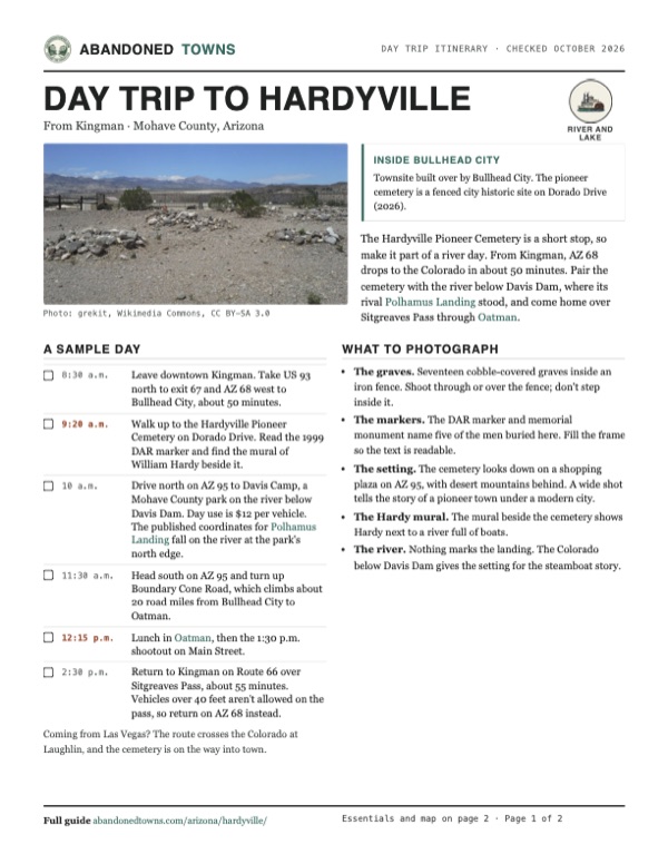
The Hardyville Pioneer Cemetery sits on top of a small hill on Dorado Drive, a block east of AZ 95, above the Bullhead Marina Plaza. The graves take up about a third of the city parcel. Seventeen are known, each covered with a pile of cobbles. A fence encloses them, and you can see it from AZ 95. A monument placed with the 1999 DAR marker remembers five men, from Johnny Killian, who died in October 1866, to A. O. Perkins, who died in December 1897.
Beside the cemetery, a mural shows Hardy next to a river full of boats, and an unofficial town marker stands in a parking lot across AZ 95. An older "Hardyville Site" marker on the highway has been reported missing. The 1970 USGS sheet marked the Hardyville Mill ruins about half a mile east of the cemetery; we haven't confirmed whether anything of the mill survives. Nothing marks the river landing, and the bank north of AZ 95 is now lined with marinas and riverfront buildings.
The historic maps below show the change. The 1886 Camp Mohave sheet prints Hardyville on the east bank, with a road along the river between Camp Mojave's ferry and a place called Harpers, and a trail heading inland. The 1926 sheet shows nothing at the site but a road. In 1950 the Davis Dam sheet marks "Hardyville (Site)" with the cemetery just west and Hardyvilla Ranch on the river. The 1970 sheet shows the cemetery, the mill ruins, AZ 95 and a boat ramp, and by 1982 the site is surrounded by the street grids of Bullhead City and Riviera.
- Pioneer cemetery, 17 cobble-covered graves
- DAR marker and memorial monument (1999)
- Mural of William Hardy
- Unofficial town marker across AZ 95
- Mill ruins (mapped 1970, current state unknown)


Historic maps
Hardyville on USGS maps, 1886–1982
Crops from the USGS Historical Topographic Map Collection, centered on the townsite. Each sheet shows what surveyors mapped that year; compare them with today's topo and aerial on this page.
Day trip
Plan a day trip to Hardyville from Kingman
Take it with you
Day trip itinerary
The essentials, the sample day with boxes to tick, what to photograph and the coordinates, on two printable pages. Handy where there's no signal.
Download the PDF (548 KB)The Hardyville Pioneer Cemetery is a short stop, so make it part of a river day. From Kingman, AZ 68 drops to the Colorado in about 50 minutes. Pair the cemetery with the river below Davis Dam, where its rival Polhamus Landing stood, and come home over Sitgreaves Pass through Oatman.
A sample day
- Leave downtown Kingman. Take US 93 north to exit 67 and AZ 68 west to Bullhead City, about 50 minutes.
- Walk up to the Hardyville Pioneer Cemetery on Dorado Drive. Read the 1999 DAR marker and find the mural of William Hardy beside it.
- Drive north on AZ 95 to Davis Camp, a Mohave County park on the river below Davis Dam. Day use is $12 per vehicle. The published coordinates for Polhamus Landing fall on the river at the park's north edge.
- Head south on AZ 95 and turn up Boundary Cone Road, which climbs about 20 road miles from Bullhead City to Oatman.
- Lunch in Oatman, then the 1:30 p.m. shootout on Main Street.
- Return to Kingman on Route 66 over Sitgreaves Pass, about 55 minutes. Vehicles over 40 feet aren't allowed on the pass, so return on AZ 68 instead.
Coming from Las Vegas? The route crosses the Colorado at Laughlin, and the cemetery is on the way into town.
What to photograph and film
- The graves. Seventeen cobble-covered graves inside an iron fence. Shoot through or over the fence; don't step inside it.
- The markers. The DAR marker and memorial monument name five of the men buried here. Fill the frame so the text is readable.
- The setting. The cemetery looks down on a shopping plaza on AZ 95, with desert mountains behind. A wide shot tells the story of a pioneer town under a modern city.
- The Hardy mural. The mural beside the cemetery shows Hardy next to a river full of boats.
- The river. Nothing marks the landing. The Colorado below Davis Dam gives the setting for the steamboat story.
Map & directions
Getting there
Hardyville is inside Bullhead City, so any visit starts on AZ 95. From Kingman, the county seat, take AZ 68 over to the river; from Las Vegas, take US 95 and NV 163 and cross into Arizona. Both routes are paved and end on Dorado Drive below the cemetery.


Base map: USGS The National Map (public domain). Routes: OSRM on © OpenStreetMap contributors data (ODbL), computed October 2026. Times assume dry roads.
- From downtown Kingman, take East Beale Street to US 93 and head north.4.2 mi
- Take exit 67 onto AZ 68, the Bullhead City–Kingman Highway, and follow it west to Bullhead City.28 mi
- Continue onto AZ 95, the Mohave Valley Highway, through Bullhead City.3.9 mi
- Turn left on Verano Drive, then right on Dorado Drive to the cemetery on the hill.0.1 mi
- From downtown Las Vegas, take I-11/US 93/US 95 south toward Boulder City.21 mi
- Take exit 14 and follow US 95 south.55.5 mi
- Turn left on NV 163, the Colorado River Highway, and follow it east across the Colorado River into Bullhead City.19.2 mi
- Turn right on AZ 95, the Mohave Valley Highway, and head south.4.1 mi
- Turn left on Verano Drive, then right on Dorado Drive to the cemetery on the hill.0.1 mi
Road and safety notes
- Both routes are paved. The cemetery sits on a hill above Dorado Drive; its fence is visible from AZ 95.
- This is a cemetery. Stay off the graves and don't move the stones that cover them.
- We found no posted hours or parking rules for the cemetery. Park legally on nearby streets.
- Bullhead City summers are very hot. Visit early in the day from May to September.
Photos
Hardyville in photos
Visitor reports
Been to Hardyville?
Been there lately? Tell the next visitor what you found: whether you could get in, the state of the road and what's still standing. Photos are welcome. We read every report before it appears here.
River and lake
More river and lake ghost towns
The nearest in Arizona.

 Guide
Polhamus Landing
35.19, -114.57Mohave County, Arizona
A steamboat landing and warehouse built in 1881 to undercut Hardyville. Within months more freight was landed there than anywhere else on the river…
 Guide
Mohave City
35.04, -114.62Mohave County, Arizona
A river landing and saloon town that grew up beside Fort Mohave in the 1860s and served as the first Mohave County seat. In 1869 the Army took its…
Nearby
Other sites near Hardyville
Straight-line distance from the townsite to other mapped sites in our Arizona index.
- Polhamus Landing5.0 mi N · Mohave
- Mohave City5.6 mi S · Mohave
- Fort Mohave5.7 mi S · Mohave
- Katherine8.1 mi N · Mohave
- Goldroad12.8 mi SE · Mohave
- Oatman13.2 mi SE · Mohave
- Eastbridge20.9 mi S · Mohave
- Murphyville22.1 mi N · Mohave
Sources
Sources and credits
- ghosttowns.com, "Hardyville": fact sheet fields (roads, legal description, climate, best time, remains, post office dates) and its "first county seat" and mail-sack claims.
- Wikipedia, "Bullhead City, Arizona", retrieved October 2026: Hardyville's founding, Hardy and Johnson, the steamboat trade, Rusling's 1866 visit, the 1870 census, the county seat, the railroads and Polhamus Landing, the 1883 closure, the cemetery, marker and mill coordinates, Davis Dam and the 1984 incorporation.
- Wikipedia, "William Harrison Hardy", "Mohave County, Arizona", "Mojave City, Arizona" and "Hardyville Cemetery": Hardy's dates and the mural, the county seat sequence and the January 21, 1867 transfer, Mohave City's location, the cemetery's size, graves and listing.
- Arizona State Society DAR, "Hardyville Pioneer Cemetery": marker text, location and coordinates, the 17 graves, the five named burials, the 1999 dedication and the 2001 National Register listing.
- Historical Marker Database, "Hardyville Pioneer Cemetery" and "Hardyville Site" (revised June 2025): marker locations, the Hardy's Landing name, the missing roadside marker.
- Kingman Daily Miner, "Preserving history: Group proposes improvements to Hardyville Pioneer Cemetery grounds" (February 23, 2026): the cemetery's setting on Dorado Drive and its share of the parcel.
- Citizen Portal, report on the Bullhead City Parks and Recreation Commission meeting of February 18, 2026: the proposal for benches and memorial headstones by volunteer groups.
- City of Bullhead City, Parks and Recreation Commission action agenda, March 18, 2026: the recommendation to approve additional amenities at the cemetery.
- Mohave County Parks, "Davis Camp" and "Fee Schedule", as of October 2026: day-use hours and fee.
- BLM, "Route 66 Oatman Road Back Country Byway": fuel in Bullhead City, the 40 ft vehicle limit over Sitgreaves Pass.
- Oatman-Gold Road Chamber of Commerce, "Events", as of October 2026: shootout times in Oatman.
- Davis Camp's boundary and the Polhamus Landing coordinates: OpenStreetMap and Wikipedia, October 2026.
- Coordinates: the cemetery, from the Arizona DAR marker listing. The USGS GNIS point "Hardyville (historical)" (feature ID 24040) lies about 5.5 miles south and was not used. Historic positions read from USGS sheets of 1886, 1950 and 1970. Elevation: USGS 3D Elevation Program point query. Routes: OSRM on OpenStreetMap data, October 2026.
Photo and map credits
- Stone-covered graves inside the cemetery fence, 2013: grekit, Wikimedia Commons, CC BY-SA 3.0
- The cemetery above the shopping plaza on AZ 95, 2013: grekit, Wikimedia Commons, CC BY-SA 3.0
- The Colorado River steamboat Cocopah, in a stereograph of about 1875–1885: Continent Stereoscopic Company -- Publisher, Wikimedia Commons, Public domain
- The stern-wheeler Mohave No. 2 at Yuma in 1876: Unknown author, Wikimedia Commons, Public domain
- Hardyville on the east bank of the Colorado, on the 1886 USGS Camp Mohave sheet: U.S. Geological Survey, USGS catalog, Public domain
- Topo map, area base map and aerial imagery: USGS The National Map (public domain).
- Historic maps: USGS Historical Topographic Map Collection (public domain): Camp Mohave 1886, 1:250,000; Mohave City 1926, 1:96,000; Davis Dam 1950, 1:62,500; Davis Dam SE 1970, 1:24,000; Davis Dam 1982, 1:100,000.