 Abandoned

Overview
A station named for a mine
Hillside sits at the foot of the McCloud Mountains in the ranch country west of Prescott. It grew up as a stop on the Santa Fe, Prescott and Phoenix Railway, which was built through this country between 1893 and 1895. A post office named Hillside is older still. Arizona Place Names dates it to July 31, 1888.
The name comes with two explanations. Arizona Place Names says the town was named for its spot on a hillside by Date Creek. Bill Peck, who grew up at the station in the 1940s, wrote that Hillside Station took its name from the Hillside Mine when a road was built from the mine to the new railroad. That mine lies in Boulder Creek canyon, four miles past Bagdad. Jack Lawler and B. T. Riggs found it in March 1887, and it ran for 61 years.
For decades Hillside was the railhead for the mines to the west. Freight for Bagdad came off the train here and went out on a 22-mile dirt road. Peck remembered three agents working around the clock and called Hillside the biggest toll producer on the line between Phoenix and Ash Fork. The Hillside Mine closed in 1951. The last passenger service was in 1969, and in the 1970s the depot was hauled to Prescott. A few families still live here, and a K–8 school district with about 10 students was still running in 2026.
Timeline
From mine road to rail stop

- Jack Lawler and his partner B. T. Riggs locate the Hillside Mine, a gold-quartz vein in Boulder Creek canyon, four miles northwest of present-day Bagdad.
- A post office named Hillside opens. Its first location isn't clear from our sources, since the railroad was still years away.
- The Santa Fe, Prescott and Phoenix Railway builds south from Ash Fork. Trains reach Prescott by April 1893 and run through to Phoenix on March 13, 1895. Hillside becomes a station on the line.
- The Santa Fe opens the Hillside depot, by two secondary accounts.
- A traveler photographs the Hillside station on a cross-country drive. The picture survives in a private album.
- Ralph Peck arrives as the Santa Fe's telegrapher and station agent. Hillside is the railhead for the Bagdad copper mine, 22 miles away by dirt road.
- The Hillside Mine closes after 61 years of work.
- Electricity reaches Hillside.
- Last passenger train service at Hillside.
- The depot is moved to Prescott, where it later houses a restaurant on Iron Springs Road.
- The Hillside school district posts its 2026–27 calendar. It teaches about 10 children from kindergarten to eighth grade.
1940s memories
Life at Hillside Station
Bill Peck came to Hillside from Ohio in 1940, when his father became the Santa Fe's telegrapher and station agent. The family lived in a yellow company house behind the clapboard depot. Over several columns for the Sharlot Hall Museum's Days Past series, Peck described a place that ran on the railroad. Beef, milk, ice and lettuce came in by railroad express. Steel pipe and cement for the Bagdad mine came in by freight. The southbound train left at 5:42 in the morning and reached Phoenix about two hours later, for a $2 fare.
Every evening the town turned out to watch the mail. Postmistress Mrs. Rice backed her pickup to the mail car and swapped sacks during the train's three-minute stop. The depot also held the Western Union office, which handled telegrams and wired money.
Peck called the railroad "the gateway to the world" for the ranchers and miners around Hillside.
The store across the tracks traces back to Morris Darnell, who by Peck's account built a store and bar by the depot and moved it to its present site around 1900. In the 1940s it was the Hillside Store and Bar, with nickel and dime slot machines opposite the bar. By 2002 the same building was a cooperative store run by the town's retired women. We don't know whether it is open today.
Peck also passed on two stories that belong in the legend column. One says the Hillside was a silver mine first found in 1510 by a member of the Farfán party coming down the Santa Maria River. The mine's recorded history begins with Lawler in 1887. The other says a locomotive plunged into Date Creek around 1901 and was never found. Peck told it as a local tale, and we found no record of it.
What's here
Homes, a school and the main line
Hillside today is a scatter of homes and yards on the north side of the BNSF main line, where the tracks bend around the foot of Hillside Peak. The school sits just north of the old station grounds; the 1969 USGS map and OpenStreetMap both label it Thompson Valley School. The 1902 depot is gone, moved to Prescott in the 1970s. The rest of the town is private land.
The historic maps below trace the town's rise. The 1892 edition, printed before the railroad arrived, shows no Hillside at all, only Kirkland Creek and a wagon road through Bell Canyon. By 1903 Hillside sits on the Santa Fe line where roads fan out to the north and northwest. The 1954 sheet adds Yava to the north, Crubo Ranch next door and Grand View Siding down the line. On the detailed 1969 sheet the town is a cluster of buildings around a siding, with the school to the north.
- Homes (private)
- School (Hillside Elementary District)
- BNSF main line and siding
- Old station grounds
- Store building (status unknown)


Historic maps
Hillside on USGS maps, 1892–1981
Crops from the USGS Historical Topographic Map Collection, centered on the townsite. Each sheet shows what surveyors mapped that year; compare them with today's topo and aerial on this page.

Day trip
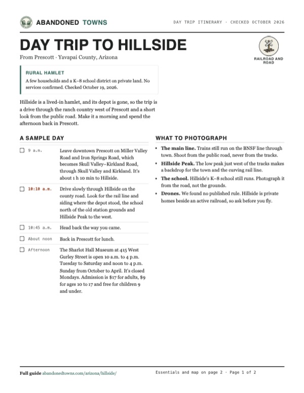
Plan a day trip to Hillside from Prescott
Take it with you
Day trip itinerary
The essentials, the sample day with boxes to tick, what to photograph and the coordinates, on two printable pages. Handy where there's no signal.
Download the PDF (335 KB)Hillside is a lived-in hamlet, and its depot is gone, so the trip is a drive through the ranch country west of Prescott and a short look from the public road. Make it a morning and spend the afternoon back in Prescott.
A sample day
- Leave downtown Prescott on Miller Valley Road and Iron Springs Road, which becomes Skull Valley–Kirkland Road, through Skull Valley and Kirkland. It's about 1 h 10 min to Hillside.
- Drive slowly through Hillside on the county road. Look for the rail line and siding where the depot stood, the school north of the old station grounds and Hillside Peak to the west.
- Head back the way you came.
- Back in Prescott for lunch.
- The Sharlot Hall Museum at 415 West Gurley Street is open 10 a.m. to 4 p.m. Tuesday to Saturday and noon to 4 p.m. Sunday from October to April. It's closed Mondays. Admission is $17 for adults, $9 for ages 10 to 17 and free for children 9 and under.
What to photograph and film
- The main line. Trains still run on the BNSF line through town. Shoot from the public road, never from the tracks.
- Hillside Peak. The low peak just west of the tracks makes a backdrop for the town and the curving rail line.
- The school. Hillside's K–8 school still runs. Photograph it from the road, not the grounds.
- Drones. We found no published rule. Hillside is private homes beside an active railroad, so ask before you fly.
Map & directions
Getting there
Prescott is the closest city, a little over an hour away on county roads through Skull Valley and Kirkland. From Phoenix the routed approach goes through Wickenburg and up AZ 89, then finishes on about 20 miles of Date Creek Road, which is dirt. We haven't driven either route.


Base map: USGS The National Map (public domain). Routes: OSRM on © OpenStreetMap contributors data (ODbL), computed October 2026. Times assume dry roads.
- From downtown Prescott, take Cortez Street, Gurley Street and Grove Avenue to Miller Valley Road.1.7 mi
- Turn left on Iron Springs Road and follow it west. It continues as Skull Valley–Kirkland Road through Skull Valley to Kirkland.24.8 mi
- Continue west on Kirkland–Hillside Road (County Road 15).15.8 mi
- Turn left on AZ 96, which becomes South Date Creek Road at the townsite.1.0 mi
- From downtown Phoenix, take Van Buren Street to Grand Avenue (US 60) and follow it northwest to Wickenburg.53.5 mi
- In Wickenburg, follow the US 93 bypass north through its roundabouts.5.9 mi
- Bear right onto AZ 89, the Wickenburg–Prescott Highway.11.8 mi
- Northeast of Congress, turn left on Date Creek Road (County Road 62), a dirt road, and follow it north to Hillside.20.4 mi
Road and safety notes
- OpenStreetMap marks Date Creek Road (County Road 62) as dirt. In 2002 Bill Peck wrote that the old road south to Congress was dangerous in flood season at the Date and Cottonwood Creek crossings. Never drive into running water.
- The Prescott route uses main county roads, but OpenStreetMap doesn't record the surface on most of the Kirkland–Hillside stretch, so we can't confirm it is paved all the way.
- Hillside is private homes beside a busy BNSF main line. Stay on public roads and off the tracks.
- We couldn't confirm any store or fuel in Hillside. Fill up in Prescott or Wickenburg, and carry water in summer.
Photos
Have photos of Hillside?
We haven’t added more photographs of Hillside yet. If you’ve visited, share your photos and a field report below.
The Sharlot Hall Museum archives hold historic photographs of the town and Hillside Mine.
Visitor reports
Been to Hillside?
Been there lately? Tell the next visitor what you found: whether you could get in, the state of the road and what's still standing. Photos are welcome. We read every report before it appears here.
Railroad and road
More railroad, road and fort ghost towns
The nearest in Arizona.

 Guide
Stanton
34.17, -112.73Yavapai County, Arizona
A stage stop at the foot of Rich Hill that took the name of its most notorious resident. A prospecting club owns it now and keeps it for members.
 Guide
Glen Oaks
34.44, -112.55Yavapai County, Arizona
A name on the Prescott–Wickenburg highway that appears on the 1947 map and is marked a site by 1969. The written record is nearly empty, so this page…
Nearby
Other sites near Hillside
Straight-line distance from the townsite to other mapped sites in our Arizona index.
- Congress Mine15.5 mi S · Yavapai
- Congress15.8 mi S · Yavapai
- Yarnell16.7 mi SE · Yavapai
- Congress Junction18.4 mi S · Yavapai
- Placerita18.6 mi SE · Yavapai
- Stanton20.5 mi SE · Gila
- Stanton20.5 mi SE · Yavapai
- Glen Oaks21.1 mi E · Yavapai
Sources
Sources and credits
- ghosttowns.com, "Hillside": fact sheet fields (roads, climate, best time). Its legal description doesn't match the townsite.
- Wikipedia, "Hillside, Arizona", retrieved October 2026: coordinates and elevation (GNIS), post office date and name origin (from Arizona Place Names), county roads, the school district.
- Phil M. Blacet, "John Lawler's Hillside Bonanza", Sharlot Hall Museum Days Past (July 2014): the 1887 discovery, location, 61 years of work and 1951 closing.
- William Peck, "Hillside's First Cat Problem, and Other Reminiscences", Days Past (February 2001): the station's name, the Bagdad railhead, 1940s rail service and mail, the 1510 legend.
- William Peck, "Railroad was the 'Gateway' for Rural Areas of Yavapai", Days Past (March 2002): the Darnell store, the depot's Western Union office, electricity in 1952, the flood-prone road to Congress, the locomotive story.
- William Peck, "Memories of 1940s Hillside, Arizona", Days Past (July 2008): the Hillside Store and Bar.
- Wikipedia, "Santa Fe, Prescott and Phoenix Railway", retrieved October 2026: construction dates.
- Wikipedia, "List of passenger train stations in Arizona" and Dixon History, "Hillside Arizona Santa Fe Railroad Station" (December 2022): the 1902 depot, the 1929 photograph, last passenger service, the move to Prescott.
- Hillside School District #35, checked October 2026: K–8 grades, about 10 students, 2026–27 calendar.
- Sharlot Hall Museum, "Hours & Admission", as of October 2026: hours, closed days and admission.
- Legal description: BLM PLSS survey grid. Land status: BLM surface management map. Road surfaces: OpenStreetMap, October 2026. Routes: OSRM on OpenStreetMap data, October 2026. Not field-checked.
Photo and map credits
- Hillside around its siding on the Santa Fe line, with the school to the north, USGS Hillside sheet, 1969: U.S. Geological Survey, USGS catalog, Public domain
- Area base map, topo and aerial imagery: USGS The National Map (public domain).
- Historic maps: USGS Historical Topographic Map Collection (public domain): Prescott 1892, 1:250,000; Congress 1903, 1:125,000; Prescott 1954, 1:250,000; Hillside 1969, 1:24,000; Bradshaw Mts 1981, 1:100,000.