 Abandoned

Overview
Where the Lynx Creek gold rush began

Walker sits at about 6,290 feet on upper Lynx Creek, in the ponderosa pines of the Bradshaw Mountains about 12 road miles southeast of downtown Prescott. It carries the name of Joseph Reddeford Walker, the mountain man whose prospecting party found gold here in 1863. Guided by Jack Swilling, the party followed the Hassayampa into the mountains that spring, found color near its headwaters, and then struck real ore on Lynx Creek. Word of the find pulled the new territory's officials north from Tucson, and the capital was laid out at Prescott, a few miles from the diggings, in 1864.
For years the camp was a string of log cabins, claims and small mills along the creek. Smelters were tried in 1880 and 1882, fed by charcoal burned in stone kilns, and both failed for lack of fuel. A post office opened in 1879. The hard-rock mines carried on into the 20th century. In 1904 the Poland Mining Company finished an 8,071-foot tunnel under the ridge so Walker ore could reach the railroad at Poland, and the Sheldon Mine, about a mile southwest of town, built a flotation plant in 1924. The tunnel's National Register nomination says every mine in the area had closed by 1930, and the post office followed in 1940.
By 1973 a Forest Service forester was describing Walker as a quiet summer-home and resort area, and it still is. Cabins and houses sit among old mine dumps, and a volunteer fire station stands on Walker Road. The historic layer takes some looking for. The best-preserved piece is the beehive charcoal kiln on the national forest just outside town.
Timeline
From gold strike to summer homes
- Joseph R. Walker's prospecting party follows the Hassayampa into the mountains, finds color near its headwaters and then richer gold on Lynx Creek.
- The territorial government settles near the diggings. Prescott is founded a few miles away, and Fort Whipple moves beside it in May.
- Walker gets a post office.
- A small smelter financed by a Mr. Dake goes up on Lynx Creek. A sign at the charcoal kiln dates the kiln to about this year.
- The Howells Smelting and Mining Company builds a larger smelter. It runs for less than a year, short of fuel like the first.
- Work starts on a tunnel from the Poland side of the mountain, at first to bring water to a planned mill.
- A second heading starts from Walker to meet it.
- The 8,071-foot Poland Tunnel is finished at a cost of $500,000. Walker ore now rides under the mountain to the railroad at Poland.
- The Lynx Creek mines close. The tunnel sits idle until 1915.
- The tunnel reopens and hauls ore from the Sheldon Mine for about five years.
- Motor haulage restarts in the tunnel. The Sheldon Mine builds a 200-ton flotation plant in 1924.
- All the mines in the area shut down, according to the tunnel's National Register nomination.
- The post office closes.
- Both tunnel entrances are filled in for safety.
- The Walker Charcoal Kiln is listed on the National Register of Historic Places.
- The EPA caps the Sheldon Mine tailings, which had been leaching arsenic and lead into Lynx Creek.
- Walker is a community of cabins and homes with its own volunteer fire association. The Forest Service lists it among the communities in a prescribed-fire project approved in August.
What's historic
Telling the old camp from the new homes
Almost everything you see from Walker Road is newer than the mining camp. The homes and cabins stand on private land, mostly old patented mining claims, in a patchwork with Prescott National Forest. Some of the level house lots along Lynx Creek are a mining relic too. Crews digging the Poland Tunnel dumped their waste rock on the boulder-strewn creek banks and made flat ground of it.
Historic. The charcoal kiln (about 1880) is the best-preserved relic. In 1973 the Forest Service counted it, the shafts and mine dumps, and the piles of placer rock in Lynx Creek as about all that was left of the camp. The old maps below fill in the rest. The 1887 sheet shows no Walker at all, only Howells, a camp about a mile down today's Walker Road. By 1903 Walker is on the map with mine symbols up and down the creek, and Poland and Providence over the ridge. The 1974 sheet names the Mudhole, Victor, Mark Twain and Pine Mountain mines around the townsite, with their dumps drawn in. The Walker portal of the Poland Tunnel opened near the Mud Hole mill, close to today's fire station; it was filled in 1949, and the 1977 nomination found it completely overgrown. A pink sedan on Pink Car Road has been a roadside landmark since 1939, according to the Highlands Center guide, and is chained down after a 2011 student prank.
Modern. The fire station, the houses, and the cluster of more than a hundred mailboxes at the Lynx Creek bridge are all recent. The townsite sign south of the Big Bug Mesa Road junction is a later marker, not a camp relic.
Cleaned up. The Sheldon Mine's waste rock and tailings leached acid runoff after storms. EPA sampling in 2005 and 2012 found high arsenic and lead reaching Lynx Creek and Lynx Lake, and in 2013 the EPA covered the tailings pile. Stay off mine dumps and tailings here.
- Charcoal kiln (about 1880)
- Mudhole Mine dumps
- Sheldon Mine site (capped 2013)
- Placer rock piles on Lynx Creek
- Walker portal of the Poland Tunnel (filled 1949)
- Pink car landmark (1939)
- Townsite sign


Walker Charcoal Kiln
A beehive of dry-laid granite

The kiln stands on Prescott National Forest land near the old Poland Junction Mine. It is built of local granite with no mortar, in a beehive shape about 25 feet high; the 1973 nomination gives its base as 50 feet across. Vent holes ring the bottom. An 8-by-4-foot door at ground level was used to stack wood and pull out charcoal, and a smaller door near the top was probably reached by a ramp from an upper service road.
It turned local oak into charcoal. The sign at the site credits Jake and Joe Carmichael with building it around 1880 to supply the local smelters, and says the forest was cut so hard for charcoal and mine timbers in the late 1800s that it is only now becoming productive again. The Forest Service nomination names no builder. It ties the kiln to the short-lived smelters of 1880 and 1882 and guesses the kiln worked only briefly too. In 1973 it noted only one other kiln of this type in Arizona.
The kiln went on the National Register of Historic Places on October 8, 1976.
1897–1949
A railroad tunnel under the mountain

Walker's mines had gold and silver but no cheap way to ship ore. Frank Murphy of the Congress Mine set out to extend his Prescott and Eastern Railroad to Mayer in 1898, and in 1902 a nine-mile spur reached Poland on Big Bug Creek, over the ridge from Walker. The tunnel joined the two. Work began on the Poland side in 1897 and on the Walker side in 1900. In November 1902 hand drillers working around the clock were making about three and a half feet a day; power drills arrived the next month.
When it opened in 1904 the tunnel was 8,071 feet long, 8 feet high and 12 feet wide, with two narrow-gauge tracks. It saved Lynx Creek shippers a 14-mile haul by mule and wagon over the mountain, and the Poland Mining Company charged tolls to other users. The 1977 National Register nomination says mules first pulled the ore cars, then smaller donkeys when the damp ground swelled on the Walker side, and finally a small engine. A 2023 Sharlot Hall Museum article describes electric cars. The sources differ and may be describing different years.
Children from Poland walked through the tunnel to school in Walker, and locals used it as a shortcut until the Walker end began to cave. Both entrances were filled in 1949. The Poland end was reopened briefly in 1956 for exploration and is the portal in the photo above.
Historic maps
Walker on USGS maps, 1887–1981
Crops from the USGS Historical Topographic Map Collection, centered on the townsite. Each sheet shows what surveyors mapped that year; compare them with today's topo and aerial on this page.

Day trip
Plan a day trip to Walker from Prescott
Take it with you
Day trip itinerary
The essentials, the sample day with boxes to tick, what to photograph and the coordinates, on two printable pages. Handy where there's no signal.
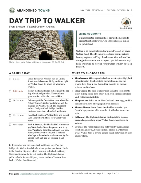
Download the PDF (654 KB)Walker is 20 minutes from downtown Prescott on paved Walker Road. The old camp is scattered among private homes, so plan a half day: the charcoal kiln, a slow drive through the townsite and a stop at Lynx Lake on the way back. We found no store or restaurant in Walker, so eat in Prescott.
A sample day
- Leave downtown Prescott east on Gurley Street, which becomes AZ 69, and turn right on Walker Road. It's about 20 minutes to Walker.
- Stop at the townsite sign just south of the Big Bug Mesa Road junction. Then walk the quarter-mile trail to the charcoal kiln.
- Drive on past the fire station, near where the Poland Tunnel's Walker portal was, and the pink car on Pink Car Road. The pavement ends at the Lynx Creek bridge, beside a cluster of more than a hundred mailboxes.
- Head back north on Walker Road and stop at Lynx Lake's North Shore for a walk by the water.
- Back in Prescott, the Sharlot Hall Museum at 415 West Gurley Street is open 10 a.m. to 4 p.m. Tuesday to Saturday and noon to 4 p.m. Sunday from October to April. It's closed Mondays. Admission is $17 for adults, $9 for ages 10 to 17 and free for children 9 and under.
In dry weather you can come back a different way. Past the bridge, dirt Walker Road climbs about 4 miles past Potato Patch to the Senator Highway, which runs 10.9 miles back to Gurley Street and is paved for its last stretch. The Highlands Center guide calls the Senator Highway the smoother of the two. Turn back if Walker Road is muddy.
What to photograph and film
- The charcoal kiln. A granite beehive about 25 feet high, laid without mortar. Step back to fit the whole dome and the ground-level door in one frame, then move in for the vent holes around the base.
- Lynx Creek. The piles of placer rock along the creek are the oldest mining traces here. Shoot them from the road or forest land, not from private lots.
- The pink car. It has sat on Pink Car Road since 1939, and it's chained down now. Photograph it from the road.
- The mailboxes. More than a hundred boxes at the Lynx Creek bridge, numbered in no order. A wide shot shows the scale.
- Fall color. The Highlands Center guide points to maples, oaks and aspens along upper Walker Road, above town, in autumn.
- Drones. The Forest Service lets hobbyists fly over national forest land under FAA rules but bans drones in wilderness areas. Walker itself is private homes, so ask before you fly over anyone's land.
Map & directions
Getting there
Prescott is the closest city, about 12 miles away. Both routes end on Walker Road, which leaves AZ 69 at a traffic light at milepost 293 and runs south past the Lynx Lake recreation area into the pines. It is paved as far as the Lynx Creek bridge in Walker.


Base map: USGS The National Map (public domain). Routes: OSRM on © OpenStreetMap contributors data (ODbL), computed October 2026. Times assume dry roads.
- From downtown Prescott, take Cortez Street to Gurley Street and turn right, heading east.1.3 mi
- Gurley Street becomes AZ 69. Continue east.3 mi
- Turn right onto Walker Road and follow it south past Lynx Lake into Walker. The townsite sign is just south of the Big Bug Mesa Road junction, and the fire station a little farther on.7.2 mi
- From downtown Phoenix, take Central Avenue, Roosevelt Street and 3rd Avenue to I-10 west, then take exit 143A onto I-17 north.3.2 mi
- Follow I-17, the Black Canyon Freeway, north.60.6 mi
- Take exit 262 and follow AZ 69 northwest toward Prescott.31.2 mi
- Turn left onto Walker Road and follow it south to Walker.7.2 mi
Road and safety notes
- Walker Road is paved to the Lynx Creek bridge in Walker. Past the bridge it turns to dirt toward Potato Patch and Hassayampa Lake; the Highlands Center guide says to turn back if it is muddy after rain.
- Most land along the road is private homes and mining claims mixed with national forest. Stay on public roads and forest land, and keep off mine dumps and tailings.
- We found no current Forest Service page for the short trail to the charcoal kiln. Ask the Bradshaw Ranger District in Prescott (928-443-8000) about access before you go.
- Walker is near 6,300 feet, and winter can bring snow.
- In August 2026 the Forest Service approved prescribed burning and other fuel work on about 65,575 acres around Walker and nearby communities. Watch for smoke and burn notices.
Photos
Walker and Lynx Creek in photos
Visitor reports
Been to Walker?
Been there lately? Tell the next visitor what you found: whether you could get in, the state of the road and what's still standing. Photos are welcome. We read every report before it appears here.
Gold mining
More gold mining ghost towns
The nearest in Arizona.

 Guide
Venezia
34.39, -112.42Yavapai County, Arizona
A small mill camp in Crooks Canyon, named for Venice by an Italian settler. It had a post office for 19 years, and the Forest Service bulldozed what…
 Guide
Big Bug
34.45, -112.28Yavapai County, Arizona
A gold camp of about 100 people on Big Bug Creek, 12 miles southeast of Prescott, built around Theodore Boggs's mines and smelter. The post office…
Nearby
Other sites near Walker
Straight-line distance from the townsite to other mapped sites in our Arizona index.
Sources
Sources and credits
- ghosttowns.com, "Walker": fact sheet fields (roads, legal description, climate, best time, remains, post office dates) and the 2,700 population figure.
- Wikipedia, "Walker, Arizona", retrieved October 2026: coordinates (GNIS 35817), elevation, the 1890 and 1920 atlas population figures.
- Wikipedia, "Walker Charcoal Kiln": National Register listing, the Carmichael brothers and forest-cutting text of the site sign.
- National Register nomination, "Walker Charcoal Kiln" (Prescott National Forest, 1973): kiln description, the 1880 and 1882 smelters, peak population, Walker as a summer-home area.
- National Register nomination, "Poland Tunnel" (Arizona State Parks, 1977): tunnel dimensions and construction, mine closures of 1907 and 1930, the 1949 closure, the school walk.
- Sharlot Hall Museum, Days Past, "Joseph R. Walker Part 2" (Andrew Wallace, 2013): the Walker party's route and the Lynx Creek strike, the move of the capital.
- Sharlot Hall Museum, Days Past, "Prescott's Rose and Jack Martin" (Marjory J. Sente, 2023): tunnel length, cost, tracks, cars and tolls.
- Sharlot Hall Museum photo archive, "Sheldon Mine": location, production before 1922, the 1924 flotation plant.
- U.S. EPA, Sheldon Mine Site: contamination findings and the 2013 tailings removal.
- Highlands Center for Natural History, Hike Spree 9B driving directions (2026): Walker Road mileposts, pavement end, fire station, mailboxes, pink car, road advice, the dirt road to Potato Patch and the Senator Highway, the 10.9 miles back to Gurley Street, fall color.
- Arizona Daily Star, January 13, 2019 (updated 2020): the quarter-mile trail to the kiln near the Walker Road and Big Bug Mesa Road junction.
- Prescott National Forest, "Lynx Lake North Shore Picnic Site", as of October 2026: day-use fee, free Wednesdays, hours, toilets, drinking water.
- Sharlot Hall Museum, "Hours & Admission", as of October 2026: hours, closed days and admission.
- USDA Forest Service, recreational drone use: FAA rules apply, and drones are banned in wilderness.
- Highlands Center, Gold Pan trail map (2026): Walker Road (Yavapai County 57) at AZ 69 milepost 293.
- Walker Fire Protection Association: board minutes through September 2026 and the fire station on East Walker Road, as current status.
- Prescott National Forest, Bradshaw Vegetation Management 2 project (updated September 2026): Walker among the communities in the project area, acreage and decision date.
- Elevation: USGS 3D Elevation Program point query. Routes: OSRM on OpenStreetMap data, October 2026. Status checked against the sources above on October 19, 2026.
Photo and map credits
- The Walker Charcoal Kiln, built about 1880: Benjamin Cody, Wikimedia Commons, CC BY-SA 3.0
- The Poland end of the Poland Tunnel, 2016: Azglenn, Wikimedia Commons, CC BY-SA 4.0
- Hydraulic-mining pipe in the lower Lynx Creek district, Prescott Valley: Marine 69-71, Wikimedia Commons, CC BY-SA 4.0
- Lynx Lake, on Walker Road north of town, 2007: Benjamin Cody, Wikimedia Commons, CC BY-SA 3.0
- Lynx Lake in June 1972: Cornelius M. Keyes, Wikimedia Commons, Public domain
- Walker on Lynx Creek among mine symbols, USGS Bradshaw Mountains sheet, 1903: U.S. Geological Survey, USGS catalog, Public domain
- Topo map, area base map and aerial imagery: USGS The National Map (public domain).
- Historic maps: USGS Historical Topographic Map Collection (public domain): Prescott 1887, 1:250,000; Bradshaw Mountains 1903, 1:125,000; Mt Union 1947, 1:62,500; Groom Creek 1974, 1:24,000; Bradshaw Mts 1981, 1:100,000.