 Abandoned
Overview
The town that zinc built

Rush lies in a narrow valley on Rush Creek, a short way above its mouth on the Buffalo River, 15.7 miles by road southeast of Yellville. Prospectors came here in the early 1880s chasing tales of lost silver mines and found flakes they took for silver. In 1886 they built a rock smelter by the creek. When it was fired in January 1887, zinc oxide fumes poured out and no silver collected. The ore was zinc. That is the Encyclopedia of Arkansas's account. The Park Service tells it differently. It dates the first zinc find on Rush Mountain to 1880 and the Morning Star Mine to 1885, before the smelter test.
Zinc turned out to be worth mining. The Morning Star Mine became the biggest operation in the district, and ten companies worked 14 mines by the Park Service's count (Wikipedia says 13). Demand peaked with World War I, and Rush became the center of Arkansas's zinc industry. Estimates of its size vary: the National Park Service puts the peak at 2,000 to 3,000 people, and the Encyclopedia of Arkansas at almost 5,000. Papers to incorporate it as a city were filed in 1916.
The boom ended with the war. By 1920 the Park Service counts 344 people, and the last Morning Star workings shut in 1931. Residents who stayed on advertised "Rush Ghost Town" to tourists. The post office closed in the mid-1950s. In 1972 the valley became part of Buffalo National River, and today the Park Service keeps the store, the smelter, a row of houses and the mill ruins as a historic district you can walk through.
Timeline
Silver hopes, zinc boom, national river
- Prospectors looking for silver find metallic flakes along Rush Creek. The NPS dates the zinc discovery on Rush Mountain to 1880.
- The Morning Star Mine opens, by the NPS's account. It becomes the district's largest operation.
- A rock smelter goes up on Rush Creek to separate silver from the ore.
- The smelter's test run gives off zinc oxide fumes and no silver collects. The ore is zinc. The Encyclopedia of Arkansas dates the start of mining at the Morning Star to just after this test.
- A six-ton zinc mass called "Jumbo" goes on show at the World's Columbian Exposition in Chicago, by the NPS's account. The Encyclopedia of Arkansas describes a 13,000-pound nugget from the Morning Star winning blue ribbons at the Chicago fair and dates it 1892.
- Most of the one-story frame houses of House Row are built.
- World War I drives zinc demand and sales rise sharply. Advertisements promise easy fortunes at Rush, and the workforce grows.
- Papers are filed to incorporate Rush as a city.
- The boom ends with the war. By 1920 the population is down to 344.
- The blacksmith shop that still stands is built.
- The last of the Morning Star workings closes. Residents later advertise "Rush Ghost Town" and build campgrounds and cabins.
- The post office closes.
- Congress creates Buffalo National River, and Rush becomes part of the park's lands.
- The Park Service improves Rush Road, stabilizes buildings and builds fences.
- The Rush Historic District, 1,316 acres, is listed on the National Register of Historic Places.
- The blacksmith shop is stabilized.
What's left
Store, smelter and House Row

The Park Service lists the Taylor-Medley General Store, the Rush Blacksmith Shop (built in 1925 and stabilized in 1989), the 1886 smelter and House Row, a line of mostly one-story frame houses from about 1899. The Morning Star Hotel and Mill survive as ruins. Only the site is left of the Hicks Hotel and Hicks General Store, along with the Hicks Wall, cobblestone columns and concrete stairs. Piers of an ore tramway stand near the Morning Star Mill, and an NPS inventory photo records the concrete piers of the New White Eagle Mill in the district. The hills of waste rock on the slopes look natural but came out of the mines.
The mine openings are fenced or gated, and the park closes all abandoned mines to entry. Floods and arson have damaged several buildings, so treat what's standing gently.
- Taylor-Medley General Store
- Rush Blacksmith Shop (1925)
- Rush Smelter (1886)
- House Row (about 1899)
- Morning Star Hotel and Mill ruins
- Hicks Hotel and store site, Hicks Wall
- Tramway piers
- New White Eagle Mill piers
- Fenced mine entrances and waste rock piles


On foot
Two trails through the mines
The Morning Star Interpretive Loop is about a quarter mile on gravel. It starts at a small gravel parking lot on the left of Rush Road, with a wooden shelter and signs, just past the houses, the general store, the smelter and the Rush Creek crossing. It has short steep pitches but suits families.
The Rush Mine Level Trail starts at the top of the loop and runs 1.5 miles one way. It is very steep at first, then levels out past fenced mine entrances and ends at the Rush launch parking lot at the end of the road, where you can also start it. The Park Service suggests 1 to 4 hours for the two.
The old sheets in the historic maps below show the town from the start. The 1893 and 1903 Yellville sheets mark Rush on Rush Creek near its mouth, with a neighbor to the southwest labeled Sylva (Desoto Springs) in 1893 and Sylva in 1903. By 1929 it is De Soto. The 1966 Rea Valley sheet shows the buildings strung along the road, benchmark 522 and a mine on the slope east of town.
Historic maps
Rush on USGS maps, 1893–1985
Crops from the USGS Historical Topographic Map Collection, centered on the townsite. Each sheet shows what surveyors mapped that year; compare them with today's topo and aerial on this page.

Day trip
Plan a day trip to Rush from Yellville
Take it with you
Day trip itinerary
The essentials, the sample day with boxes to tick, what to photograph and the coordinates, on two printable pages. Handy where there's no signal.
Download the PDF (658 KB)From Yellville, Rush makes an easy half day: a slow drive down the valley past the houses, store and smelter, the short Morning Star loop, then the Mine Level Trail if your legs are up to the first climb. The park pages list no store or café at Rush, so bring lunch and water.
A sample day
- Leave Yellville on AR 14 south and turn onto Rush Road, about 36 minutes in all.
- Park at the small gravel lot with the wooden shelter. Walk back along the road to the houses, store and smelter just before it, then take the quarter-mile Morning Star Interpretive Loop.
- From the top of the loop, take the Mine Level Trail past the fenced mine entrances. It ends at the Rush launch lot, 1.5 miles on.
- Walk back the way you came, or have lunch by the river at the launch first.
Recreation.gov warns that the two creek crossings into Rush can flood after heavy rain. If it has been wet, call the park at 870-439-2502 before you set out.
What to photograph and film
- The general store. The Taylor-Medley General Store, by the road on the way to the trailhead. Step back down the road to set it in the trees.
- The smelter. The 1886 rock smelter that proved the ore was zinc. It stands by the road near the Rush Creek crossing, just before the trailhead lot.
- House Row. The frame houses of about 1899 line up along the valley. Fall color behind them works well.
- Mine entrances. The fenced portals on the Mine Level Trail. Shoot through the fencing; don't climb it.
- Rush Creek. The creek and the waste rock hills show how the mines reshaped the valley.
Map & directions
Getting there
Yellville is the closest town, about 36 minutes away. From Little Rock the route runs north on US 65 to Marshall, then AR 27 and AR 14. Both end on Rush Road (County Road 6035), which runs down the valley to the townsite.

Base map: USGS The National Map (public domain). Routes: OSRM on © OpenStreetMap contributors data (ODbL), computed October 2026. Times assume dry roads.
- From downtown Yellville, head out on US 62/US 412.0.3 mi
- Turn right on AR 14 and follow it south.11.5 mi
- Turn left on Rush Road (County Road 6035) and follow it down to the townsite.4.0 mi
- From the State Capitol, take Broadway across the Arkansas River to North Little Rock, then Pike Avenue and MacArthur Drive (AR 365) to I-40.4.8 mi
- Follow I-40/US 65 west to Conway.26.1 mi
- Exit to US 65 and follow it north through Greenbrier and Clinton to Marshall.64.6 mi
- In Marshall, take AR 27 north to Harriet.10.6 mi
- Continue on AR 14 to Rush Road.12.1 mi
- Turn sharp right on Rush Road (County Road 6035) to the townsite.4.0 mi
Road and safety notes
- The Park Service's trail page says about 10 miles south on AR 14 from Yellville, then left on County Road 6035 for 5 miles to the trailhead. Its Recreation.gov listing says 11 miles on AR 14, then about 4 miles on County Road 6035 to the County Road 635 turnoff. Our routed figures to the townsite are 11.5 and 4.0.
- Recreation.gov warns that the two creek crossings leading into Rush can flood in heavy rain. Never drive into a flooded crossing.
- Rush Campground lies 1.5 miles down County Road 635, off Rush Road. It is walk-in tent camping only. The park bans RVs and pull-behind campers there because the roads in are narrow, steep and winding (Superintendent's Compendium, December 2025).
- Hunting is allowed in most of the park's backcountry, though not within 150 yards of a trail or developed area. The Park Service suggests hikers wear bright orange in hunting season.
- Cell service is unreliable in the park. Buffalo National River's 24-hour dispatch number is 1-888-692-1162.
Photos
Rush in photos
Visitor reports
Been to Rush?
Been there lately? Tell the next visitor what you found: whether you could get in, the state of the road and what's still standing. Photos are welcome. We read every report before it appears here.
Other mining and oil
More lead, iron, mercury and oil ghost towns
The nearest, in other states.

 Guide
Carson
36.71, -91.80Howell County, Missouri
A village on the Frisco railroad by Jack Carson's iron mines, with a post office from 1908 to 1928. The record is thin and we don't know what is…
 Guide
Phenix
37.38, -93.55Greene County, Missouri
A company town built around a marble quarry on Sugar Creek, once among the biggest stone producers west of the Mississippi. The town emptied, but the…
Nearby
Other sites near Rush
Straight-line distance from the townsite to other mapped sites in our Arkansas index.
- Bruno11.6 mi W · Marion
- Eros16.0 mi W · Marion
- Zinc21.8 mi NW · Boone
- Harness22.0 mi SE · Stone
- Dubuque30.8 mi NW · Boone
- Racket Ridge40.7 mi S · Van Buren
- Booger Hollow45.2 mi SW · Pope
- Moko46.8 mi NE · Fulton
Sources
Sources and credits
- ghosttowns.com, "Rush": fact sheet fields (roads, climate, best time).
- Wikipedia, "Rush Historic District" and "Rush Creek mining district", retrieved October 2026: acreage, National Register date, center of the state's zinc industry in World War I, 13 developed mines, coordinates (GNIS).
- National Park Service, "Rush Historic District Cultural Landscape", updated January 21, 2026: discovery, Morning Star Mine, smelter, Jumbo, mines and companies, population 2,000–3,000 and 344 in 1920, 1931 closing, "Rush Ghost Town" tourism, surviving buildings and ruins, 1980s work, flood and arson damage, open to the public. (The article places the district in Boone County; the GNIS coordinates and Wikipedia put Rush in Marion County.)
- National Park Service, "Hike the Rush Mine Level Trail and Morning Star Interpretive Loop", updated June 21, 2024: trail lengths, trailheads, directions, year-round hours, pets, terrain.
- Buffalo National River, "Fees & Passes", updated August 31, 2026: no entry or day-use fee; Rush Campground's vault toilet, drinking water and water season.
- Buffalo National River, "Hiking Trails", updated February 22, 2026: Rush Mine Level Trail among the Lower District hikes, the trails open to dogs (Rush's are not), hunting season advice, unreliable cell service, park phone (Tyler Bend Visitor Center) and 24-hour dispatch number.
- Buffalo National River, Superintendent's Compendium, section 1.5, updated December 27, 2025: drone ban, abandoned mines closed to entry, campground visiting hours, Rush Campground tents only and why, hunting buffer.
- Buffalo National River, "Alerts & Conditions", read October 21, 2026: no alert or closure for Rush.
- Encyclopedia of Arkansas, "Rush (Marion County)" by Bill Dwayne Blevins, updated May 9, 2025: silver hunt, 1887 smelter test, population, 1916 incorporation, post office closing, 1972.
- Recreation.gov, "Rush Campground", the NPS's own listing, read October 2026: year-round vault restroom, hand-pump water season, the two creek crossings that flood, vehicle rules, directions, pet rule for park trails.
- Wikimedia Commons, "White Eagle New Mill Piers": the NPS inventory photo that names the New White Eagle Mill ruins in the district.
- Elevation: USGS 3D Elevation Program point query. Routes: OSRM on OpenStreetMap data, October 2026.
Photo and map credits
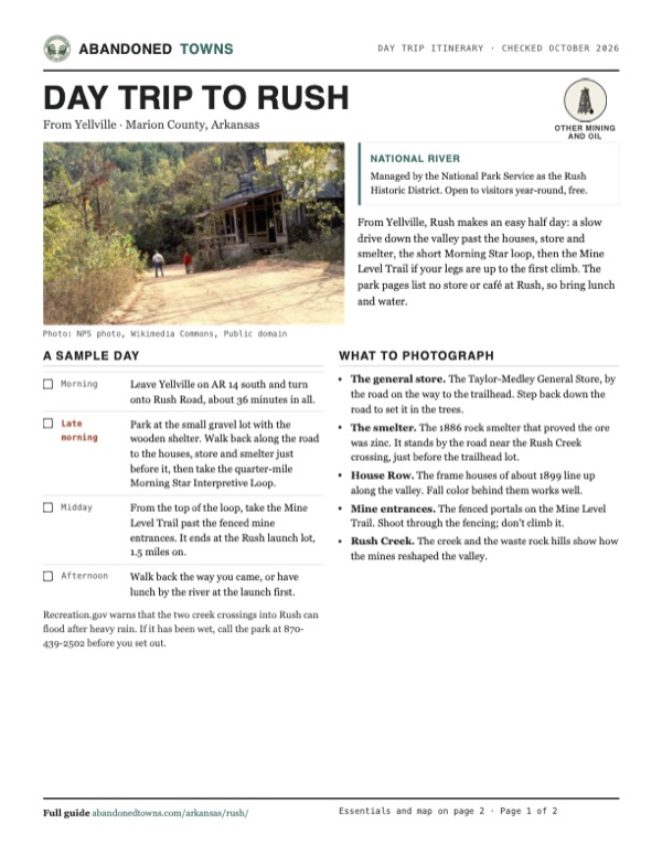
- Visitors on the road past an old mercantile building (undated NPS photo): NPS photo, Wikimedia Commons, Public domain
- Piers of the New White Eagle Mill (undated NPS inventory photo): National Park Service inventory, Wikimedia Commons, Public domain
- Area base map, topo and aerial imagery: USGS The National Map (public domain).
- Historic maps: USGS Historical Topographic Map Collection (public domain): Yellville 1893, 1:125,000; Yellville 1903, 1:125,000; Yellville 1929, 1:125,000; Rea Valley 1966, 1:24,000; Bull Shoals Lake 1985, 1:100,000.