 Abandoned
Overview
Two miles up, and empty every winter

Animas Forks sits where the West Fork and North Fork join the Animas River, about 12 miles northeast of Silverton and above 11,000 feet. The first log cabin went up in 1873 and a post office opened in 1875. By 1876 the camp had 30 cabins, a hotel, a store and a saloon, and by 1883 about 450 people lived here. It had its own newspaper, the Pioneer, from 1882 to 1886.
The altitude ruled life. Every fall most of the town moved down to Silverton, and in 1884 a 23-day blizzard dropped 25 feet of snow. Mining and mills kept the camp going, with a late revival when the Gold Prince Mill was built in 1904. The mill closed in 1910, the post office in 1915, and in 1917 the mill's main parts went to Eureka. By the 1920s it was a ghost town.
Today the Bureau of Land Management owns the townsite. Grants paid to stabilize the buildings in the late 1990s and to restore them in 2013 and 2014, and the site went on the National Register in 2011. The BLM counts close to 400,000 visitors a year on the Alpine Loop and calls the Animas Forks buildings popular architectural attractions.
Video
Animas Forks in 30 seconds
A mining camp above 11,000 feet: Main Street in the late 1800s, cabins on the slope, a restored house and the townsite below Cinnamon Pass.
Timeline
From first cabin to restoration


- The town's first log cabin is built.
- The Animas Forks post office opens, in Colorado Territory.
- By statehood the camp has 30 cabins, a hotel, a general store, a saloon and a post office.
- The Animas Forks Pioneer newspaper is published.
- About 450 people live here. Each fall most of them move down to Silverton for the winter.
- A 23-day blizzard buries the town in 25 feet of snow. Residents tunnel between buildings.
- The Silverton Northern Railroad builds to the area, by Wikipedia's account. The BLM says the railroad never met expectations.
- The Gold Prince Mill brings a short revival.
- The Gold Prince Mill closes.
- The post office closes.
- Most of the mill's major parts are removed for a new mill at Eureka. The BLM says the town is a ghost town by the 1920s.
- A State Historical Fund grant to San Juan County, with the BLM, pays to stabilize the buildings.
- A land swap makes the BLM the sole owner of the townsite.
- The townsite is listed on the National Register of Historic Places.
- A fuller restoration repairs the nine standing buildings and rebuilds the jail's roof.
- The BLM's Gunnison office reports that a cleanup of lead contamination at the town's historic buildings is still in planning.
What's left
What you'll see


Nine buildings stand. The restoration repaired their floors, walls, windows and doors, put cedar shingles back on several roofs and improved drainage. The jail, the oldest building on the site, got a rebuilt gable roof, and new interpretive signs went in during 2014. Wikipedia says the BLM provides brochures and maps at the parking area. Look from outside: the BLM's Alpine Loop guide says the historic buildings are unstable and asks visitors not to enter them. In 2025 the BLM also reported lead contamination at the buildings, with a cleanup still in planning.
The 1897 sheet below marks the town where the West Fork meets the Animas, with the Red Cloud Mine to the northwest and the Henson Mill to the southwest. The 1955 sheet labels it "Aband'd," with the Columbus Mine and the Bagley Tunnel just north.
- Nine stabilized buildings
- Jail (oldest building)
- Interpretive signs


Historic maps
Animas Forks on USGS maps, 1897–1982
Crops from the USGS Historical Topographic Map Collection, centered on the townsite. Each sheet shows what surveyors mapped that year; compare them with today's topo and aerial on this page.

Day trip
Plan a day trip to Animas Forks from Silverton
Take it with you
Day trip itinerary
The essentials, the sample day with boxes to tick, what to photograph and the coordinates, on two printable pages. Handy where there's no signal.
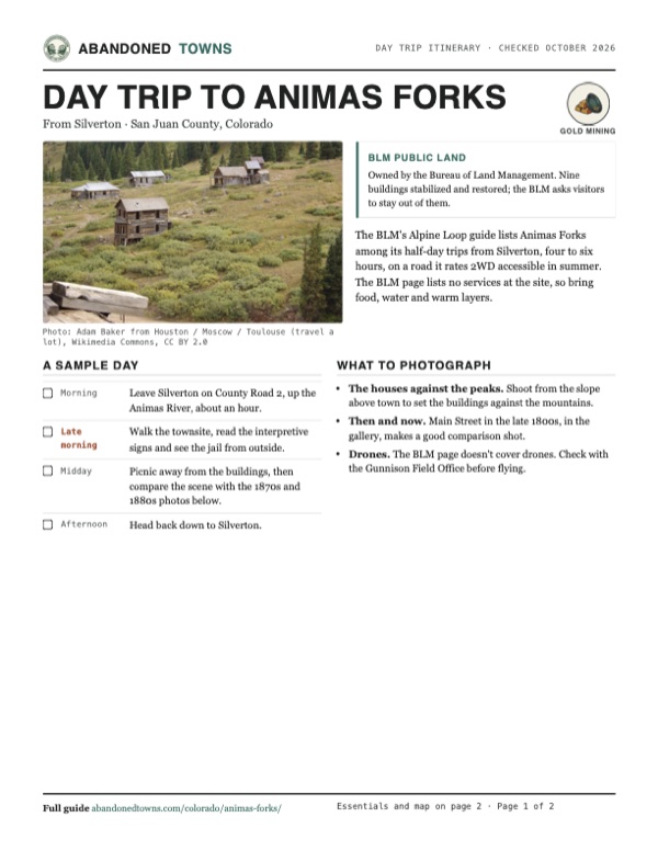
Download the PDF (587 KB)The BLM's Alpine Loop guide lists Animas Forks among its half-day trips from Silverton, four to six hours, on a road it rates 2WD accessible in summer. The BLM page lists no services at the site, so bring food, water and warm layers.
A sample day
- Leave Silverton on County Road 2, up the Animas River, about an hour.
- Walk the townsite, read the interpretive signs and see the jail from outside.
- Picnic away from the buildings, then compare the scene with the 1870s and 1880s photos below.
- Head back down to Silverton.
What to photograph and film
- The houses against the peaks. Shoot from the slope above town to set the buildings against the mountains.
- Then and now. Main Street in the late 1800s, in the gallery, makes a good comparison shot.
- Drones. The BLM page doesn't cover drones. Check with the Gunnison Field Office before flying.
Map & directions
Getting there
Silverton is the jumping-off point. County Road 2 leaves the north end of town and follows the Animas River up to the forks. From Durango, take US 550 north over the passes to Silverton first.


Base map: USGS The National Map (public domain). Routes: OSRM on © OpenStreetMap contributors data (ODbL), computed October 2026. Times assume dry roads.
- From 12th Street in Silverton, turn left on Greene Street (CR 110).0.3 mi
- Turn right onto County Road 2 and follow the Animas River upstream.11.4 mi
- Bear left onto California Gulch Road (CR 19) into the townsite.0.6 mi
- From downtown Durango, take Camino del Rio and Main Avenue north onto US 550.4.1 mi
- Follow US 550 north to Silverton.43.6 mi
- Take Greene Street through town, then County Road 2 up the river.12.4 mi
- Bear left onto California Gulch Road (CR 19) into the townsite.0.6 mi
Road and safety notes
- The BLM calls the unimproved road from Silverton passable in summer by two-wheel drive, and its 2023 Alpine Loop guide lists Animas Forks as 2WD accessible. The same guide says the Alpine Loop is managed for high-clearance vehicles.
- Beyond Animas Forks, the BLM says the road over Engineer Pass to Lake City may require four-wheel drive.
- The BLM rates the trip best from May until October. San Juan County's road-conditions page lists County Road 2 to Animas Forks among its closed roads in winter.
- Don't camp or build fires within 800 feet of the historic site, and stay on designated routes (BLM).
- The BLM warns that weather above timberline is severe and changes fast, and that phones don't work in most of the Alpine Loop.
Photos
Animas Forks in photos
Visitor reports
Been to Animas Forks?
Been there lately? Tell the next visitor what you found: whether you could get in, the state of the road and what's still standing. Photos are welcome. We read every report before it appears here.
Gold mining
More gold mining ghost towns
The nearest in Colorado.

 Guide
Tin Cup
38.75, -106.48Gunnison County, Colorado
A mining camp of 1879 named for a tin cup of gold, known early on for killing its marshals. It never fully emptied: the old town is now mostly summer…
 Guide
Saint Elmo
38.70, -106.34Chaffee County, Colorado
A gold and silver camp of 1880 near 10,000 feet in the Sawatch Range. Its main street of false-fronted wooden buildings still stands, a few people…
Nearby
Other sites near Animas Forks
Straight-line distance from the townsite to other mapped sites in our Colorado index.
- Eureka3.6 mi S · San Juan
- Middleton5.3 mi S · San Juan
- Ironton6.6 mi W · Ouray
- Guston6.6 mi W · Ouray
- Howardsville6.7 mi S · San Juan
- Red Mountain Town7.4 mi W · Ouray
- Capitol City7.8 mi NE · Hinsdale
- Ouray8.7 mi NW · Ouray
Sources
Sources and credits
- Bureau of Land Management, "Animas Forks", read October 2026: the Alpine Loop, elevation, summer road, 1873 to 1917 history, best season, fees, field office.
- BLM, "The Alpine Loop Back Country Byway" map and guide (2023): 2WD access and half-day trip from Silverton, high-clearance management, unstable buildings and the request not to enter them, the 800-foot no-camping rule, weather.
- BLM Gunnison Field Office, Field Manager Report, April 2025: Alpine Loop visitation and the planned lead cleanup at the Animas Forks buildings.
- Wikipedia, "Animas Forks, Colorado", retrieved October 2026: post office dates, the newspaper, the railroad, stabilization and restoration, the 2009 land swap, the 2011 listing, the nine buildings and the jail.
- San Juan County, "County Road Conditions" (last updated February 12, 2020): County Road 2 to Animas Forks listed as closed.
- Wikimedia Commons and Denver Public Library photo descriptions: dates and contents of the historic views.
- Elevation: USGS 3D Elevation Program point query. Routes: OSRM on OpenStreetMap data, October 2026.
Photo and map credits
- A wooden mill and tailings below the road, in the BLM's 2013 Animas Forks photos: Bureau of Land Management, Wikimedia Commons, Public domain
- Main Street, late 1800s, by Joseph Collier: Joseph Collier, Wikimedia Commons, Public domain
- Houses at the townsite, 2009: Adam Baker from Houston / Moscow / Toulouse (travel a lot), Wikimedia Commons, CC BY 2.0
- The camp around 1875 to 1880, by William Henry Jackson: William Henry Jackson, Wikimedia Commons, Public domain
- Railroad cars below the town, undated: Unknown author, Wikimedia Commons, Public domain
- The townsite with Cinnamon Pass behind, September 2021: D&RG Railfan, Wikimedia Commons, CC BY 3.0
- A two-story house with a bay window, 2018: Int77345, Wikimedia Commons, CC BY-SA 4.0
- Cabins scattered on the slope above the road, 2018: Int77345, Wikimedia Commons, CC BY-SA 4.0
- A small plank building with a barred window and a heavy door, beside a gravel path, September 2015: Int77345, Wikimedia Commons, CC BY-SA 4.0
- Topo map, area base map and aerial imagery: USGS The National Map (public domain).
- Historic maps: USGS Historical Topographic Map Collection (public domain): Silverton 1897, 1:62,500; Silverton 1901, 1:62,500; Durango 1945, 1:250,000; Handies Peak 1955, 1:24,000; Silverton 1982, 1:100,000.