 Abandoned

Overview
The end of the road

Flamingo was settled around 1892 on the shore of Florida Bay, at the southern tip of the mainland. Its people lived on what they could sell in Key West: fish, vegetables and charcoal. In 1893 they named their post office for the flamingo, then the most distinctive bird around. A naturalist who came that year found 38 shacks on stilts.
Talk that Henry Flagler's railroad would cross the bay brought a short boom, and by 1900 about 50 families lived here. Plume hunters raided the nearby rookeries for hat feathers. In 1905 one of them shot Guy Bradley, a Flamingo man hired as a game warden, and the outcry helped end the trade. The railroad went down the Keys instead. The post office closed in 1909, and by 1910 only three homes were occupied.
A road from Homestead reached Flamingo in 1922. After Everglades National Park was dedicated in 1947, the park took the private land here by eminent domain and the residents were relocated. A lodge opened in 1959; Hurricane Wilma wrecked it in 2005, and a new lodge opened in 2023. Wikipedia places the original village about 4½ miles west of today's campground, where a few foundation remnants are all that is left.
Timeline
Village, park and hurricanes

- Settlers build on the shore of Florida Bay. They sell fish, vegetables and charcoal to Key West.
- The new post office is named for the flamingo, then the most distinctive bird in the area. Naturalist Leverett White Brownell finds a village of 38 shacks on stilts.
- About 50 families live here, and there is a Monroe County school. Talk that Henry Flagler's railroad will cross Florida Bay brings a short boom.
- Guy Bradley, a Monroe County game warden whose family had moved to Flamingo in 1900, confronts plume hunters at a rookery near Flamingo and is shot dead. The shooter, Walter Smith, claims self-defense and goes free; the outcry helps outlaw the plume trade.
- A fish house is built in 1908, but by 1910 only three homes are occupied. The post office closed in 1909.
- The Ingraham Highway from Homestead reaches Flamingo. It stays poorly kept until the late 1940s.
- By one account, Christian Point, east of Flamingo, gets its name when the Labor Day Hurricane washes bodies ashore from the Keys.
- President Truman dedicates Everglades National Park. Soon after, the park takes private land at Flamingo by eminent domain, and the residents are relocated.
- The two-story Flamingo Lodge opens, with 103 rooms and 24 cabins.
- Hurricane Wilma's surge of up to 9 feet wrecks most buildings. The lodge and cabins are torn down by 2009.
- Hurricane Irma damages the visitor center.
- A new Flamingo Lodge and restaurant open, and the rebuilt visitor center reopens as the Guy Bradley Visitor Center.
What's there
What you'll see

The visitor area is not on the village site, which Wikipedia places about 4½ miles west of today's campground. Only a few foundation remnants are left there, Wikipedia says, and the Coastal Prairie Trail leads to the old townsite; park trails can be impassable at times because of mosquitoes and high water. Visitors come to the park outpost that took the village's name: the pink Guy Bradley Visitor Center overlooking Florida Bay, the marina and store, the lodge and restaurant, and the campgrounds along the shore. A plaque set in a boulder by the visitor center honors Bradley; it was put up by the Tropical Audubon Society. Trails and paddling routes start here.
The historic sheets below trace the park era. The 1956 Miami sheet marks the Flamingo Ranger Station at the end of the road, with Cape Sable Ranger Station and Coot Bay to the north. The 1973 Flamingo sheet shows the picnic area, the canal, the radio tower and loop roads lined with buildings west along the shore. The 1982 sheet marks a campground at the western loops and names Bradley Key and Joe Kemp Key offshore.
- Guy Bradley Visitor Center
- Guy M. Bradley memorial plaque
- Marina and store
- Flamingo Lodge and restaurant
- Campgrounds


Historic maps
Flamingo on USGS maps, 1956–1982
Crops from the USGS Historical Topographic Map Collection, centered on the townsite. Each sheet shows what surveyors mapped that year; compare them with today's topo and aerial on this page.

Day trip
Plan a day trip to Flamingo from Florida City
Take it with you
Day trip itinerary
The essentials, the sample day with boxes to tick, what to photograph and the coordinates, on two printable pages. Handy where there's no signal.
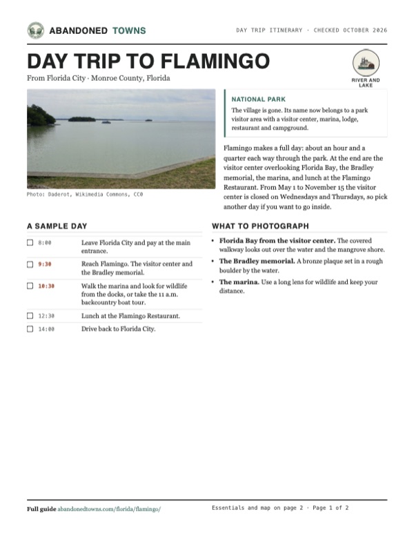
Download the PDF (449 KB)Flamingo makes a full day: about an hour and a quarter each way through the park. At the end are the visitor center overlooking Florida Bay, the Bradley memorial, the marina, and lunch at the Flamingo Restaurant. From May 1 to November 15 the visitor center is closed on Wednesdays and Thursdays, so pick another day if you want to go inside.
A sample day
- Leave Florida City and pay at the main entrance.
- Reach Flamingo. The visitor center and the Bradley memorial.
- Walk the marina and look for wildlife from the docks, or take the 11 a.m. backcountry boat tour.
- Lunch at the Flamingo Restaurant.
- Drive back to Florida City.
What to photograph and film
- Florida Bay from the visitor center. The covered walkway looks out over the water and the mangrove shore.
- The Bradley memorial. A bronze plaque set in a rough boulder by the water.
- The marina. Use a long lens for wildlife and keep your distance.
Map & directions
Getting there
Florida City is the last town before the park. From there, SR 9336 leads to the main entrance and becomes the Main Park Road, which runs 38 miles through the Everglades to Flamingo. From Miami, take the Turnpike south to Florida City first.


Base map: USGS The National Map (public domain). Routes: OSRM on © OpenStreetMap contributors data (ODbL), computed October 2026. Times assume dry roads.
- From Florida City, take SW 344th Street (SR 9336) west, then SW 192nd Avenue and Ingraham Highway to the park entrance.8.5 mi
- Continue on the Main Park Road through the park.38.0 mi
- Continue on Flamingo Lodge Highway to Flamingo.0.4 mi
- From downtown Miami, take I-95 and US 1 south.9.3 mi
- Take the Snapper Creek and Don Shula expressways (tolls) to the Homestead Extension of Florida's Turnpike.24.1 mi
- At the end of the Turnpike, join US 1, then turn right on SW 344th Street (SR 9336).2.3 mi
- Follow SW 192nd Avenue and Ingraham Highway to the park entrance.7.1 mi
- Follow the Main Park Road and Flamingo Lodge Highway to Flamingo.38.4 mi
Road and safety notes
- NPS gives 38 miles from the Homestead entrance to Flamingo.
- NPS says gasoline and diesel are sold near the Flamingo Marina Store.
- From May 1 to November 15 the Guy Bradley Visitor Center is closed on Wednesdays and Thursdays.
Photos
Flamingo in photos
Visitor reports
Been to Flamingo?
Been there lately? Tell the next visitor what you found: whether you could get in, the state of the road and what's still standing. Photos are welcome. We read every report before it appears here.
River and lake
More river and lake ghost towns
The nearest, in other states.

 Guide
Dorchester
32.95, -80.17Dorchester County, South Carolina
A trading town founded in the 1690s by settlers from Massachusetts on the Ashley River. It was a military post in the Revolution; accounts date its…
 Guide
La Balize
29.12, -89.11Plaquemines Parish, Louisiana
For a century and a half, ships entering the Mississippi stopped at La Balize to pick up a pilot. The French founded it in 1721; storms and the…
Nearby
Other sites near Flamingo
Straight-line distance from the townsite to other mapped sites in our Florida index.
- Indian Key23.9 mi SE · Monroe
- Naranja40.7 mi NE · Miami-Dade
- Silver Palm41.4 mi NE · Miami-Dade
- Aladdin City41.6 mi NE · Miami-Dade
- Chevelier44.0 mi NW · Monroe
- Peters47.9 mi NE · Miami-Dade
- Cutler50.5 mi NE · Miami-Dade
- Perky52.9 mi SW · Monroe
Sources
Sources and credits
- Wikipedia, "Flamingo, Florida", retrieved October 2026: settlement, trade with Key West, the 1893 naming and Brownell's 38 shacks, the 1900 boom, Guy Bradley, the 1908 fish house and 1910 homes, the post office closing, the 1922 road, the 1935 hurricane, the relocation of residents, the 1959 lodge, Wilma, Irma, the 2023 lodge and visitor center, the village location and its foundation remnants, the Coastal Prairie Trail, Christian Point and the 1935 hurricane, the Wilderness Waterway.
- Wikipedia, "Everglades National Park": the dedication by President Truman on December 6, 1947, the eminent-domain taking at Flamingo after the park was established, trails made impassable by mosquitoes and water levels.
- NPS, Guy Bradley Visitor Center (Flamingo) (updated April 3, 2026, read October 2026): visitor center hours by season, boat tour times, rental hours, marina store hours and restrooms, fuel, campground bathhouses. NPS, Everglades fees (updated July 22, 2025, read October 2026): entrance fees. NPS, operating hours (updated November 20, 2025): the 24-hour main entrance, hours varying with staffing, park phone. NPS FAQ (updated February 11, 2025): 38 miles from the Homestead entrance, food advice. NPS, current conditions (read October 2026): no closures listed at Flamingo.
- Flamingo Adventures, hours and schedule, the park concessioner, read October 2026: restaurant, marina store and activities booth hours, the mosquito notice.
- Wikipedia, "Guy Bradley": his work as a warden, the family's move to Flamingo in 1900, his killing on July 8, 1905, Walter Smith's self-defense claim and release. The memorial plaque at the visitor center (photographed 2017) names the Tropical Audubon Society.
- Elevation: USGS 3D Elevation Program point query. Routes: OSRM on OpenStreetMap data, October 2026.
Photo and map credits
- Florida Bay from the visitor center grounds, 2017: Daderot, Wikimedia Commons, CC0
- The visitor center walkway, 2012: Acroterion, Wikimedia Commons, CC BY-SA 4.0
- The Guy M. Bradley memorial, 2017: Daderot, Wikimedia Commons, CC0
- The marina, 2017: Daderot, Wikimedia Commons, CC0
- The Flamingo camping area in March 1960, with travel trailers under palms: State Library and Archives of Florida, Wikimedia Commons, Public domain
- Topo map, area base map and aerial imagery: USGS The National Map (public domain).
- Historic maps: USGS Historical Topographic Map Collection (public domain): Miami 1956, 1:250,000; Flamingo 1973, 1:24,000; Homestead 1982, 1:100,000.