 Abandoned

Overview
Nine thousand miners in a mountain basin
Florence sits in a high basin about 14 air miles east-northeast of Riggins and more than 4,000 feet above the Salmon River. In August 1861, by Wikipedia's account, a party of five found rich placer gold in its creeks and gulches. Miners poured in through the winter, named the camp Florence in November, and by the next year the Forest Service puts the population at about 9,000. Washington Territory made the camp the seat of the new Idaho County in December 1861, and the first district court sat there in September 1862.
The shallow gold went fast. The census found 575 people in 1863 and 254 in 1864, and the county seat moved to the Warren camp in 1869. Chinese miners reworked the old ground for years; the sources disagree on whether they left about 1880 or in the late 1890s. A road to Mount Idaho in 1895 brought a second, smaller boom and a New Florence half a mile south. In 1924 a steam shovel dug up much of the old placer ground, and by 1933 only one of the original buildings was partly standing. Ten people lived there in 1940.
Today Florence is on the Nez Perce-Clearwater National Forest. Wikipedia describes only a few foundations and an overgrown cemetery. The Forest Service keeps a parking area, a footbridge to the cemetery and interpretive panels with a map of the town, and invites visitors to walk the site where it stood.
Timeline
From gold strike to cemetery

- A party of five finds rich placer gold in a high basin south of Grangeville, by Wikipedia's account. The Forest Service gives 1861 without a month.
- A miners' meeting names the camp Florence. It had briefly been called Millersburg.
- Washington Territory creates Idaho County, with Florence as its first seat.
- A tent camp of about 50 becomes a town of about 9,000, as the Forest Service puts it. Wikipedia gives "over 9,000" within the first year. The first district court sits at Florence on September 22, 1862.
- The territorial census finds 575 people in 1863 and 254 in 1864. By the winter of 1865, Western Mining History says, one man lived there, a gambler named Billy Courtney.
- Chinese miners come in as the richest claims play out. Wikipedia says they worked most claims from about 1869 to about 1880; Western Mining History counts 200 in 1885 and says they stayed until the late 1890s.
- The territorial legislature moves the county seat to Washington, in the Warren camp. Mount Idaho wins it in an 1875 election, and Grangeville in 1902.
- A new road links Florence to Mount Idaho in 1895 and sets off a second boom. Western Mining History says a New Florence grew up about half a mile south in 1896.
- A large steam shovel is brought in to work the placer ground, and much of the old town is dug away, by Western Mining History's account.
- Of the original buildings, only a hurdy-gurdy house is left partly standing.
- Ten people live at Florence. By 1951 there is no local mail delivery.
- The Forest Service lists the Florence Cemetery as a site open year-round with no fee, with interpretive panels, a parking area and a footbridge to the cemetery.
What's left
A cemetery and a townsite in the trees
The town itself is mostly gone. Wikipedia lists a few building foundations and an overgrown cemetery, and Western Mining History calls what's left "hints" of the boomtown. An undated listing names more than a dozen structures, mostly cabins, and an undated local history mentions private cabins on patented mining claims; we haven't been able to date either description. What the Forest Service describes in 2026 is the cemetery, where it says many of the town's "more unsavory and interesting residents" were buried, the walkable townsite, interpretive panels, a parking area and a footbridge to the cemetery.
The 1963 and 1995 USGS sheets in the historic maps below put Florence where several unimproved roads meet south of Baboon Gulch, with a mineral monument (USMM 1) just west of the label, the Waverly Mine to the west and a prospect to the northeast, beyond Summit Creek. Today's map shows the same junction, with Forest Roads 643, 643A and 643D meeting at the town and Road 394 heading southeast past it along the Idaho Centennial Trail.
- Florence Cemetery
- Townsite
- A few foundations (Wikipedia)
- Interpretive panels
- Footbridge and parking area


Historic maps
Florence on USGS maps, 1963–1995
Crops from the USGS Historical Topographic Map Collection, centered on the townsite. Each sheet shows what surveyors mapped that year; compare them with today's topo and aerial on this page.
Day trip
Plan a day trip to Florence from Grangeville
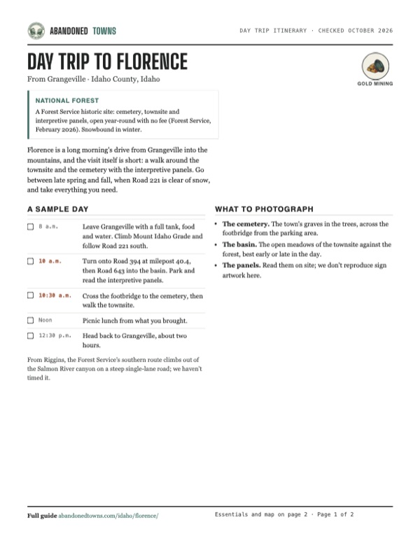
Take it with you
Day trip itinerary
The essentials, the sample day with boxes to tick, what to photograph and the coordinates, on two printable pages. Handy where there's no signal.
Download the PDF (320 KB)Florence is a long morning's drive from Grangeville into the mountains, and the visit itself is short: a walk around the townsite and the cemetery with the interpretive panels. Go between late spring and fall, when Road 221 is clear of snow, and take everything you need.
A sample day
- Leave Grangeville with a full tank, food and water. Climb Mount Idaho Grade and follow Road 221 south.
- Turn onto Road 394 at milepost 40.4, then Road 643 into the basin. Park and read the interpretive panels.
- Cross the footbridge to the cemetery, then walk the townsite.
- Picnic lunch from what you brought.
- Head back to Grangeville, about two hours.
From Riggins, the Forest Service's southern route climbs out of the Salmon River canyon on a steep single-lane road; we haven't timed it.
What to photograph and film
- The cemetery. The town's graves in the trees, across the footbridge from the parking area.
- The basin. The open meadows of the townsite against the forest, best early or late in the day.
- The panels. Read them on site; we don't reproduce sign artwork here.
Map & directions
Getting there
Grangeville is the nearest city. The route follows the Forest Service's own directions from the north: south on the Grangeville-Salmon Road (Road 221), left at milepost 40.4 onto Road 394, then Road 643 into the basin. The Forest Service says Road 221 is paved to Boulder Creek at milepost 36.6, and the cemetery is on a primitive road 1.4 miles from the Road 394 and 643 junction. It also gives a southern approach from Riggins: Salmon River Road 1614, then 15.2 miles of steep single-lane road on Road 221 out of the canyon, then 10.2 miles east on Road 394.


Base map: USGS The National Map (public domain). Routes: OSRM on © OpenStreetMap contributors data (ODbL), computed October 2026. Times assume dry roads.
- From North College Street, turn left on West Main Street (ID 13).0.7 mi
- Turn sharp right on the Mount Idaho/Grangeville-Salmon Road, which becomes Mount Idaho Grade Road.0.7 mi
- Bear right onto the Grangeville-Salmon Road (Forest Road 221) and follow it south. The Forest Service says it is paved to milepost 36.6.40.4 mi
- Continue onto Kelly Mountain Road (Forest Road 394).1.8 mi
- Turn right on Florence Basin Road (Forest Road 643) to the townsite.1.9 mi
- From downtown, take Idaho Street, 19th Street, 7th Avenue and 21st Street to US 12.0.9 mi
- Follow US 12, the Nez Perce National Historic Trail, east.13.8 mi
- Continue on US 95 south over the prairie to Grangeville.57.6 mi
- Turn left on West Main Street (ID 13), then sharp right on the Mount Idaho/Grangeville-Salmon Road and Mount Idaho Grade Road.1.9 mi
- Bear right onto the Grangeville-Salmon Road (Forest Road 221) and follow it south.40.4 mi
- Continue onto Forest Road 394, then turn right on Forest Road 643 to the townsite.3.7 mi
Road and safety notes
- The Forest Service says Road 221 is paved to Boulder Creek, milepost 36.6, about 4 miles south of Rocky Bluff Campground. Beyond that we have no dated source on surfaces, and the last 1.4 miles to the cemetery are a primitive road.
- In winter the Forest Service grooms Road 221 as a snowmobile route, and only snowmobiles are allowed on it. Its Adams Ranger Station page puts spring melt from mid-March to late May.
- Road 221 had weekday daytime construction closures between about milepost 9 and milepost 30.61 in June 2026 (Forest Order 01-17-01-26-004, June 8 to 12). Check the forest's alerts page before you go.
- There is no drinking water at the site. Carry water, a full tank and a paper map.
- The routes are computed from OpenStreetMap and haven't been driven by us.
Photos
Have photos of Florence?
We haven’t added more photographs of Florence yet. If you’ve visited, share your photos and a field report below.
Visitor reports
Been to Florence?
Been there lately? Tell the next visitor what you found: whether you could get in, the state of the road and what's still standing. Photos are welcome. We read every report before it appears here.
Gold mining
More gold mining ghost towns
The nearest in Idaho.

 Guide
Custer
44.39, -114.70Custer County, Idaho
The company town of the General Custer mine, a ghost town since 1911 and now kept by the Forest Service and Idaho Parks and Recreation. The…
 Guide
Idaho City
43.83, -115.83Boise County, Idaho
In 1864 Idaho City was the largest town in the Northwest, with about 7,000 people. By 1920 it had 104. It never quite emptied, and its brick and…
Nearby
Other sites near Florence
Straight-line distance from the townsite to other mapped sites in our Idaho index.
Sources
Sources and credits
- ghosttowns.com, "Florence": fact sheet fields (county, road, climate, best time, remains).
- Wikipedia, "Florence, Idaho", retrieved October 2026: location, the August 1861 discovery, Millersburg, the naming, the county and court dates, the 1863 and 1864 censuses, the 1869 county-seat move, the Chinese miners, the 1895 road, the 1940 population, mail delivery by 1951, the remains, coordinates and elevation.
- USDA Forest Service, Nez Perce-Clearwater National Forests, "Florence Cemetery", last updated February 23, 2026, read October 20, 2026: the 1861 discovery, 50 to 9,000 people, the cemetery, townsite, panels, parking and footbridge, directions from Grangeville and Riggins, the paved section of Road 221, season, no fee, no drinking water.
- USDA Forest Service, "Adams Ranger Station", last updated April 9, 2025: Road 221 as a groomed winter snowmobile route and the spring-melt period.
- USDA Forest Service, "Grangeville Salmon Road Closure Extension", Forest Order 01-17-01-26-004, last updated June 29, 2026: the June 8 to 12, 2026 weekday closure of Road 221 and the ranger district's address and phone. The forest's alerts page, read October 20, 2026, listed no alert naming Florence or Roads 394 and 643.
- Western Mining History, "Florence, Idaho", partly adapted from the Forest Service booklet "The Lure of Gold": the Chinese miners, Billy Courtney, New Florence, the 1924 steam shovel, the 1933 hurdy-gurdy house, the later county seats, Road 643 through the townsite.
- Idaho County, "Idaho County History": Florence as the first county seat, the September 22, 1862 court, and Mount Idaho's 1875 election.
- IdGenWeb, "Florence Idaho", undated: private cabins on patented mining claims.
- Elevation: USGS 3D Elevation Program point query. Routes: OSRM on OpenStreetMap data, October 2026. Not field-checked.
Photo and map credits
- Florence on the 1963 USGS sheet, with the Waverly Mine to the west and a prospect to the northeast: U.S. Geological Survey, USGS catalog, Public domain
- Area base map, topo and aerial imagery: USGS The National Map (public domain).
- Historic maps: USGS Historical Topographic Map Collection (public domain): Florence 1963, 1:24,000; Florence 1995, 1:24,000.