 Abandoned

Overview
A field planted for the people behind

Mount Pisgah grew out of the Latter-day Saints' flight from Nauvoo, Illinois, in 1846. The advance companies crossing Iowa stopped in May on the middle fork of the Grand River, on land then held by the Potawatomi, and decided to build a second resting place after Garden Grove. Parley P. Pratt named it for the mountain from which Moses saw the Promised Land. Work crews fenced a great field and planted corn, beans, potatoes, pumpkins and squash, so that the poor and the sick who came later would have something to eat.
It was meant to be temporary, and it was. From 1846 to 1852 Mount Pisgah held more than 2,000 people at its height and about 700 on average, living in cabins and dugouts. The U.S. Army first asked the Saints for volunteers here, which led to the Mormon Battalion. Food was short and sickness common: the Iowa DNR counts more than 160 deaths in the first six months alone, and estimates of the total run from 300 to 800. In 1852 the settlers were told to break up the settlement and go west, and they sold their land and left.
In 1888 the Church bought the cemetery and put up a white obelisk. Today the Church's monument and cemetery sit beside Mount Pisgah Park, run by Union County Conservation, which has wayside exhibits and a picnic area; the Iowa DNR describes the one-acre cemetery preserve as lying within the park. Most of the village site lies on the private pasture next door, where the Park Service says traces of wagon roads and building footings can still be seen.
Timeline
Six years on the Grand River

- Latter-day Saints begin leaving Nauvoo, Illinois, for the West. Spring thaw turns the Iowa prairie to mud and the wagons average about three miles a day in the first month.
- The advance companies stop on the middle fork of the Grand River. Wikipedia dates the camp to May 18; Orson Pratt's journal for May 19 reads, "We concluded to form another settlement here, for the benefit of the poor." Parley P. Pratt names it for the biblical Pisgah, the mountain from which Moses saw the Promised Land.
- Work crews fence and plant a great field. The National Park Service says nearly 1,000 acres went in within four days; Wikipedia says several thousand acres were planted.
- The U.S. Army first asks the Saints for volunteers here, the start of the Mormon Battalion. The Ensign Peak Foundation counts about 65 men who left Mount Pisgah to serve.
- Hunger and disease hit the camp. The Iowa DNR counts more than 160 deaths in the first six months; a marker quoted by the Ensign Peak Foundation says at least 150.
- Mount Pisgah serves as a way station for companies heading west. Its people live in cabins and dugouts, more than 2,000 at the height by Wikipedia's and the Park Service's count, about 700 on average.
- The Mount Pisgah settlers are told to break up the settlement and go to the Salt Lake Valley. They sell their land and move to Utah and other Latter-day Saint settlements.
- The Church buys the cemetery and an acre around it and puts up a monument. Oliver B. Huntington's letter of February 13, 1888, sends a draft epitaph for "the Monument being erected at Pisgah"; the Park Service dates the monument to fall 1888.
- One acre of the cemetery is dedicated as a historical state preserve.
- Union County's supervisors sign a National Park Service certification of the site as part of the Mormon Pioneer National Historic Trail, with the county and the private landowners keeping all legal rights to their property.
- The Park Service describes the old campsite as a nine-acre park with wayside exhibits, markers and a reconstructed log cabin.
What's left
A monument, a cemetery and a pasture


The monument is a 12-foot obelisk that lists 63 of the people buried at Mount Pisgah. The Church's page says the cemetery holds as many as 150 pioneers; the Iowa DNR says 300 to 800 wooden grave markers have disappeared. Either way, the graves themselves are unmarked. One acre of the cemetery has been a historical state preserve since 1971. Around it, the county park has wayside exhibits and historical markers, a shelter house, picnic tables and a pit latrine.
Sources disagree on the log cabin. The Park Service's page, updated April 2025, lists a reconstructed log cabin, and the photos on this page show it in 2004 and 2016. The Ensign Peak Foundation says the cabin had been removed by 2021. We haven't been able to check which is right.
The rest of the 1846 settlement is on private pasture beside the park. In a page last updated in January 2023, the Park Service said its owner "gives frequent tours" and opens the pasture to interested visitors and tour groups. It also said traces of wagon roads and building footings are visible there. We have no contact for the owner, so don't cross the fence without an invitation.
The 1951 Afton topographic sheet, in the historic maps below, labels Mt Pisgah Cem beside a railroad running northeast, with Riverdale School to the northwest and Talmage to the southwest. Today's map shows the park as two small buildings beside Mt Pisgah Road.
- 1888 obelisk with 63 names
- Pioneer cemetery, graves unmarked
- State preserve, 1 acre (1971)
- Wayside exhibits and markers
- Log cabin (reported removed by 2021; listed by the Park Service in 2025)
- Shelter house and picnic area
- Private pasture over the village site


Historic maps
Mount Pisgah on USGS maps, 1951
Crops from the USGS Historical Topographic Map Collection, centered on the townsite. Each sheet shows what surveyors mapped that year; compare them with today's topo and aerial on this page.

Day trip
Plan a day trip to Mount Pisgah from Creston
Take it with you
Day trip itinerary
The essentials, the sample day with boxes to tick, what to photograph and the coordinates, on two printable pages. Handy where there's no signal.
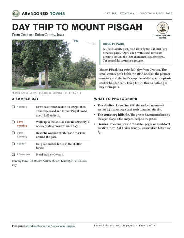
Download the PDF (599 KB)Mount Pisgah is a quiet half day from Creston. The small county park holds the 1888 obelisk, the pioneer cemetery and the trail's wayside exhibits, with a picnic shelter beside them. Bring lunch; there's nothing to buy at the park.
A sample day
- Drive east from Creston on US 34, then Talmadge Road and Mount Pisgah Road, about half an hour.
- Walk up to the obelisk and the cemetery, a one-acre state preserve since 1971.
- Read the wayside exhibits and markers around the park.
- Eat your packed lunch at the shelter house.
- Head back to Creston.
Coming from Des Moines? Allow about 1 hour 25 minutes each way.
What to photograph and film
- The obelisk. Raised in 1888, the 12-foot monument carries 63 names. Step back to fit it against the sky.
- The cemetery hillside. The graves have no markers, so the open slope is the subject. Keep to the paths.
- Drones. The county's and the state's pages we read don't mention them. Ask Union County Conservation before you fly.
Map & directions
Getting there
The map point is at the park and cemetery on Mount Pisgah Road. Wikipedia's coordinates (41.0386, -94.1130) fall about a mile to the southwest, in the fields; follow the address and the signs instead. Creston is the closest city, about half an hour west on US 34. From Des Moines, the routed drive takes I-235, I-80 and US 169. The Iowa DNR's own directions start at the junction of US 34 and US 169: north on 169 for 2 miles to 167th Street, west 1.5 miles to Tulip Avenue, then south half a mile to the preserve on the west side of the road.

Base map: USGS The National Map (public domain). Routes: OSRM on © OpenStreetMap contributors data (ODbL), computed October 2026. Times assume dry roads.
- From North Pine Street, take West Adams Street and South Elm Street to West Taylor Street.0.8 mi
- Turn left on West Taylor Street (US 34) and stay on US 34.13.4 mi
- Turn left on Talmadge Road, then right on Mt Pisgah Road, which continues as Mount Pisgah Road to the park.2.6 mi
- From 6th Avenue, take Grand Avenue, 8th Street and Keosauqua Way to I-235.1.4 mi
- Follow I-235, then I-80, and take the exit for US 169 and US 6 (Adel, Winterset).19.9 mi
- Turn left on North Avenue (US 6 / US 169) and stay on US 169 as it runs as Guthrie Street and North Avenue.13.9 mi
- Turn right on 210th Street (US 169 / IA 92), which continues as North 24th Avenue, and follow US 169 south.21.3 mi
- Turn right on 167th Street, which becomes Mt Pisgah Road, then turn left on Mount Pisgah Road to the park.1.8 mi
Road and safety notes
- The routes are computed from OpenStreetMap and haven't been driven by us. We have no dated source on the road surfaces.
- The Iowa DNR's directions use US 169, 167th Street and Tulip Avenue; the routed Creston approach uses US 34, Talmadge Road and Mount Pisgah Road instead.
- Most of the village site is private pasture. Stay in the county park and the cemetery unless the landowner invites you.
- The graves are unmarked. Keep to the paths and leave everything in the cemetery as you find it.
Photos
Mount Pisgah in photos
Visitor reports
Been to Mount Pisgah?
Been there lately? Tell the next visitor what you found: whether you could get in, the state of the road and what's still standing. Photos are welcome. We read every report before it appears here.
Railroad and road
More railroad, road and fort ghost towns
The nearest in Iowa.

 Guide
Jordan
42.05, -93.78Boone County, Iowa
A railroad stop on the Chicago and North Western east of Boone, home to 69 people in 1940. On June 13, 1976 one of the most violent tornadoes Ted…
 Guide
Conover
43.22, -91.89Winneshiek County, Iowa
A railroad boomtown platted in two weeks in 1864. It had more than 200 buildings by 1865 and the grain house where Cargill began, then lost the…
Nearby
Other sites near Mount Pisgah
Straight-line distance from the townsite to other mapped sites in our Iowa index.
- Terre Haute28.2 mi SE · Decatur
- Big Spring39.3 mi SE · Wayne
- Morrisburg39.6 mi N · Guthrie
- New York46.0 mi E · Wayne
- Herrold50.0 mi N · Polk
- Zook Spur56.6 mi N · Dallas
- Red Rock57.5 mi NE · Marion
- Angus57.6 mi N · Boone
Sources
Sources and credits
- Wikipedia, "Mount Pisgah, Iowa", retrieved October 2026: the camp of May 18, 1846, on Potawatomi land, Parley P. Pratt and the name, the crops, more than 2,000 people at the height and about 700 on average, the Mormon Battalion, the 1852 departure, the estimate of 300 to 800 deaths, coordinates and the 1704 address.
- National Park Service, "Mount Pisgah - Thayer, Iowa", Mormon Pioneer National Historic Trail, updated April 23, 2025: way station from 1846 to 1852, Orson Pratt's journal for May 19, 1846, over 2,000 people, and the nine-acre park with wayside exhibits, markers and a reconstructed log cabin.
- National Park Service, "Mount Pisgah Historic Site", archived copy of April 12, 2026, of a page last updated January 16, 2023: the 1741 address, nearly 1,000 acres planted in four days, cabins and dugouts, the fall 1888 monument, the three sections and who runs them, the owner's tours and the traces of roads and footings.
- Iowa DNR, "Mount Pisgah Cemetery State Preserve", read October 2026: one acre within Mount Pisgah Park, dedicated in 1971, the vanished 300 to 800 wooden markers, more than 160 deaths in the first six months, the February 5, 1846 exodus and the pace across Iowa, and directions from US 34 and US 169.
- The Church of Jesus Christ of Latter-day Saints, "Mount Pisgah Monument", last updated May 1, 2023: 2,000 to 3,000 people at the height, abandonment in 1852, as many as 150 burials, the 12-foot obelisk with 63 names, and "Grounds always open."
- Larry Richman, "A Visitor's Guide to Church History Sites in Iowa and Nebraska," LDS365, February 20, 2025: the obelisk and its 63 names, and the interpretive markers in the adjacent county park.
- Ensign Peak Foundation, "Mount Pisgah, Iowa", read October 2026: about 65 men for the Mormon Battalion, at least 150 deaths in six months by a marker, the 1852 instruction to leave, the Church's 1888 purchase of the cemetery and an acre, the 1704 address, and its note that the log cabin had been removed by 2021.
- Wilford Woodruff Papers, letter from Oliver B. Huntington, Springville, Utah, February 13, 1888: the draft epitaph for "the Monument being erected at Pisgah Iowa."
- Union County Board of Supervisors, minutes of September 30, 2024: the National Trails System Act certification of Mt. Pisgah at 1741 Mt. Pisgah Road, with Union County and the private landowners keeping all legal rights to the property.
- Union County Conservation, read October 2026: Mount Pisgah Park among the parks it manages, and its park page, archived October 9, 2024: the state preserve, a peak of 3,000 in 1852, the shelter house, picnic tables, latrine and water, and "open year around." The live page refuses automated readers.
- Photos: Wikimedia Commons, credited below each one. Elevation: USGS 3D Elevation Program point query. Routes: OSRM on OpenStreetMap data, October 2026. Not field-checked.
Photo and map credits
- Pasture on the Mormon trail route from the east, at the site of the Mount Pisgah settlement, September 2016: Chris Light, Wikimedia Commons, CC BY-SA 4.0
- The obelisk at the end of its walk, with benches inside the iron fence, September 2016: Chris Light, Wikimedia Commons, CC BY-SA 4.0
- The monument seen across the lawn, September 2016: Chris Light, Wikimedia Commons, CC BY-SA 4.0
- The obelisk under the trees, September 2016: Chris Light, Wikimedia Commons, CC BY-SA 4.0
- The cemetery lawn above the valley, September 2016: Chris Light, Wikimedia Commons, CC BY-SA 4.0
- The park on the trail route: the log cabin at left, the picnic shelter and the obelisk, September 2016: Chris Light, Wikimedia Commons, CC BY-SA 4.0
- The park lawn with the picnic shelter at right, September 2016: Chris Light, Wikimedia Commons, CC BY-SA 4.0
- The park lawn, with the edge of the log cabin at left and the obelisk in the distance, September 2016: Chris Light, Wikimedia Commons, CC BY-SA 4.0
- The reconstructed log cabin with its sod roof, May 2004: National Park Service staff, Wikimedia Commons, Public domain
- The monument in an engraving published in 1891: Unknown artist, from an 1891 book scanned by the British Library, Wikimedia Commons, Public domain
- Area base map, topo and aerial imagery: USGS The National Map (public domain).
- Historic maps: USGS Historical Topographic Map Collection (public domain): Afton 1951, 1:62,500.