 Abandoned

Overview
The port at the mouth of the Pinnebog

Port Crescent stood on a bluff where the Pinnebog River meets Saginaw Bay, at the tip of Michigan's Thumb about five miles southwest of Port Austin. The bay curves into a crescent here and makes a natural harbor, which gave the town its name in 1864. Lumbermen floated logs down the 25-mile river to the mills at its mouth, and steamboats from Detroit and Port Huron called on their way to Bay City.
A county history of 1884 found about 350 people, two piers, two hotels, a grist mill, a sawmill and two salt works pumping brine from wells more than 1,200 feet deep. Fishermen salted herring and whitefish in small barrels for market. Later accounts give the town more than 500 people across 17 blocks, with breweries, blacksmiths and a boot factory.
Fire ended it. The Port Huron Fire of 1871 and the great Thumb Fire of September 5, 1881 burned the forests the mills lived on. Buildings were moved away, the salt blocks closed, and the last business, a white-sand quarry, shut in 1936. The state began buying the land in 1956, and in 1961 it pulled down the town's last landmark, the 120-foot chimney of the Pack & Woods sawmill. Today the townsite is part of Port Crescent State Park, 640 acres of beach, dunes and woods along Saginaw Bay.
Video
Across the steel bridge
A couple walk the Steel Bridge Trail, a loop of two to two and a half miles, on a clear spring day with the trees still bare: from the small trailhead lot across the old steel truss bridge, past trail maps, a concrete ruin in the woods they can't identify, turtles and geese in the river backwaters and views of Lake Huron, finishing past the campground and back at the bridge.
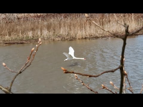 Play “Hiking The Steel Bridge Trail / Port Crescent State Park Michigan” from YouTube
Timeline
From Pinnebog to state park
- Walter Hume settles in the area and keeps a hotel and trading post. Sources differ on where: Michigan Enjoyer puts it at the river mouth, Huron County's economic development office at today's Pinnebog, five miles inland.
- The township's first post office opens at Pinnebog Bridge.
- The settlement at the mouth, first called Pinnebog, takes the name Port Crescent to end confusion with the post office upstream. The Port Crescent post office opens in 1865.
- Henry Kennedy opens the first hotel in 1868. C. F. Schlegelmilch's grist mill, the first mill in the county, follows in 1869.
- Telegraph service arrives. The Port Huron Fire of 1871 burns timber the mills depend on.
- Two salt works sink brine wells more than 1,240 feet deep, rated at 150 and 200 barrels of salt a day.
- The Thumb Fire burns more than a million acres in a day. The timber that kept the mills running is gone.
- A county history counts about 350 people, two piers, two hotels, a sawmill, the grist mill, a school of about 120 pupils and a daily mail. Later accounts put the peak at more than 500 people across 17 blocks.
- By this year buildings have been moved away and the businesses have closed, by Michigan Enjoyer's account.
- The last business, white-sand quarrying, closes.
- The state buys the first 124 acres for Port Crescent State Park; Wikipedia dates the park to 1955, a 2020 local account to 1959.
- The state razes the 120-foot chimney of the Pack & Woods sawmill, one of the last landmarks of the town, over residents' objections.
- A 455-acre purchase enlarges the park, which now covers 640 acres.
- The park is named a Michigan dark sky preserve.
What's left
Foundations, a chimney base and the cemetery
Port Crescent is mostly gone, and the sources disagree about how much is left. Michigan Enjoyer, in April 2025, says the 1961 demolition left only the chimney's base, that the original steel truss bridge stands near the shore, and that much of the old town lies inland under dunes and brush. A 2019 radio station piece says a visitor might spot old foundations, and flowers and bushes planted by the people who lived here. A 2021 piece from the same station says a smokestack still stands. We have no dated photograph of either, so look for yourself and tell us.
The town cemetery lies just east of M-25 on Port Crescent Road, outside the park, with headstones from the 1800s and graves marked only by shallow depressions. It is the subject of local ghost stories, which are legend, not record.
The old maps help place the town. The 1904 plat shows Port Crescent's streets laid out in the wedge between the Pinnebog River and the bay, with Water, Church and Hume streets and the Learned addition to the south. The 1970 Port Austin West sheet labels Port Crescent just east of M-25, with the state park on both sides of the river and Port Crescent Cemetery to the southeast. The 1984 Tawas City sheet marks Port Crescent and the state park on M-25 west of Port Austin.
- Chimney base of the Pack & Woods sawmill
- Foundations and old garden plantings
- Steel truss bridge near the shore
- Port Crescent Cemetery (outside the park)


Historic maps
Port Crescent on USGS maps, 1970–1984
Crops from the USGS Historical Topographic Map Collection, centered on the townsite. Each sheet shows what surveyors mapped that year; compare them with today's topo and aerial on this page.

Map & directions
Getting there
Port Crescent is on M-25, the shore road around the tip of the Thumb. From Port Austin it is a short drive southwest along the bay. From Detroit, the route runs north on M-53 through the Thumb.


Base map: USGS The National Map (public domain). Routes: OSRM on © OpenStreetMap contributors data (ODbL), computed October 2026. Times assume dry roads.
- Leave on Adams Street, turn left on East State Street, then right on Lake Street (M-25 and M-53).0.3 mi
- Turn left on West Spring Street (M-25), which becomes Port Austin Road, and follow it southwest along the bay.4.8 mi
- From Cadillac Square, take Randolph Street and Monroe Street to the freeway.0.9 mi
- Follow the Walter P. Chrysler Freeway north.16.4 mi
- Take exit 67, turn right on Rochester Road, then right on East Big Beaver Road.2.6 mi
- Continue on Metropolitan Parkway and make a U-turn.3.2 mi
- Turn right on Van Dyke Avenue (M-53) and keep right at the fork.26.4 mi
- Turn left to stay on M-53 north, as North Van Dyke Road, Cedar Street, Main Street and South Van Dyke Road.63.8 mi
- Follow West Huron Avenue, then turn left on North Port Crescent Street (M-53 and M-142).1.1 mi
- Continue north on North Van Dyke Road (M-53 and M-142).13.4 mi
- Turn left on Port Crescent Road to M-25 at the townsite.2.4 mi
Road and safety notes
- The routes are computed from OpenStreetMap and haven't been driven by us.
- Michigan's travel site says the park's day-use area and its trail need a permit; check the DNR page for current rules before you go.
- The cemetery on Port Crescent Road has no drive-in access by a 2021 account: one road is gated and the other overgrown.
Photos
Port Crescent in photos
Visitor reports
Been to Port Crescent?
Been there lately? Tell the next visitor what you found: whether you could get in, the state of the road and what's still standing. Photos are welcome. We read every report before it appears here.
Mill, lumber and company
More mill, lumber and company ghost towns
The nearest in Michigan.

 Guide
Pere Cheney
44.58, -84.64Crawford County, Michigan
A lumber and railroad town that diphtheria emptied in the 1890s and that was gone by 1917. Its cemetery, in a clearing in the pines, is all that is…
 Guide
Singapore
42.68, -86.21Allegan County, Michigan
A lumber port at the mouth of the Kalamazoo River that printed its own money and then disappeared under the sand. Nothing of the town shows today.…
Nearby
Other sites near Port Crescent
Straight-line distance from the townsite to other mapped sites in our Michigan index.
- Tyre24.0 mi S · Sanilac
- Freidberger27.0 mi S · Sanilac
- Killmaster47.7 mi NW · Alcona
- Pine Hill51.4 mi SE · Sanilac
- Alcona53.7 mi N · Alcona
- Hard Luck56.7 mi W · Gladwin
- Lum62.5 mi S · Lapeer
- Damon66.7 mi NW · Ogemaw
Sources
Sources and credits
- Wikipedia, "Port Crescent State Park", retrieved October 2026: the ghost town at the river mouth, the 120-foot Pack & Woods chimney razed in 1961, the 1955 establishment, the 124 and 455 acre purchases, 640 acres, the 2012 dark sky designation, coordinates.
- Portrait and Biographical Album of Huron County (Chapman Bros., 1884), pp. 442–443, transcription: the crescent harbor, about 350 people, piers, steamboats, fishing, the salt wells, the mills, Kennedy's hotel, the 1860 and 1865 post offices, telegraph, the school.
- Huron County Economic Development, "Ghost Towns of Huron County", by Justin Schnettler: the Pinnebog name swap, sawmills, grist mill and fisheries, the last business closing in 1936, Walter Hume at Pinnebog.
- Michigan Enjoyer, "The Ghost Town at the Tip of the Thumb Consumed By Fire", Jeremy Ritts, April 3, 2025: Hume from 1844, the 1864 renaming, 500 people and 17 blocks, the 1881 fire, the 1894 decline, sand quarrying, the 1956 purchase, the chimney base, the cemetery, the steel truss bridge.
- 99.1 WFMK, "Port Crescent, Michigan", John Robinson, January 25, 2019: the 1864–1881 heyday, the fires, foundations and plantings to look for.
- 99.1 WFMK, "Port Crescent: The Michigan Town That Completely Disappeared", John Robinson, July 31, 2020: the chimney demolition and the 1959 park date.
- 99.1 WFMK, "The Defunct Town of Port Crescent and Its 'Haunted' Cemetery", John Robinson, May 12, 2021: the cemetery's location and access, the smokestack, the legends.
- Pure Michigan, "Port Crescent Day-Use Trail", read October 29, 2026: the 2.3-mile trail, the permit requirement, the park phone number.
- Roaming Michigan Together, "Hiking The Steel Bridge Trail / Port Crescent State Park Michigan", YouTube, posted May 13, 2026: the steel bridge and the trail loop in spring 2026 (the video on this page); checked against its captions and storyboard frames.
- Photos: Wikimedia Commons, credited below. Elevation: USGS 3D Elevation Program point query. Routes: OSRM on OpenStreetMap data, October 2026. Not field-checked.
Photo and map credits
- A boardwalk through the dunes above Saginaw Bay in Port Crescent State Park, August 2019: Notorious4life, Wikimedia Commons, CC0
- The beach at Port Crescent State Park, August 2019: Notorious4life, Wikimedia Commons, CC0
- Port Crescent's town plat in the 1904 Huron County plat book: Library of Congress, Wikimedia Commons, Public domain
- Area base map, topo and aerial imagery: USGS The National Map (public domain).
- Historic maps: USGS Historical Topographic Map Collection (public domain): Port Austin West 1970, 1:24,000; Tawas City 1984, 1:100,000.