 Abandoned

Overview
The port the river took away

Grand Gulf took its name from a whirlpool. The Mississippi struck a rocky bluff here and spun, and La Salle and later river guides warned boatmen about the eddies. The British and the Spanish both settled the area before it became American. The town itself was laid out in 1828 and incorporated in 1833, and it grew fast as the river port for Port Gibson, eight miles inland. Cotton came from Claiborne, Copiah and Hinds counties. Between September 1834 and May 1835 the wharves shipped about 47,770 bales by a 1937 newspaper account, or 37,770 by Legends of America, and only Natchez and Vicksburg handled more in the state.
At its height Grand Gulf had about a thousand people, two hotels, a hospital, a theater, two weekly newspapers and a railroad to Port Gibson. Then everything went wrong at once. Yellow fever came up the river with the boats from 1843. In 1853 a tornado tore through, and the Mississippi began cutting into the riverfront; by 1860 it had swallowed about 52 blocks and the town was down to 158 people. Union forces burned what was left in 1862, by Wikipedia's account; Legends of America says the town was spared then and its last buildings went in the 1863 battle. In April 1863 Admiral Porter's ironclads failed to knock out the forts on the bluff, and Grant took his army across the river farther south at Bruinsburg instead.
After the war the river moved west and left the town inland. Grand Gulf had 150 people in 1900, the post office closed in 1932, and in 1937 the Clarion-Ledger called it not much more than a name. In 1962 the state opened a military park on the bluffs. It keeps the forts, the town cemetery, the Spanish House and a church brought in from Rodney. The name lives on in the Grand Gulf Nuclear Station, Entergy's reactor at Grand Gulf.
Video
A motorcycle loop of the park
A rider takes his motorcycle around the park's drives on a summer day, past the museum, the church and the water wheel. He stops to walk the Grand Gulf Cemetery and read its fenced plots and worn stones, then the Confederate rifle pits and gun emplacements with their signs, and finishes by the picnic area and the campground bathhouses.
 Play “Ride through Grand Gulf Military Park in Mississippi” from YouTube
Timeline
Cotton, fever, fire and a battle

- Thomas White Sr. receives a Spanish land grant in the Natchez District, on ground that later holds Grand Gulf.
- Ezra Marble, Turpin White and Amos Whiting lay out the town, and William Davis surveys 80 blocks.
- A post office opens. The village has three stores, a tavern and a stage line to Port Gibson.
- Grand Gulf is incorporated.
- Between September 1834 and May 1835 the wharves ship 47,770 bales of cotton, by a 1937 Clarion-Ledger account (Legends of America gives 37,770). Only Natchez and Vicksburg ship more in Mississippi.
- About 1,000 people, two hotels, a hospital, a theater, a cotton press and mills. A railroad links the landing to Port Gibson.
- A yellow fever epidemic begins. The fever returns again and again with the riverboats.
- A tornado wrecks much of the town, and the river starts cutting away the riverfront.
- The river has taken about 52 blocks. Legends of America counts 158 residents.
- Union forces burn the town after Confederates mount guns there, by Wikipedia's account. Legends of America says the Navy spared the town that year and its last buildings were destroyed in the 1863 battle.
- The Battle of Grand Gulf. Porter's ironclads shell Forts Cobun and Wade for hours and fail to silence them, so Grant crosses the river farther south at Bruinsburg.
- After the Battle of Port Gibson, Grant makes Grand Gulf his base of operations.
- Population 150. In the decades after the war the Mississippi moves west and leaves the town inland.
- The post office closes.
- Grand Gulf Military Monument Park opens on the bluffs.
- The park museum is completed.
- Sacred Heart Church is moved to the park from Rodney and restored.
Sources disagree on a few numbers. The 1835 cotton count is 47,770 bales in the 1937 Clarion-Ledger and 37,770 at Legends of America. The park covers 450 acres on its own home page and 400 at Legends of America.
What's left
Forts, a cemetery and two old buildings

The old town sat below the bluff along today's Grand Gulf Road, where aerial imagery shows a few buildings today. Most of what a visitor sees is in the park above it. Start at the museum, finished in 1967, where you pay admission. About half the collection is Civil War material; the rest runs from a mastodon bone to items from the old town. Nearby are a carriage house with a Civil War ambulance, a blacksmith shop, an old fire engine and the original town jail.
On top of the hill above Fort Wade is the Spanish House, built in the late 1790s and one of the two buildings left from the old town. Fort Wade keeps its earthworks and an ammunition magazine excavated from 1977 into the 1980s. The Grand Gulf Cemetery covers about four acres under moss-hung oaks, with some 200 graves and 160 tombstones from 1822 to 1954; Confederate rifle pits run along its rear. The park warns that erosion of the steep ridge has displaced coffins and buried stones, so keep to the paths. Above the cemetery a 75-foot observation tower looks out to the Mississippi.
Sacred Heart Church was built in Rodney in 1868 and moved here in 1983. The grounds also have a dogtrot house and a water wheel. Across the road the park says it is a third of a mile to the river, where a sign shows river stages back to 1927. Fort Cobun's earthworks are about a mile from the park, with interpretive signs.
The 1965 Davis Island sheet below tells the river's story. It marks the bank lines of 1826, 1846 and 1908 in the bottomland west of the town, the Yucatan Cutoff of 1929 and an upper Grand Gulf landing on the new channel, with Fort Cobun on the bluff to the north. The 1963 Grand Gulf sheet shows the handful of buildings on the old street grid and the military monument on the hills to the south.
- Spanish House (late 1790s)
- Fort Wade earthworks and magazine
- Fort Cobun earthworks
- Grand Gulf Cemetery (1822–1954)
- Town jail, in the museum yard
- Museum (1967)
- Sacred Heart Church (moved from Rodney, 1983)
- 75-ft observation tower


Historic maps
Grand Gulf on USGS maps, 1955–1982
Crops from the USGS Historical Topographic Map Collection, centered on the townsite. Each sheet shows what surveyors mapped that year; compare them with today's topo and aerial on this page.

Day trip
Plan a day trip to Grand Gulf from Port Gibson
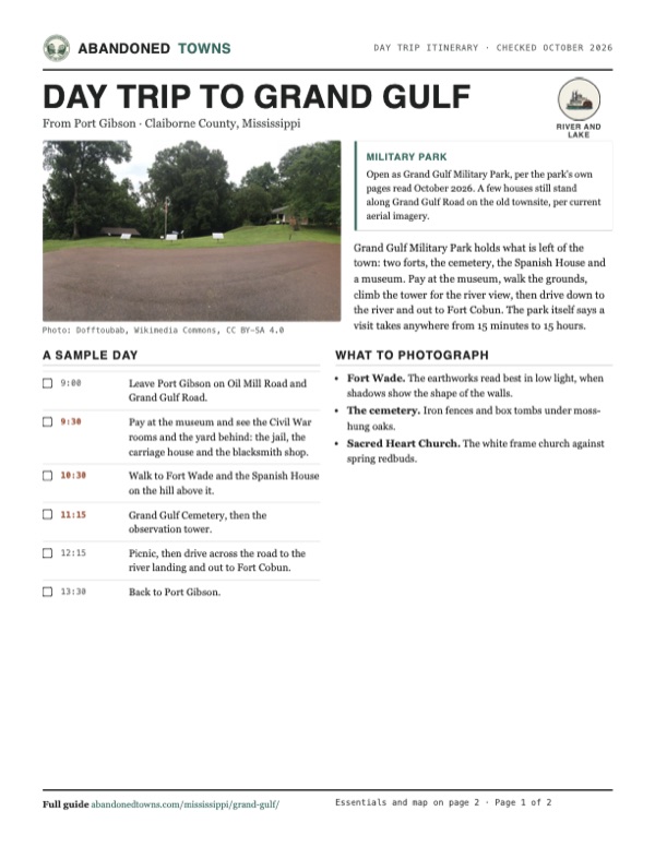
Take it with you
Day trip itinerary
The essentials, the sample day with boxes to tick, what to photograph and the coordinates, on two printable pages. Handy where there's no signal.
Download the PDF (554 KB)Grand Gulf Military Park holds what is left of the town: two forts, the cemetery, the Spanish House and a museum. Pay at the museum, walk the grounds, climb the tower for the river view, then drive down to the river and out to Fort Cobun. The park itself says a visit takes anywhere from 15 minutes to 15 hours.
A sample day
- Leave Port Gibson on Oil Mill Road and Grand Gulf Road.
- Pay at the museum and see the Civil War rooms and the yard behind: the jail, the carriage house and the blacksmith shop.
- Walk to Fort Wade and the Spanish House on the hill above it.
- Grand Gulf Cemetery, then the observation tower.
- Picnic, then drive across the road to the river landing and out to Fort Cobun.
- Back to Port Gibson.
What to photograph and film
- Fort Wade. The earthworks read best in low light, when shadows show the shape of the walls.
- The cemetery. Iron fences and box tombs under moss-hung oaks.
- Sacred Heart Church. The white frame church against spring redbuds.
Map & directions
Getting there
Port Gibson is the closest town with services. Oil Mill Road and Grand Gulf Road run northwest from town to the park and the old townsite. From Jackson, take I-20 west to Vicksburg and US 61 south to Grand Gulf Road.


Base map: USGS The National Map (public domain). Routes: OSRM on © OpenStreetMap contributors data (ODbL), computed October 2026. Times assume dry roads.
- From Fair Street in downtown Port Gibson, head out to Oil Mill Road.0.1 mi
- Turn left on Oil Mill Road.2.4 mi
- Continue straight as it becomes Old Mill Road.0.8 mi
- Turn left on Grand Gulf Road and follow it to the park and the old townsite.4.1 mi
- Turn right to the townsite point.0.1 mi
- From downtown Jackson, take East Pearl Street and University Boulevard to the interstate ramp.2.4 mi
- Merge onto I-20 west (with US 49).38.4 mi
- Keep right on I-20 west with US 61 at Vicksburg.3.8 mi
- Keep left on US 61 south.22.9 mi
- Turn right on Grand Gulf Road and follow it to the park and the townsite.7.6 mi
- Turn right to the townsite point.0.1 mi
Road and safety notes
- The park's address is 12006 Grand Gulf Road, Port Gibson. The park says it lies eight miles northwest of Port Gibson off Highway 61.
- The route ends at the townsite point on Grand Gulf Road. OpenStreetMap marks the military park about 0.4 mi south of it and the cemetery about 0.2 mi southeast.
- Fort Cobun is about a mile from the park, and the Mississippi River overlook a third of a mile across the road, per the park's tour page.
Photos
Grand Gulf in photos
Visitor reports
Been to Grand Gulf?
Been there lately? Tell the next visitor what you found: whether you could get in, the state of the road and what's still standing. Photos are welcome. We read every report before it appears here.
River and lake
More river and lake ghost towns
The nearest in Mississippi.

 Guide
Rodney
31.86, -91.20Jefferson County, Mississippi
Once a busy cotton port on the Mississippi, Rodney lost its river, its trade and finally its charter. A brick church with a cannonball set in its…
 Guide
Cotton Gin Port
33.97, -88.54Monroe County, Mississippi
A French fort, a federal cotton gin for the Chickasaw, a river port at the head of navigation on the Tombigbee. When the railroad founded Amory in…
Nearby
Other sites near Grand Gulf
Straight-line distance from the townsite to other mapped sites in our Mississippi index.
- Bruinsburg8.8 mi SW · Claiborne
- Rocky Springs14.4 mi E · Claiborne
- Rodney14.7 mi SW · Jefferson
- Uniontown20.3 mi S · Jefferson
- Old Greenville20.5 mi S · Jefferson
- Coars Springs46.1 mi E · Copiah
- Woolworth53.4 mi SE · Lincoln
- Baleshed56.0 mi N · Issaquena
Sources
Sources and credits
- Wikipedia, "Grand Gulf, Mississippi", retrieved October 2026: the whirlpool name, the 1833 incorporation, the 47,770 bales (from the Clarion-Ledger, March 24, 1937), the railroad to Port Gibson, about 1,000 people in 1854, the 1862 burning, the battle, the river shift, 150 people in 1900, the 1829–1932 post office, the nuclear station.
- Kathy Alexander, Legends of America, "Grand Gulf, Mississippi", updated April 2026: the 1792 grant, the 1828 layout, the 1829 village, 37,770 bales, yellow fever from 1843, the 1853 tornado and erosion, 52 blocks and 158 people in 1860, the battle, the Spanish House, Sacred Heart Church (1868, moved 1983), the 400-acre park.
- Grand Gulf Military Park, State of Mississippi, home page, About, Park Fees, Tour, Museum and Cemetery pages, read October 29, 2026: the May 1962 opening, 450 acres, hours, fees, address and phone, the 1967 museum, the jail and yard, the Spanish House, Fort Wade and its magazine, the cemetery (1822–1954, about 200 graves, erosion, rifle pits), the tower, the church, the river and Fort Cobun.
- Dunbar Rowland, Mississippi, vol. 1 (1907), p. 794, as cited by Wikipedia: the name, the incorporation, the Grand Gulf Advertiser, 150 people in 1900.
- American Battlefield Trust, Grand Gulf Military Monument Park, read October 2026: the river batteries as the southern end of the Vicksburg defenses, and Grand Gulf as Grant's base after the Battle of Port Gibson.
- Life By Jim, "Ride through Grand Gulf Military Park in Mississippi", YouTube, posted July 9, 2024: the video on this page; the park drives, cemetery, rifle pits and gun emplacements as they looked.
- Historic maps: USGS Historical Topographic Map Collection. Elevation: USGS 3D Elevation Program point query. Routes: OSRM on OpenStreetMap data, October 2026.
Photo and map credits
- Fort Wade's earthworks, June 2016: Dofftoubab, Wikimedia Commons, CC BY-SA 4.0
- An old gun barrel on a stone block at Fort Wade, from a scanned slide (photo date not given): JERRYE & ROY KLOTZ MD, Wikimedia Commons, CC BY-SA 3.0
- The excavated ammunition magazine at Fort Wade under its shelter, June 2016: Dofftoubab, Wikimedia Commons, CC BY-SA 4.0
- Fort Cobun's earthworks in the woods, June 2016: Dofftoubab, Wikimedia Commons, CC BY-SA 4.0
- The observation tower above the park, June 2016: Dofftoubab, Wikimedia Commons, CC BY-SA 4.0
- The Grand Gulf Cemetery, November 2006: NatalieMaynor from Jackson, Mississippi, USA, Wikimedia Commons, CC BY 2.0
- Sacred Heart Church, moved from Rodney in 1983, March 2006: NatalieMaynor from Jackson, Mississippi, USA, Wikimedia Commons, CC BY 2.0
- Sacred Heart Church behind redbuds in bloom, March 2018: Tamarathurman, Wikimedia Commons, CC BY-SA 4.0
- Approaches to Grand Gulf, 1864 Union survey: Gerdes, F. H., Wikimedia Commons, Public domain
- The Battle of Grand Gulf, engraving published 1887: F. H. Schell and Thomas Hogan, Wikimedia Commons, Public domain
- Topo map, area base map and aerial imagery: USGS The National Map (public domain).
- Historic maps: USGS Historical Topographic Map Collection (public domain): Jackson 1955, 1:250,000; Grand Gulf 1963, 1:24,000; Davis Island 1965, 1:62,500; Tallulah 1982, 1:100,000.