 Abandoned

Overview
A town around a spring

Travelers on the old Natchez Trace knew this place as "the Rocky Spring," a reliable watering stop in the hills of Claiborne County. Settlers took up land around it from the late 1790s. Over the years the scattered community had carpenters, wheelwrights, blacksmiths, cabinetmakers, a cotton gin maker and a well digger, and by the mid-1800s a church, a post office and a Masonic lodge. The National Park Service puts its peak at about 2,600 people around 1860, spread over some 25 square miles of cotton farms. Wikipedia and Legends of America give 2,616, plus about 2,000 enslaved people.
The decline came in stages. Union troops foraged through the county in May 1863; an 1863 letter quoted by the NPS describes livestock taken and crops destroyed. Yellow fever came in the 1870s; a local pastor counted 180 cases and 43 deaths. In the early 1900s the boll weevil destroyed the cotton, and decades of erosion had worn out the fields. The last store closed in the 1930s, and the spring stopped flowing.
Today the town site is part of the Natchez Trace Parkway. A short trail from the parking area at milepost 54.8 leads past two rusting safes and old cisterns to the 1837 Methodist church and its cemetery, which sit just off parkway land. Regular services there ended in 2010.
Timeline
Watering stop, cotton town, empty woods

- Settlers take up land around the spring that Natchez Trace travelers called "the Rocky Spring." Legends of America names Mayburn Cooper, in 1796, as the first; Wikipedia also dates his arrival to 1796.
- A post office opens under the name Rocky Springs, by Wikipedia's account.
- The Rocky Springs election precinct records 90 votes.
- The brick Methodist church is built.
- Rocky Springs Academy opens. Legends of America gives both 1838 and 1839.
- The community peaks. The National Park Service gives about 2,600 people; Wikipedia and Legends of America give 2,616, plus about 2,000 enslaved people, across about 25 square miles.
- Union troops pass through. The NPS quotes a letter of 1863 describing livestock taken and crops destroyed. Legends of America says Grant made the church his headquarters for ten days while his troops foraged.
- Yellow fever. A local pastor counted 180 cases and 43 deaths, by the NPS account, which gives the year as both 1873 and 1878. Legends of America adds a second epidemic in 1888.
- The boll weevil wrecks the cotton crop, and eroded fields wear out. The population falls fast.
- The last store closes. Wikipedia and Legends of America date it to 1930. Wikipedia says the spring dried up the same year and the post office closed in 1932; Legends of America closes the post office in 1930.
- No residents remain, according to Legends of America.
- Regular services at the Methodist church end because the congregation has become too small, by Wikipedia's account.
What's left
A church, a cemetery and two safes


The NPS lists what is left: the church and cemetery, two rusting safes and several abandoned cisterns. The spring nearby no longer flows. The church is the only building still standing, a brick meeting house of 1837 with a wooden belfry. The small graveyard beside it is kept up and holds the graves of some of the first settlers. Interpretive signs along the trail tell the town's story.
The 1939 USGS sheet in the historic maps below shows Rocky Springs as a few buildings and church symbols where several roads meet, with Humphreys to the southwest and Midway School to the northeast. The 1963 sheet marks the church and cemetery and Pleasant Hill Church to the south, with the parkway's corridor drawn across the hills to the east. On the 1984 sheet the finished Natchez Trace Parkway runs past to the southeast.
- Methodist church (1837)
- Cemetery
- Two safes
- Cisterns
- Site of the spring
- A stretch of the Old Natchez Trace


Legend and record
Stands, bandits and the Old Trace

Rocky Springs grew up on the Natchez Trace, and a stretch of the Old Trace still runs through the campground, by the NPS account.
Legends of America tells the Trace's stories here: the Red House Inn, which it says the planter Isaac Powers built as one of four stands on the Trace in Claiborne County, and where Andrew Jackson is said to have stayed on his way home from the Battle of New Orleans; and the gang of Samuel Mason, who robbed travelers from a hideout near Rocky Springs and had a $2,000 reward on his head.
We found no record that places the inn or the hideout on today's town site. Treat them as the lore of the Trace.
Historic maps
Rocky Springs on USGS maps, 1939–1984
Crops from the USGS Historical Topographic Map Collection, centered on the townsite. Each sheet shows what surveyors mapped that year; compare them with today's topo and aerial on this page.

Day trip
Plan a day trip to Rocky Springs from Port Gibson
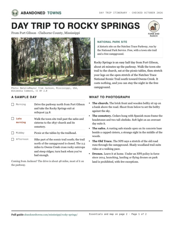
Take it with you
Day trip itinerary
The essentials, the sample day with boxes to tick, what to photograph and the coordinates, on two printable pages. Handy where there's no signal.
Download the PDF (610 KB)Rocky Springs is an easy half day from Port Gibson, about 26 minutes up the parkway. Walk the town site trail to the church, eat at the picnic tables, then stretch your legs on the open stretch of the Natchez Trace National Scenic Trail south toward Owens Creek. It costs nothing, and you can stay the night in the free campground.
A sample day
- Drive the parkway north from Port Gibson and take the Rocky Springs exit at milepost 54.8.
- Walk the town site trail past the safes and cisterns to the 1837 church and its cemetery.
- Picnic at the tables by the trailhead.
- Hike part of the scenic trail south; the trail north of the campground is closed. The 2.5 miles to Owens Creek cross rocky outcrops and steep ridges; turn back when you've had enough.
Coming from Jackson? The drive is about 48 miles, most of it on the parkway.
What to photograph and film
- The church. The brick front and wooden belfry sit up on a bank above the road. Shoot from below to set the belfry against the sky.
- The cemetery. Cedars hung with Spanish moss frame the headstones and two tall obelisks. Soft light on an overcast day suits it.
- The safes. A rusting safe stands open on its concrete base beside a capped cistern, a strange sight in the middle of the woods.
- The Old Trace. The NPS says a stretch of the old road runs through the campground. Shady woodland trail suits video at a walking pace.
- Drones. Leave it at home. Under an NPS policy in force since 2014, launching, landing or flying drones on park land is prohibited, with few exceptions.
Map & directions
Getting there
Port Gibson is the closest town. From Jackson, take I-20 west to the parkway and drive it south. The routes below were computed from OpenStreetMap and haven't been driven by us. They leave the parkway at Whitaker Road and finish on Old Port Gibson Road at the church. The NPS points visitors to the Rocky Springs area at milepost 54.8, where the parking, restrooms and the town site trail are.

Base map: USGS The National Map (public domain). Routes: OSRM on © OpenStreetMap contributors data (ODbL), computed October 2026. Times assume dry roads.
- From Walnut Street in Port Gibson, turn left on Church Street (US 61).0.7 mi
- Turn right on MS 18.1.2 mi
- Turn left onto the connector road and, at its end, turn left onto the Natchez Trace Parkway, heading north.11.9 mi
- Turn left on Whitaker Road, then right on Old Port Gibson Road to the church.1.8 mi
- From East Pearl Street, take University Boulevard to I-20.2.4 mi
- Follow I-20 west and take the exit for the Natchez Trace Parkway.9.4 mi
- Turn left onto the Natchez Trace Parkway and drive it south, past the Rocky Springs exit at milepost 54.8.34.7 mi
- Turn right on Whitaker Road, then right on Old Port Gibson Road to the church.1.9 mi
Road and safety notes
- To use the NPS facilities, leave the parkway at the Rocky Springs exit, milepost 54.8, instead of Whitaker Road. We haven't checked the surface of Old Port Gibson Road.
- The campground's water is listed as non-potable. Bring drinking water.
- The Rocky Springs section of the Natchez Trace National Scenic Trail is for hikers only. An NPS alert posted in September 2024, and still listed in October 2026, closes it from the campground at milepost 55 to the northern terminus at milepost 59 until further notice, because of erosion and deteriorated bridges. South to Owens Creek it crosses rocky outcrops and steep ridges, and the NPS warns that the Owens Creek end can be unstable from erosion.
- The church and cemetery are off parkway property. Treat them with respect.
- Campsites are first come, first served and busiest in spring and fall, especially on holiday weekends.
Photos
Rocky Springs in photos
Visitor reports
Been to Rocky Springs?
Been there lately? Tell the next visitor what you found: whether you could get in, the state of the road and what's still standing. Photos are welcome. We read every report before it appears here.
Farm and ranch
More farm and ranch ghost towns
The nearest, in other states.

 Guide
Frenier
30.11, -90.43St. John the Baptist Parish, Louisiana
A settlement of German farmers on the western shore of Lake Pontchartrain who shipped cabbage and sauerkraut by rail to New Orleans and Chicago. The…
 Guide
Bayou Chene
30.14, -91.54St. Martin Parish, Louisiana
A community of planters, loggers, fishermen and moss pickers deep in the Atchafalaya Basin, reached only by boat. Floods drove it out between 1927…
Nearby
Other sites near Rocky Springs
Straight-line distance from the townsite to other mapped sites in our Mississippi index.
- Grand Gulf14.4 mi W · Claiborne
- Bruinsburg22.5 mi SW · Claiborne
- Rodney27.5 mi SW · Jefferson
- Old Greenville30.4 mi SW · Jefferson
- Uniontown31.0 mi SW · Jefferson
- Coars Springs33.9 mi SE · Copiah
- Woolworth44.7 mi SE · Lincoln
- Liverpool46.8 mi NE · Yazoo
Sources
Sources and credits
- National Park Service, "Rocky Springs Town Site", last updated February 24, 2021: "the Rocky Spring," settlement from the late 1790s, the trades, church, post office and lodge, about 2,600 people, the 1863 letter, yellow fever, the boll weevil, the last store, what remains, the dry spring.
- NPS, "Rocky Springs Picnic Area and Trailhead, Milepost 54.8", last updated January 11, 2024: the side trail to the old town, the church and cemetery off parkway property, hikers only, trail distances north and south, parking, picnic tables, restrooms.
- NPS, "Rocky Springs Campground, Milepost 54.8", last updated October 13, 2026: 22 sites, first come first served, busy seasons, flush and accessible restrooms, non-potable water, the Old Trace and town site trails.
- NPS, Natchez Trace Parkway camping, last updated August 21, 2026: free campgrounds, the 14-day limit. NPS, fees, last updated May 11, 2023: no entrance fees for the parkway or its facilities, and no campground fees.
- NPS, Natchez Trace Parkway "Road and Site Status", last updated October 19, 2026, and the parkway's alerts as of October 21, 2026: no closure at Rocky Springs; the campground comfort station's water is non-potable but the facilities can be used.
- NPS, Natchez Trace National Scenic Trail alerts, read October 21, 2026: "Partial Closure of Rocky Springs Trail", posted September 2024, closing the section from the campground at milepost 55 to the northern terminus at milepost 59. NPS, "Rocky Springs Section", last updated May 5, 2021: trailheads, and erosion at the Owens Creek end.
- NPS, "Uncrewed Aircraft in the National Parks", last updated May 22, 2025: the 2014 drone prohibition.
- Wikipedia, "Rocky Springs, Mississippi", retrieved October 2026: Mayburn Cooper, post office 1819–1932, the 1829 precinct, the church and academy, 2,616 and the enslaved population, the 1930 store closing and dry spring, the end of services in 2010, the trail remnants, coordinates and elevation.
- Legends of America, "Rocky Springs, Mississippi – Bandits and Bibles on the Natchez Trace", updated May 2025: Mayburn Cooper, the academy, Grant's headquarters and the foraging of 1863, the epidemics of 1878 and 1888, the 1930 closings, the Red House Inn and Samuel Mason stories, no residents by 1940.
- National Park Service, report on the Natchez Trace Parkway survey (published 1941), via Wikimedia Commons (in the photos): the photograph of Rocky Springs Church.
- USGS Yokena sheet, 1939, Jackson sheet, 1955, Carlisle sheet, 1963, and Jackson sheet, 1984 (in the historic maps below): the buildings, churches, cemetery, neighboring places and the parkway corridor.
- Elevation: USGS 3D Elevation Program point query. Routes: OSRM on OpenStreetMap data, October 2026. Not field-checked.
Photo and map credits
- The cemetery under Spanish moss, June 2006: NatalieMaynor from Jackson, Mississippi, USA, Wikimedia Commons, CC BY 2.0
- The Methodist church, July 2016: Dofftoubab, Wikimedia Commons, CC BY-SA 4.0
- The church, from the parkway survey report published in 1941: USGov, Wikimedia Commons, Public domain
- Cedars and an obelisk in the churchyard, May 2022: Luhsteesay, Wikimedia Commons, CC BY-SA 4.0
- Headstones and obelisks in the cemetery, July 2005: NatalieMaynor from Jackson, Mississippi, USA, Wikimedia Commons, CC BY 2.0
- A safe and a cistern on the trail, July 2016: Dofftoubab, Wikimedia Commons, CC BY-SA 4.0
- The Rocky Springs section of the scenic trail, September 2008: NPS, Wikimedia Commons, Public domain
- Area base map, topo and aerial imagery: USGS The National Map (public domain).
- Historic maps: USGS Historical Topographic Map Collection (public domain): Yokena 1939, 1:62,500; Jackson 1955, 1:250,000; Carlisle 1963, 1:24,000; Jackson 1984, 1:100,000.