 Abandoned

Overview
Nevada's biggest city, briefly

Harry Stimler and Billy March found gold in the hills south of Tonopah in December 1902. The next year the camp had 36 people. By 1906 it had somewhere between 20,000 and 30,000, depending on whose count you trust, and was the largest city in Nevada. Ore worth $10,000 a day came out of the mines, and in 1907 output topped $8.4 million.
Goldfield had money to show off. Tex Rickard ran the Northern Saloon, with Wyatt Earp as a pit boss, and in 1906 the town hosted the 42-round lightweight title fight between Joe Gans and Battling Nelson. The county seat moved here in 1907, and the courthouse and the four-story Goldfield Hotel went up in 1908. A bitter strike in 1907 brought federal troops at the mine owners' request, and the owners won.
The boom was short. By 1910 the census found 4,838 people. A flood in 1913 swept away hundreds of buildings, and in 1923 a moonshine still exploded and the fire burned 27 blocks. The mines produced more than $86 million before 1940. About 120 buildings from the boom survive in the historic district, and the courthouse is still in use.
Timeline
Boom, strike, flood and fire


- Harry Stimler and Billy March find gold in the hills south of Tonopah. The district is first called Grandpa.
- Thirty-six people live in the camp, many in dugouts along Coyote Wash.
- The district produces about $2.3 million in ore, 30 percent of Nevada's output. Virgil and Wyatt Earp arrive.
- The Tonopah & Goldfield Railroad arrives. Tex Rickard opens the Northern Saloon. A fire on July 8 destroys two blocks.
- Joe Gans beats Battling Nelson in 42 rounds for the lightweight title before a crowd more than twice the arena's 8,000 seats.
- Goldfield peaks at about 20,000 people by Wikipedia's count, over 30,000 by Legends of America's, and is briefly Nevada's largest city.
- Gold output tops $8.4 million, and the county seat moves here from Hawthorne.
- Federal troops are sent in during a miners' strike at the mine owners' request. They stay until March 7.
- The courthouse opens in May. The Goldfield Hotel opens with 154 rooms.
- The census counts 4,838.
- A flood sweeps away hundreds of buildings.
- A moonshine still explodes, and the fire burns 27 blocks.
- Mines have produced more than $86 million since 1903.
- The Goldfield Historic District, about 120 buildings on 200 acres, is listed on the National Register.
- The census counts 225 residents.
What's left
What you'll see

The Esmeralda County Courthouse has been in use since 1908, and its original jail still holds prisoners. The Goldfield Hotel, built in 1907–08 for over $300,000, has been empty since the end of World War II. The old high school, the Santa Fe Saloon of 1905, the Mozart Saloon and Tex Rickard's 1905 house also stand. Many lots between them have stood empty since the 1923 fire, and the dumps of the old mines ring the town.
The 1908 USGS sheet in the next section shows Goldfield at its height, beside the camp of Columbia, with Diamondfield to the northeast and the railroads that served the district.
- Esmeralda County Courthouse (1908)
- Goldfield Hotel (1908, closed)
- Goldfield High School
- Santa Fe Saloon (1905)
- Mozart Saloon
- Tex Rickard house (1905)
- Mine dumps


Historic maps
Goldfield on USGS maps, 1908–1987
Crops from the USGS Historical Topographic Map Collection, centered on the townsite. Each sheet shows what surveyors mapped that year; compare them with today's topo and aerial on this page.

Day trip
Plan a day trip to Goldfield from Tonopah
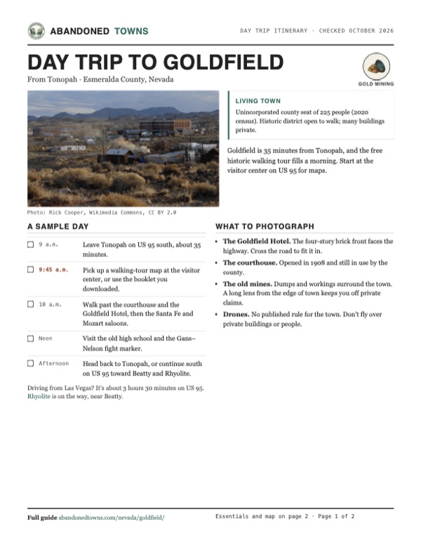
Take it with you
Day trip itinerary
The essentials, the sample day with boxes to tick, what to photograph and the coordinates, on two printable pages. Handy where there's no signal.
Download the PDF (572 KB)Goldfield is 35 minutes from Tonopah, and the free historic walking tour fills a morning. Start at the visitor center on US 95 for maps.
A sample day
- Leave Tonopah on US 95 south, about 35 minutes.
- Pick up a walking-tour map at the visitor center, or use the booklet you downloaded.
- Walk past the courthouse and the Goldfield Hotel, then the Santa Fe and Mozart saloons.
- Visit the old high school and the Gans–Nelson fight marker.
- Head back to Tonopah, or continue south on US 95 toward Beatty and Rhyolite.
Driving from Las Vegas? It's about 3 hours 30 minutes on US 95. Rhyolite is on the way, near Beatty.
What to photograph and film
- The Goldfield Hotel. The four-story brick front faces the highway. Cross the road to fit it in.
- The courthouse. Opened in 1908 and still in use by the county.
- The old mines. Dumps and workings surround the town. A long lens from the edge of town keeps you off private claims.
- Drones. No published rule for the town. Don't fly over private buildings or people.
Map & directions
Getting there
Goldfield is on US 95, 27 miles south of Tonopah and about three and a half hours north of Las Vegas. Paved all the way.


Base map: USGS The National Map (public domain). Routes: OSRM on © OpenStreetMap contributors data (ODbL), computed October 2026. Times assume dry roads.
- Head south on Erie Street, US 6/US 95, out of Tonopah.1.7 mi
- Continue south on US 95, the Veterans Memorial Highway, into Goldfield.25.3 mi
- From downtown, take US 95 north to Beatty.117 mi
- Continue north on US 95 through Beatty to Goldfield.66.6 mi
Road and safety notes
- US 95 is paved all the way. Fuel up in Tonopah or Beatty; distances between towns are long.
- Most historic buildings are private. The Goldfield Hotel is closed to the public.
- Old mine workings surround the town. Stay out of shafts and off unstable dumps.
Photos
Goldfield in photos
Visitor reports
Been to Goldfield?
Been there lately? Tell the next visitor what you found: whether you could get in, the state of the road and what's still standing. Photos are welcome. We read every report before it appears here.
Gold mining
More gold mining ghost towns
The nearest in Nevada.

 Guide
Manhattan
38.54, -117.08Nye County, Nevada
A 1905 gold rush town at 7,000 feet that never quite emptied. Counts from 2005 to 2011 put the population between about 50 and 125. The post office…
 Guide
Rhyolite
36.90, -116.83Nye County, Nevada
Rhyolite went from a tent camp to a town of concrete banks, three railroads and a stock exchange in three years, then emptied almost as fast. Its…
Nearby
Other sites near Goldfield
Straight-line distance from the townsite to other mapped sites in our Nevada index.
- Alkali9.8 mi NW · Esmeralda
- Silver Peak22.0 mi W · Esmeralda
- Lida22.5 mi SW · Esmeralda
- Cactus Springs22.7 mi SE · Nye
- Blair23.3 mi W · Esmeralda
- Archer23.4 mi N · Nye
- Tonopah24.8 mi N · Nye
- Gold Point25.5 mi S · Esmeralda
Sources
Sources and credits
- ghosttowns.com, "Goldfield": fact sheet fields (roads, climate, best time).
- Wikipedia, "Goldfield, Nevada", retrieved October 2026: 1904 output, peak population, Gans–Nelson fight, county seat, federal troops, 1910 census, 1923 fire, historic district, hotel, 2020 census, climate, Goldfield Days.
- Legends of America, "Goldfield": discovery, Grandpa district, 1903 population, the Earps and Rickard, 1905 fire, the 30,000 figure, the strike, courthouse and jail, hotel, 1913 flood, 1923 fire extent, production, surviving buildings.
- Travel Nevada, "Goldfield Visitor's Center" and "Goldfield Historic Walking Tour": visitor center location and services, walking tour hours, booklet download and no admission, as of October 2026.
- Travel Nevada, "Goldfield Hotel" and "Goldfield Historic High School", as of October 2026: the hotel is privately owned, closed and not offering tours; high school tours by appointment, year-round.
- Coordinates: Wikipedia (from USGS GNIS). Elevation: USGS 3D Elevation Program point query. Routes: OSRM on OpenStreetMap data, October 2026.
Photo and map credits
- The town center and the Goldfield Hotel: Rick Cooper, Wikimedia Commons, CC BY 2.0
- Main Street around 1904: Unknown author, Wikimedia Commons, Public domain
- Main street around 1905: Unknown author, Wikimedia Commons, Public domain
- The Mohawk mine around 1905: Pierce, C.C. (Charles C.), 1861-1946, Wikimedia Commons, Public domain
- The Esmeralda County Courthouse: FloNight (Sydney Poore) and Russell Poore, Wikimedia Commons, CC BY-SA 3.0
- The Gans–Nelson fight marker: FloNight (Sydney Poore) and Russell Poore, Wikimedia Commons, CC BY-SA 3.0
- Main Street, looking northeast: Chris English, Wikimedia Commons, CC BY-SA 3.0
- Overlooking Goldfield: Rick Cooper, Wikimedia Commons, CC BY 2.0
- Topo map, area base map and aerial imagery: USGS The National Map (public domain).
- Historic maps: USGS Historical Topographic Map Collection (public domain): Lida 1908, 1:250,000; Goldfield 1945, 1:125,000; Goldfield 1952, 1:62,500; Goldfield 1985, 1:100,000; Goldfield 1987, 1:24,000.