 Abandoned

Overview
Three years of boom

On August 9, 1904, Shorty Harris and Ed Cross found gold in the Bullfrog Hills, at the edge of what is now Death Valley National Park. Rhyolite was founded early the next year and had 2,500 people by June. Charles M. Schwab bought the district's biggest mine, the Montgomery Shoshone, in 1906 and paid for piped water, an electric line from the Sierra and a rail connection.
By 1907 three railroads served the town, a stock exchange had opened, and estimates put the population at 3,500 to 5,000. Then the money stopped. The 1906 San Francisco earthquake and the Panic of 1907 cut investment, and a 1908 engineering report hurt the mine's stock. The banks closed by 1910, the Montgomery Shoshone closed in 1911, and the census of 1920 found 14 people.
The concrete and stone buildings outlasted the town. The Cook Bank, the school and Tom Kelly's bottle house still stand at the historic townsite the Bureau of Land Management looks after, and the privately owned train depot is one of the few complete buildings left. The Goldwell Open Air Museum, on private land just south of the ruins, shows outdoor sculptures, among them works by the Belgian artist Albert Szukalski.
Video
Rhyolite in 30 seconds
A gold boom town near Death Valley: Rhyolite in 1908, the Cook Bank ruins, Tom Kelly's bottle house and the Goldwell Open Air Museum next door.
Timeline
From tent camp to ruins

- Shorty Harris and Ed Cross find gold in the Bullfrog Hills. Their Bullfrog mine names the district.
- Rhyolite is founded. The first post office opens in a tent on May 19, and by June the camp has 2,500 people.
- Tom Kelly builds his bottle house from about 50,000 bottles. Charles M. Schwab buys the Montgomery Shoshone, the district's biggest mine.
- The Las Vegas and Tonopah Railroad begins regular service. The Bullfrog Goldfield follows about six months later.
- The Rhyolite Mining Stock Exchange opens. By December the Tonopah and Tidewater also serves the town.
- Rhyolite peaks at an estimated 3,500 to 5,000 people. The Cook Bank building is finished in 1908 at a cost of more than $90,000.
- The 1906 earthquake, the Panic of 1907 and a damaging 1908 engineering report dry up investment. All three banks close by March 1910.
- The Montgomery Shoshone closes.
- The post office closes in November 1913, the last train leaves in July 1914, and the power is cut in 1916.
- The census counts 14 people.
- An open-pit gold mine on Ladd Mountain, last run by Barrick Gold, produces about 690,000 ounces.
- Lightning burns the Rhyolite Mercantile.
What's left
What you'll see


The three-story shell of the Cook Bank on Golden Street is the best-known ruin. Up the hill, the mission-style Las Vegas and Tonopah depot has been repaired and preserved. It is privately owned and its windows are boarded, so see it from outside. The bottle house, built in 1906 from about 50,000 bottles, stands at the south end of town. You'll also find the two-story school, a stone miner's cabin and, slightly south of town, the Rhyolite-Bullfrog cemetery. The Rhyolite Mercantile burned after a lightning strike in 2014.
The 1908 USGS sheet in the next section shows Rhyolite at its peak, with railroad lines running into town and the rival camps of Bullfrog, Gold Center and Beatty close by.
- Cook Bank building (1908)
- Las Vegas & Tonopah depot (private)
- Bottle house (1906)
- School building
- Miner's cabin
- Cemetery
- Goldwell Open Air Museum sculptures


Next door
The Goldwell Open Air Museum

Just south of the townsite, on private land, the museum shows seven large outdoor sculptures by a group of artists led by the late Albert Szukalski of Belgium. His first pieces, made in 1984, are ghostly plaster figures: The Last Supper, and Ghost Rider, a shrouded figure about to mount a bicycle. The museum is open around the clock, and personal photography is allowed at any time. Commercial photography and filming need the owners' permission.
Historic maps
Rhyolite on USGS maps, 1908–1987
Crops from the USGS Historical Topographic Map Collection, centered on the townsite. Each sheet shows what surveyors mapped that year; compare them with today's topo and aerial on this page.

Day trip
Plan a day trip to Rhyolite from Beatty
Take it with you
Day trip itinerary
The essentials, the sample day with boxes to tick, what to photograph and the coordinates, on two printable pages. Handy where there's no signal.
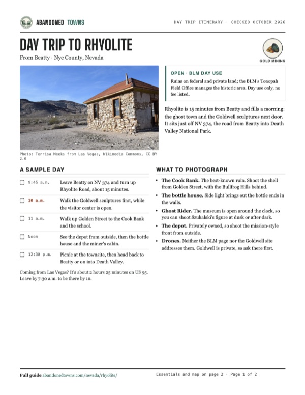
Download the PDF (586 KB)Rhyolite is 15 minutes from Beatty and fills a morning: the ghost town and the Goldwell sculptures next door. It sits just off NV 374, the road from Beatty into Death Valley National Park.
A sample day
- Leave Beatty on NV 374 and turn up Rhyolite Road, about 15 minutes.
- Walk the Goldwell sculptures first, while the visitor center is open.
- Walk up Golden Street to the Cook Bank and the school.
- See the depot from outside, then the bottle house and the miner's cabin.
- Picnic at the townsite, then head back to Beatty or on into Death Valley.
Coming from Las Vegas? It's about 2 hours 25 minutes on US 95. Leave by 7:30 a.m. to be there by 10.
What to photograph and film
- The Cook Bank. The best-known ruin. Shoot the shell from Golden Street, with the Bullfrog Hills behind.
- The bottle house. Side light brings out the bottle ends in the walls.
- Ghost Rider. The museum is open around the clock, so you can shoot Szukalski's figure at dusk or after dark.
- The depot. Privately owned, so shoot the mission-style front from outside.
- Drones. Neither the BLM page nor the Goldwell site addresses them. Goldwell is private, so ask there first.
Map & directions
Getting there
Beatty is 6 miles away. Take NV 374, the road to Death Valley, west out of town and turn right on Rhyolite Road. From Las Vegas it's about two and a half hours north on US 95 to Beatty. Paved all the way.


Base map: USGS The National Map (public domain). Routes: OSRM on © OpenStreetMap contributors data (ODbL), computed October 2026. Times assume dry roads.
- Head west on Main Street, which becomes Death Valley Road, NV 374.4.1 mi
- Turn right onto Rhyolite Road and follow it up to the townsite.1.8 mi
- From downtown, take US 95 north (the Purple Heart Highway, then the Veterans Memorial Highway) to Beatty.117 mi
- In Beatty, turn left onto Main Street, NV 374, which becomes Death Valley Road.4.0 mi
- Turn right onto Rhyolite Road to the townsite.1.8 mi
Road and safety notes
- Paved to the townsite. Day use only; the BLM doesn't allow camping.
- Summers are hot. Bring water and shade; the BLM lists picnicking but no other services.
- Keep off the unstable walls of the ruins.
- Death Valley National Park is just down NV 374 if you want to continue.
Photos
Rhyolite in photos
Visitor reports
Been to Rhyolite?
Been there lately? Tell the next visitor what you found: whether you could get in, the state of the road and what's still standing. Photos are welcome. We read every report before it appears here.
Gold mining
More gold mining ghost towns
The nearest in Nevada.

 Guide
Goldfield
37.71, -117.24Esmeralda County, Nevada
For a few years after 1902 Goldfield was the biggest city in Nevada, with a gold output in the millions and a world title fight. Floods and fire took…
 Guide
Manhattan
38.54, -117.08Nye County, Nevada
A 1905 gold rush town at 7,000 feet that never quite emptied. Counts from 2005 to 2011 put the population between about 50 and 125. The post office…
Nearby
Other sites near Rhyolite
Straight-line distance from the townsite to other mapped sites in our Nevada index.
- Bullfrog1.0 mi S · Nye
- Gold Center4.2 mi SE · Nye
- Pioneer7.4 mi N · Nye
- Carrara9.6 mi SE · Nye
- Springdale9.6 mi NE · Nye
- Leeland25.8 mi SE · Nye
- Bonnie Claire27.5 mi NW · Nye
- Wahmonie37.5 mi E · Nye
Sources
Sources and credits
- ghosttowns.com, "Rhyolite": fact sheet fields (roads, climate, best time), the first post office in a tent, the jail and store buildings.
- Wikipedia, "Rhyolite, Nevada", retrieved October 2026: discovery, founding, Schwab, railroads, stock exchange, population, decline, closures, buildings, depot repairs and boarded windows (April 2026 photo), cemetery, Ladd Mountain mine, Mercantile fire, BLM and Goldwell.
- National Park Service, "Rhyolite Ghost Town" (updated November 2021): paved road into town, federal and private land, privately owned depot.
- BLM, "Rhyolite Historic Area": location, day use only, no camping, picnicking, contact, as of October 2026.
- BLM blog (November 1, 2024): the guided walk of the townsite on October 26, 2024.
- Goldwell Open Air Museum, official site, with its "Plan Your Visit" and "Walking Tours" pages: hours, summer closing, visitor center, donations, monthly tours, brochure, seven sculptures, private property, photography rules, as of October 19, 2026.
- Wikipedia, "Goldwell Open Air Museum", retrieved October 2026: Szukalski's 1984 The Last Supper and Ghost Rider.
- Coordinates: Wikipedia (from USGS GNIS). Elevation: USGS 3D Elevation Program point query. Routes: OSRM on OpenStreetMap data, October 2026.
Photo and map credits
- The miner's cabin, with the Cook Bank in the distance: Terrisa Meeks from Las Vegas, Wikimedia Commons, CC BY 2.0
- The Cook Bank ruins on Golden Street: Tahoenathan, Wikimedia Commons, CC BY-SA 3.0
- Rhyolite in January 1908: photographer unknown; Rhyolite, Nevada, U.S.A.; Jan. 1908, Wikimedia Commons, Public domain
- The Cook Bank in 1908: Mark Holloway from Beatty, Nevada, USA, Wikimedia Commons, Public domain
- Tom Kelly's bottle house: Finetooth, Wikimedia Commons, CC BY-SA 3.0
- The Las Vegas & Tonopah depot: Draxfelton, Wikimedia Commons, Public domain
- The miner's cabin: BLM Nevada, Wikimedia Commons, Public domain
- Ghost Rider at the Goldwell museum: Marc Cooper from Woodland Hills, California, Wikimedia Commons, CC0
- The Bullfrog Hills above Rhyolite: Finetooth, Wikimedia Commons, CC BY-SA 3.0
- The Cook Bank shell in July 2019: Pom', Flickr, CC BY-SA 2.0
- The Rhyolite Mercantile in March 2009, five years before lightning burned it: Ken Lund, Flickr, CC BY-SA 2.0
- The Las Vegas & Tonopah depot behind a Joshua tree, March 2009: Ken Lund, Flickr, CC BY-SA 2.0
- A wooden caboose lettered Union Pacific, April 2010: Rafał Próchniak, Flickr, CC BY-SA 2.0
- Stone walls in the townsite, with the Cook Bank shell behind, December 2012: BLM Nevada, Flickr, CC BY 2.0
- A Bureau of Land Management sign: “Safety zone. No shooting. Respect life and property” (April 2010): Rafał Próchniak, Flickr, CC BY-SA 2.0
- Topo map, area base map and aerial imagery: USGS The National Map (public domain).
- Historic maps: USGS Historical Topographic Map Collection (public domain): Furnace Creek 1908, 1:250,000; Bullfrog 1942, 1:125,000; Bullfrog 1954, 1:62,500; Beatty 1987, 1:24,000.