 Abandoned

Overview
A lawless canyon above the Colorado

Eldorado Canyon cuts through the Eldorado Mountains down to the Colorado River, southeast of Las Vegas. Gold and silver turned up around 1859, and a rush began in 1861. The Techatticup was the best-known mine, and with its neighbors it produced several million dollars in gold, silver, copper and lead before the last mines closed in the 1940s. Steamboats on the Colorado called at Colorado City, at the mouth of the canyon, until the railroad made the landing unnecessary.
The canyon was rough. Deserters from both sides of the Civil War are said to have hidden here, and the Techatticup was notorious for killings over labor and ownership. The town took its name from Charles Nelson, a camp leader killed in 1897. In 1907 the Eldorado post office moved up the road to Nelson.
In 1974 a flash flood destroyed Nelson's Landing on Lake Mohave and killed ten people. The 2020 census counted 22 residents, most in private ranch houses. A river and mine tour business runs from a former gas station that has been a backdrop for films including 3000 Miles to Graceland.
Video
Nelson in 30 seconds
Eldorado Canyon's gold camp: the rush of 1861, the Techatticup Mine yard, the old gas station film backdrop and mine tours today.
Timeline
Gold, guns and floods

- Spaniards call the area Eldorado, by Wikipedia's account.
- The Ives Expedition passes through.
- Gold and silver are found in the canyon, and a rush begins in 1861. The Techatticup Mine opens that year.
- Civil War deserters from both armies are said to hide in the canyon. Colorado City, at its mouth, serves as a steamboat landing on the Colorado River.
- Charles Nelson, a camp leader, is killed. The town later takes his name.
- The Eldorado post office closes and moves to Nelson.
- The canyon's mines, active since about 1858, shut down. Showcaves.com dates the Techatticup's closing to 1942; Wikipedia says the canyon mines ran to about 1945.
- A flash flood destroys Nelson's Landing on Lake Mohave and kills ten people.
- The census counts 22 residents.
What's left
What you'll see


Most visitors stop at the Techatticup Mine, about 2 miles past Nelson on NV 165. Its yard is crowded with old cars, trucks, gas pumps and weathered buildings, and the business rents it out for photo shoots, film work and weddings. The guided tour walks into the old mine. Nelson itself is mostly private ranch houses; look from the road. The road continues down the canyon toward the Colorado River.
The oldest USGS sheet in the next section, from 1886, shows El Dorado Cañon running down to the Colorado River, with Miners Spring and a well along the canyon road.
- Techatticup Mine (tours)
- Mine and mill buildings
- Former gas station (film location)
- Vintage vehicles
- Ranch houses (private)


Historic maps
Nelson on USGS maps, 1886–1984
Crops from the USGS Historical Topographic Map Collection, centered on the townsite. Each sheet shows what surveyors mapped that year; compare them with today's topo and aerial on this page.

Day trip
Plan a day trip to Nelson from Boulder City
Take it with you
Day trip itinerary
The essentials, the sample day with boxes to tick, what to photograph and the coordinates, on two printable pages. Handy where there's no signal.
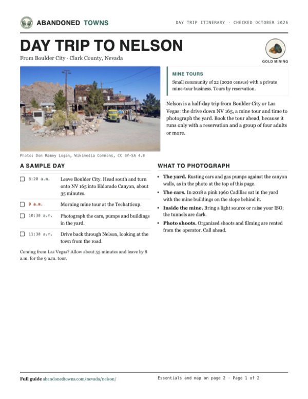
Download the PDF (504 KB)Nelson is a half-day trip from Boulder City or Las Vegas: the drive down NV 165, a mine tour and time to photograph the yard. Book the tour ahead, because it runs only with a reservation and a group of four adults or more.
A sample day
- Leave Boulder City. Head south and turn onto NV 165 into Eldorado Canyon, about 35 minutes.
- Morning mine tour at the Techatticup.
- Photograph the cars, pumps and buildings in the yard.
- Drive back through Nelson, looking at the town from the road.
Coming from Las Vegas? Allow about 55 minutes and leave by 8 a.m. for the 9 a.m. tour.
What to photograph and film
- The yard. Rusting cars and gas pumps against the canyon walls, as in the photo at the top of this page.
- The cars. In 2018 a pink 1960 Cadillac sat in the yard with the mine buildings on the slope behind it.
- Inside the mine. Bring a light source or raise your ISO; the tunnels are dark.
- Photo shoots. Organized shoots and filming are rented from the operator. Call ahead.
Map & directions
Getting there
From Boulder City or Las Vegas, head south toward Searchlight and turn east on NV 165, Nelson Road, into Eldorado Canyon. It's paved all the way, about 45 minutes from the Las Vegas Strip.


Base map: USGS The National Map (public domain). Routes: OSRM on © OpenStreetMap contributors data (ODbL), computed October 2026. Times assume dry roads.
- Head out of town on Arizona Street, Nevada Way and Boulder City Parkway.3.6 mi
- Take the ramp and turn left onto the Veterans Memorial Highway, signed SR 173 in the route data, heading south.10.3 mi
- Turn left onto Nelson Road, NV 165, into Eldorado Canyon.11.0 mi
- Continue onto Western Road in Nelson.0.2 mi
- From downtown, take I-11/US 93/US 95 south toward Boulder City.22.3 mi
- Take exit 14 and follow US 95 south.9.2 mi
- Turn left onto Nelson Road, NV 165, into Eldorado Canyon.11.0 mi
- Continue onto Western Road in Nelson.0.2 mi
Road and safety notes
- NV 165 is paved. Eldorado Canyon floods in heavy rain; the 1974 flood killed ten people at Nelson's Landing. Don't drive into a running wash.
- Most buildings in Nelson are private. The mine yard is a business; ask before wandering.
- Mine tours need a reservation and at least four adults.
Photos
Nelson in photos
Visitor reports
Been to Nelson?
Been there lately? Tell the next visitor what you found: whether you could get in, the state of the road and what's still standing. Photos are welcome. We read every report before it appears here.
Gold mining
More gold mining ghost towns
The nearest in Nevada.

 Guide
Searchlight
35.47, -114.92Clark County, Nevada
An 1897 gold strike in the desert south of Las Vegas made a town of 5,000 by 1907. It shrank to about 50 people, then came back as a highway town of…
 Guide
Delamar
37.46, -114.77Lincoln County, Nevada
For five years Delamar was the richest gold camp in Nevada, and its dry-crushed quartzite filled the air with the dust that earned it the name…
Nearby
Other sites near Nelson
Straight-line distance from the townsite to other mapped sites in our Nevada index.
- Buster Falls0.4 mi SE · Clark
- Louisville1.3 mi E · Clark
- Lucky Jim Camp1.3 mi E · Clark
- El Dorado City1.4 mi E · Clark
- Searchlight17.5 mi S · Clark
- Quartette21.3 mi SE · Clark
- Crescent24.9 mi SW · Clark
- Borax28.9 mi W · Clark
Sources
Sources and credits
- ghosttowns.com, "Nelson": fact sheet fields (roads, climate, best time, remains).
- Wikipedia, "Nelson, Nevada", retrieved October 2026: Eldorado name, discovery and rush, deserters, Techatticup, Colorado City, Charles Nelson, post office, 1974 flood, 2020 census, film location.
- Eldorado Canyon Mine Tours, official site, with its "Mine Tours" and "Directions/Contact Us" pages, as of October 19, 2026: tour times, four-adult minimum, prices, length, holiday closures, location 2 miles past Nelson, rentals, 45 minutes from the Strip, 1861–1942 mine dates.
- Showcaves.com, "Eldorado Canyon Mine Tours": operator, location 2.5 km past Nelson, 1861 opening, 1858 Ives Expedition, 1942 closing.
- Travel Nevada, "Eldorado Canyon and Techatticup Mine", as of October 2026: tour length of about 90 minutes, private ownership, film use.
- Coordinates: Wikipedia (from USGS GNIS). Elevation: USGS 3D Elevation Program point query. Routes: OSRM on OpenStreetMap data, October 2026.
Photo and map credits
- The store in the Techatticup Mine yard: Don Ramey Logan, Wikimedia Commons, CC BY-SA 4.0
- A rusting sedan by a gas-station front: raduranga, Wikimedia Commons, CC BY-SA 4.0
- Old trucks in the mine yard: Agnieszka Kwiecień, Nova, Wikimedia Commons, CC BY-SA 4.0
- A weathered cabin in the mine yard: Agnieszka Kwiecień, Nova, Wikimedia Commons, CC BY-SA 4.0
- A 1960 Cadillac in the yard: Agnieszka Kwiecień, Nova, Wikimedia Commons, CC BY-SA 4.0
- A school bus, a water tower and the main store: Agnieszka Kwiecień, Nova, Wikimedia Commons, CC BY-SA 4.0
- The Techatticup Mine yard and NV 165 from the hillside, 2013: Hypersite, Wikimedia Commons, CC BY-SA 3.0
- Topo map, area base map and aerial imagery: USGS The National Map (public domain).
- Historic maps: USGS Historical Topographic Map Collection (public domain): Camp Mohave 1886, 1:250,000; Nelson 1926, 1:96,000; Nelson 1958, 1:62,500; Boulder City 1983, 1:100,000; Nelson 1984, 1:24,000.