 Abandoned
Overview
A town squeezed into a canyon

Mogollon fills the bottom of Silver Creek Canyon, high in the mountains east of Glenwood. A soldier from Fort Bayard, Sergeant James Cooney, found gold here in the 1870s. John Eberle built the first cabin in 1889, and a post office and jail followed the next year.
More than 20 mines worked the slopes, with the Little Fannie the largest employer. By 1909 about 2,000 people lived in the canyon. It was a hard place to keep standing: fires burned the town five times between 1894 and 1942, and Silver Creek flooded it four times. Over their lives the mines produced more than 18 million ounces of silver and close to $20 million in gold, silver and copper.
The population fell to about 200 by 1930. Today a few caretakers keep the town, and it is a National Register historic district. In the warm months the Purple Onion Cafe, the Mogollon Museum and a few shops open, mostly on weekends.
Timeline
Gold, fire and flood


- Sergeant James C. Cooney, a soldier from Fort Bayard, finds gold in the Mogollon Mountains.
- John Eberle builds the first cabin in what becomes Mogollon.
- A post office and a jail open.
- Fire hits the town in 1894, 1904, 1910 and 1915. Silver Creek floods it in 1894, 1896, 1899 and 1914.
- About 2,000 people live here. The Little Fannie is the biggest employer among more than 20 mines.
- The district has produced about $1.5 million in gold and silver so far.
- The town has about 1,500 people, with electricity, water and telephones.
- About 200 people remain.
- Another fire burns part of the town.
- My Name Is Nobody, with Henry Fonda and Terence Hill, is filmed here.
- Listed on the National Register as the Fannie Hill Mill and Company Town Historic District.
What's left
What you'll see


The main street runs along the creek, lined with stone and adobe-style buildings, among them the J.P. Holland General Store. Around town are rusting mine carts, rails, ore chutes and gated mine openings. The Mogollon Museum covers the mining history, and the cemetery records are kept in binders in town. New Mexico Magazine reported in 2025 that the museum and its collection were for sale.
The old cemetery is about 1¼ miles up Graveyard Gulch on a rough gravel road that starts at the old schoolhouse at the north end of the main street. The state tourism site says a high-clearance vehicle can drive it but recommends walking. The 1963 and 1999 sheets in the historic maps below mark the cemetery at the head of the gulch and the Little Fannie Mine on the slope to the west.
- Main street buildings
- J.P. Holland General Store
- Mogollon Museum
- Mine carts, rails and chutes
- Gated mine openings
- Graveyard Gulch cemetery


Historic maps
Mogollon on USGS maps, 1910–1999
Crops from the USGS Historical Topographic Map Collection, centered on the townsite. Each sheet shows what surveyors mapped that year; compare them with today's topo and aerial on this page.
Day trip
Plan a day trip to Mogollon from Silver City
Take it with you
Day trip itinerary
The essentials, the sample day with boxes to tick, what to photograph and the coordinates, on two printable pages. Handy where there's no signal.
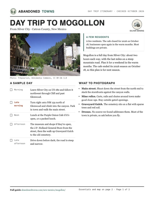
Download the PDF (632 KB)Mogollon is a full day from Silver City: about two hours each way, with the last miles on a steep mountain road. Plan it for a weekend in the warm months. The cafe ended its 2026 season on October 18, so this plan is for next season.
A sample day
- Leave Silver City on US 180 and follow it northwest through Cliff and past Glenwood.
- Turn right onto NM 159 north of Glenwood and climb into the canyon. Park in town and walk the main street.
- Lunch at the Purple Onion Cafe if it's open, or a packed lunch.
- The museum and shops if they're open, the J.P. Holland General Store from the street, then the walk up Graveyard Gulch to the old cemetery.
- Drive down before dark; the road is steep and narrow.
What to photograph and film
- Main street. Shoot down the street from the north end to stack the storefronts against the canyon walls.
- Mine relics. Carts, rails and chutes around town make good close-ups. Stay outside gated openings.
- Graveyard Gulch. The cemetery sits on a flat with sparse trees and red soil.
- Drones. No source we found addresses them. Most of the town is private, so ask before you fly.
Map & directions
Getting there
Silver City is the nearest real town with services, about two hours away. Take US 180 north past Glenwood and turn right on NM 159, Bursum Road, which climbs about nine and a half miles into the canyon. The routes below are computed from OpenStreetMap; we haven't driven them.


Base map: USGS The National Map (public domain). Routes: OSRM on © OpenStreetMap contributors data (ODbL), computed October 2026. Times assume dry roads.
- From North Cooper Street in downtown Silver City, take West Market Street to US 180.1.3 mi
- Follow US 180 northwest through Cliff and past Glenwood.63.1 mi
- Turn right onto NM 159, Bursum Road, and climb to Mogollon. About a mile and a half before town, the computed route cuts across on Forest Road 4056M; stay on NM 159 instead.9.6 mi
- From downtown Tucson, take I-10 east past Benson.94.4 mi
- Exit onto US 191 north toward Safford, then through Safford on US 70 and US 191.65.8 mi
- Continue on AZ 78, which becomes NM 78, across the state line.34.7 mi
- Turn left on US 180 south toward Glenwood.19.1 mi
- Turn right onto NM 159, Bursum Road, and climb to Mogollon, staying on NM 159 where the computed route cuts across on Forest Road 4056M.9.6 mi
Road and safety notes
- New Mexico Magazine calls the road rough enough that high-clearance vehicles are recommended. The state tourism site says to get directions locally first.
- East of Mogollon, NM 159 becomes an unpaved single-lane road that is closed in winter for ice and snow.
- Check nmroads.com for closures before you go.
- Most of the town is private property. Stay off porches and out of fenced mine openings.
Photos
Mogollon in photos
Visitor reports
Been to Mogollon?
Been there lately? Tell the next visitor what you found: whether you could get in, the state of the road and what's still standing. Photos are welcome. We read every report before it appears here.
Silver mining
More silver mining ghost towns
The nearest in New Mexico.

 Guide
Shakespeare
32.33, -108.74Hidalgo County, New Mexico
A stage stop that became a silver camp, then a ranch. The Hill family and their relatives have kept its buildings since 1935, and you see them on a…
 Guide
Lake Valley
32.72, -107.57Sierra County, New Mexico
A silver town made famous by the Bridal Chamber, a cave of nearly pure silver. The 1893 crash and an 1895 fire ended the boom, manganese kept a few…
Nearby
Other sites near Mogollon
Straight-line distance from the townsite to other mapped sites in our New Mexico index.
- Cooney2.0 mi NW · Catron
- Clairmont3.4 mi N · Catron
- Alma6.1 mi W · Catron
- Pleasanton9.8 mi SW · Catron
- Aragon37.5 mi NE · Catron
- Birchville49.3 mi SE · Grant
- Tyrone55.3 mi SE · Grant
- Red Hill57.0 mi N · Catron
Sources
Sources and credits
- ghosttowns.com, "Mogollon": fact sheet fields (road, climate, remains, 1909 population).
- Wikipedia, "Mogollon, New Mexico", retrieved October 2026: Cooney, Eberle, mines, production, population, fires and floods, post office, National Register listing, film.
- Islands, updated September 25, 2026: caretakers, museum, Purple Onion Cafe, J.P. Holland General Store, weekend season, relics, cemetery binders, Silver City base, camping.
- New Mexico Magazine, "Take Your Pick Between These Old Mining Towns," 2021: Saturday, Sunday and Monday-holiday openings, high-clearance advice, the green chile cheeseburger.
- New Mexico Magazine, "A Ghost Town with Spirit," October 2025, updated April 2026: weekends from May to October as the time most businesses open, the museum for sale, the narrow road, the cemetery road.
- The Purple Onion in Mogollon NM, the cafe's own Facebook page, read October 19, 2026: 2026 closing date of October 18 (posted October 3), 9 a.m. to 5 p.m. openings.
- New Mexico True, "Mogollon", October 2026: Friday to Sunday season from May to October, elevation, the Graveyard Gulch road and cemetery, get directions locally.
- Wikipedia, "New Mexico State Road 159": unpaved single-lane road east of Mogollon, closed in winter.
- Elevation: USGS 3D Elevation Program point query. Routes: OSRM on OpenStreetMap data, October 2026. Not field-checked.
Photo and map credits
- The main street, 2008: Trbpearson, Wikimedia Commons, CC BY-SA 3.0
- The J.P. Holland General Store, 2006: Cam Vilay, Wikimedia Commons, CC BY 3.0
- A rusted car and an old gas pump, 2008: Tom Blackwell from UK, Wikimedia Commons, CC BY-SA 2.0
- A Cinco de Mayo procession, 1914: Unknown author, Wikimedia Commons, Public domain
- Mogollon on the 1910 USGS sheet, with Cooney to the north: U.S. Geological Survey, USGS catalog, Public domain
- Area base map, topo and aerial imagery: USGS The National Map (public domain).
- Historic maps: USGS Historical Topographic Map Collection (public domain): Mogollon 1910, 1:125,000; Clifton 1954, 1:250,000; Mogollon 1963, 1:24,000; Mogollon Mountains 1985, 1:100,000; Mogollon 1999, 1:24,000.