 Abandoned

Overview
Ghost town of the Borscht Belt

Lemuel Martin settled here in 1800, but it was William Parks and his son Elijah, who built the mills, that the residents named the hamlet for. The New York, Ontario and Western Railway arrived in 1880, and the farms around Parksville began taking in boarders from the city. In the Borscht Belt years the marker project counts about 65 hotels and 14 bungalow colonies around the hamlet. Young's Gap, opened in 1928, held up to 600 guests and had an indoor pool, a theater and a synagogue, and Bobby Darin started out as a busboy at the Sunnylands Hotel.
The decline came in stages. The O&W ran its last train in 1957. Route 17 took the vacationers elsewhere in the 1960s, and many hotels and colonies closed. Route 17 itself still ran through the middle of Parksville, with a traffic light at the Cooley Road junction, until the state built a bypass: announced in 2007, begun in 2009 at $95 million, and opened in autumn 2011. The passing trade vanished. By 2020 most storefronts were empty, Wikipedia says, citing the Times Herald-Record.
That emptied Main Street is why Parksville is called a ghost town. Wikipedia files it in its Ghost towns in New York category. A 2022 local history post titled it a "Ghost town in the Borscht Belt," describing vacant commercial buildings with papered-over windows, and a 2023 Architectural Afterlife post, filed under ghost towns, found a timeworn town of mostly deserted buildings. But Parksville never emptied of people: the 2022 post put the population at a little under 1,000. Visit it as a lived-in hamlet with a ghost of a main street.
Video
Main Street on a bare winter day
The camera moves along Parksville's streets on a grey day with the trees bare: frame houses and storefronts on Main Street, the brick corner building, a boarded-up roadside building and empty lots along the old highway, a white church with a steeple and a columned house, ending where the road meets the highway. Posted in February 2023, before most of the renovation work and the 2025 marker described below. The homes and businesses it shows are private; see them from the street.
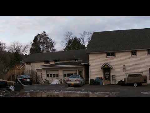 Play “PARKSVILLE NEW YORK ABANDONED GHOST TOWN” from YouTube
Timeline
Mills, boarders, bypass
- Lemuel Martin settles here. William Parks and his son Elijah later build the mills, and the residents name the hamlet for Parks.
- The New York, Ontario and Western Railway reaches Parksville. Farms begin taking in summer boarders from the city.
- Young's Gap Hotel opens. It grows to hold 600 guests, with an indoor pool, a theater and a synagogue.
- The O&W runs its last trains and the whole line is abandoned.
- With Route 17 built, many hotels and bungalow colonies close.
- The state announces a bypass to take Route 17 traffic out of the hamlet. Construction begins in spring 2009, at $95 million.
- The bypass and the new exit 98 open, and passing traffic leaves Main Street.
- Most storefronts are empty, the Times Herald-Record reports.
- An $800,000 Restore NY grant funds work on three Main Street buildings.
- Renovation begins on a pizzeria closed since 2013 and the Dari King next door.
- The Borscht Belt Historical Marker Project dedicates its fourteenth marker in Parksville.
What's left
A Main Street coming back

A photographer who drove through on March 16, 2024 found the gas station still doing business and the old restaurants on the former Route 17 all in states of decay. Main Street's storefronts were largely empty. The 2022 history post notes that visitors can still find the graves of William Parks and his family.
The town has been working to bring the street back. In February 2023 the Sullivan County Democrat reported an $800,000 Restore NY grant for 29, 30 and 39 Main Street, planned as a community market, a toy store, and retail space with apartments, and the town supervisor said about 60 percent of Main Street's buildings had recently changed hands to owners able to fix them. Manor Ink reported in October 2024 that Charlie's Pizzeria on Old Route 17, closed since 2013, was being renovated as a restaurant, and the Fiddle's Dari King next door was to reopen as a produce market. On October 5, 2025 the Borscht Belt Historical Marker Project unveiled its fourteenth marker at Old Route 17, Short Avenue and Cooley Road, with the Sullivan County historian among the speakers.
Homes and businesses are private. Walk Main Street and Old Route 17, read the marker, and see the First Methodist Episcopal Church and the Tefereth Israel Anshei Parksville Synagogue from the street.
The old maps show the hamlet strung along the railroad and the highway. The 1921 Livingston Manor sheet shows Parksville beside the O&W in its valley, with Fox Mountain School to the southwest. The 1965 Liberty West sheet shows the four-lane Route 17 cutting straight through the hamlet, with houses, a school and cemeteries around it.
- Main Street's storefronts, many empty, several under renovation (private)
- Roadside restaurant buildings on Old Route 17
- The 2025 Borscht Belt historical marker at Old Route 17, Short Avenue and Cooley Road
- The First Methodist Episcopal Church
- The Tefereth Israel Anshei Parksville Synagogue
- The graves of William Parks and his family (2022 report)


Historic maps
Parksville on USGS maps, 1921–1986
Crops from the USGS Historical Topographic Map Collection, centered on the townsite. Each sheet shows what surveyors mapped that year; compare them with today's topo and aerial on this page.

Map & directions
Getting there
Parksville is just off NY 17 (future I-86) at exit 98, about 4.8 miles by road from Liberty. The routes end at Short Avenue and Cooley Road, where the 2025 marker stands.

Base map: USGS The National Map (public domain). Routes: OSRM on © OpenStreetMap contributors data (ODbL), computed October 2026. Times assume dry roads.
- From Liberty, take North Main Street and turn right on Exit Road.1.2 mi
- Take NY 17 to exit 98.3.4 mi
- Turn right on Short Avenue (CR 85) to Cooley Road in Parksville.0.2 mi
- From Midtown Manhattan, take West 45th Street, 9th Avenue and West 41st Street to the Lincoln Tunnel.0.8 mi
- Go through the Lincoln Tunnel (NY 495).3.8 mi
- Take NJ 3, then NJ 17, which joins I-287 and NY 17.27.2 mi
- Bear left on NY 17; at exit 16 stay on NY 17.16.3 mi
- Follow NY 17 to exit 98, then turn right on Short Avenue (CR 85) into Parksville.58.6 mi
Road and safety notes
- Both routes are on highways and an expressway to exit 98.
- Homes and businesses in Parksville are private property.
Photos
Parksville in photos
Visitor reports
Been to Parksville?
Been there lately? Tell the next visitor what you found: whether you could get in, the state of the road and what's still standing. Photos are welcome. We read every report before it appears here.
Nearby
Other sites near Parksville
Straight-line distance from the townsite to other mapped sites in our New York index.
- Shavertown16.8 mi N · Delaware
- Trapps Mountain Hamlet29.3 mi E · Ulster
- Cold Spring51.3 mi SE · Putnam
- Johnsontown55.2 mi SE · Rockland
- Doodletown55.3 mi SE · Rockland
- Dicktown57.1 mi SE · Putnam
- Jones Point57.2 mi SE · Rockland
- Sharon63.5 mi N · Schoharie
Sources
Sources and credits
- Wikipedia, "Parksville, New York", read October 29, 2026: the hamlet in Liberty, ZIP 12768, Lemuel Martin in 1800 and the Parks mills, the O&W from 1880 to March 29, 1957, the traffic light at Cooley Road, the bypass announced in May 2007, begun in spring 2009 at $95 million and opened in autumn 2011, empty storefronts by 2020 (citing the Times Herald-Record), the 2025 marker, the coordinates and the Ghost towns in New York category.
- Bruce Forsyth, "Ghost town in the Borscht Belt - The rise and fall of Parksville, New York," August 11, 2022: the label, the vacant papered-over Main Street, about 100 hotels and colonies at the peak, a little under 1,000 residents, the Parks family graves.
- Architectural Afterlife, "The Quiet Hamlet of Parksville, New York," September 22, 2023: the ghost town label and the mostly deserted buildings.
- Joseph Abraham, "$800,000 grant to continue Parksville's revitalization," Sullivan County Democrat, February 10, 2023: the Restore NY grant, the three Main Street projects, 60 percent of buildings changing hands.
- Manor Ink, "Rte. 17 sites in Parksville undergoing updates," October 2024: Charlie's Pizzeria and Fiddle's Dari King.
- Art Steinhauer, "Manor, P'ville get historic signs," Manor Ink, November 2025: the October 5 dedication of the fourteenth Borscht Belt marker, Young's Gap in 1928, Bobby Darin at the Sunnylands, the county historian.
- Borscht Belt Historical Marker Project, Parksville, read October 29, 2026: the marker's site and text, the O&W, boarding houses, Young's Gap and its 600 guests, the last train in 1957, Route 17 in the 1960s, about 65 hotels and 14 bungalow colonies.
- Roadgeek Adam, Parksville photos, Wikimedia Commons, March 16, 2024: the photographer's note that the gas station still does business and the restaurants are in decay.
- Historic maps: USGS Historical Topographic Map Collection, Livingston Manor (1921), Scranton 1:250,000 (1950), Liberty West (1965) and Monticello 1:100,000 (1986) sheets.
- Elevation: USGS 3D Elevation Program point query. Routes: OSRM on OpenStreetMap data, October 2026.
- NEIGHBORHOOD GUY, "PARKSVILLE NEW YORK ABANDONED GHOST TOWN", YouTube, posted February 20, 2023: a street-level tour of the hamlet (the video on this page); no captions, checked against its storyboard frames.
Photo and map credits
- Main Street in downtown Parksville, March 16, 2024: Adam Moss, Wikimedia Commons, CC BY-SA 2.0
- Old Route 17 coming into the hamlet, March 16, 2024: Roadgeek Adam, Wikimedia Commons, CC BY-SA 2.0
- Roadside restaurant buildings at Parksville Road and Cooley Road, March 16, 2024: Roadgeek Adam, Wikimedia Commons, CC BY-SA 2.0
- A faded diner sign in Parksville, March 16, 2024: Roadgeek Adam, Wikimedia Commons, CC BY-SA 2.0
- The First Methodist Episcopal Church of Parksville, April 30, 2011: Doug Kerr, Wikimedia Commons, CC BY-SA 2.0
- Tefereth Israel Anshei Parksville Synagogue, September 19, 2012: Vonsky87, Wikimedia Commons, CC BY-SA 3.0
- The old Route 17 through Parksville closed off after the bypass opened, February 4, 2012: Adam Moss, Wikimedia Commons, CC BY-SA 2.0
- Panorama of the old Route 17, the hamlet and the closed County Route 176, February 4, 2012: Adam Moss, Wikimedia Commons, CC BY-SA 2.0
- Topo map, area base map and aerial imagery: USGS The National Map (public domain).
- Historic maps: USGS Historical Topographic Map Collection (public domain): Livingston Manor 1921, 1:62,500; Scranton 1950, 1:250,000; Liberty West 1965, 1:24,000; Monticello 1986, 1:100,000.