 Abandoned
Overview
Hoops, huckleberries and a highway

The Trapps was a hamlet of small farms along the top of the Shawangunk Ridge, west of New Paltz, in the towns of Gardiner and Rochester. Families, most of Dutch descent, moved up after the Revolution onto land opened by colonial patents. The soil was thin and rocky, so a farm alone didn't pay. People cut hoop poles for barrels, peeled bark for the tanneries, quarried millstones, burned charcoal and, from the 1800s, picked huckleberries for market. They built houses of logs, planks and frame, and by the late 1800s the hamlet had 40 to 50 families, a school, a store, a chapel, boarding houses and a tavern on the Wawarsing–New Paltz Turnpike.
After 1900 the trades failed one by one. Steel hoops replaced wooden ones and steel replaced millstones, and epidemics, the 1918 flu among them, thinned the families. Many found work at the Smiley family's Mohonk and Minnewaska mountain houses, and in the 1920s Mohonk Mountain House bought the Van Leuven place. US 44/55, finished in 1930 by Mohonk Preserve's account, bypassed the hamlet's center and destroyed many homesteads. The last resident, Irving Van Leuven, died in 1956 in a house with no electricity or running water.
The woods have grown back over the fields. In 2000 the 433-acre district joined the National Register of Historic Places. Most of what survives is stone: cellar holes, walls, bridge abutments, charcoal pits and burying grounds. One house, the Eli Van Leuven Cabin, has been restored by Mohonk Preserve, and a marked path from the West Trapps Trailhead leads past the hamlet's sites.
Timeline
Two centuries on the ridge
- The Groote Transport Patent and the Nineteen Partners Tract open the Shawangunk Ridge to settlement. After the Revolution, families mostly of Dutch descent move up onto the ridge.
- Families farm the thin, rocky soil and add cash work: barrel hoops, tanbark, millstones, charcoal and, from the 1800s, huckleberries.
- A one-room school opens.
- The Wawarsing–New Paltz Turnpike is built through the hamlet as a toll road (1856 by Mohonk Preserve's account, seven years after the 1850 school by Wikipedia's). It soon goes bankrupt and becomes a public road. Ben Fowler keeps a lodging house and tavern on it.
- The hamlet's peak. Mohonk Preserve says it housed 40 to 50 families by the Civil War; Wikipedia puts 40 to 50 families in the 1880s and 1890s. It has a school, a hotel, boarding houses, a store and a chapel.
- The oldest headstone in the Fowler burying ground.
- William Hagen builds a plank house in 1889 or 1890. Eli Van Leuven buys it in 1898, and his family lives there into the 1920s.
- Steel hoops and steel millstones end the hamlet's trades, and epidemics including the 1918 flu cut its numbers. Many residents work at the Smileys' Mohonk and Minnewaska mountain houses.
- Mohonk Mountain House buys the Van Leuven property.
- US 44/55 is completed across the ridge (late 1920s, by Wikipedia's account). It bypasses the hamlet's center and destroys many homesteads.
- Irving Van Leuven, the last Trapps resident to live the old ways, dies in a house without electricity or running water. (The restored cabin is named for an earlier Van Leuven, Eli, whose family lived in it into the 1920s.)
- The Trapps Mountain Hamlet Historic District, 433 acres, joins the National Register of Historic Places.
- Mohonk Preserve posts that the Eli Van Leuven Cabin has been restored as an interpretive site.
What's left
Cellar holes, charcoal pits and one cabin

Mohonk Preserve counts about 60 cellar holes and foundations of houses, mills, barns, a school, a tavern, a chapel and other buildings, more than 40 charcoal pits and four family burying grounds. Wikipedia says six buildings still stand across the district. The one on Preserve land is the Eli Van Leuven Cabin, a plank house built by William Hagen in 1889 or 1890 and bought by Van Leuven in 1898. Mohonk posted in January 2023 that it had been restored as an interpretive site. It opens only for occasional guided tours, which the Preserve announces on its website; we found no 2026 date.
Along the path the Preserve's audio tour points out the large cellar hole of Ben Fowler's lodging house and tavern, about a hundred yards up the old turnpike, and the Fowler burying ground, where the oldest stone dates from 1866. Wikipedia adds a millstone quarry, a bridge abutment and stone walls on the route, and the Enderly sawmill and farm off the Coxing Trailhead on Clove Road.
The map point on this page is the coordinate Wikipedia gives for the district, which falls on US 44/55 at the place the USGS sheets label Minnewaska, at the west end of Trapps Road. The 1903 sheet in the historic maps below shows the old roads across the ridge there; the 1943 and 1957 sheets show the new highway's sharp bend there with a scatter of buildings along the older roads, and the Trapps Bridge at the right edge of the 1957 crop.
- Eli Van Leuven Cabin (1889 or 1890, restored)
- About 60 cellar holes and foundations
- Over 40 charcoal pits
- Four family burying grounds
- Fowler tavern cellar hole
- Millstone quarry
- Stone walls and bridge abutment


The path
Walking the Trapps Mountain Hamlet Path
Mohonk Preserve's directions: from the New York State Thruway take exit 18, New Paltz, and go 7 miles west through New Paltz on Route 299 to its end. Turn right on Route 44/55. The Preserve's Visitor Center is half a mile up on the right; the West Trapps Trailhead parking area is 1.3 miles past it, on the right. The lot fills very early on summer and fall weekends; the Preserve suggests parking at the Visitor Center instead and hiking up the East Trapps Connector.
From the trailhead, follow the blue markers. The Preserve describes the path as a moderate walk of about a mile and a half with 12 stops, uphill in places and not wheelchair accessible. Come back the same way; the Preserve's page says not to follow the highway. An audio tour is on the Preserve's website, and Wikipedia says a printed guide is available at the trailhead kiosk or the Visitor Center.
Preserve lands are open daily from sunrise to sunset. Members walk free; others pay a day-use fee of $15 for hikers Monday to Thursday and $20 Friday to Sunday and on holidays, at the Visitor Center, a staffed booth or a self-pay station. Bikers, climbers, skiers and riders pay $25. Children 15 and under are free with an adult. Dogs are welcome on a six-foot leash. The Visitor Center is open daily, 9 a.m. to 5 p.m., free, except on New Year's Day, Thanksgiving, Christmas Day and Christmas Eve afternoon.
Historic maps
Trapps Mountain Hamlet on USGS maps, 1903–1986
Crops from the USGS Historical Topographic Map Collection, centered on the townsite. Each sheet shows what surveyors mapped that year; compare them with today's topo and aerial on this page.

Day trip
Plan a day trip to Trapps Mountain Hamlet from New Paltz
Take it with you
Day trip itinerary
The essentials, the sample day with boxes to tick, what to photograph and the coordinates, on two printable pages. Handy where there's no signal.
Download the PDF (673 KB)The Trapps Mountain Hamlet is an easy half day from New Paltz. Park at Mohonk Preserve's West Trapps Trailhead and follow the blue-marked hamlet path past cellar holes, a family burying ground and the restored Van Leuven Cabin, then come back the same way. Add the Preserve's Visitor Center on the way down for a full day.
A sample day
- Leave New Paltz on NY 299 west and turn right on US 44/55, about 15 minutes.
- Buy a day pass at the Visitor Center, half a mile up US 44/55, as it opens. Or pay at the West Trapps booth.
- Park at West Trapps and pick up the blue markers.
- Walk the 12 stops: an abandoned millstone, the old wagon crossing, Ben Fowler's land, the family burying ground and the Van Leuven Cabin.
- Walk back the same way to the trailhead.
- Stop at the Visitor Center on the way down. Its quarter-mile Sensory Trail is an easy, level loop.
Coming from New York City? Allow about 2 hours each way, and more on fall weekends.
What to photograph and film
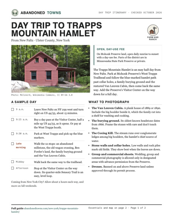
- The Van Leuven Cabin. A plank house of 1889 or 1890. Include the big boulder beside it, which the family cut into a shelf for washing and cooking.
- The burying ground. Its oldest known headstone dates from 1866. Frame the stones with care and don't touch them.
- The Coxing Kill. The stream runs over conglomerate ledges among big boulders, the hamlet's chief source of water.
- Stone walls and cellar holes. Low walls and rock piles mark old fields. They show best when the leaves are down.
- Group and commercial shoots. Wedding, group and commercial photography is allowed only in designated areas with advance permission from the Preserve.
- Drones. Banned on and above Preserve land unless approved through its permit process.
Map & directions
Getting there
New Paltz is the nearest town, about a quarter of an hour away. From New York City the drive runs through New Jersey on NJ 17 and up the Thruway to exit 18. Both routes end at the mapped point on US 44/55, about 1.1 miles past the West Trapps Trailhead, where the hamlet path starts. Park at the trailhead.

Base map: USGS The National Map (public domain). Routes: OSRM on © OpenStreetMap contributors data (ODbL), computed October 2026. Times assume dry roads.
- From Main Street (NY 299) in New Paltz, head west on NY 299, which becomes the New Paltz-Minnewaska Road, to its end.6.0 mi
- Turn right on US 44/NY 55 and climb the ridge. By Mohonk's directions the Visitor Center is 0.5 mile up and the West Trapps Trailhead 1.3 miles beyond it, both on the right; the mapped point is farther up the highway.2.9 mi
- From Park Row, take Barclay, Church, Reade and Hudson streets to the Holland Tunnel.1.2 mi
- Go through the Holland Tunnel (I-78) and follow 14th Street, the 14th Street Viaduct and NJ 139 onto the Pulaski Skyway, then exit for US 1/9 North.3.4 mi
- Turn right on Tonnelle Avenue (US 1/9), then follow NJ 3 west.7.2 mi
- Merge onto NJ 17 and follow it north to I-287/NY 17.23.1 mi
- Continue north on the New York State Thruway to exit 18, New Paltz.46.5 mi
- Turn left on Main Street (NY 299) through New Paltz and continue on the New Paltz-Minnewaska Road to its end.7.4 mi
- Turn right on US 44/NY 55, past the Visitor Center and the West Trapps Trailhead, to the mapped point.2.9 mi
Road and safety notes
- The routes are computed from OpenStreetMap and haven't been driven by us. We have no dated source on road surfaces.
- The routed point is on US 44/55 past the trailhead. Park at the West Trapps Trailhead (3700 Route 55) or the Visitor Center. Mohonk Preserve advises against parking on the highway; the state DOT has posted half-hour limits at the Scenic Overlook and the Hairpin Turn, about a mile up from Route 299.
- The West Trapps lot fills very early on peak summer and fall weekends. Arrive early or park at the Visitor Center.
- Walk the path out and back. Mohonk Preserve says not to follow the highway on foot.
Photos
Trapps Mountain Hamlet in photos
Visitor reports
Been to Trapps Mountain Hamlet?
Been there lately? Tell the next visitor what you found: whether you could get in, the state of the road and what's still standing. Photos are welcome. We read every report before it appears here.
Farm and ranch
More farm and ranch ghost towns
The nearest in New York, then the nearest elsewhere.

 Guide
Doodletown
41.30, -73.99Rockland County, New York
A valley hamlet settled by 1762 and bought out for Bear Mountain State Park. Its foundations, stone steps and two cemeteries lie along old roads that…
 Guide
Dudleytown
41.81, -73.35Litchfield County, Connecticut
A 1740s cluster of hill farms southeast of Cornwall Bridge that emptied as farming declined, and that a 20th-century curse story turned into a…
Nearby
Other sites near Trapps Mountain Hamlet
Straight-line distance from the townsite to other mapped sites in our New York index.
- Cold Spring25.5 mi SE · Putnam
- Dicktown28.8 mi SE · Putnam
- Parksville29.3 mi W · Sullivan
- Doodletown32.2 mi S · Rockland
- Jones Point33.7 mi SE · Rockland
- Johnsontown36.1 mi S · Rockland
- Doanesburgh38.8 mi SE · Putnam
- Shavertown40.6 mi NW · Delaware
Sources
Sources and credits
- ghosttowns.com, "Trapps Mountain Hamlet": fact sheet fields (roads, climate, best time, remains).
- Wikipedia, "Trapps Mountain Hamlet Historic District", retrieved October 2026: the patents, settlers, trades, house types, the 1850 school, the turnpike seven years later, the 1880s–1890s peak, the decline, the highway, Irving Van Leuven's 1956 death, six standing buildings, about 65 sites, ownership, the 2000 listing, 433 acres, the path, the Enderly sawmill, coordinates.
- Mohonk Preserve, "Take a Walk Back in Time", read October 20, 2026: 40 to 50 families by the Civil War, the cellar holes, charcoal pits and burying grounds, Ben Fowler, the 1856 turnpike, the tavern, the 1866 headstone, the Van Leuven Cabin's history, the 1930 highway, the path's length, stops and rules.
- Mohonk Preserve, "The Eli Van Leuven Cabin is restored as an interpretive site", posted January 6, 2023.
- Mohonk Preserve, "Visitor Guidelines", "Plan Your Visit" and "Trailheads", read October 20, 2026: sunrise-to-sunset hours, day-use fees and payment, children, dogs, the Visitor Center, the West Trapps address, directions and parking, roadside parking limits, and the phone number. Rechecked October 21, 2026 for the day trip: Visitor Center hours and holiday closures, where to buy passes and the self-pay stations, the leash rule, the photography and drone policies.
- Mohonk Preserve, "Visitor Center", read October 21, 2026: address, hours, exhibits and the quarter-mile Sensory Trail.
- USGS Newburg sheet, 1903, and Gardiner sheets, 1943 and 1957 (in the historic maps below): Minnewaska, the old roads, the highway bend and the Trapps Bridge.
- Photos: Wikimedia Commons, credited below each one. Elevation: USGS 3D Elevation Program point query. Routes: OSRM on OpenStreetMap data, October 2026. Not field-checked.
Photo and map credits
- The restored Eli Van Leuven Cabin, July 2013: Melsner4, Wikimedia Commons, CC BY-SA 3.0
- Davis House foundation, October 2008: Daniel Case, Wikimedia Commons, CC BY-SA 3.0
- Area base map, topo and aerial imagery: USGS The National Map (public domain).
- Historic maps: USGS Historical Topographic Map Collection (public domain): Newburg 1903, 1:62,500; Gardiner 1943, 1:31,680; Gardiner 1957, 1:24,000; Scranton 1962, 1:250,000; Monticello 1986, 1:100,000.