 Abandoned

Overview
The town at the crossing

Bridgeport sits on the bluff above the Canadian River at the north edge of Caddo County, with Blaine County across the water. The crossing came first. Stagecoaches waited here to cross, the Rock Island railroad bridged the river in 1891, and a toll bridge followed in 1893. When the Caddo and Wichita lands opened in 1901, a town was laid out on a federal townsite and filled with tents, then brick stores. It incorporated in 1902 and shipped wheat and cotton.
It didn't hold its size for long. Water on the west side of town was clear, while water on the east side was full of gypsum, and the fight over where the post office should be split the town. Businesses fell from 76 in 1904 to 43 in 1909, and some merchants moved to Hinton. The census counted 462 people in 1907 and 294 in 1920.
Route 66 arrived in 1926 over George Kay's 1921 suspension toll bridge north of town, and Bridgeport became the west end of the safe crossing. In 1934 the highway was moved to a new road over the Pony Bridge downstream, half a mile south of town. Businesses followed the traffic to Hinton Junction and the Y on the new road, and the town shrank to 302 people by 1940 and 97 by 2020. Today it is a quiet grid of houses and empty lots around a 1907 church.
Timeline
Bridges, a feud and a bypass


- The Chicago, Rock Island and Pacific bridges the Canadian River here, and a work camp grows on the south bank.
- A toll bridge is built over the river, and in February 1895 a post office opens in a store at its south end.
- Caddo and Wichita lands open to settlement. Bridgeport starts on a federal townsite and booms as a tent town; Legends of America says up to 3,000 people.
- A branch railroad to Anadarko is finished and the town incorporates.
- 76 businesses. The Sanborn map of November 1904 puts the population at 900, with the post office, a bank and Hotel Bridgeport on Main Street.
- A feud between the east and west sides, over water and the post office, splits the town. Some merchants move to Hinton. By 1909 there are 43 businesses, and the Sanborn map estimates 350 people.
- The census counts 462 people.
- George Kay builds a suspension toll bridge over the Canadian a mile north of town, charging $1.00 a car and $1.50 a truck.
- US 66 is routed through Bridgeport and across the toll bridge.
- The state buys the toll bridge and drops the fee, per Legends of America. Bridgeport counts 432 people and about 25 businesses by the mid-1930s.
- The Pony Bridge is built across the river downstream. In 1934 Route 66 is moved onto a new road from El Reno to Hydro, half a mile south of town.
- 302 people. Businesses move to the new highway at Hinton Junction and the Y south of town.
- A grass fire ruins the old toll bridge in 1948, and it is taken down and sold for scrap in 1952.
- I-40 replaces the 1934 road as US 66, TheRoute-66.com says.
- Territory Route 66 RV Park opens at the old highway corner on June 30.
- The census counts 97 people (99 per the state encyclopedia). The Pony Bridge is listed on the National Register on December 4.
- The Pony Bridge is closed, widened and rebuilt with its 38 trusses, and reopens on May 10, 2024.
The three Sanborn fire insurance maps show the feud on paper. In November 1904 the stores, the post office, a bank and Hotel Bridgeport line Main Street on the East Side, with Hotel Tremont a block east, on Seventh Street. By November 1909 Hotel Tremont, the post office, the bank and the stores are on Market Street to the west, and the map's population estimate has fallen from 900 to 350. Legends of America says businessmen moved the post office in the night and hauled the three-story hotel to a west-side corner.
Legends of America also tells of a 1907 wreck in which a freight car hit a span of the railroad bridge and a train of livestock and settlers' goods sank into the quicksand, where the cars are said to lie still. We found no other source for it.
Route 66
Eight years on the highway
Before 1934 Route 66 followed the old Ozark Trail and postal road from Geary, crossed the Canadian on the Kay toll bridge, which Route 66 News calls the Key Bridge, and came through Bridgeport before turning west for Hydro. The toll was steep, and the state bought the bridge in 1930 and dropped the fee, Legends of America says.
The William H. Murray Bridge, known as the Pony Bridge for its 38 low "pony" trusses, opened in 1934 downstream, east of town. It is about 3,900 feet long, and Route 66 News, quoting its National Register nomination, calls it the most important major river crossing on US 66. The new road ran west from it past Hinton Junction to Hydro, half a mile south of Bridgeport. Its concrete from Bridgeport Hill to Hydro is on the National Register as a 19.5-mile segment.
Bridgeport's roadside businesses moved out to it. Leon Little, who had a station by the suspension bridge, opened the Hinton Junction cafe, station and cabins where US 281 meets the highway, and in 1940 a second cafe, station and motel on the west side of the junction. Harvey Wornstaff moved his station to the Y at the Bridgeport turnoff and added a restaurant and small motel. TheRoute-66.com shows the Hinton Junction cafe caving in by March 2021. The Harvey House site is now the Territory Route 66 RV Park, which opened in 2019.
The Pony Bridge was closed in October 2022, widened and rebuilt with its original trusses put back, and reopened on May 10, 2024. A wooden grave marker for Grandpa Joad, from the 1940 film The Grapes of Wrath, which shows the bridge, appeared at its west end in 2025, and a 25-foot yellow sculpture called "Compass" was installed at one end in July 2026.
What's here
Market Street and the church
Few of the old buildings remain. On the southeast corner of Broadway and Market Street, the First United Methodist Church, built in 1907, is in good condition and still in use, according to both TheRoute-66.com and Legends of America. On the east side of Market Street between Wichita Avenue and Broadway stands the old post office, a tin-roofed building that TheRoute-66.com calls a ruin. Legends of America says no other business buildings remain, the depot is gone and sand and grass cover the rail spurs. Neither source dates its visit.
Across the river, two steel pylons of the 1921 suspension bridge still stand on the north bank, TheRoute-66.com says. It describes a detour to them on dirt roads, and says the old highway across the river is private and can't be driven. Route 66 News's editor reached the north end in a small car but advised high clearance or four-wheel drive in 2013.
People live in Bridgeport. The church and homes are private. Look from the street.
- First United Methodist Church (1907, in use)
- Old post office building on Market Street
- Street grid, much of it empty lots
- Toll-bridge pylons on the north bank, off dirt roads
- 1934 Route 66 concrete, half a mile south
- Hinton Junction ruins and the Pony Bridge to the east
The historic maps below trace the shrinking town. The 1942 sheet shows Bridgeport's grid on the bluff, a railroad marked Pacific heading north across the floodplain, and US 66 running east and west half a mile south. The 1955 sheet shows US 66 south of town as a four-lane dual highway, with Hinton to the south and Geary to the northeast. The 1985 sheet labels Bridgeport and Hinton Junction, with I-40 and US 66 on one line and an old railroad grade to the east.


Historic maps
Bridgeport on USGS maps, 1942–1985
Crops from the USGS Historical Topographic Map Collection, centered on the townsite. Each sheet shows what surveyors mapped that year; compare them with today's topo and aerial on this page.

Day trip
Plan a day trip to Bridgeport from Hinton
Take it with you
Day trip itinerary
The essentials, the sample day with boxes to tick, what to photograph and the coordinates, on two printable pages. Handy where there's no signal.
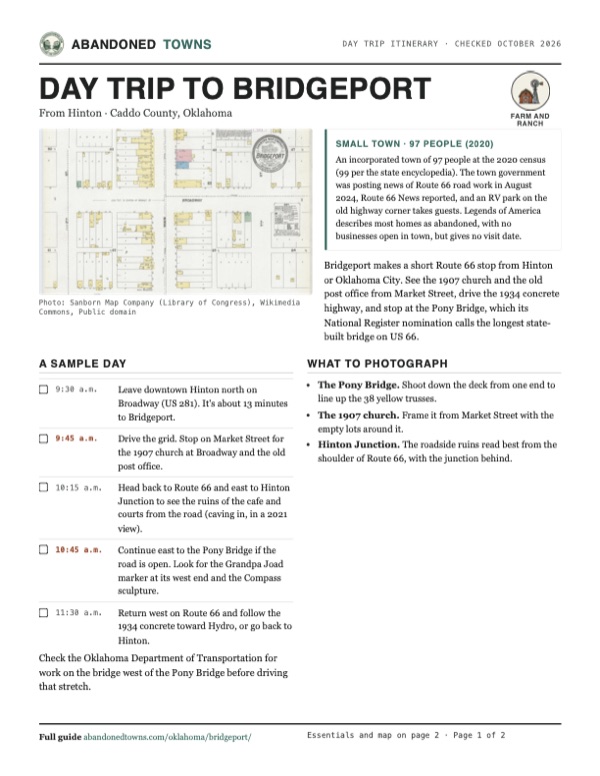
Download the PDF (557 KB)Bridgeport makes a short Route 66 stop from Hinton or Oklahoma City. See the 1907 church and the old post office from Market Street, drive the 1934 concrete highway, and stop at the Pony Bridge, which its National Register nomination calls the longest state-built bridge on US 66.
A sample day
- Leave downtown Hinton north on Broadway (US 281). It's about 13 minutes to Bridgeport.
- Drive the grid. Stop on Market Street for the 1907 church at Broadway and the old post office.
- Head back to Route 66 and east to Hinton Junction to see the ruins of the cafe and courts from the road (caving in, in a 2021 view).
- Continue east to the Pony Bridge if the road is open. Look for the Grandpa Joad marker at its west end and the Compass sculpture.
- Return west on Route 66 and follow the 1934 concrete toward Hydro, or go back to Hinton.
What to photograph and film
- The Pony Bridge. Shoot down the deck from one end to line up the 38 yellow trusses.
- The 1907 church. Frame it from Market Street with the empty lots around it.
- Hinton Junction. The roadside ruins read best from the shoulder of Route 66, with the junction behind.
Map & directions
Getting there
Bridgeport is half a mile north of Route 66 (OK 66) and a mile north of I-40, between El Reno and Hydro. From Hinton it's about 13 minutes north on US 281 and west on Route 66. From Oklahoma City it's about an hour west on I-40, leaving at exit 101.

Base map: USGS The National Map (public domain). Routes: OSRM on © OpenStreetMap contributors data (ODbL), computed October 2026. Times assume dry roads.
- From downtown Hinton, head north on Broadway (US 281 and OK 8).4.3 mi
- At Hinton Junction, bear left onto Route 66 and continue west.1.6 mi
- Turn right on County Road N2590, which becomes Main Street, into Bridgeport.0.8 mi
- From downtown Oklahoma City, take Robinson Avenue, Reno Avenue and Oklahoma City Boulevard west.2.7 mi
- Merge onto I-40 west and follow it.46.1 mi
- Take exit 101 and turn right onto US 281 (OK 8).0.4 mi
- Bear left onto Route 66 and continue west.1.6 mi
- Turn right on County Road N2590, which becomes Main Street, into Bridgeport.0.8 mi
Road and safety notes
- Both routes stay on U.S. and state highways until the last mile of county road into town.
- Route 66 News reported in August 2024 that work to replace the so-called Tower Bridge on Route 66, just west of the Pony Bridge, was to start on September 9, 2024 and close that stretch for up to five months. We found no notice of its reopening. Neither route here uses it, but check the Oklahoma Department of Transportation before driving east from Hinton Junction to the Pony Bridge.
- The way to the old toll-bridge pylons north of the river is on dirt roads, and the old highway across the river is private. A 2013 visitor advised high clearance or four-wheel drive.
- People live in Bridgeport. Stay on public streets.
Photos
Bridgeport on old maps
Visitor reports
Been to Bridgeport?
Been there lately? Tell the next visitor what you found: whether you could get in, the state of the road and what's still standing. Photos are welcome. We read every report before it appears here.
Farm and ranch
More farm and ranch ghost towns
The nearest in Oklahoma.

 Guide
Foss
35.45, -99.17Washita County, Oklahoma
A farm town that a flood washed away in 1902 and that was rebuilt on the hill above. It had about 1,000 people by 1905 and 101 by 2020, with a ruined…
 Guide
Hext
35.25, -99.75Beckham County, Oklahoma
A farm hamlet that had a post office for a year and a half and never much more. What's left beside old Route 66 is the shell of a 1930s WPA school…
Nearby
Other sites near Bridgeport
Straight-line distance from the townsite to other mapped sites in our Oklahoma index.
- Alpha27.2 mi NE · Kingfisher
- Indianapolis27.3 mi W · Custer
- Eagle City29.2 mi NW · Blaine
- Cloud Chief33.2 mi SW · Washita
- Independence33.8 mi W · Custer
- Frisco34.2 mi E · Canadian
- Braithwaite39.8 mi W · Washita
- Stecker40.9 mi S · Caddo
Sources
Sources and credits
- Cynthia Savage, "Bridgeport," Encyclopedia of Oklahoma History and Culture (last updated February 23, 2024): location half a mile north of US 66, the name, the 1901 federal townsite and 1902 incorporation, the railroads and switches, the mid-1930s businesses, populations 1907 to 2020 (99 in 2020), newspapers.
- Wikipedia, "Bridgeport, Oklahoma", retrieved October 2026: the name, location on the county line, Route 66 half a mile south and I-40 exit 101, the 2020 census (97), coordinates (GNIS).
- Kathy Alexander, "Bridgeport, Oklahoma – Fording the Canadian River," Legends of America (updated October 2026): the 1891 railroad bridge, 1893 toll bridge and February 1895 post office, the 1901 boom, the water feud and the moved post office and hotel, the 1907 wreck story, the Key Bridge tolls, the 1930 state purchase, the 1933 to 1934 bypass, the 1948 fire and 1952 scrapping, the church, post office and abandoned homes today.
- Austin Whittall, "Bridgeport," TheRoute-66.com (updated September 9, 2024): Route 66 through town 1926 to 1934, George Kay's 1921 bridge and its surviving pylons, the Pony Bridge, the Bridgeport Hill to Hydro segment and its 1962 end as US 66, Little's and Harvey House businesses, the Hinton Junction cafe in 2019 and 2021 views, the church and old post office.
- Route 66 News, "Pony Bridge near Bridgeport added to National Register of Historic Places", December 16, 2020: the December 4 listing, length and significance, the Key Bridge.
- Route 66 News, "Route 66 landmark Pony Bridge near Bridgeport reopens to traffic", May 13, 2024: the October 2022 closing, the rebuilding and the reopening.
- Route 66 News, "Construction project west of Pony Bridge will close Route 66 for a few months starting Sept. 9", August 15, 2024: the Tower Bridge replacement and the Town of Bridgeport's posts about it.
- Route 66 News, "Gravesite of Grandpa Joad added to west side of Pony Bridge", April 18, 2025, and "Giant “Compass” sculpture installed near Route 66’s iconic Pony Bridge", July 17, 2026: the marker and the sculpture.
- Route 66 News, "Exploring the old Bridgeport alignment of Route 66", May 29, 2013: the bridge supports and the dirt road to them.
- Territory Route 66 RV Park, "About Us" and "Contact" (read October 2026): opening on June 30, 2019, sites, showers, phone.
- ghosttowns.com, "Bridgeport" (undated): fact sheet (county, 2WD road, climate, best time, remains) and history (the water feud, 76 businesses in 1904 and 43 in 1909).
- Sanborn Fire Insurance Maps of Bridgeport, November 1904, November 1909 and October 1916 (Library of Congress, via Wikimedia Commons): street names, buildings and population estimates. USGS historical topographic maps (Geary 1942, Clinton 1955, Watonga 1985). Elevation: USGS 3D Elevation Program point query. Routes: OSRM on OpenStreetMap data, October 2026.
Photo and map credits
- Sanborn map of the East Side, 1904: Sanborn Map Company (Library of Congress), Wikimedia Commons, Public domain
- Sanborn map of Market Street, 1909: Sanborn Map Company (Library of Congress), Wikimedia Commons, Public domain
- Sanborn map of Market Street, 1916: Sanborn Map Company (Library of Congress), Wikimedia Commons, Public domain
- Area base map, topo and aerial imagery: USGS The National Map (public domain).
- Historic maps: USGS Historical Topographic Map Collection (public domain): Geary 1942, 1:62,500; Clinton 1955, 1:250,000; Watonga 1985, 1:100,000.