 Abandoned

Overview
Washed out, rebuilt, bypassed
Foss sits on Turkey Creek in northern Washita County, on land opened to settlers in 1892. A community called Maharg was here by 1898, and the Foss post office opened in 1900. When the railroad came through in 1902, the town grew up in the creek valley. That spring a flash flood swept it away, destroying 39 homes, the depot and more than a mile of track and killing nine people. The survivors rebuilt on higher ground north of the tracks.
The new town did well for a while. By 1908 it had two banks, three hotels, two newspapers, four cotton gins and factories making hay balers and brooms, and by 1912 an electric plant and an opera house. But Clinton and Elk City, the bigger rail towns on either side, drew its trade away. The census counted 525 people in 1910 and 348 in 1920. Route 66 ran through town for five years before it was moved half a mile south in 1931, and Foss lived on the highway, a wartime naval base and later the Clinton-Sherman Air Force Base. The base closed and Interstate 40 took the traffic. The last bank closed in September 1977.
Foss is still an incorporated town, with 101 people in 2020. Its blocks are mostly empty lots and sidewalks now, and the town's own monument says little remains beyond an old church, a cemetery, a jail, an abandoned gas station and a handful of residents.
Timeline
Flood, railroad and highway
- The Cheyenne and Arapaho lands are opened to non-Indian settlement.
- A community called Maharg, an anagram of the postmaster's name, Graham, exists in the area.
- The Foss post office opens, with William Radford as postmaster; Wikipedia gives September 15. The state encyclopedia says the name honors J. M. Foss, an early Cordell postmaster.
- The Choctaw, Oklahoma and Gulf Railway builds through, and a new town grows in the Turkey Creek valley.
- A flash flood destroys 39 homes, most of the businesses, the depot and more than a mile of track, and nine people die. The encyclopedia says April; Wikipedia and Legends of America say May 2. The town is rebuilt on higher ground north of the railroad.
- Foss grows to between 900 and 1,000 people by 1905, by Wikipedia's count. By 1908 it has two banks, three hotels, two newspapers, four cotton gins and a broom factory, and by 1912 an electric plant and an opera house.
- The census counts 525 people; it falls to 348 by 1920 as Clinton and Elk City take the trade.
- US 66 is routed through town.
- The highway is straightened, paved and moved half a mile south of town.
- A naval base operates south of town during World War II. In 1946 a Route 66 guidebook lists 306 people and a gas station and café at the junction.
- The school closes for lack of students, by the town's monument.
- The Clinton-Sherman Air Force Base at Burns Flat brings a revival in the 1950s. It closes about the time I-40 bypasses the town.
- The last bank closes.
- The Temple Building, home of the first bank and post office, burns.
- The census counts 101 people.
What's here
Kobel's Place and the cage jail
The best-known ruin is Kobel's Place, at the junction of the 1931 Route 66 alignment and Broadway (OK 44), about half a mile south of town. Legends of America says it served as a gas station, café and bus station. TheRoute-66.com describes cracked walls, peeling paint and trees growing around it, with "Kobel's Place" still readable on the wall facing the old highway. A visitor who filmed it on Easter Sunday 2025 found the lettering faded but legible, the canopy roof collapsing, the restroom roof caved in and a tree breaking up the concrete, and said it had changed little since 2023. Its roofs are falling in; stay outside.
In town, the jail is a steel cage of the kind the Pauly Jail Building Company of St. Louis sold to frontier towns. It has been moved more than once; TheRoute-66.com found it by the railroad on the way into town and at Foss Park. The park, on 1st Street by the water tower, has a monument with three granite plaques on the town's history. Legends of America lists an 1894 Baptist church building, and the monument says the old church is now a residence. Most of the business district is gone: foundations and sidewalks line blocks of empty lots.
Foss State Park, on Foss Lake north of town, has campsites, trails and a swimming beach. Sources put it six to ten miles away.
- Kobel's Place filling station ruins
- Steel cage jail
- Town history monument in Foss Park
- 1894 church building (a private home)
- Foundations and sidewalks
- Route 66 roadbed (1931) south of town
The historic maps below show the town after the highway moved. The 1957 sheet shows US 66 as a straight red line crossing OK 44 south of the small grid, with the Rock Island tracks and Turkey Creek between them and the cemetery south of the highway. The 1955 sheet shows the highway past Clinton Lake and Foss, marked four-lane near Canute, and the 1985 sheet adds I-40.


Historic maps
Foss on USGS maps, 1955–1985
Crops from the USGS Historical Topographic Map Collection, centered on the townsite. Each sheet shows what surveyors mapped that year; compare them with today's topo and aerial on this page.

Day trip
Plan a day trip to Foss from Clinton
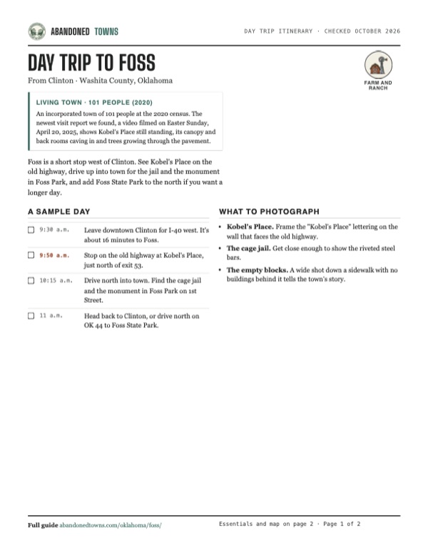
Take it with you
Day trip itinerary
The essentials, the sample day with boxes to tick, what to photograph and the coordinates, on two printable pages. Handy where there's no signal.
Download the PDF (392 KB)Foss is a short stop west of Clinton. See Kobel's Place on the old highway, drive up into town for the jail and the monument in Foss Park, and add Foss State Park to the north if you want a longer day.
A sample day
- Leave downtown Clinton for I-40 west. It's about 16 minutes to Foss.
- Stop on the old highway at Kobel's Place, just north of exit 53.
- Drive north into town. Find the cage jail and the monument in Foss Park on 1st Street.
- Head back to Clinton, or drive north on OK 44 to Foss State Park.
What to photograph and film
- Kobel's Place. Frame the "Kobel's Place" lettering on the wall that faces the old highway.
- The cage jail. Get close enough to show the riveted steel bars.
- The empty blocks. A wide shot down a sidewalk with no buildings behind it tells the town's story.
Map & directions
Getting there
Foss is just north of I-40 exit 53, about 16 minutes west of Clinton. From Oklahoma City it's about an hour and 45 minutes west on I-40. Both routes take OK 44 north from the exit into town.

Base map: USGS The National Map (public domain). Routes: OSRM on © OpenStreetMap contributors data (ODbL), computed October 2026. Times assume dry roads.
- From downtown Clinton, turn left onto West Gary Boulevard, Route 66.0.1 mi
- Turn right onto North 4th Street, US 183.0.9 mi
- Take the ramp onto I-40 west.0.3 mi
- Follow I-40 west.12.4 mi
- Take exit 53.0.2 mi
- Turn right onto OK 44, then left onto Main Street in Foss.0.7 mi
- From downtown Oklahoma City, take Robinson Avenue, Reno Avenue and Oklahoma City Boulevard to I-40.2.7 mi
- Follow I-40 west.94.3 mi
- Take exit 53.0.2 mi
- Turn right onto OK 44, then left onto Main Street in Foss.0.7 mi
Road and safety notes
- Interstate to exit 53, then OK 44 north into town. The 1931 Route 66 alignment crosses OK 44 on the way, at Kobel's Place.
- People live in Foss, and the church building is a home. Look at the ruins from the road and don't go inside Kobel's.
Photos
Have photos of Foss?
We haven’t added photographs of Foss yet. If you’ve visited, share your photos and a field report below.
Visitor reports
Been to Foss?
Been there lately? Tell the next visitor what you found: whether you could get in, the state of the road and what's still standing. Photos are welcome. We read every report before it appears here.
Farm and ranch
More farm and ranch ghost towns
The nearest in Oklahoma.

 Guide
Hext
35.25, -99.75Beckham County, Oklahoma
A farm hamlet that had a post office for a year and a half and never much more. What's left beside old Route 66 is the shell of a 1930s WPA school…
 Guide
Bridgeport
35.55, -98.38Caddo County, Oklahoma
A cotton town on the Canadian River that boomed in 1901 and carried Route 66 across a toll bridge until 1934. The new highway went half a mile south…
Nearby
Other sites near Foss
Straight-line distance from the townsite to other mapped sites in our Oklahoma index.
- Stafford6.3 mi NE · Custer
- Braithwaite8.8 mi SE · Washita
- Carpenter12.5 mi NW · Roger Mills
- Indianapolis18.5 mi E · Custer
- Port19.0 mi SW · Washita
- Independence22.8 mi NE · Custer
- Cloud Chief23.1 mi SE · Washita
- Gotebo31.3 mi SE · Kiowa
Sources
Sources and credits
- Wayne Boothe, "Foss," Encyclopedia of Oklahoma History and Culture (updated March 1, 2024): location, the name, Maharg, the 1900 post office and first postmaster, the railroad, the April 1902 flood and its toll, 1908 businesses, populations 1910–2020, Foss Dam, the school's closing.
- Wikipedia, "Foss, Oklahoma", retrieved October 2026: the move from Wilson, the May 2, 1902 flood, the 1900 post office date, the 1905 population, 1912 businesses, Route 66 half a mile south, the naval base, the air base, the last bank in 1977, the 2020 census, coordinates (GNIS).
- Kathy Alexander, "Foss & Canute, Oklahoma – Beyond Glory Days," Legends of America (updated October 2026): Kobel's station as gas station, café and bus station, the 1894 Baptist church, the jail, the foundations and empty blocks, Foss State Park.
- TheRoute-66.com, "Foss" (read October 2026): Route 66 through town in 1926 and its 1931 move, the 1946 Rittenhouse entry, Kobel's Place and its condition, the Pauly cage jail and its locations, the Foss Park monument and its text.
- Keith Vaughn's Flying Circus, "Route 66, Back to Abandoned "Kobel's Place" on Easter Sunday 2025", YouTube, posted April 22, 2025, filmed Easter Sunday 2025 per the creator: the condition of Kobel's Place, the collapsing canopy and restroom roof, little change since 2023.
- ghosttowns.com, "Foss": fact-sheet cross-check (county, 2WD road, best time, remains).
- Elevation: USGS 3D Elevation Program point query. Routes: OSRM on OpenStreetMap data, October 2026.
Photo and map credits
- Area base map, topo and aerial imagery: USGS The National Map (public domain).
- Historic maps: USGS Historical Topographic Map Collection (public domain): Clinton 1955, 1:250,000; Dill City 1957, 1:62,500; Elk City 1985, 1:100,000.